
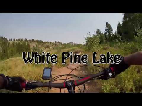
Bruce cruises along White Pine Lake. Original ride and write-up 2007, this review August 9, 2018.
White Pine LakeThe White Pine Lake trail is a popular hiking route in Logan Canyon.
It's also used by mountain bikers, either as an out-and-back ride or as
part of the
Bunchgrass shuttled ride
. It's a
fairly technical ride due to embedded boulders, but can be managed by
strong intermediates who are willing to walk their bike through the cruel
spots.
The out-and-back consists of a 3.5 mile ride to the intersection with the Bunchgrass trail,
a 0.8 mile loop that takes you down along the edge of the lake, then back again. It's 8 miles,
with 1400 feet of climbing overall. The entire ride takes place at over 8000 feet elevation.
So the riders who will enjoy this route are aerobically conditioned to altitude, strong enough
to tackle steep pitches, and experienced at working over and around the boulders in the trail.

Navigating the many embedded boulders. Dodge 'em or ride over top.

Climbing away from Tony Grove Lake as we begin the ride.
The ride begins at Tony Grove Lake at an elevation of 8050 feet. Note that the parking lot
at Tony Grove is a Forest Service fee area ($7 per car in 2018, no discounts).
Go to the northwest (uphill) corner of the parking lot and find the correct trail. The climbing
is not constant, nor are the techy boulders a non-stop feature. There are stretches of flat
pedaling on smooth trail. Most of the riding is sun-exposed -- at this elevation it's not a
problem of heat; it's the UV exposure. Slather on the sunblock.

Crossing a meadow of wildflowers.

Aspens are found here and there, but this old pack trail avoids the dense woods. So you won't find a lot of shaded riding.
The vegetation is a nice mix. There are meadows of sage and wildflowers, mixed well with small
stands of aspen or fir. The ride is constantly changing.
The one constant feature, though is beautiful scenery. This ride is eye candy.
In general, keep to the right at any trail forks during the climb. You'll run across a couple
of trail forks where the left trail takes you toward Mount Naomi. (All forks were marked with
wooden trail signs during my ride.)
At mile 2.7, you reach the ride's highest point at 8800 feet as you cross a ridgeline and begin
the descent toward the lake. You're about to hit the toughest 1/2 mile of the ride. Intermediates
will walk much of this on the downhill, and almost all of it when coming back uphill.

Crossing the ridge to begin the descent to White Pine Lake.

Narrow trail with boulders that have to be taken head-on. Plus roots.
The trail hugs the side of the mountain as it descends through fir forest. The terrain is rich
with embedded boulders. Steeper spots, in particular, tend to be a stair-step plunge down rock
gardens. But it's all ride-able, 100%.
As the trail flattens out, you've got some plush riding as you approach the lake. At the four-way
trail intersection, pick your riding direction. Straight takes you counterclockwise around
the lake loop, while a left turn is clockwise. (The trail to the right is the
Bunchgrass
trail
)
 before the lake.")
Pedaling toward the final little ridge (made of glacial till) before the lake.

The trail runs parallel to the lake for a bit. This area is full of wildflowers in July.
Plan for a picnic at the lake. There are shaded spots on the northwest corner of the loop that
are perfect for this.
There are also numbered tent campsites on the northern side of the lake loop, if you're interested
in a bike-packing campout. (No road serves the lake. Anyone who camps here has to hike or bike
in.)
The cliffs across the lake are visually interesting. The lower white layer is Swan Peak quartzite,
laid down about 450 million years ago when the area was a sandy beach. Then the ocean moved
inward, and the Fish Haven dolomite -- a magnesium-rich limestone-like rock, was deposited
in shallow brackish seas. That's the blue-gray layer above.

View of the rock layers across the lake.

Climbing uphill from the lake.
Enjoy a bit of easy cruising as you leave the loop and head back. Once you hit the slope, you've
got around 400 vertical feet to climb in under 1/2 mile. Add the boulder-fields and, well,
everybody walks some of the climb.
I suggest taking frequent photo and scenery-gawking breaks. At this altitude, even walking
your bike uphill will be taxing.

Ride what you can.

Three miles of fun downhill.
Once you cross the ridge, it's pretty much downhill all the way. There will be smooth sections
but a lot of the downhill is boulder-bumping, tombstone-dodging techy. So you rarely will be
able to simply let the bike fly.
As you descend, keep in mind that this is a very popular hiking route. Even on weekdays, you
will encounter many foot soldiers. There aren't many blind corners and sight-lines are usually
fairly long. But the loose trail surface means you'll take a bit longer to brake than you'd
think.

Dodging the some boulders and rolling over the top of others.

Descending the final meadow down to Tony Grove.
Bottom Line!Great ride for strong skilled altitude-tolerant riders. Short, but still a fair amount of work.
Beautiful scenery.
See also:
Bunchgrass trail Riding notes, from Tony Grove Lake:
0.0 Northwest corner of parking, pick correct trail
N41 53.705 W111 38.552
Elevation 8000 feet
(Check sign! White Pine
Lake)
0.3 Fork R N41 53.900 W111 38.558
0.9 Fork R N41 54.351 W111 38.647
2.6 Top of ridge 8800 feet, descend
3.5 4-way: L=lake loop, R=descend
N41 55.381 W111 39.008
4.2 Back at 4-way, go straight through
5.0 Cross ridge and begin downhill
7.9 Back at Tony Grove

Map of White Pine area
Getting there: In Logan, turn east at 400 North
on US-89 towards Logan Canyon (about 2 miles). Drive 21 miles from the
canyon mouth. At the sign for Tony Grove Lake, turn left, then immediately
turn left again. (Right goes to a campground.) Now drive 7 miles uphill to
the end of the pavement at Tony Grove Lake. There are bathrooms and
camping at the lake. Pay your fee at the self-service post near the entry
sign. The trailhead is at the northwest corner of the
parking loop N41 53.705 W111 38.552.


 before the lake.")


