
Approaching a turn above a cliff. The red and yellow signs tell you not to overshoot this turn. Photos and review by Bruce on August 12, 2014.
Snowbird Big Mountain TrailSnowbird's Big Mountain Trail descends from the top of the tram on Hidden Peak at 11,000 feet
elevation. It's an intermediate-technical singletrack, opened in 2014.
From tram to parking
lot, the route is 7.6 miles with 3000 feet of descending. The Snowbird
tram ($20 for a day
pass in 2014) takes you quickly to the top. Hero types can climb to the
top either (A) early
in the morning so you reach the top before the upper trail closes to climbing,
or (B) by climbing
the tram road, which is a brutal proposition.
After 11 a.m., the route is downhill-only from the top down to the tram-road crossing at mile
5.7. The bottom 1.8 miles is two-way traffic all day. To climb Big Mountain,
I'd suggest a
start before 9 in the morning (8 if you're a slow climber), to allow time
for a little sight-seeing
and a rest stop or two.
On the lower mountain, you can deviate onto some of Snowbird's other
singletrack, described on the
Snowbird cross-country page
.
Tram Road Climb
-- for those with Hard Thighs and
Tight WalletsAttention, climbing junkies! My climbing route is 4.5
miles at a brutal average grade of
650
vertical feet per mile.
That's a 12.5% slope. Many spots are are dusty-sandy and chunky. You need
to be capable of sustaining steep granny-gear power at over 10,000 feet
of
elevation, while skilled enough to not spin out in the churned stuff.
It
will hurt. May I, as your friend, suggest you arrive early enough to climb
the singletrack (see directions near page bottom), or pry open your wallet
and give Snowbird a few bucks to take the tram.

Looking west as we climb the Dick Bass Highway. If your legs are hurting by the time you reach the tram road, may I suggest that you Don't Be An Idiot. Cough up the bucks for a tram ride to the top, or just play on the XC trails.
The tram road starts below Entry 1. Just across the creek, go to the left of the ski lift and
begin climbing on gravel road. From here, it's 5 miles.
Because most riders park at Entry 2, may I suggest taking Dick Bass Highway up to the tram
road. This will shave 1/2 mile and 200 vertical feet from the climb. It
will also give you
a chance to test your legs. Much of the climb will be as brutal as Dick
Bass (or more). This
ride description assumes you're taking Dick Bass, so our mileage will
start at the bridge east
of Entry 2.
After driving into Entry 2, descend to the flat parking area along the creek and stash your
car. Head east (up-canyon) to the cement bridge across Little Cottonwood
Creek. Grind straight
uphill on sometimes-loose gravel, passing a gravel road that enters from
your right. As the
road flattens, find Dick Bass Highway at mile 0.2 on your right. It's
a broad doubletrack path,
directly across from the paved path that connects hikers and cyclists
to the tram and plaza
at the top of the lodge.

Looking north downhill.

Eyeballing the final switchbacks up to the tram. I thought it actually got easier here, despite the elevation.
Grind on up Dick Bass. Keep straight as two connectors to the Mid Gad singletrack enter on
your right. A bit higher, the Chauner's Loop singletrack comes in on your
left (mile 0.3).
Just keep grunting straight up.
The trail will veer to the left, southbound. Stay straight as Big Mountain crosses at mile
0.6.
Just shy of mile 0.9, Dick Bass reaches the tram road. Fork left uphill. The tram road isn't
ever labeled "road to top of tram" nor "this way to Hidden Peak." So it's
easy to get lost,
or to simply think you're lost.
At mile 1.0, keep straight as a road forks to the right (and a hiking trail comes in from the
left), following the signs toward Peruvian Gulch.
At mile 1.8, keep right and uphill as the alternate route comes in from the east. (This is
the path that mountain scooters and road-only mountain bikers will take
to descend back to
the base of the tram.) Again, there are no signs saying "This way to the
top of the Tram" so
follow the Peruvian Gulch signs.

Looking south into Mineral Basin. Almost done.

Bald Mountain from the ridge just before the final push.
The road gets a bit steeper here. Much of the surface will be loose, torn up by construction
and service traffic to the tram. You might find the road in better condition,
but in 2014 construction
work along the road and at the top of the tram meant the road was often
powder and chunks.
As you plaster your chest onto the handlebars for the grunts, keep enough
weight on your rear
tire that you don't spin out.
Attack the last switchbacks up towards the tram. A "false summit" at mile 4.2 shows you views
into Mineral Basin of American Fork Canyon. Keep right at the fork and
keep heading uphill.
The Big Mountain Trail forks off the north corner of the last switchback. You can grunt up
that final steep approach just to say you made it (I did), but you'll
be dodging foot traffic
from the tram. Skipping the grunt up to the tram saves you 0.1 mile horizontal
and 100 vertical.

View to the west from the top.

Looking north from the tram area. The yellow sign says to walk your bike so you won't run over the many small children who will be hiking down this path.
First, take a minute to look around.
From the top of the tram, descend straight north along the broad ridge. The sign says you should
walk your bike to avoid smashing families that are hiking down in front
of you. At the switchback
in the road, veer left onto singletrack. You're now on the Big Mountain
Trail.
After a quick left turn, the trail begins a long down-sloping traverse to the west around the
large bowl of the Little Cloud ski runs. It's a bit bumpy -- too bumpy
to fly all-out -- so
this first long way-too-straight pass can create an unhappy first impression.
Hang on. You'll
never again go so straight for so long.

Early in the first traverse, as the chatter of the rockslide sets the tone for the next two miles.

Nicely bermed, but with a tight turning radius. Get as high as you can on the upside of the turn as you enter.
The trail now zigzags down the bowl through mostly-treeless terrain. Turns are quite tight
but bermed so you can roll them. The trail is clinging to the side of
a steep mountain, so
there's not much the trail-builders could do but go back and forth as
the trail sheds vertical.
After you've wound your way downhill through 9 or 10 switchbacks, the trail hits the trees
and begins to get a bit more interesting. If you managed to withhold judgment
through the first
two miles, you'll now find a reason to like this trail.

Looking west at the Little Cloud area. You can see a few of the zigzags ahead.

Planks on top of pallets in an area of ooze.
There are some swampy spots that are covered with pallets and planks. The 4x6 planks are held
on only by gravity, so they'll bump around a bit as you ride over them.
I assume the pallets are necessary because permanent structures require special permission,
and (located on a ski slope) these structures would require marking to
avoid liability during
ski season.
Some of the turns are a bit too tight or a bit too flat for my taste. But even a month after
opening, the turns are getting significant TLC by trail crews. And riders
are hitting the upslope
sides to create a more flow-y riding line.

An example of a turn that I thought was too tight and too flat. Needs a new line in the raw area at left.

View to the north.
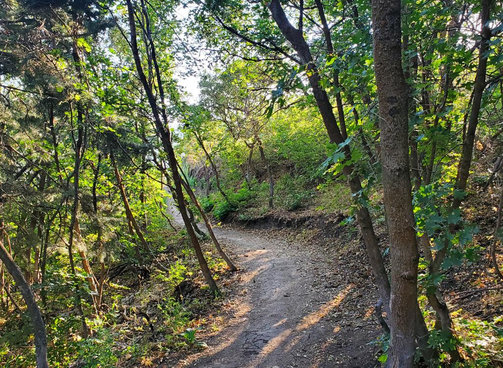
Once you're in the fir forest, the trail becomes more typical winding Wasatch singletrack.
There are a couple of spots where you may need to hit the pedals to get
up a short gentle slope.
Otherwise, it's 7.5 miles of continuous downhill.
In this area, you'll pass through lift unloading zones (Gadzoom and Mid-Gad) and cross lift
roads. Watch for vehicles and hikers in these areas!
A few A/B lines and stunts are appearing. These don't start until you're off the steepest slopes.
But even on the higher straight trail, the water-shedding bumps give plenty
of opportunity
to take a little air. And as you get close to the tram road around mile
4.5, there will be
some table jumps.

Looking back at an A/B split, an up-the-rock and plunge.

The rock garden. With the trail only weeks old, I'd already heard a bit of complaining about this spot.
There's a rock-pile around mile 4.5, about 50 feet in length. Intermediates should simply dismount
and walk. I tried hitting it twice and -- even with a full-suspension
29er -- got bounced to
an abrupt stop both times. It may get better with time as the trail fairies
rearrange the rocks.
At mile 5.7, you'll cross the Tram (Peruvian Gulch) Road.so watch for climbers! At mile 6.2, cross the Dick Bass Highway. 1/10 mile later, the route
to the tram forks hard right. The trail straight ahead takes you back
across the tram road
to descend the west-side singletrack (from which you could take the Bird
Trail back to the
tram).

A wooden crossing. Note: at least for now, the planks are loose. And as the sign says, it's NOT safe to try to stop on this structure. But there's no plunge or stunt at the other end. Just coast up and over.

Lots of nice riding left as we hit the final mile.
Keep straight when the singletrack joins doubletrack at mile 7.0. Then after a quick shot downhill,
veer to the right to singletrack (Mid Gad Trail). This will take you back
to the bottom of
Dick Bass. The paved trail right across the road is the path to the tram,
or to a well-earned
beer.
BMT Singletrack Bottom to Top directions
(Note: the signage for the climb isn't helpful. Snowbird can be forgiven
if they don't spend money to help you Not Pay while you ride their trails.
You must be at the top before 11 a.m. Average slope will
be
380 vertical per mile (7%).)
0.0 Cross cement bridge N40 34.771 W111 39.535
Keep straight and uphill
0.2 Fork hard right on Dick Bass
N40 34.810 W111 39.348
0.25 R on singletrack N40 34.782 W111 39.366
0.3 Upper singletrack joins, keep straight
N40 34.722 W111 39.438
0.5 Keep straight onto DT
(Miner's Road)
0.6 R on singletrack N40 34.633 W111 39.752
0.7 Cross road to ST
1.2 Hard L at fork N40 34.448 W111 39.603
1.3 Cross Dick Bass N40 34.524 W111 39.635
1.9 Cross tram road N40 34.515 W111 39.448
3.2 Stay on ST at lifts and roads
7.5 ST arrives at final approach to tram
Never-Again Tram-Road Loop
0.0 Cross cement bridge N40 34.771 W111 39.535
Keep straight and uphill
0.2 Fork hard right on Dick Bass
N40 34.810 W111 39.348
Keep straight on broad trail
past 3 STs
0.6 BMT crosses, keep straight N40 34.521 W111 39.633
0.9 L uphill on gravel road N40 34.395 W111 39.521
1.0 Keep straight N40 34.506 W111 39.498
1.8 R and uphill (Peruvian Gulch)
N40 34.546 W111 38.775
4.4 BMT on R, L uphill to tram
N40 33.733 W111 38.767
4.5 Top, R&R and photo time
Descend backtrack.
4.6 L on BMT N40 33.733 W111 38.767
10.2 Cross tram road N40 34.515 W111 39.448
Begin two-way traffic!
10.7 Cross Dick Bass N40 34.521 W111 39.633
10.8 Hard R N40 34.457 W111 39.602
11.4 Cross road N40 34.596 W111 39.764
11.5 Join road downhill
11.6 Veer R onto ST N40 34.667 W111 39.618
11.8 Keep L N40 34.718 W111 39.440
11.9 L on Dick Bass
L on gravel road
12.1 Back at bridge

Map of Big Mountain
Getting there: From I-15, take the 90th South
exit. Drive east. 90th South will veer southward to become 9400 South.
Keep straight until you hit the mouth of the canyon. When the road ends at
the stop sign at the Little Cottonwood Canyon road (U-210), turn right towards the
flashing canyon sign. Drive 5.8 miles up the canyon. For the Tram Road trailhead, turn right into Snowbird Entry 1. Park immediately and cross
Little Cottonwood Creek to find the Mid-Gad chairlift. Go to the left of
the lift and begin climbing.
For the tram or the Dick Bass to tram road climb, continue to Entry 2, 0.5 miles
further up-canyon. Park in the flat area along the creek. Pedal east toward the Tram and
Snowbird Center. Cross the big cement bridge below the lodges. Pedal
up the gravel road 0.2 miles, then either fork left downhill on paved
trail to reach the Snowbird Plaza and tram, or fork right uphill for a
brutal ugly climb.


