Mount Timpanogos from the trail. Timpanogos is entirely formed of limestone of t...
Mount Timpanogos from the trail. Timpanogos is entirely formed of limestone of the Pennsylvanian Period (320 million years ago) when Utah was covered by ocean. September 6, 1999 by Bruce. Page updated July 2016.
Bonneville Shoreline Trail North Provo Canyon Section
(Orem Bench and Dragon's Back)

This segment of the Bonneville Shoreline Trail (BST) extends east from the Orem Bench BST trailhead to Canyon Glen Park in Provo Canyon. It includes 3.2 miles of improved dirt road and 1.3 miles of singletrack. It won't be your favorite BST section, but it provides access to some great riding in the north Provo Canyon (Orem Bench) area.

The BST trail is low altitude. That means it gets hot on summer afternoons, but offers off-season riding. January and February are only occasionally passable for standard bikes, but a fat-bike rider will find the Orem Bench Road section good to ride all winter. The Dragon's Back singletrack section, part of the Great Western Trail (GWT), is hit-and-miss for fat biking.
Northbound just after passing the Cliff/Zorro drop-off. Thats Little Baldy ahead...
Northbound just after passing the Cliff/Zorro drop-off. That's Little Baldy ahead, with Timpanogos on the right.
View down to Canyon View Park. The Race Loop is downhill from us, just to the le...
View down to Canyon View Park. The Race Loop is downhill from us, just to the left of this photo.
There is significant climbing on this route. Even the Orem Bench Road portion has a stretch that's too steep for young children and miserable for beginners. Once you get past the first 0.9 mile -- and its 400 vertical feet of climbing -- it's a flat and easy cruise for new riders.

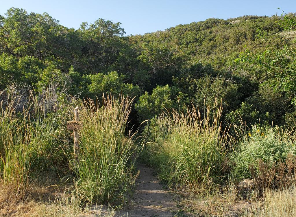
The Dragon's Back section is singletrack, starting at 5050 feet elevation at Canyon Glen. Your climbing will be 500 vertical over 1.3 miles of intermediate-technical trail.

Note!  Portions of these trails are on Utah Division of Wildlife Resources land, purchased with sportsmen dollars and set aside as the Orem Bench Wildlife Management Area specifically to protect Utah's native animals. Mountain Biking is allowed, but only insofar as it is not harmful to wildlife. To insure continued access please be respectful to the landowner by following proper trail etiquette and obeying all posted rules. Specifically:
1.  Do NOT ride these trails during the winter. The area is closed December 1st through April 15th!
     Deer will not survive the winter if frequently disturbed.
2.  Unauthorized trail-building is strictly prohibited!
3.  To reduce erosion and prevent "trenching" of trails, do not ride trails when muddy.
4.  Avoid disturbing wildlife, and do not allow your dog to chase animals.
On the Orem end, the BST starts at 5150 feet elevation at the trailhead just off 800 North. There's a bathroom here. Don't head north on the obvious trail near the bathroom. That's the northbound BST , and it's not the one you want.

Go back to where your car turned into the paved parking area and find the singletrack going southeast. It will take you to join the gravel road in 1/10th mile. Settle into your climbing cadence and crank uphill for 0.9 miles.

Looking back at the conglomerate cliffs at the mouth of Provo Canyon. These are ...
Looking back at the conglomerate cliffs at the mouth of Provo Canyon. These are formed of river deposits under prehistoric Lake Bonneville.
Nice fast cruising with some morning shade here.
After the initial climb, the doubletrack trail is flat and plush as it contours the side canyons. You'll notice singletrack trails branching away. If one of these is your destination, go ahead and hit the dirt. Here are some connections:

Lazuli left at 0.8 miles, north to Elk Crossing, Gopher Snake, Swift Ridge, Wild Turkey and Little Baldy near the Altar
Aquila (Cliff) right at 0.9 on doubletrack then left, connects to Race Loop
Zorro same DT but then R downhill, to Orem's 1560 east
Race Loop connector right at 1.45 descends to Race Loop
Rattlesnake left at 1.5, to Gopher Snake, Elk Crossing, Altar, GWT, Mouse (key to uphill trails)
Bee Line descender to Race Loop right at 1.55
Frank (GWT, 033) left at 2.9 climbs to Elk Crossing, Altar and Little Baldy

When you reach a road fork at mile 3.2, don't proceed past the gate on the level road (unless you're heading for Taj Mahal or the road's end on Highway 189). Fork left downhill on the right-hand gravel road.

Go around the downhill gate, then watch on the left for the Dragon's Back (GWT, forest trail 033) singletrack. The singletrack is the continuing BST. PS, the doubletrack on the right descends to the Race Loop, if you're so inclined.

Heres the gate you DO NOT go through. When you see this, its time to turn downhi...
Here's the gate you DO NOT go through. When you see this, it's time to turn downhill to continue the BST.
Ah, heres the gate you want. Now find your singletrack trail heading east (up ca...
Ah, here's the gate you want. Now find your singletrack trail heading east (up canyon). My Rocky Mountain -- from the UMB shop, of course -- is ready for a fun downhill!
You'll quickly encounter a trail fork. Keep right for the Dragon's Back. (The right fork descends rapidly then crosses the sink area Johnson's Hole to rejoin trail 033.
The Dragon's Back is a ridgeline with fabulous views of the canyon and surrounding mountains. The trail downhill from the trail on both sides are low scrub forest of gambel oak and bitterbrush. The trail will invite you to fly down the mountain, but stop and appreciate the pretty stuff at least once.
Heres a view of where youre going, shot from a bit further down the road (wrong ...
Here's a view of where you're going, shot from a bit further down the road (wrong road for you -- I was headed for Taj Majal). The Johnson's Hole trail is hard to see here, but it goes from bottom right, crosses the sink area and reconnects at the leftmost arrow.
Jackie enjoys the ridgeline of Dragons Back as we climb uphill on September 6, 1...
Jackie enjoys the ridgeline of Dragon's Back as we climb uphill on September 6, 1999. Hard to believe I've been reviewing bike trails that long!
As the trail flattens and crosses a long grassy area, the Johnson's Hole trail will rejoin on your left. Now hug the mountainside as you head east.

After the traverse, you'll start descending toward Canyon Glen. Here and there in cooler spots, choke cherry, elderberry, and maple are found. Follow the ST down to the pipeline. Turn right onto the pipeline, then 30 feet later, drop down the singletrack that forks off on the left.

When you hit the paved Provo River Parkway trail, turn right to go down-canyon about 200 feet, then cross the river to parking. Or, head down the parkway to make a pavement loop -- 800 North will take you to 800 East and to Cascade Drive. (Note that the climb up Cascade Drive to the BST trailhead is hatefully steep on a bicycle!)
Two riders head toward Canyon Glen on the traversing section of the Dragons Back...
Two riders head toward Canyon Glen on the traversing section of the Dragon's Back trail. The cliffs across the canyon are Pennsylvanian limestone of the Oquirrh Formation. (Another photo from 1999.)
View west from Dragons Back.
View west from Dragon's Back.
Uphill...

Many riders use Dragon's Back as a climbing route to the Timpanogos foothill area trails Navigation is simple -- just take the uphill or westbound option.

After leaving the parkway uphill, take the first right turn to switch back. Arriving at the pipe, go east 20 feet past it and find the trail that heads uphill to the west. Immediately on top of the ridge, take the left fork in the trail (the right fork dead-ends in the shallow valley on the other side of the ridge). When you reach double-track, turn right, then turn left onto the Orem Bench Road when you reach the second gate.
Now go 0.3 miles east on the Orem Bench Road. Just after rounding a right turn to the left, you'll see the continuing Trail 033 (Little Baldy Trail, just called "Frank" by the locals) going uphill on your right. If your objective is The Altar and the north Provo Canyon foothill trails, take it.

If your objective is the BST Orem Bench trailhead (or one of the alternate singletracks in the area) just stay on the road and pedal. If you're riding the BST out-and-back, you'll be at the trailhead with 9.2 miles total -- and 1000 vertical climbing.

Entry to Trail 033, in case thats where youre going.
Entry to Trail 033, in case that's where you're going.
Orem to Provo Canyon BST route
Getting there, Orem Bench BST Trailhead:
Exit I-15 on Orem's 800 North and drive straight towards the mountains. At 800 East, turn left and drive north about 1 mile. Immediately past the fence at the uphill end of the cemetery, turn right (east) on Cascade Drive. Drive 1/2 mile then fork uphill before you approach the water treatment plant. Take two switchbacks up, passing the lower overflow parking, to the paved parking area with the bathroom. Your trail is right across from where the road entered the parking lot.

Canyon Glen: Use this trailhead if you plan to ride counter-clockwise or out-and-back. Note that if you ride this direction there are some granny-gear climbs that are a bit loose. Exit I-15 on Orem's 800 North and drive straight towards the mountains. Keep left to enter Provo Canyon. About 3 miles later, you'll see the parking area for Canyon Glen on your left. Go across the bridge to the Parkway. Turn right, and find the GWT on your left about 200 feet later, forking uphill just before the paved parkway curves around a rock outcrop.
Nunn's Park:
  This makes the ride about a mile longer, but at the expense of a rather ugly short section of trail from Nunn's park up to the aqueduct. Going up-canyon, turn right 4 miles up the canyon, then left under 89. Go into Nunn's Park. On your bike, come back through the park entrance, then turn left on a broken-up roadway just before the road goes under 89. Turn left at the fence and follow the fence uphill. This section is a hike-a-bike uphill. Downhill, it's tricky because if you slide or bobble you're going to hit the fence. As the singletrack reaches the top, go left (down-canyon).
Canyon Mouth Provo River Parkway:
There's a parking area on Orem's 800 North Street just before you enter Provo canyon. It's just east of the gas station. GPS N 40° 18.840'  W 111° 39.472'. To get to the parkway, go east over the river and through the fence. To backtrack to the Orem Bench trailhead, head back west (away from the mountains) to 800 East, then go to the Orem Trailhead as above.

Riding resources:
One-page riding guide

GPS track files (right-click and "Save as..."):
    GPX BST Orem Bench to Canyon Glen
    Multi-track area file (over 70 tracks)
Topo map for printing:
    View
    View wide canyon mouth area
    Provo Parkway
Lodging, camping, shops:    Links to Provo area resources