Dominic cranks along the north edge of the lake, passing quakies and spruce. Pho...
Dominic cranks along the north edge of the lake, passing quakies and spruce. Photo July 13, 2001 by Bruce Argyle. Latest update August 28, 2018.
Navajo Lake Loop Trail

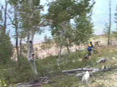
The Navajo Lake Loop Trail is an intermediate technical singletrack loop running around Navajo Lake near Brian Head. The trail is located at 9100 feet altitude in cool pine, fir, and aspen forest. The trail base is mostly packed dirt, with a little cinder riding over the lava flow at the east end of the lake.

The loop includes a tiny bit of dirt road and paved road to link the Navajo Lake Loop trailhead to the combined Virgin River Rim and Navajo Lake Loop trails west of the lake.

The total ride is 11.5 miles; total climbing about 400 vertical feet. The altitude can be a challenge for some. But the climb pace is reasonable with most of the climbing in the first 2 miles of a counterclockwise ride from the trailhead.

Handlebar view of the forest on the Navajo Lake Loop Trail.
Trailhead, looking east. Were heading back the way we came. Well finish on the t...
Trailhead, looking east. We're heading back the way we came. We'll finish on the trail behind me.
The Navajo Lake Loop trailhead is on the west end of the lake. After you turn off Highway 14 at the Navajo Lake sign, continue 5 miles on Forest Road 053 past the lake. As you approach Te Ah campground, turn right onto dirt road and follow it 0.4 miles to the trailhead.

To begin a clockwise ride, just go straight onto the trail. For a counterclockwise ride, pedal back to the paved road. Go 1/3rd mile west uphill, passing the entry to the Te Ah campground, then turn left to the singletrack. You've done 0.8 miles and climbed 100 vertical feet from the trailhead.

Begin climbing uphill on the Virgin River Rim Trail (VRRT) In this segment of singletrack, you'll climb another 200 vertical feet over the next 1.5 miles. The trail climbs through pine forest with occasional aspen. The many cut-off deadfall trees that line the trail warn you to expect trees across the trail after major storms.J
ust getting started on the Virgin River Rim trail.
Climbing up toward the trail fork with the Lake Loop.
At mile 1.5 of the VRRT (mile 2.3 from the trailhead), you'll reach a trail fork. Turn left downhill onto the Navajo Lake Loop trail. You'll now have a fun descent down toward the Navajo Lake Lodge. As you approach the paved road at mile 3.3, turn right and ride east.
The trail now undulates a bit up and down, occasionally climbing to get above the campgrounds. This section lies in thick connifer forest. Now and then you'll catch a glimpse of the lake through the trees.
Bruce rolls around a curve on the fun descent after forking away from the Virgin...
Bruce rolls around a curve on the fun descent after forking away from the Virgin River Rim Trail in this 2001 photo.
Rolling a turn between aspen and spruce.
Cross the Navajo campground trail at mile 4.3 and Spruces campground trail at mile 5.2 from the trailhead.
At mile 5.9, there's a connector on your left that drops to the road. This takes you to the paved road, where you can connect to the gravel road to the dike. Riding across the dike is a nice shortcut for kids, and it's kind of pretty.
Taking the shortcut across the dike in 2018.
This is a very pretty ride!
At mile 6, the Dike trail comes in from uphill on your right.

At 7.1 miles from the trailhead, the Navajo Lake Loop trail crosses the paved road. Head north into the lava field. Things will get bumpy now.

Rounding the east end of the lake, you'll pass lava flows among flower-filled meadows and quakies. This terrain is unique and beautiful. While they appear fresh and new, the broken chunks of lava originated in flows a few thousand years ago, when volcanoes were active on the Colorado Plateau.
Dominic, Mike, and Bruce pause in the middle of a lava flow, on the east end of ...
Dominic, Mike, and Bruce pause in the middle of a lava flow, on the east end of the lake. Photo 2001.
Climbing up the Dike trail from the shortcut. Im joining the northern side of th...
Climbing up the Dike trail from the shortcut. I'm joining the northern side of the loop heading west.
The trail curves around to head west on the north side of the lake. At mile 7.9, the Dike trail joins you from downhill. Keep straight.
The trail will undulate a bit up and down as it traverses the hillside above the lake westbound. The north side of the lake is more open, with grass and wildflowers among moderately spaced quakies and the occasional fir. You'll have plenty of views of the lake on this side of the loop. You'll see plenty of penstemmon, gilia, and daisy species.
Rolling a turn on the north side of the lake.
Handlebar view. Westbound on the north side of Navajo Lake.
At mile 11.6 you'll reach the trailhead where you started.

A ride with the kids at Navajo Lake...

[Back to video list ]
Bruce cruises through a field of penstemon.
Bottom Line

This is one of the easiest true alpine trails in the state, and it's quite pretty. While the kids are trying to catch a fish, Navajo Lake is a great place for a quick ride.

The trail is covered with snow on the south side until mid-June, with a return of snow in mid-October.

Riding notes, counterclockwise:
0.0   West on DT from TH N37 31.794 W112 48.539
0.4   R on paved road N37 31.887 W112 48.869
0.8   L on ST Virgin River Rim N37 31.992 W112 49.255
2.3   R on Navajo Lake Loop N37 31.253 W112 48.595
3.3   Veer R at near lodge N37 31.202 W112 48.241
4.3   Cross Navajo CG trail N37 31.180 W112 47.360

5.2   Cross Spruces CG trail N37 31.043 W112 46.477
5.9   Straight (L = down to dike) N37 30.987 W112 45.662
6.0   Straight (R = Dike trail up) N37 30.970 W112 45.620
7.1   Cross paved road N 37 31.056 W 112 44.996
7.9   Straight (L = to dike) N37 31.510 W112 45.662
11.6 Back at trailhead

Navajo Lake loop
Navajo Lake loop
Getting there:  From Cedar City, drive up the canyon on U-14 for 25 miles. Turn right on the Navajo Lake road FR 053 and drive 5.4 miles past the lake. Turn right on dirt road at the sign (if you reach Te Ah, you went too far). The road will turn back to the east. Park at the trailhead 0.4 miles from the paved road.

Water: Te Ah campground
Bathroom:  Lake Loop trailhead

Riding resources for this trail:
Single-page riding guide
GPS track files and route (right-click and "Save as..."):
      GPX track of loop
High-res topo map in new window for printing:  View
Lodging, camping, shops:   Links to Cedar City - Brian Head area resources
Updated 2018