The South Maple Hollow trail lies on the southern side of Traverse Mountain in Draper. This trail is usually done as part of a larger ride, rather than being a destination trail in its own right.
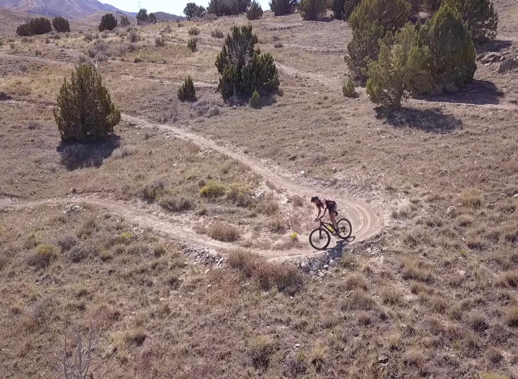
The trail is easier-intermediate in technical requirement. As a climbing route, the pitch will be somewhat strenuous for newer riders but easy for conditioned climbers. As a downhill route, it's easily done by experienced beginning bikers.

South Maple Hollow is 1.7 miles long. From the lower trailhead on Brookside Drive it climbs 550 vertical feet, reaching a top altitude of 6100 feet at the Maple Hollow trailhead on Traverse Mountain in Suncrest. Most riders will be using this trail as a climbing route, either to the Eagle Crest trail (connecting to Vertigo and Levitate , Woods Hollow and Rattle and Hum or Mercer Hollow to the east), or to Ann's Connector or the Maple Hollow DH at the ridgeline trailhead.
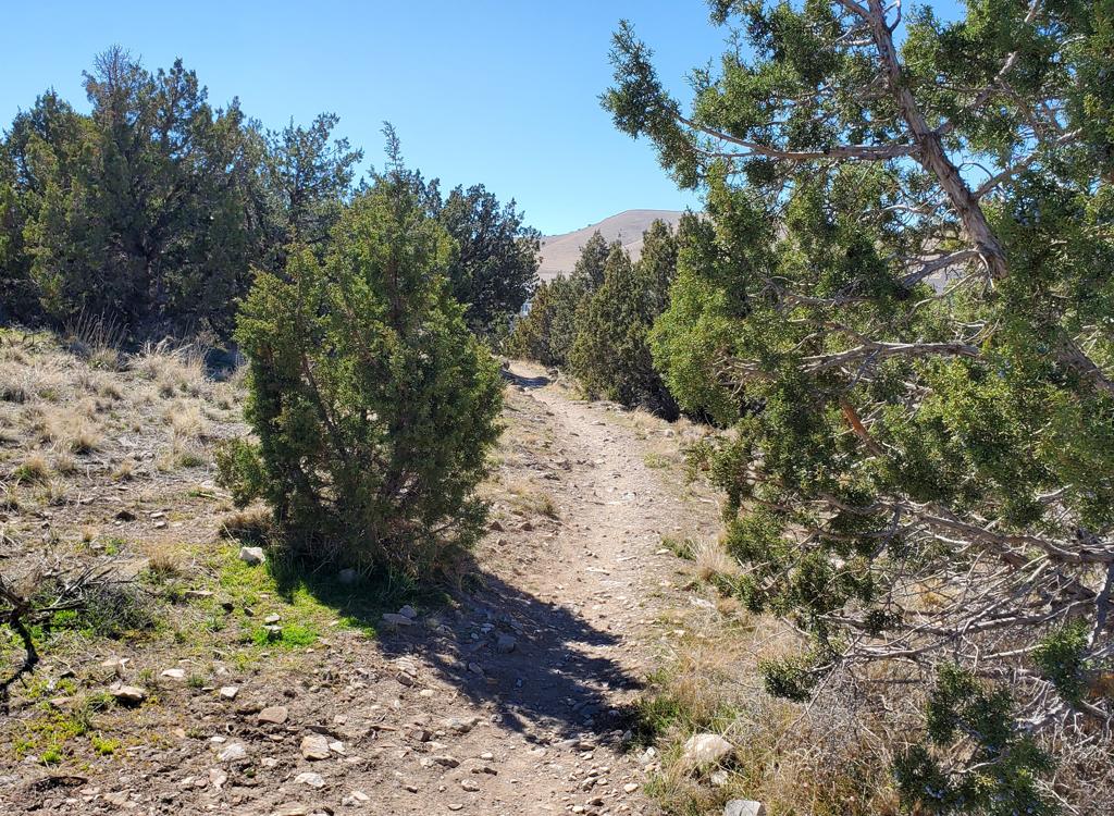
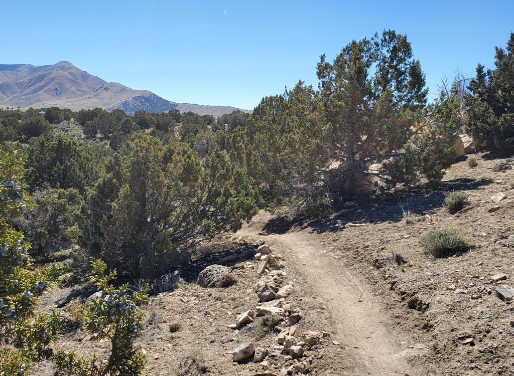
As you might guess from the name, South Maple Hollow is forested with a mix of oak brush and maple. Often the gambel oak is short enough to see over, so there are nice views of Utah Valley to the south. Utah Lake is to the southwest, and the multiple mountains of the Wasatch form a line along the entire eastern side of the valley.For clarity...
The little canyon called Maple Hollow is found on both sides of Traverse Mountain in Draper. To prevent confusion I will refer to the part in Utah County as South Maple Hollow. The area on the north side of Traverse Mountain, home of the Maple Hollow DH trail, I will call simply Maple Hollow.
The trail system was re-worked in 2016. The upper 0.5 miles of South Maple Hollow, and the 0.3 miles of the connector (see map), were formerly part of Eagle Crest but were bypassed by the 2016 new Eagle Crest trail-cut. Those former Eagle Crest pieces have been smoothed and widened. The western side is now part of South Maple Hollow, and the eastern side is the Eagle Crest to South Maple Hollow Connector Trail.
In the lower half of South Maple Hollow, new trail was cut down the eastern side of the hollow. This replaces the old creekside South Maple Hollow trail for cyclists -- with the old route being designated a hiking route -- and replaces the old doubletrack from the catch-basin down to the subdivision. If you're a rider who's done this area in the past, don't sweat the changes. Navigation is simple once your tires are on the dirt.
Another option that climbs South Maple Hollow is the Traverse Mountain south-side loop. This loop traverses Eagle Crest eastbound, descends Mercer Hollow , then uses one mile of road (Suncrest and Brookside Drives) to connect to the South Maple Hollow lower trailhead.


At the top of South Maple Hollow (at the Maple Hollow trailhead) there are connections to the Maple Hollow DH and to Ann's Connector down to Ann's Trail . A great ride for strong cyclists is to make a big loop of Ann's Trail and the Bonneville Shoreline trail (BST), with Canyon Hollow linking the BST to Ann's at the eastern end. ( Clark's , Rush , or Ghost Falls / Rattler can be substituted at the east end depending on which direction you're riding the loop.)


At the next fork 0.4 miles later, make a hard right turn. (Left is the old descending trail down to the catch-basin pond. Again, this old trail is now signed as a hiking trail.)


Assuming you forked to the left to stay on South Maple Hollow, you'll arrive at the next trail fork in another 0.3 miles. The left fork is a hiking-only trail, so veer to the right and keep climbing. In another 0.2 miles, you'll arrive at the base of the big overpass. To your right is the eastbound Eagle Crest trail. This is your route to the Connector, to Vertigo or Levitate, to Mercer Hollow , or to the Peak View Trailhead at the top of Canyon Hollow and Rush . (Note fall 2016! Construction has temporarily interrupted passage to Peak View through the area east of Suncrest Drive!)
Straight ahead (through the tunnel) the trail climbs another 0.1 mile to the Maple Hollow Trailhead. At the trailhead, you can connect to Ann's Connector (and on to Ann's Trail for a big ride) or to the Maple Hollow DH route.
Go through the tunnel under the road. At the trail fork immediately after exiting the tunnel, the trail to the left is Eagle Crest . Keep straight and southbound for South Maple Hollow.


After 0.4 miles, pass the connector to the doubletrack and catch-basin dam by staying straight and left. Now roll 0.7 miles down to the trailhead at Brookside Drive.


A former short "MEH" route, now made worthy by re-routes and new trail construction. Within weeks of completion, the new South Maple Hollow is already one of the more popular trails in Draper's system. As the climbing route for the 7.5 mile south side loop ride (see the Mercer Hollow page for the ride description) or the Vertigo/Levitate trail loop, South Maple Hollow is definitely worth your attention.
Here's a two-hour ride for experienced and strong intermediate riders. It makes a figure eight with one loop on each side of Traverse Mountain. Start at the Brookside Drive trailhead at the bottom of South Maple Hollow. Climb to the Maple Hollow trailhead, then take Ann's Connector to Ann's Trail. Turn right and pedal down to the underpass by Potato Hill. As you exit the tunnel, turn left toward the trailhead. Pass the Potato Hill trailhead to take Red Potato down to the Bonneville Shoreline Trail. Turn left (west) on the BST. At the tunnel go left under Traverse Ridge Road and head uphill on Ann's back to the Connector. Back at the Maple Hollow trailhead, take Eagle Crest east to Vertigo and drop back to your car.
0.0 Brookside Dr, L on S Maple Hollow
N40 27.717 W111 50.209
0.7 Keep R (L = down to DT)
N40 28.041 W111 50.587
1.1 Hard R (L = foot trail down)
N40 28.286 W111 50.756
1.2 Hard L (R = to Eagle Crest)
N40 28.359 W111 50.714
1.6 Straight into tunnel (R = Eagle Crest)
N40 28.491 W111 50.996
1.7 TH, L on Ann's Connector
N40 28.536 W111 51.067
2.8 R on Ann's
N40 28.499 W111 51.579
3.2 Maple Hollow DH crosses, keep level
N40 28.643 W111 51.342
4.2 Keep R (L=Little Valley)
N40 29.061 W111 50.916
4.5 Keep R (L=Little Valley)
N40 29.172 W111 50.814
4.6 Under tunnel, then L (R=Ann's)
N40 29.273 W111 50.841
50 ft then keep L (R=Potato Hill)
4.7 Pass Potato Hill TH
N40 29.311 W111 50.932
Straight onto Red Potato
N40 29.341 W111 51.165
5.7 Keep straight past Red Rock TH
N40 29.296 W111 51.340
6.0 Cross road N40 29.164 W111 51.648
6.9 L under tunnel (R=Oak Hollow)
N40 29.080 W111 51.988
7.3 L on Ann's (R=BST)
N40 28.873 W111 52.038
Uphill and cross road
8.9 R on Ann's Connector
N40 28.536 W111 51.067
10.0 Maple Hollow TH, R downhill
N40 28.536 W111 51.067
10.1 After underpass, L on Eagle Crest
N40 28.491 W111 50.996
10.2 Keep straight (L = to road)
N40 28.529 W111 50.833
10.5 Keep L (R=connector to SMH)
N40 28.396 W111 50.720
11.0 DT, trail on R is Vertigo
N40 28.353 W111 50.250
12.6 Back at parking
0.0 Brookside Dr, L on S Maple Hollow
N40 27.717 W111 50.209
0.7 Keep R (L = down to DT)
N40 28.041 W111 50.587
1.1 Hard R (L = foot trail down)
N40 28.286 W111 50.756
1.2 Keep R to Connector (L = S Maple)
N40 28.359 W111 50.714
N40 28.397 W111 50.706
2.0 Doubletrack, take trail on R
descend Vertigo
N40 28.353 W111 50.250
3.7 Back at Brookside

From Utah County, get on the Timpanogos Highway. At the Lehi-Highland border, go north on Highland Blvd at the big stop light east of Smiths. This will become Suncrest Drive as it enters Draper. Climb to the stop sign at the top of the hill.
Deer Ridge (Maple Hollow) trailhead: At the stop sign in Suncrest, get on Deer Ridge Drive (right turn from SLC, straight from Utah Co). Go 0.9 miles. Just before the road crosses a bridge, turn right onto Elk Glen Drive and immediately turn left to park at the small picnic area.
Eagle Crest trailhead: From the hill-top stop sign in Suncrest, go south on Traverse Ridge Road (straight from SLC, left turn from Utah Co). To to the end of the road and park. This is your best spot if you're starting Vertigo or Levitate loops from the top.
Bottom of Mercer Hollow: There's room for 3 or 4 cars at the bottom of the doubletrack portion of Mercer Hollow on Suncrest Drive. Riders park here if they're planning to make a loop of South Maple Hollow, Eagle Crest, and Mercer Hollow.
Single-page riding guide, figure-8 ride as above
GPS track files for download (Right-click and "Save as..."):
South Maple Hollow track
Figure-eight ride (12.6 mi)
Eagle Crest - Mercer - Maple Hollow Loop
Draper Traverse Ridge area multi-track file
Corner Canyon area multi-track file
Higher-res satellite map for printing: View map
Lodging, camping, shops: Links to southern SLC resources