
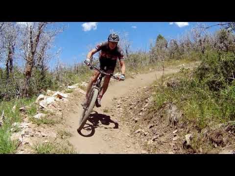

Bruce hits an uphill turn on the lower Escalator trail. Photos, video, and ride review on May 30, 2017. Updated for new trails and trail names July 2018.
High Star Ranch Trails
The High Star trail system lies on a west-facing mountain slope northeast of Kamas. It begins at the DeJoria Center. There are around 13 miles of trail starting at an altitude of 6400 feet, with a top elevation of 8000. The usual riding season is mid-May through October.
The High Star trail system lies on a west-facing mountain slope northeast of Kamas. It begins at the DeJoria Center. There are around 13 miles of trail starting at an altitude of 6400 feet, with a top elevation of 8000. The usual riding season is mid-May through October.
The trails are on private property but are open to the public for riding without charge. Trail
forks are marked with posts indicating trail name, difficulty level, and one-way versus bi-directional
status. Many major trail intersections have trail maps on posts.
Most of the High Star system is one-way trails. Difficulty varies from easy beginner (Lazy Dazz and Tombstone) to expert (the RADke DH and Short Fuse). It's easy to select a ride specifically for beginners or for intermediate riders. And while the expert trails are challenging, all the features can be rolled by a skilled rider.
Most of the High Star system is one-way trails. Difficulty varies from easy beginner (Lazy Dazz and Tombstone) to expert (the RADke DH and Short Fuse). It's easy to select a ride specifically for beginners or for intermediate riders. And while the expert trails are challenging, all the features can be rolled by a skilled rider.

Looking north from Bottoms Up, a fun add-on lariat loop in the middle of the mountain.

Rolling into a rock garden on RADke, an expert-level downhill-only trail.
To ride every trail in the system would be over 20 miles and more than 3000 vertical feet of
climbing, even if you take the most efficient paths. Plenty to do here, with a good mix of
terrain. Both beginners and the hard-core will love High Star.
Trailhead and Connections
Trailhead parking is north of the DeJoria Center in High Star Ranch. To get there, go past
all the buildings and parking lots until it looks like you're entering pure farmland. Then
turn to your right to the parking area. The trail entry is at the far north-east corner.

Looking northeast from the parking lot. There were 10 cars with bike racks here on the day I rode, but I didn't see a single biker on the mountain. That's the beauty of one-way trails!

The step-over entry to the trails. If you're behind the buildings and wondering where to go, look ahead to the left and uphill for this fence. The uphill trails begin by veering to the right at the trail forks 60 feet from the fence.
Follow the trail until it joins dirt road and turns toward the Weber-Provo canal. Just uphill
from the step-over, stay to the right at the trail fork to begin your ride. (The two left-hand
forks are one-way downhill trails.)
Individual High Star Rides
Beginner Rides!
Tombstone
Veer to the right after crossing the canal. Stay southbound and keep right at the next trail intersection to stay on Lazy Dazz. Fork to the right on Tombstone. Ride around the loop and join the bottom of the Graveyard downhill to take you back north to Lazy Dazz.
Tombstone
Veer to the right after crossing the canal. Stay southbound and keep right at the next trail intersection to stay on Lazy Dazz. Fork to the right on Tombstone. Ride around the loop and join the bottom of the Graveyard downhill to take you back north to Lazy Dazz.

Yes, there really is a graveyard, and there are tombstones. Looking east from the Tombstone trail.

Climbing uphill on Lazy Dazz. Pretty mellow stuff.
Graveyard
This is a little harder than the Tombstone ride, but still easy. Stay on Lazy Dazz until you reach the Graveyard one-way downhill trail. Then descend around the loop back to the bottom of Lazy Dazz northbound.
For a slightly harder loop, take Graveyard (an intermediate trail) uphill before descending on the Graveyard one-way downhill. The climbing is a bit tougher, and you'll climb higher before beginning the downhill.
Easier-intermediate Rides!
From the bottom, there are two intermediate climbing choices -- Escalator and Graveyard. Lazy Dazz is a beginner-level alternate climbing route that joins Graveyard uphill. Graveyard, in turn, will join Escalator uphill.
Again, turn right on Lazy Dazz after crossing the canal (the two trails to the left are downhill-only). The first fork comes about 150 yards after the step-over. Left uphill is the Escalator trail, the main climbing route for the trail system. To climb Graveyard, continue on Lazy Dazz 1/10th mile and stay left on Lazy Dazz at the Tombstone fork. 100 feet later, fork left uphill on Graveyard.

Heading uphill on Escalator, a two-way trail that connects to the upper mountain.

The entry into Whip It, as seen while climbing uphill on Escalator. Note the trail map on the post at left. The trail marker for Whip It on the second post is blue to indicate an intermediate trail.
Intermediates who are not strong climbers can now select a downhill. Graveyard is easiest.
Whip It requires that you climb a little higher on the mountain, and was slightly more techy
than Graveyard at the time of my ride.
For a short quick experienced-beginner ride, take Escalator uphill. At the next uphill fork, go downhill on Graveyard, which at this point is a two-way trail. Keep left and uphill at the next trail fork, then left again as Lazy Dazz joins. You're now on Graveyard downhill, an intermediate downhill-only flow trail. (This is the easiest of the downhill flow trails, with nothing dangerous or tricky.) At the bottom, keep heading north back to the trailhead.
For a short quick experienced-beginner ride, take Escalator uphill. At the next uphill fork, go downhill on Graveyard, which at this point is a two-way trail. Keep left and uphill at the next trail fork, then left again as Lazy Dazz joins. You're now on Graveyard downhill, an intermediate downhill-only flow trail. (This is the easiest of the downhill flow trails, with nothing dangerous or tricky.) At the bottom, keep heading north back to the trailhead.
An upper-intermediate ride...
Most riders will want to keep heading uphill. On Escalator 1.8 miles from parking, pass the entry to the Whip It downhill flow trail. 0.2 miles later, stay left as the Bad Hombre one-way downhill flow trail joins. What follows is a traverse to the northeast, which will bring you to the bottom of a little (one-way) loop at mile 2.7 called the Saddle Loop. Fork to the right if you want to keep climbing -- at which point the Saddle Loop will become one-way counterclockwise.
Most riders will want to keep heading uphill. On Escalator 1.8 miles from parking, pass the entry to the Whip It downhill flow trail. 0.2 miles later, stay left as the Bad Hombre one-way downhill flow trail joins. What follows is a traverse to the northeast, which will bring you to the bottom of a little (one-way) loop at mile 2.7 called the Saddle Loop. Fork to the right if you want to keep climbing -- at which point the Saddle Loop will become one-way counterclockwise.

The climbing turns are generous in radius, with a flatter roll-in before and a recovery section afterward. You'll like climbing here.

We're approaching the top of the two-way Escalator trail, where we'll enter the Saddle Loop. The terrain has changed from sage and oak brush to maple, chokecherry, and squawbush.
If you turn left when you reach the Saddle Loop, it will take you over to the Bottoms Up lariat
loop and the RADke DH trail. Note that once you reach the fork for Bottoms Up, the Saddle Loop
becomes a do-not-enter one-way.
For now, we'll assume you're continuing uphill on a counter-clockwise ride. You went to the right at the Saddle Loop fork.
For now, we'll assume you're continuing uphill on a counter-clockwise ride. You went to the right at the Saddle Loop fork.
0.6 miles into the Saddle Loop, you'll reach the entry to Bad Hombre. If you're done, keep right and descend Bad Hombre. Otherwise, turn to the left and keep climbing
on the Saddle Loop. At mile 3.5, the left (downhill) fork takes you around the Saddle Loop
to descend. Staying right and uphill starts you on the next higher loop, called The Chase.

Drone shot on the south side of the smaller one-way loop, heading east, just before the trail fork where you either complete the little loop, or keep climbing on the bigger loop to the top.

View of Kamas and the mountains of the Wasatch Front.
Like the Saddle Loop, The Chase is also one-way counterclockwise. When you hit a trail fork
0.9 miles later, turn hard left for a return ride on The Chase.
The right fork takes you on a one-mile loop even higher on the mountain. This upper loop called Short Fuse is also one-way counterclockwise. Short Fuse will rejoin The Chase on the northern downhill side.
The right fork takes you on a one-mile loop even higher on the mountain. This upper loop called Short Fuse is also one-way counterclockwise. Short Fuse will rejoin The Chase on the northern downhill side.
The trail descends through beautifully bermed swooping turns. Lots of turns. The trees will
change from aspen to oak and maple.
The Chase trail joins the north side of the Saddle Loop (still one-way here, so keep to the right).
The Chase trail joins the north side of the Saddle Loop (still one-way here, so keep to the right).

Rocketing around a turn in the aspens on The Chase. Note the high berm.

Bottoms Up winds back and forth in a grove of aspen.
In about 1/10 mile, as you approach a yurt platform at the bottom of the upper loop, there's
a side lariat loop to your right called. This fun loop adds a mile with about 200 feet of extra
climbing, then returns you to the Saddle Loop.
The expert trail RADke DH leaves the Saddle Loop at this same point. For now, we're riding past it.
The expert trail RADke DH leaves the Saddle Loop at this same point. For now, we're riding past it.
If you stay on the Saddle Loop, you'll return to the trail fork where Escalator ends. I recommend
you keep straight (left) and climb back uphill on the Saddle Loop to reach the Bad Hombre downhill trail you passed on your way up.
Bad Hombre feels different than the downhill you rode at the top. It's rockier and more open. There are periodic challenges -- little rock gardens to bang over and ledges to drop. None are beyond the abilities of an intermediate rider. But this trail is a little trickier and there's more potential to mess up.
Bad Hombre feels different than the downhill you rode at the top. It's rockier and more open. There are periodic challenges -- little rock gardens to bang over and ledges to drop. None are beyond the abilities of an intermediate rider. But this trail is a little trickier and there's more potential to mess up.

Rock garden roll-over on the Bad Hombre trail. Still intermediate, but a little tougher than Whip It or Graveyard.

Fun stuff. This trail system belongs on your list.
When you rejoin the two-way Escalator trail, keep going downhill. After 1/4 mile, you'll reach
the top of the downhill flow trail called Whip It.
Make a hard right to enter the trail. Descend the Whip It trail to the first trail fork just
above the canal.
Either call it a day, or head back uphill to hit the parts you missed.
Either call it a day, or head back uphill to hit the parts you missed.
Expert Stuff!
The RADke DH trail starts right where Bottoms Up forks away from Saddle Loop. Look for the trail post. In 2018, there was also a trail map on a post here. This spot is a bit complicated because there's a doubletrack past the yurt platform, and a horse trail to the north -- with a prominent "Trail" sign to confuse you. Look for the standardized bike-trail marker post.
The RADke DH trail starts right where Bottoms Up forks away from Saddle Loop. Look for the trail post. In 2018, there was also a trail map on a post here. This spot is a bit complicated because there's a doubletrack past the yurt platform, and a horse trail to the north -- with a prominent "Trail" sign to confuse you. Look for the standardized bike-trail marker post.

The entry into RADke. Note the sign background is black to indicate Expert.

Heading into a rock drop -- which can simply be "rolled with speed" with a "chicken line" on the right.
The RADke trail is a true expert route, but is not extreme. The turns are steep, tight, and
loose. You need to let the bike roll.
There are rock gardens and launch sites. But nothing requires "taking air." If you keep the bike moving, you can roll over all the hard spots.
There are rock gardens and launch sites. But nothing requires "taking air." If you keep the bike moving, you can roll over all the hard spots.
The top loop, called Short Fuse, is rated expert. While generally similar to the intermediate-level
The Chase just below, the turns are steeper and the bumps are a little meaner.

Somebody left some bumps in the trail.

Almost to the bottom. Heading west toward the trailhead on the Whip It one-way trail.
Bottom Line!
Beautifully constructed trails. Scenic and fun to ride. The upper loop offers great flow, and is certainly worth the climb.
Again, High Star Ranch is private property. So behave yourself. Respect trail closures and follow the rules, so these trails can stay open to the public for free riding.
Beautifully constructed trails. Scenic and fun to ride. The upper loop offers great flow, and is certainly worth the climb.
Again, High Star Ranch is private property. So behave yourself. Respect trail closures and follow the rules, so these trails can stay open to the public for free riding.

Aerial view map of High Star
Getting There:
From Utah Country, head to Heber and turn left on US-40. At the light below Jordanelle, turn right on SR-32. In Francis, turn left at the stop sign to stay on SR-32. Go straight through Kamas, and just as you're about to leave town, turn right at the High Star Ranch entry. Turn left at the road intersection, then head northeast until you see the sign for trailhead parking.
From Salt Lake, take I-80 to US-40, then take the Kamas exit to SR-248 eastbound. In Kamas, turn left on SR-32 and proceed to the trailhead as above.
Riding resources:
Topo map for printing:
View topo
GPX track file for trails:
Download multi-track file
Short easy loop Up and Back figure-eight plus
Lodging, camping, shops:
Links to Park City area resources Links to Heber resources
Topo map for printing:
View topo
GPX track file for trails:
Download multi-track file
Short easy loop Up and Back figure-eight plus
Lodging, camping, shops:
Links to Park City area resources Links to Heber resources
Facilities: DeJoria Center. Porta-john at the trailhead (summer 2018).


