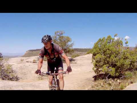
The Guacamole Trail is located near Zion National Park on top of a
mesa overlooking the Virgin River. The mountain bike trail is a mix of undulating open-rock riding plus singletrack
through pinion, juniper, and brush. The trail is upper-intermediate in
tech requirement, with a short area of advanced tech at the southeast
corner of the loop. For the expert techies, there are ledges
and stunts just a few feet away from the main trail, plus some side-dish
trails that are significantly more challenging.
Bruce heads into the Margarita portion of Guacamole
trail. Original Guacamole review in 2006. Latest update by Bruce
April 25, 2019
The classic Guacamole Trail is shaped like a lollipop, with
the sweet part on the south end. The two-mile stem of the lollipop is called the
Marguarita Trail. The loop at the end is 2.5 miles around.
At the east end of
the Guacamole loop, there's some add-on trail for tech-lovers. The first
is a half-circle off the Guacamole loop called "Lime with a
Twist," one mile in length. And off that half-circle, there's another
3.2-mile semicircle of technical trail called "Holy Guacamole"
Those trails are described on the South Guacamole Trail Page.
The trailhead. We're looking west from
the tiny parking area at the mesa top. Note the rock pile in the photo's
center. That's how we'll navigate the main loop. Remaining photos November
2011.
There's a technical option called "Salt on the
Rim" that forks off the Margarita trail and rejoins later. It's one
mile long, as it bypasses 1/2 mile of Margarita. The trail heads for the
Mesa Rim at mile 1.1 from the trailhead and reconnects at mile 1.6 of
Margarita. There are cutoff trails at mile 1.4 and 1.5 that join Salt on
the Rim to the Margarita trail.
Looking northwest on the west cliffs "Salt on
the Rim" singletrack, as the trail flirts with the mesa edge. This
bit of trail is not a sanctioned part of the trail system.
The Guacamole trail starts at 4350 feet elevation and tilts
very slightly uphill as you head south. There's less than 150 feet of
absolute elevation change over the first two miles of trail. The ride's highest point will be just before you hit the loop.
Constant up-and-down riding will bring your total climbing to around 400
vertical feet. If you started from the bottom of the mesa, make that 700
vertical.
Lots of opportunity to play on the rock.
First, a note on where to start your ride. The last 0.6
miles of the dirt road to Guacamole climbs steeply up the mesa. It's over
10% grade. When the road is wet, it's slippery and dangerous. After rain
storms or when rain is forecast -- and throughout winter and early spring
-- start your ride on the road and bike up the mesa. There's a wide spot
for parking at the road fork below the mesa.
Typical trail section. Singletrack in
the trees, with rocky ledges and humps.
The classic Guacamole ride is a lollipop shaped route of 6.5 miles.
If
you start from the parking spot at the fork below the mesa, the ride will
be 7.7 miles. And add 300 vertical feet of climbing for the grunt to the mesa top.
This rock walked here. It's just
waiting for you to leave before it moves on.
In slickrock
areas, the trail is marked with small rockpiles. Navigation has improved a
lot since my first visit in 2006, but you may occasionally need to stop and
look around for the ongoing path. As you pass one rock pile, look for the
next. If you don't see one, keep straight.
Marker cairn, this one made completely
of petrified wood. The trail will go up and over countless elephant-back
rock mounds like those in the photo.
The rock is Shinarump conglomerate from the Triassic Era (about 240 million years ago).
Mountains of metamorphic quartzite in the west of Utah were eroding,
sending gravel and sand down into this area. Pebbles of quartzite and
petrified wood are everywhere on the mesa. (PLEASE leave the petrified
wood where it is!)
In the valley below, that's the road
in. The slope in mid-photo would be red Chinle and Moenkopi, but the red
mudstone is covered by gray debris from the mesa top.
For a group of rock-lovers, Guacamole can fill up a half-day or more of
tech riding. The tech sections will be more work per mile than you'd
think. Even with leg power to spare, the upper body may get worn out after
an hour of hitting the technical challenges. Take your time. This is more of a
stay-and-play than a grind-the-miles.
There's a lot of up-and-down riding. Following
a ridge of sandstone before dropping back down.
A video of Guacamole from
2019...
If the above video does not appear on your
browser/device, you can watch it on YouTube by clicking
here.
The Classic Guacamole can be done as a quickie, finished in under 90
minutes by a skilled rider. With a couple of short rock-scrambles, it's
within the ability level of an experienced intermediate rider.
For the hard-core rider, the optional rides (Salt on the Rim, Lime with
a Twist, and Holy Guacamole) can be added on for a satisfying day of
riding.
Looking toward Zion National Park from
the southeast corner of the loop.
Riding notes, Classic Guacamole:
0.0 R from road on rock following cairns
N37 13.575 W113 06.869
1.1 Keep L for Margarita Trail
N37 13.103 W113 07.501
1.5 West ST rejoins, keep L
N37 12.775 W113 07.447
1.6 ST rejoins, keep L
N37 12.713 W113 07.417
2.1 Keep R for counterclockwise loop
N37 12.398 W113 07.236
2.6 South ST joins on R (hard to spot)
Keep L N37 12.153 W113 06.990
3.2 Fork L (R = South ST)
N37 12.178 W113 06.633
4.4 Loop fork, R to return
N37 12.398 W113 07.236
4.8 Keep R (L = West Cliffs)
N37 12.713 W113 07.417
4.9 Keep R (L = West Cliffs)
N37 12.775 W113 07.447
5.3 Keep R (L = West Cliffs)
N37 13.103 W113 07.501
6.5 Back at trailhead
Note: the West Cliff and South ST are
not
authorized routes. They're mentioned here
for navigation purposes.
OK, here's a fun spot. In 2006 while standing scratching our heads
trying to pick up the continuing trail, Chad found this tube through the
rock. We think it's likely the impression of an old tree trunk in the
stone. When you reach a high point on an almost-impossible up-and-down
just north of the trip around the slot (you'll know it when you ride it),
at around N37 12.246 W113 06.642), look north about 50 feet. (See map.)
And an old analog video
from 2006...
If the above video does not appear on your
browser/device, you can watch it on YouTube by clicking
here.
Getting there: From La Verkin, turn
towards Zion National Park on Highway 9. Go 7 miles from the traffic light
where you turned east in La Verkin, through the town of Virgin, and past
the Kolob Reservoir Road on the left. At 7.3 miles, you'll see a dirt road
on the north (left) side of the road (N37 11.874 W113 09.876). This is Dalton Wash Road. Drive north 1.9 miles. As the road
turns to the east past a farm, you'll come to a fork (N37 12.456
W113 08.268). Turn left (north). Go 1.7 miles. As you approach the steep
mesa, there's a wide spot in the road and a fork. The uglier road straight
ahead is the correct one. In winter and early spring, or if the weather has been wet, park
here and bicycle up the mesa. With any mud at all, the next 0.6 miles can
be ugly and dangerous. Immediately as you get to the top of the mesa, the road forks
again. Go right (south) about 100 yards. Look for a big open
slickrock area on your right (GPS N37 13.575 W113 06.852). This is where the ride starts.
Head west across the rock area to pick up the trail as it enters the trees.
Over the Edge Sports (76 E. 100 S., Hurricane) is
happy to provide current trail and dirt-road conditions. Call 435-635-5455.