

The Cassidy Trail lies on Claron Formation limestone, creating colorful rock formations. Photos by Bruce, July 31, 2004.
Cassidy Trail
The Cassidy Trail is a little-known but awesome ride. The trail is upper-intermediate technical, moderate aerobic. Trailhead is at 7200 feet, rising to 7900. The trail starts on Highway 12 in Red Canyon, and connects to the Casto Canyon and Losee Canyon trails. Ride options include out-and-back (to Braxton Point 5.5 miles round trip), loop with Losee Canyon (14 miles), or a loop with Casto Canyon (20 miles).
The Cassidy Trail is a little-known but awesome ride. The trail is upper-intermediate technical, moderate aerobic. Trailhead is at 7200 feet, rising to 7900. The trail starts on Highway 12 in Red Canyon, and connects to the Casto Canyon and Losee Canyon trails. Ride options include out-and-back (to Braxton Point 5.5 miles round trip), loop with Losee Canyon (14 miles), or a loop with Casto Canyon (20 miles).
The Cassidy Trail is a lot like Thunder Mountain, which is located just on the other side of
highway 12. This is probably the greatest ride you've never heard of. Done as a loop (or shuttle
ride) up Cassidy then down Losee Canyon, it's a world-class ride.
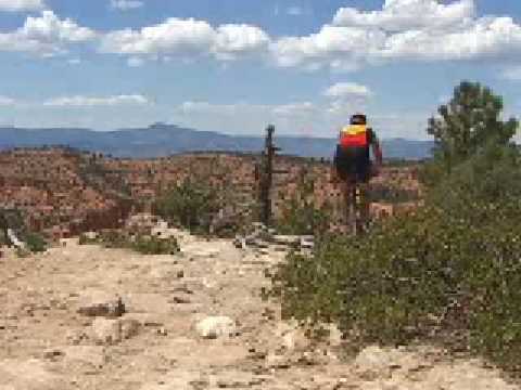
The scenery is colorful limestone with a sprinkling of manzanita, cedar, long-leaf and bristlecone pine. Temperatures are warm but tolerable at mid-day in summer.
The scenery is colorful limestone with a sprinkling of manzanita, cedar, long-leaf and bristlecone pine. Temperatures are warm but tolerable at mid-day in summer.

Bruce pilots "Banana Thunder" down Losee Canyon.

View from Braxton Point, top of Cassidy Trail
Cassidy to Losee Canyon Loop,
counterclockwise
0.0 Trailhead on U-12, N on ST
N 37° 44.111' W 112° 18.089'
0.9 Fork R (L = Rich Trail)
N 37° 45.320' W 112° 17.890'
2.3 Rich Trail rejoins
2.4 Fork L (R = Rich Trail)
N 37° 45.775' W 112° 18.349'
2.8 View, Braxton Point N 37° 46.062' W 112° 18.352' Alt=7860
3.2 Trails rejoin and split, veer R (L = Rich)
N 37° 45.944' W 112° 17.963'
3.5 Rich Trail rejoins on L N 37° 46.036' W 112° 17.724'
5.2 Begin steep descent
5.7 Bottom of canyon, L to Losee
(R = Cassidy continues to Casto)
N 37° 46.638' W 112° 17.292'
9.1 Losee Canyon trailhead, L on gravel road
N 37° 46.183' W 112° 20.054'
11 L up paved road
12 Transfer to paved bike trail along road
14.1 Watch for trailhead (hard to see across road)

Nearing the bottom of Losee Canyon. You can shuttle from here to the Red Canyon trailhead, or complete the loop with 5 miles on gravel and pavement.

Map of Cassidy, Casto, and Losee.
Getting there:
From US-89, drive 4.2 miles east on U-12 (towards Bryce Canyon National Park). Pass the Thunder Mountain trailhead, the Visitor's Center, and a campground. Watch for a turnoff into a well-hidden parking area on the left, signed "Red Canyon Trailhead." The Cassidy Trail begins at the northeast corner of the parking area. N 37° 44.111' W 112° 18.089'
From US-89, drive 4.2 miles east on U-12 (towards Bryce Canyon National Park). Pass the Thunder Mountain trailhead, the Visitor's Center, and a campground. Watch for a turnoff into a well-hidden parking area on the left, signed "Red Canyon Trailhead." The Cassidy Trail begins at the northeast corner of the parking area. N 37° 44.111' W 112° 18.089'
Riding resources for this trail:
One-page guide to this trail
GPS track files (right-click and "Save as..."):
Cassidy-Losee GPX
Medium-res topo: View
High-res topo includes Casto (700 KB): View
Lodging, camping, shops: Links to Red Canyon area resources
One-page guide to this trail
GPS track files (right-click and "Save as..."):
Cassidy-Losee GPX
Medium-res topo: View
High-res topo includes Casto (700 KB): View
Lodging, camping, shops: Links to Red Canyon area resources


