Two Tortoise Rock lies south of the trail. Photos and trail description from a May 4, 2011 ride by Bruce.
Two Tortoise Rock Loop
Two Tortoise is an ATV and 4x4 route connecting the Gold Bar Rim 4x4 road to the Bull Canyon road. It's located just below the Gemini Bridges area north of Moab. Most riders will use Two Tortoise as an alternate more-fun route to Bull Canyon, or as one side of a loop including the Little Canyon Singletrack . This route is suitable for an advanced beginner or early intermediate rider.
The Two Tortoise route itself is around 3 miles long and is intermediate in tech difficulty.
Altitude change is about 200 vertical, but with up-and-down riding the
total climbing is 500.
To reach and ride Two Tortoise, you'll need to combine other trails. Our
"featured ride" is
a loop using the lower
Gemini Bridges
Road, part of Gold Bar Rim, Two Tortoise, part of Bull Canyon, and the Little Canyon Singletrack.

Almost through climbing on Gemini Bridges, as the road follows the tilted stone near the junction of the Chinle Formation with the Moenkopi Formation.

We're 0.5 miles up Gold Bar. Note this spot. Just to the left of this photo is a wide area where a few vehicles can park to do the shorter version of the ride.
For advanced beginners and early-intermediates, I recommend parking on Gold Bar Rim right where
it starts climbing and riding the loop described below. This ride will
be 6 miles.
Stronger advanced-beginner riders can do the 16-mile ride that includes the lower Gemini Bridges
road to the 6-mile Two Tortoise loop. The Gemini Bridges portion is scenic
but technically
easy and will go by quickly. It doesn't add that much extra work to the
little loop.

At this point, fork right. (As of 2011, there's no Two Tortoise sign or other trail indicators anywhere along the route.)

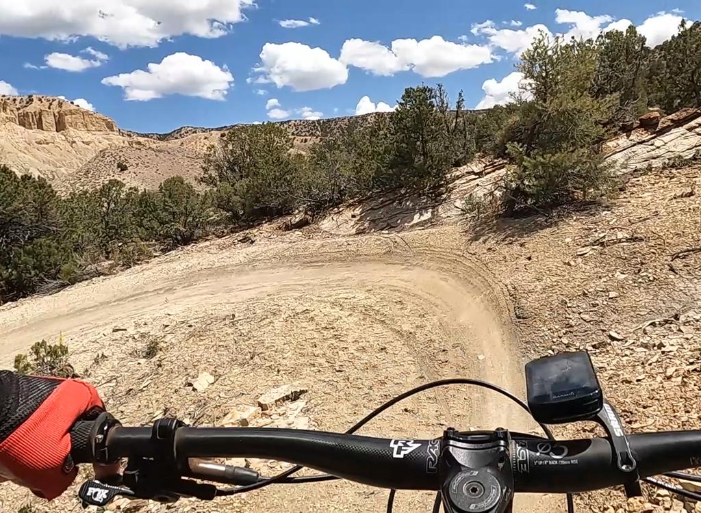
Trail view looking southwest.
Riders with the time and leg to do extra miles can add an out-and-back to Bull Canyon in the
middle of the loop. If you go only to the hiking trail below Gemini Bridges,
it will add 4
miles (two each way) without adding much vertical change. When done from
the bottom of the
Gemini Bridges road, this ride will be around 20 miles.
Start from the bottom of Gemini Bridges road. Climb up and over the Moenkopi skirts below the
cliffs and descend into the scenic canyon. Turn left when you reach the
Gold Bar Rim road.
This will take you to Two Tortoise.

The trail meanders up and down. We're descending toward the base of Two Tortoise rock.

As we pass the rock, the angle changes. 4x4 drivers going eastbound see this view, which they call "doggie style."
After a short distance on Two Tortoise, you'll see Two Tortoise Rock on the skyline to the
south. You'll be able to appreciate the landmark from various angles during
your ride.
Two Tortoise is mostly slickrock with short stretches of dirt. There are only a couple of ledges
that would challenge intermediate riders. The hardest part of the ride
is actually the little
section of Gold Bar Rim that you must ride to reach Two Tortoise.

Climbing away from Two Tortoise Rock to the highest point of the ride.

View to the southeast. In mid-photo is the Moab Rim and Behind the Rocks, with the La Sal Mountains on the skyline.
Once you gain altitude, there are panoramic views. You'll see the dark slash of the canyon
of the Colorado extending from southeast to southwest. The La Sal Mountains
sit on the skyline
to the southeast. To the northeast is Eagles Nest and the cliffs along
Highway 191.
The trail meanders up and down, generally climbing. At the western end, it descends a little
before ending on the Bull Canyon road. The riding is fairly easy here.

Looking to the northeast, we see the canyon of the Gemini Bridges road, with Eagles Nest (Little Canyon Rim) above it.

Looking at Gemini Bridges from the hiking trail.
While you're riding Two Tortoise, I do recommend the out-and-back in Bull Canyon. You're in
the area. Why not? It's not that much work. Just fork left on the Bull
Canyon, then catch the
critical right fork 0.3 miles later. Park your bike at the hiking trail
and walk to the spot
below the bridges. Then backtrack to the fork with Two Tortoise.
It's one mile from the west end of Two Tortoise to the Little Canyon Singletrack. It will be
on your right as Bull Canyon makes a right turn and begins the final climb
to the Gemini Bridges
Road. If you arrive at the Gemini Bridges road, backtrack around 0.1 mile
on Bull Canyon to
the first left turn. Find the ST eastbound.

View of the Little Canyon Singletrack as we descend. Pretty mellow riding for Moab.

The Gooney Bird, a landmark on the Gemini Bridges road.
When you reach the Gold Bar 4x4 route again, turn downhill and retrace your route back to the
Gemini Bridges trailhead.
Note for Big Mile riders: Ride the paved Old 191 path from Moab to reach the Gemini Bridges road. This will add (at least) 16 fairly easy miles to your trip. This will be a big day, so take plenty of water.
Two Tortoise Loop from Gemini/Old 191:
0.0 Southbound on Gemini Bridges Road
N38 39.378 W109 40.692
4.6 L on Gold Bar Rim N38 36.062 W109 40.463
5.1 Keep L - parking for short loop
N38 35.830 W109 40.221
(R=sandy connector to Little Canyon ST)
5.2 Pass Gold Bar Singletrack
N38 35.881 W109 40.143
5.7 Fork R on Two Tortoise
N38 35.866 W109 39.742
7.7 Fork R (L = dead end) N38 34.797 W109 40.306
7.9 Keep L N38 34.830 W109 40.379
8.5 R on Bull Canyon Rd N38 34.934 W109 40.899
Alternate = L to Bull Canyon
9.5 Left on Little Canyon ST
N38 35.729 W109 41.007
10.7 Keep R (L = sandy DT to Gold Bar)
N38 35.683 W109 40.194
10.9 L downhill on Gold Bar
N38 35.881 W109 40.143
11.5 R on Gemini Bridges Rd
16.1 Back at 191
8.5 R on Bull Canyon Rd N38 34.934 W109 40.899
Alternate = L to Bull Canyon
9.5 Left on Little Canyon ST
N38 35.729 W109 41.007
10.7 Keep R (L = sandy DT to Gold Bar)
N38 35.683 W109 40.194
10.9 L downhill on Gold Bar
N38 35.881 W109 40.143
11.5 R on Gemini Bridges Rd
16.1 Back at 191
Little Two Tortoise with Bull Canyon:
Park at "Dead End" 0.5 miles up Gold Bar
0.0 L uphill N38 35.830 W109 40.221
0.1 Pass Gold Bar Singletrack N38 35.881 W109 40.143
0.6 Fork R on Two Tortoise N38 35.866 W109 39.742
2.6 Fork R (L = dead end) N38 34.797 W109 40.306
2.8 Keep L N38 34.830 W109 40.379
3.4 L on Bull Canyon Rd N38 34.934 W109 40.899
3.8 Fork R and enter wash N38 34.934 W109 40.899
5.4 Hiking trail to arches N38 34.914 W109 42.027
Double back
7.4 Pass Two Tortoise N38 34.934 W109 40.899
8.4 L on Little Canyon ST N38 35.737 W109 41.006
9.8 L downhill on Gold Bar N38 35.881 W109 40.143
9.9 Back at parking
5.4 Hiking trail to arches N38 34.914 W109 42.027
Double back
7.4 Pass Two Tortoise N38 34.934 W109 40.899
8.4 L on Little Canyon ST N38 35.737 W109 41.006
9.8 L downhill on Gold Bar N38 35.881 W109 40.143
9.9 Back at parking
Getting there:
Gemini Bridges TH: From I-70 drive south on US-191 for 22 miles. From Moab, drive 7 miles north of the Colorodo. Turn west (left if you're coming from Moab) into the parking area. GPS N 38° 39.381' W 109° 40.672'. To avoid a parking fee (private lot), go across 191 to the Bar M parking.
Gold Bar Rim road parking: Drive up the Gemini Bridges road 4.6 miles, and fork L toward Gold Bar Rim and drive along the wash 0.5 miles. You can park near the wash at N38 35.849 W109 40.304. Begin by riding up the hill.
Old 191 parking: Go to the north end of Moab. Just south of the Colorado River, turn east on Highway 128. Immediately turn left and descend to the parking area. Start your ride on the paved bike path northbound.
Bathroom: Gemini TH
Water: none
Camping: primitive on Gemini Bridges Rd (bring your toilet!)

Map for the Two Tortoise ride.
Riding resources for this trail:
Single-page riding guide
GPS track files (right-click and "Save as..."):
Area track files
Two Tortoise only
Small Loop
Loop w Gemini
Loop w Bull Canyon
High-res topo for printing (1.2 MB): View
Lodging, camping, shops: Links to Moab area resources
Single-page riding guide
GPS track files (right-click and "Save as..."):
Area track files
Two Tortoise only
Small Loop
Loop w Gemini
Loop w Bull Canyon
High-res topo for printing (1.2 MB): View
Lodging, camping, shops: Links to Moab area resources