View into the narrows of Onion Creek from the Top of the World. Photos and description based on a ride by Bruce on November 4, 2010.
Top of the World
The Top of the World trail is a 9 mile climb from the Colorado River to a viewpoint over the Onion Creek Narrows. This ride is reserved for very strong climbers who can handle some technical rock. The ride starts at 4100 feet and tops at 7050. With some up-and-down riding on the Kokopelli to get to Top of the World, your total climbing will be 3300; the round trip 18.5 miles.
The ride starts at the old burned-out Dewey suspension bridge, 29 miles northeast of Moab on
U-128. There's parking and a bathroom right off the highway. (Consider
driving another 1/3
mile up the gravel road to a larger parking area on the left.) For the
first five miles, you'll
be riding on gravel road.

Looking north at the remnant cables of the old Dewey Bridge. We're now 100 feet into the ride.

To the left of this double-scoop formation of Entrada sandstone, steam rises off the Colorado River in the crisp early-morning November air.
The road doubles as the
Kokopelli
Trail. The climb is mellow at first, then you'll hit some steep pitches. There's a bit of loose
rock and washboard. Fortunately, the scenery diverts you from total boredom
if you detest gravel-road
rides as much as I do.
It will seem like each climb on the road is followed by a downhill where you give half of it
back. Don't push too hard here. You've got a huge unrelenting climb coming
up. Enjoy the views.

The road follows the break between Navajo sandstone underground and Entrada rising above the desert. Most of the formations you see are Entrada.

Here's the spot. Turn right.
Stay on the main road for 5 miles. Then you'll come to a marked fork where a primitive doubletrack
forks off the main gravel road on your right. This is the
Kokopelli
Pedal another 100 yards, and you'll come to the fork shown in the photo. Turn right again and
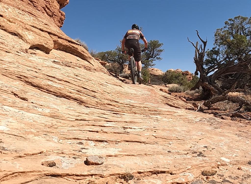
begin climbing.You'll now be following the Kayenta sandstone layer uphill
on a 10% slant.
Top of the World is four miles of 500 vertical per mile. That's a 10% average slope, my friends.
Yet there are multiple ledges and tech features. On the smooth stretches,
save some leg to
hit the spots that required speed and muscle.

The doubletrack is surrounded by pinion pine and juniper. I'd guess that about 60% of the ride is on rock.

This layer of lime-rich rock in the Kayenta has what appears to be fossilized worm trails. Must have been a lake or seashore here.
As you climb, the doubletrack becomes more open rock and less dirt. Schedule a few breaks to
look back over your shoulder at the views to the north. A two-minute rest
every half-mile keeps
your legs and attitude fresh. Or maybe you aren't 60 years old and didn't
do 33 miles the day
before. In that case, crank away.

Looking back the way we came. Some stretches have loose rock to make the downhill interesting.

Good luck with this one. I couldn't find the combination to unlock this knee-high ledge.
The last mile seems pretty steep, with 570 vertical. It's pretty much 100% open rock here,
with a lot of ledges. Hang in there. This is a hero-level, peg-the-meter,
bragging-rights climb.

We're about there. In the center of the photo is the junction between rock and air.

View to the west.
At the viewpoint, the Kayenta you've been riding on ends at sheer Wingate cliffs. Creep carefully
up to the edge. To the right, you can see Fisher Towers and Castle Valley.
Below the Chinle,
the first layer of deep brown cliffs is Moenkopi. The more stratified
rock near the bottom
is the Organ Rock formation.
Peeking over the edge, you're looking down into the Onion Creek narrows. I spotted this little
group of hoodoos. The white caps are a thin layer of White Rim sandstone
(the stuff you ride
on at the White Rim trail). The columns are Organ Rock mudstone.

Lying on my stomach, shakily holding the camera up to the edge to shoot a photo of the skirts below the cliff.

View to the east.
To the east, you're looking over Fisher Valley and Cowhead Hill. The cliff line is Wingate
sandstone. The layered Kayenta at the top protects the Wingate so it can
form sheer vertical
drop-offs. The skirts below the cliff are first Chinle, then Moenkopi.
To the south, the first line of cliffs is Fisher Mesa. Nice bike trail there. Above loom the
snowcapped peaks of the La Sal Mountains.
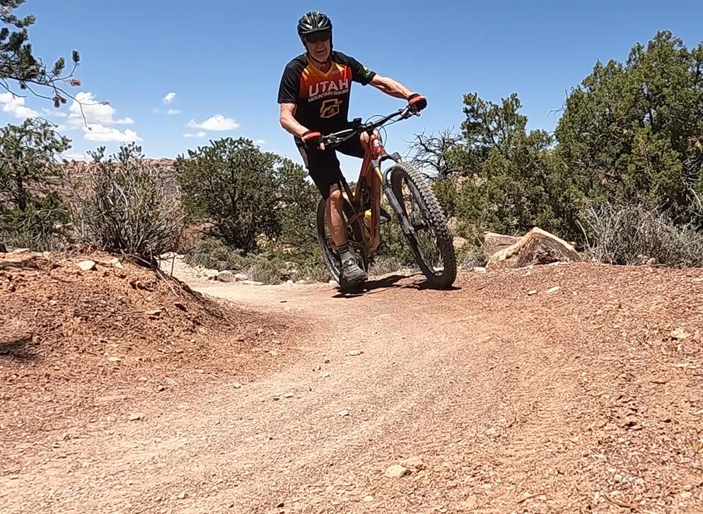
Once you've had a snack, slurped the last of your water, and finished your share of Ooh Ah, it's time for the downhill. Prepare for some fun.

View to the south.

It's just what you think. But it's not mine.
Downhill, the top two miles are awesomely just-right technical. There are plenty of uphill-facing
ledges ready to pinch-flat your tire. Downhill-facing ledges give you
plenty of spots to launch.
There are tire traps and endo opportunities. And loose rock slabs to catch
your front tire.
Keep your speed up and pick your line quickly. The slow and careful are
more likely to eat
rock by hanging up the front wheel.
Riding notes, from Dewey:
0.0 Head east from bathroom on gravel road
N38 48.648 W109 18.240
0.3 Pass alternate parking (on L)
N38 48.621 W109 17.914
1.2 Stay R (L goes to Waring Canyon)
N38 48.196 W109 17.233
3.5 Veer R and uphill N38 47.109 W109 15.826
3.9 Stay R again N38 46.931 W109 15.777
5.2 CRITICAL FORK, R off main road
Kokopelli Trail N38 46.237 W109 14.991
5.3 Fork R onto Top of the World
N38 46.209 W109 14.943
Stay on main doubletrack
9.3 You're there N38 43.222 W109 15.978
18.6 Back at car
Camping: Dewey campground, just east of the
trailhead.
Water: Campground. Otherwise, Moab.
Bathroom: At the trailhead
Bike services: Moab

Top of the World
Getting there from Moab: At the
Colorado River bridge north of town, turn east on Highway 128. Drive 29
miles. As the highway turns to go across the river, keep straight and turn
off on the right. Off-season, use the parking at the bathroom. On weekends
and peak season, I suggest you drive another 1/3 mile up the gravel road
and park in the fenced area on the left N38 48.621 W109 17.914.
Getting there from the Wasatch Front: On I-70, keep driving past the Crescent Junction (Moab) exit. After 22 miles, take exit 204 (Cisco) to U-128/US-6. Go right. Drive 2.8 miles and turn right on U-128. Drive another 11 miles. Just after crossing the Colorado River bridge, turn left into the parking area.
Getting there from the Wasatch Front: On I-70, keep driving past the Crescent Junction (Moab) exit. After 22 miles, take exit 204 (Cisco) to U-128/US-6. Go right. Drive 2.8 miles and turn right on U-128. Drive another 11 miles. Just after crossing the Colorado River bridge, turn left into the parking area.
Riding resources for this trail:
Single-page riding guide
GPS track files (right-click and "Save as..."):
GPX
Topo map for printing: View Hres
Lodging, camping, shops: Links to Moab area resources
Single-page riding guide
GPS track files (right-click and "Save as..."):
GPX
Topo map for printing: View Hres
Lodging, camping, shops: Links to Moab area resources