
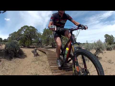
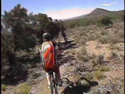


(General riding area and Race Course Loop)
The Three Peaks Trail System has lots of goodies: developed camping, singletrack loops of varying length and difficulty, and technical rock that's definitely worth your attention. This trail system is located near Cedar City at the Three Peaks recreation area. Altitude is around 5800 feet, with peak altitude 6150 for the loop rides. This page covers the general riding area and loop rides. For the Twilight Zone and the "Whale Trails" see the Twilight Zone page . See also specific pages for the Three Peaks Loop and Big Hole Loop .
. Theres a bathroom (just ou...")


For intermediate riders, go for the Race Loop. This singletrack climbs up to the ridgeline, then plunges back down. I'd rate it an intermediate technical, but beginners can manage nicely if they walk a couple of very short rocky side-tilted areas on the trail.
And a word about the granite: this fine-grained pink granite presents a riding surface you won't find elsewhere in Utah. The traction is so good that you'll be able to make moves on the granite that you couldn't do on sandstone.


On the southeast corner of the Three Peaks Loop are the " whale trails ." These are advanced-technical trails that, on the fun scale, are equal to anything else in Utah. Short trips through the trees are punctuated by tech challenges on the granite.
If you're in a hurry to get to Petrified Whales, you can take the new (2016) Twilight Zone trail. See the topo map link below.
Note that in May 2015, the Four Loco trail shown on the BLM map at the trailhead is not accurate. I'm presuming a safer, saner, more sustainable trail will soon replace the current wild rough route. (For now, I have the GPX track of the old trail in my downloadable multi-trail file if you want to try it. I don't recommend it. It's nasty. Hard to ride and hard to find your way.)

| Trail | Length | Description |
| Big Hole Loop | 3.4 | Furthest north of area trails; loops around mountain. Intermediate tech. |
| Earl's | 0.7 | Singletrack alternate to west side Race Course or main Three Peaks Loop. Intermediate. |
| Four Loco | 1.4 | Wild route off southwest corner of Three Peaks Loop, being replaced. Upper-advanced. |
| Humpback | 0.3 | Alternate route within Petrified Whales loop. Advanced tech. |
| Iron Creek Cutoff | 0.9 | Singletrack between east and west sides of Three Peaks Loop. Intermediate. |
| Jumbled Jonah | 0.4 | Extension loop off east side of Petrified Whales, connects to Twilight Zone. Upper intermediate. |
| Lost World | 0.7 | Joins Practice Loop to Big Hole Loop, ladders and stunts, intermediate. |
| Moby Dick | 0.3 | Connects Humpback to N side of Petrified Whales. Advanced. |
| Orange Fork | 0.5 | Joins middle of Lost World to SE corner of Big Hole Loop. Intermediate. |
| Outer Limits | 0.4 | Connects north end of Practice Loop to Orange Fork. Easier. |
| Outlaw | 0.6 | East-west route north of camping, shortcuts between two limbs of Race Loop. Easier. |
| Petrified Whales | 1.4 | Loop off southwest corner of Three Peaks Loop, technical rock. Advanced. |
| Practice Loop | 1.6 | Loop north of parking; route to other trails. Mostly dirt ribbon. Easier. |
| Race Loop | 5.1 | Complex loop with ST and DT; passes through picnic area. Intermediate. |
| Shortcut | 0.4 | Links south side of Big Hole Loop (and north Race Loop) to southern Race Loop. Easier. |
| Sweet Pea | 0.3 | Links Lost World to Outlaw, crosses southern Race Loop. Easier. |
| Three Peaks Loop Trail | 5.6* | Circles the peaks, *to close loop via Big Hole and Earls adds 1.9 miles. Upper-intermediate. |
| Three Peaks Technical | 1.1 | Alternate ST off traditional Three Peaks Loop, adds 1/2 mile to distance. Upper-intermediate. |
| Twilight Zone | 2.6 | Connects Practice Loop to Jumbled Jonah. Intermediate. |
| Twilight Bypass | 0.4 | ST bypasses some tech sections of Twilight Zone, drops 0.4 miles. Easier-intermediate. |
0.0 Left through fence then keep R
N37 46.017 W113 10.090
0.2 Keep right (Practice Loop)
N37 46.145 W113 10.147
0.5 Trail turns L w fence
N37 46.363 W113 10.147
0.6 L and through fence
N37 46.381 W113 10.257
Follow signs carefully!
0.9 L on dirt road N37 46.182 W113 10.307
1.5 R off DT onto ST
N37 46.267 W113 10.674
1.6 Keep L (R = Outlaw)
N37 46.333 W113 10.765
2.1 Fork L (R = Short Cut)
N37 46.646 W113 11.030
N37 46.541 W113 11.247
2.5 Keep R (L = Earl's)
N37 46.627 W113 11.312
3.2 Fork R on Big Hole/Race Course
N37 47.054 W113 10.956
3.3 Keep L (R = Short Cut)
N37 46.966 W113 10.827
3.5 Fork R (L = Big Hole)
N37 46.947 W113 10.703
4.0 Keep straight (cross Sweet Pea)
N37 46.530 W113 10.512
4.3 Fork L on Practice Loop
N37 46.471 W113 10.238
4.4 Fork R (L = Lost World)
N37 46.502 W113 10.226
5.1 Back at trailhead
An alternate is to continue past the mountain bike parking and take the next right toward the picnic and camping area (with flag poles and Three Peaks sign). At the fork in the road, turn right to the picnic pavilion, GPS N 37 46.172' W 113 10.259'. Camp spots are to your north. To your west is the ATV and tech play area. Once you're riding, you'll need to head north to find the bike trails at a break in the fence.
Note: Click on this topo map link for specific trail names and accurate alignments.
Camping: On site, option group or individual
sites, option developed vs primitive
Water: Trailhead, pavilion, and campground
Bathrooms: Trailhead, campground, picnic area, pavilion
Bike services: Cedar Cycle in Cedar City

Single-page riding guide, Race Loop
GPS track files for this trail (right-click and "Save as..."):
Race Course Loop
Area trails multi-track file
High-res area trail topo for printing: View topo map
Lodging, camping, shops: Links to Cedar City area resources
Trails within riding area:
Three Peaks Loop
page
Big Hole Loop
page
Twilight Zone and Petrified Whales
page
High-res topo trail map and GPS file updated 2016.


