Matt Flygare (the Mad Scientists brother-in-law) cools down while overlooking Cottonw...
Matt Flygare (the Mad Scientist's brother-in-law) cools down while overlooking Cottonwood Canyon. August 28, 1999
Three Forks Loop
(Cottonwood Creek to Fifth Water)

Three Forks Loop (Cottonwood Creek to Fifth Water)The Three Forks Loop is a strong-intermediate to advanced trail in Diamond Fork (near Spanish Fork Canyon). The trail climbs Cottonwood Canyon as a single-track, traverses over a couple of canyons on Ray's Valley Road, then drops down Lower Fifth Water to Sixth Water and back to the Three Forks parking area.

This is a surprisingly pretty trail, with twists and turns, quick up and downs, creek crossings, rock-dodging and root hopping. Length is 16 miles, with 1900 vertical feet of elevation change.

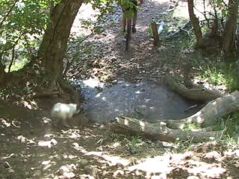
The trail begins at Three Forks, where Cottonwood Creek, Sixth Water, and Diamond Fork come together. From the parking area, continue straight past the rest rooms 100 feet. Turn right to a bridge that crosses Sixth Water. After crossing the river, bike straight ahead another 100 feet and plunge straight through the gully of Cottonwood Creek. Once you're on the far side of tiny Cottonwood Creek, you're on the trail. Starting at 5200 feet, the trail will climb to 7100.

Looking east into the early morning sun along Cottonwood Creek. August 28, 1999
Matt plunges through Cottonwood Creek on the way up the canyon. August 28, 1999
The single-track trail up Cottonwood Creek passes through box elder, oak, cedar, and maple. This canyon "feels" very different from other northern Utah trails. The trail has some quick technical uphills, a few tricky creek crossings, and a lot of twisting trail. Nothing too tough, though.

You'll occasionally smell sulfur in the air from hot springs. Either that, or the biker in front of you had a very interesting breakfast.

At 4.7 miles, the trail comes onto a dirt road.* Hop onto the dirt road and grind 1.2 miles up to the paved Ray's Valley Road. Turn left and bike 5 miles to the Fifth Water Trail. (Look for a prominent double-track crossing the road on the far side of a creek, note the sign that says "Fifth Water," and turn left downhill.)
*The trail that turns left uphill at the dirt road now connects to Ray's Valley Road, shortening the total ride by about a mile. It adds more nice trail to your ride -- who misses a mile of paved road? (When I explored it in 1999, this trail petered out into a maze of cattle trails and disappeared. I'm told it's now THE way to go.)
Riding the morning after a heavy rain, we carried a load of mud up the canyon wi...
Riding the morning after a heavy rain, we carried a load of mud up the canyon with us. And the high humidity made the sweat linger despite the cool temperature. Here's the Doc and Jackie. Photo August 28, 1999 by Matt.

Old analog video of Three Forks...

[Back to video list ]
Matt makes a turn around a moss-covered bounder of conglomerate. August 28, 1999...
Matt makes a turn around a moss-covered bounder of conglomerate. August 28, 1999
The first mile of Fifth Water is double-track. The next two miles of single-track have some tricky sections, then the trail widens and runs quickly down to Sixth Water (a larger creek), then to the Three Forks trailhead. You'll come out of the woods next to the bridge you crossed to reach Cottonwood Creek.
The Falls are about 2.5 miles up the Fifth Water Trail. This is a popular attraction, but if it's not too crowded, you might want to stop and play a while.
View of the falls from the trail. Looks like fun. August 28, 1999
Riding notes, counterclockwise loop
0.0   Trailhead, ride 100 feet past restroom
        N 40° 05.104' W 111° 21.302'  Alt=5200'
        Turn R over bridge, 100 feet, through creek
        Uphill (L) on ST immediately after creek
4.7   Cross small creek to DT
        Alternate: follow singletrack on left
        N 40° 03.300' W 111° 17.822'  Alt=6750'
5.8   Left on paved Rays Valley Road
        N 40° 02.752' W 111° 16.830'  Alt=7100
6.5   Pass Second Water Trailhead
        N 40° 03.383' W 111° 16.750'  Alt=7200
10.7 L onto trail at Fifth Water
        N 40° 06.340' W 111° 17.460'  Alt=6900
12.7 Pass hot springs, falls
14.7 Bridge, cross Sixth Water
        N 40° 05.132' W 111° 20.330'  Alt=7200
15.8 Back at parking
Other riding options:
Easy:  Ride up Sixth Water, connect to Fifth Water, and ride to the hot springs below the falls. 6 miles total round trip.
Hard:  Head up Cottonwood Creek as above, then cross Rays Valley Road to the Second Water Trail. Follow it all the way to the Strawberry Ridge Road, turn left and ride it six miles to the top of Fifth Water, then descend (20 miles).
Very Hard:  Head up Cottonwood Creek, connect to Second Water, then turn left onto the Center Trail. Follow the Center Trail to Fifth Water and descend (21 miles, significant climbing on the Center Trail).
Three Forks loop
Three Forks loop
Getting there: Going south, take the first Spanish Fork exit from I-15 (US-6 to Price and Manti). Go east on US-6 and enter Spanish Fork Canyon. Drive 5.5 miles from the mouth of the canyon then turn left on the Diamond Fork road. Drive 10 miles and spot a gravel turnoff on the right (southeast side of the road) that crosses Diamond Fork Creek. Drive into the parking area (restrooms may be closed). GPS N 40° 05.104' W 111° 21.302'.
Other ways you can get to the Diamond Fork trails:  (1) Hobble Creek:  From Springville, head up Hobble Creek Canyon. Once you enter the canyon, keep right at every fork in the road. You'll cross over the pass and down into Diamond Fork. You'll reach the Diamond Fork Road about 13 miles after leaving Springville. (2) Ray's Valley Road:  In Spanish Fork Canyon, go a few miles further up the canyon to Ray's Valley Road. You can access the trails directly from the paved road, or continue onto the dirt road (keep left at the intersection with the Strawberry road) and down into Diamond Fork. You'll reach the paved Diamond Fork road about 17 miles after leaving US-6. (3) Strawberry:  From US-40, turn south at the westernmost end of the reservoir. Drive 8 miles on pavement then turn right onto a dirt road. (Note: May be paved in the future.) About 7 miles later, it will meet the dirt extension of Ray's Valley Road. Keep right and drop 2 miles down to the Diamond Fork road.
Riding resources for this trail:
Single-page riding guide
GPS track files (right-click and "Save as..."):
   GPX Three Forks
   GPX Strawberry Ridge    Epic Three Forks using Center Trail (21 mi) GPX
Lodging, camping, shops: Links to south Utah County area resources