

via Bearclaw, Santa Clara, or Bloomington
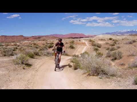
The Stucki Springs Trail lies within the Bearclaw Poppy preserve southwest of St. George. The trail itself is about 10 miles long. While it lies in barren desert, it's a popular and well-traveled trail. The trail is intermediate technical but suitable for experienced conditioned beginners -- as long as you don't take the "Classic Stucki" plunge from the Race Course (see the options below).
There are many different riding options. You'll need to ride other trails to reach Stucki, so the typical ride will be 13 to 20 miles. I've tried to hold the options on this web page to 12-14 miles, within the range of the typical rider. Take more if you want to by adding other connecting trails.


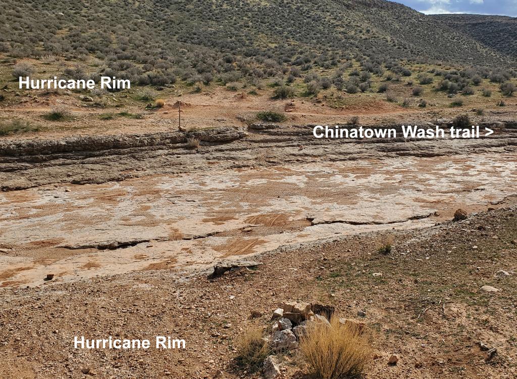
A ride to the Cottonwood Wash overlook. 13-mile out-and-back. Head west on Stucki Springs to the viewpoint overlooking Cottonwood Wash (where the trail turns 90 degrees), then double back. From Bloomington, take the Bloomington Trail westbound (Bearclaw is one-way eastbound here). The trail twists and dips on hard-pack white clay as you head northwest under the slopes of Bloomington Hill. Never ride this trail when it's wet -- the clay is easily rutted.


Shortly after starting out on Bearclaw, fork left on the narrower Bloomington Trail. This trail is a little more difficult than Bearclaw, but not as scenic. It will drop into a wash for much of the trip. It parallels Bearclaw as it heads northwest. Go outbound on the Bloomington Microloop . Keep straight onto Stucki. Fork right into the wash and take Snakepit to the far side of Stucki. Fork left and circle around on Stucki. As you hit the 4-way, fork left to Clavicle Hill, then turn right on Bearclaw for the return.

0.0 Bloomington TH, step over gate
N37 03.125 W113 37.344
0.2 Fork L on Bloomington Microloop
N37 03.224 W113 37.504
2.4 4-way, keep straight to Stucki Spring
N37 04.160 W113 39.387
2.7 R and into wash for Snakepit
N37 04.268 W113 39.584
2.8 R on edge of wash (in wash = alternate)
N37 04.326 W113 39.699
3.1 Rejoin alternate from wash
N37 04.399 W113 39.907
3.2 Stay in wash (L = up to Stucki)
N37 04.482 W113 40.018
4.4 Snakepit Rim joins on R
N37 05.180 W113 40.836
5.0 Hard L on Stucki Spring trail
N37 05.659 W113 40.933
(straight = plunge, R = around)
5.2 Alternates rejoin N37 05.366 W113 41.568
6.7 Viewpoint, Cottonwood Wash, turn L
N37 05.227 W113 42.143
9.3 Keep R (L = down to Snakepit)
N37 04.619 W113 40.243
9.6 Keep R (L = to Snakepit)
N37 04.470 W113 40.184
10.3 Keep R at original Snakepit fork
N37 04.261 W113 39.620
10.6 At 4-way, turn L
N37 04.160 W113 39.387
10.7 Bottom of Clavicle Hill, fork R
N37 04.202 W113 39.313
East (R) on Bearclaw Poppy trail
N37 04.209 W113 39.259
13.0 Back at Bloomington parking

From the Preserve parking lot at the Barrel Roll trailhead, backtrack to the Stucki Springs road (or continue south and cross Cove Wash then veer left to join the road later). After the road dips through the wash and climbs over a hill, you'll spot the Stucki Springs trail to your left at a gate in the fence. Continue south on the trail.

0.0 South on DT from Barrel Roll TH
N37 07.255 W113 40.514
Descend into Cove Wash
0.2 Hard L in washbottom to climb out
N37 07.184 W113 40.520
Rim Rock Connector
0.6 Fork L (R = to Rim Rock)
N37 06.946 W113 40.252
1.0 R on Stucki Springs Road
N37 06.829 W113 39.999
1.2 L across fence to Stucki ST
N37 06.658 W113 40.171
1.25 Keep R (L = primitive trail)
N37 06.630 W113 40.184
1.9 Keep straight (R = over fence to road)
N37 06.100 W113 40.536
2.1 Veer L (R = over to springs and road)
N37 05.999 W113 40.579
100 feet, then R on Stucki Springs trail
N37 05.985 W113 40.561
2.6 Keep R (L = Snakepit trail)
N37 05.660 W113 40.934
3.3 Alternates, straight = to plunge
N37 05.387 W113 41.473
3.5 Alternates rejoin N37 05.365 W113 41.569
3.9 Cottonwood Wash viewpoint, L
N37 05.229 W113 42.143
6.6 Keep R (L = to Snakepit)
N37 04.620 W113 40.244
6.8 Keep R (L = to Snakepit)
N37 04.470 W113 40.183
N37 04.257 W113 39.611
7.8 4-way, fork L N37 04.158 W113 39.389
8.0 Below Clavicle Hill, fork L
N37 04.201 W113 39.315
Snakepit Rim trail
8.1 Fork L N37 04.278 W113 39.321
8.2 Fork R on connector Stucki Cutoff
(L = Snakepit Rim) N37 04.356 W113 39.425
8.4 Keep L (R = alternate)
N37 04.492 W113 39.417
8.8 L on main Stucki Cutoff trail
N37 04.789 W113 39.438
10.0 Fork R, steep up N37 05.524 W113 40.236
10.3 Fork R (L = alternate)
N37 05.570 W113 40.111
Ride under edge of rock
10.4 Cross over (keep straight)
N37 05.613 W113 40.061
10.5 L on Classic Stucki trail
N37 05.734 W113 40.107
10.6, 10.7 Keep R
11.1 Straight, then R on Stucki singletrack
N37 05.985 W113 40.561
(Begin retracing outgoing route)
12.0 Cross fence to Stucki road, northbound
N37 06.658 W113 40.171
12.3 Fork L N37 06.829 W113 39.999
12.6 Keep R N37 06.946 W113 40.252
13.0 R and uphill N37 07.184 W113 40.520
13.2 Back at parking

This loop is 19 miles, strenuous aerobic, intermediate technical with a rare smattering of advanced technical. Start in the valley downhill from the official Bearclaw Poppy Trailhead (and north of the Zen trailhead). Cross the little wash and find the downhill section of the Green Valley race loop . Go up the downhill singletrack. Near the top, turn right at the fork, following the race loop backwards. Dominic cranks to clear the rocks while heading "up the down staircase" on the Green Valley race course. Photo 2000.


0.0 Just N of road to Bearclaw TH,
N37 05.511 W113 37.932
W on DT through wash and fence then NW
0.5 Join trail, keep L N37 05.620 W113 38.357
0.55 Fork R N37 05.597 W113 38.395
Cross rock wash, up steep hill
1.6 Fork R (L = to Barrel Trail and viewpoint)
N37 05.519 W113 39.452
1.8 4-way with 3 DTs, go straight and down
N37 05.618 W113 39.524
Cross fence, L (west) downhill in saddle
N37 05.640 W113 39.544 Steep plunge
2.1 Keep R (L = alternate to Stucki Cutoff)
N37 05.658 W113 39.900
2.2 Keep L (R = to remote trail along bluff)
N37 05.679 W113 39.922
2.4 Keep R (connectors to Stucki Cutoff)
N37 05.734 W113 40.108
2.5 Keep R N37 05.725 W113 40.197
2.6 Keep R N37 05.713 W113 40.314
3.0 Veer L, follow ST southwest
N37 05.949 W113 40.541
3.5 Keep R (L = Snakepit trail)
N37 05.660 W113 40.934
4.2 Alternates, straight = to plunge
N37 05.387 W113 41.473
4.4 Alternates rejoin N37 05.365 W113 41.569
N37 05.229 W113 42.143
7.5 Keep R (L = to Snakepit)
N37 04.620 W113 40.244
7.7 Keep R (L = to Snakepit)
N37 04.470 W113 40.183
8.5 Keep R (L = Snakepit)
N37 04.257 W113 39.611
8.7 4-way, fork L N37 04.158 W113 39.389
8.9 Arrive Clavicle Hill area
N37 04.201 W113 39.315
Follow Bearclaw Poppy NNortheast
(Alternate climbing routes on R and L)
9.5 End of acid drops, keep going NNE
N37 04.563 W113 39.159
10.2 L out of wash, then fork R on ST
Flatline Trail N37 05.056 W113 38.780
10.5 Join main Bearclaw, keep NNE up hill
N37 05.131 W113 38.848
10.6 Step over gate, cross road to ST
Barrel Trail N37 05.180 W113 38.823
10.7 Fork R N37 05.228 W113 38.801
11.0 Keep R and downhill
N37 05.441 W113 38.617
11.3 Rejoin racetrack N37 05.597 W113 38.395
100 ft, then R N37 05.620 W113 38.357
11.8 Back at parking
From the Bearclaw Poppy Trail parking area, head uphill to the
step-over gate then ride the trail south. Popular options are:
(1) turning off Bearclaw onto the Stucki Cutoff trail, riding Stucki
counterclockwise and returning via Bearclaw,
(2) continuing past Clavicle Hill to Stucki, then forking onto Snakepit
and turning left on Stucki for a little loop and a return via Bearclaw,
(3) out-and-back on Bearclaw plus the southern limb of Stucki to the
overlook above Cottonwood Wash.


After dropping the Three Fingers of Death, head south in the Wash on Bearclaw. Just after the trail pulls out of the wash, watch for a trail on your right. (There will be three more trails over the next half-mile, some of which are harder to spot. They all join into the same northwest-bound path.) This trail takes you to the classic route just below the bluff. Fork left. As you approach the fence, fork left and ride Stucki to Clavicle Hill. Backtrack on Bearclaw.
0.0 From upper Bearclaw TH, up DT
N37 05.338 W113 38.431
0.4 R across stepover gate
N37 05.170 W113 38.829
Drop Three Fingers of Death
0.6 Straight, drop into The Wash
N37 05.056 W113 38.780
1.1 (Option: R to Stucki Cutoff)
N37 04.788 W113 39.054
1.4 Fork R onto Stucki Cutoff
N37 04.544 W113 39.175
1.7 Keep straight (L) as alternate joins
N37 04.766 W113 39.371
1.8 Keep straight (R) as alternate joins
N37 04.790 W113 39.439
3.1 Keep L N37 05.523 W113 40.236
3.2 Keep L N37 05.612 W113 40.259
3.3 Keep L N37 05.715 W113 40.315
3.8 (Option straight to visit Spring)
Fork L on Stucki Springs ST
N37 05.949 W113 40.541
4.3 Keep R (L = Snakepit trail)
N37 05.660 W113 40.934
5.0 Alternates, straight = to plunge
N37 05.387 W113 41.473
N37 05.365 W113 41.569
5.6 Cottonwood Wash viewpoint, L
N37 05.229 W113 42.143
8.3 Keep R (L = to Snakepit)
N37 04.620 W113 40.244
8.5 Keep R (L = to Snakepit)
N37 04.470 W113 40.183
9.3 Keep R (L = Snakepit)
N37 04.257 W113 39.611
9.5 4-way, fork L N37 04.158 W113 39.389
9.7 Arrive Clavicle Hill area
N37 04.201 W113 39.315
Follow Bearclaw Poppy NNortheast
(Alternate climbing routes on R and L)
10.3 End of acid drops, keep going NNE
N37 04.563 W113 39.159
11.0 L out of wash, then fork R on ST
Flatline Trail N37 05.056 W113 38.780
11.3 Join main Bearclaw, keep NNE up hill
N37 05.131 W113 38.848
11.4 R on DT downhill
N37 05.180 W113 38.823
11.8 Back at parking
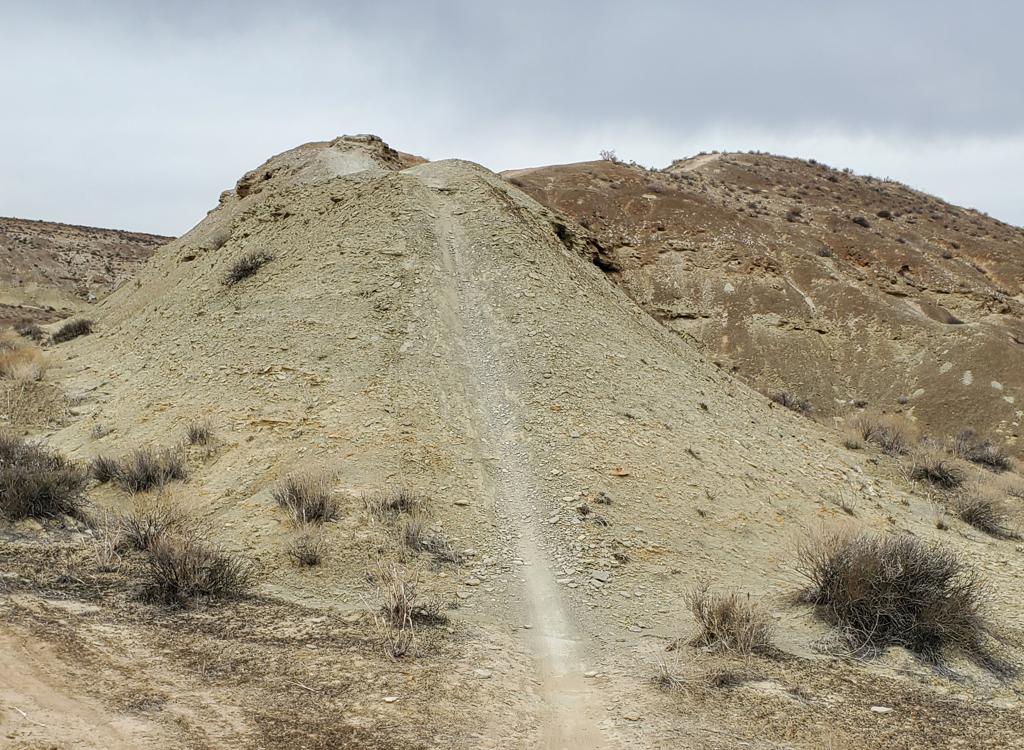
Take Bearclaw to Clavicle Hill. Drop down, then drop another steep pitch to a trail heading south (Bearclaw turns left to the east here). As you reach a 4-way, turn right on Stucki Springs. Keep left to take Stucki Springs to the viewpoint above Cottonwood Wash (where the trail turns north). Backtrack. Mike Engberson descends the loose clay of Clavicle Hill on the way to the Stucki Spring trail in 2000.


Head north on the doubletrack as though you're starting the Desert Rampage race. Follow the race course . When you hit the last doubletrack before Keyhole Wash, turn right. Follow it north until it drops down into a wash. Follow the wash all the way to the Stucki Springs Road.
When you reach Stucki Springs Road, turn left and follow the road. Keep left at the road fork (right takes you to the Rim Rock trails). After dropping down a hill, you'll find the singletrack across the fence on your left.


0.0 From end of pavement above Green Valley
N37 05.516 W113 37.673
North on DT 100 yards, then drop L to valley
0.2 Veer R onto start of GV raceloop, follow it
N37 05.529 W113 37.832
1.0 L off DT onto ST
N37 06.040 W113 38.353
1.3 Keep L at fork in wash
At road, cross to DT
N37 06.099 W113 38.582
1.6 R on DT (don't drop into Keyhole Wash)
N37 06.272 W113 38.777
1.7 Option either way (rejoin at bottom)
N37 06.379 W113 38.725
2.6 L in wash (DT on R = wet weather alternate)
N37 06.724 W113 39.246
3.4 L on road up from wash
N37 07.047 W113 39.721
3.8 Keep L (R = to Rim Rock TH)
N37 06.833 W113 40.001
4.1 L across fence to Stucki ST
N37 06.658 W113 40.171
4.15 Keep R (L = primitive trail)
N37 06.630 W113 40.184
4.8 Keep straight (R = over fence to road)
N37 06.100 W113 40.536
5.0 Veer L (R = over to springs and road)
N37 05.999 W113 40.579
100 feet, then R on Stucki Springs trail
N37 05.985 W113 40.561
5.5 Keep R (L = Snakepit trail)
N37 05.660 W113 40.934
N37 05.387 W113 41.473
6.4 Alternates rejoin N37 05.365 W113 41.569
6.8 Cottonwood Wash viewpoint, L
N37 05.229 W113 42.143
9.5 Keep R (L = to Snakepit)
N37 04.620 W113 40.244
9.7 Keep R (L = to Snakepit)
N37 04.470 W113 40.183
10.5 Keep R (L = Snakepit)
N37 04.257 W113 39.611
10.7 4-way, fork L N37 04.158 W113 39.389
10.9 Below Clavicle Hill, fork L
N37 04.201 W113 39.315
10.9 Arrive Clavicle Hill area
N37 04.201 W113 39.315
Follow Bearclaw Poppy NNortheast
(Alternate climbing routes on R and L)
11.5 End of acid drops, keep going NNE
N37 04.563 W113 39.159
12.2 L out of wash, then fork R on ST
Flatline Trail N37 05.056 W113 38.780
12.5 Join main Bearclaw, keep NNE up hill
N37 05.131 W113 38.848
12.6 Step over gate, cross road to ST
Barrel Trail N37 05.180 W113 38.823
12.7 Fork R N37 05.228 W113 38.801
13.0 Keep R and downhill
N37 05.441 W113 38.617
13.3 Rejoin racetrack N37 05.597 W113 38.395
100 ft, then R N37 05.620 W113 38.357
13.8 Cross valley, climb road back up
14.1 Back at upper parking at pavement
The Snakepit trail can substitute for a portion of the Stucki loop, either outgoing or returning. Go to the Snakepit page for a pretzel-shaped ride using Snakepit and Snakepit Rim with the southern limb of Stucki.
 Photo courtesy ...")

Take the Bluff Street I-15 exit in St. George and turn west. Immediately turn south (left). Go over the hill and turn right on Dixie Drive. Keep straight past the golf course and some businesses. Turn left at the sign for Green Valley Spa. (If you reach a "Green Valley Market" with gas pumps, you just passed it. Turn around and backtrack to the second road on your right.) Drive past the spa and park at the end of the road. From the top of the mesa, ride down across the wash. Keep left until you're through the fence, then turn right as the Green Valley trail turns left up the hill. Find the singletrack on the left about 100 yards up, just before the doubletrack drops into a rock wash.
Bloomington Trailhead: Go to the west end of Navajo Drive in Bloomington. Go across the cattle guard. See the low rail on the fence 100 feet to your right? That's the trailhead. N 37° 03.116' W 113° 37.362'. Start out on Bearclaw Poppy, and fork left on the mini-loop about 1/3 mile later.
Maps for printing:
High-res area map (1.3 MB) - NICE! Track GPX files (to download, right-click and select "Save target as..."):
Monster file of area tracks and alternates!
Major trails only
Bloomington Snakepit to Stucki Figure-8
Stucki Loop from Santa Clara TH
Classic Stucki Loop via Race Course and Bearclaw
Classic Stucki to Bloomington P2P
Stucki Loop from Bearclaw TH
Stucki-Snakepit Pretzel Ride from Bearclaw TH
Stucki Big Loop through Cove Wash from Green Valley
Stucki w Cutoff track Only
Bearclaw Only
Snakepit only
Bloomington Microloop Only
Quick on-trail guide: Single-page riding guide
Lodging, camping, shops: Links to St. George area resources


