View north as the Sovereign Singletrack meanders through the sandstone. Photos a...
View north as the Sovereign Singletrack meanders through the sandstone. Photos and trail review May 2, 2013 by Bruce.
Sovereign to Klondike Route

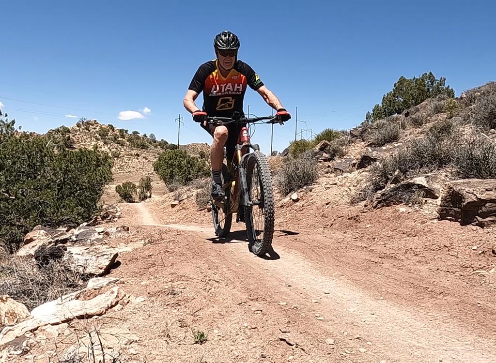
Located just north of Moab, the Sovereign Trail is a singletrack trail for motorcycles and mountain bikes. This new northern segment (2013) brings the trail length to 15 miles (one way). Most of the trail is intermediate technical, with some short stretches of advanced riding.

Most riders use "Sovereign" to refer only to the southernmost -- and first developed -- singletrack section. (See web page for lower Sovereign.) This segment goes from Willow Springs Road on the south to Dalton Wells Road on the north.
Paintbrush blooms among the Salt Wash sandstone.
The singletrack begins on a doubletrack (jeep road) 0.2 miles from the Klondike ...
The singletrack begins on a doubletrack (jeep road) 0.2 miles from the Klondike Bluffs Road.
The middle section of the Sovereign Singletrack -- opened several years ago -- meanders west from Dalton Road, then climbs Cedar Mountain. The area on Cedar Mountain's slopes is the toughest section of the trail.
The new extension of Sovereign forks away from Cedar Mountain on a ridgeline just above Ann's Arroyo. It parallels Highway 191 north, dumping onto doubletrack for 0.2 miles before reaching the Klondike Bluffs Road.
Most of the trail is dirt singletrack. There are occasional stretches of open ro...
Most of the trail is dirt singletrack. There are occasional stretches of open rock.
Carsonite posts mark the route. This view is where the trail meets an old double...
Carsonite posts mark the route. This view is where the trail meets an old doubletrack.
There's no parking at the northern end. If you plan to ride from the north, park at the Klondike Bluffs parking area along the highway. Ride the gravel Klondike Bluffs Road one mile northeast, then turn right at the doubletrack. 0.2 miles later, turn right at the singletrack.
The new northern section offers a few new possibilities. My favorites is a short lariat from the north. See Sample Rides below. For big-mile riders, consider a 27-mile epic loop from the south.
The fork where the Cedar Mountain Trail splits from Sovereign. Were looking nort...
The fork where the Cedar Mountain Trail splits from Sovereign. We're looking north. Both trails initially follow old doubletrack, then drop off to the north within 100 yards.
Sample Rides
Were on the Cedar Mountain Trail just past Anns Arroyo.
We're on the Cedar Mountain Trail just past Ann's Arroyo.
Northern Lariat to Cedar Mountain:
This is a good ride, and it would be my recommendation for a casual intermediate rider. It's 14.5 miles round trip. Twelve miles are singletrack and 2.4 miles are on dirt road. Starting at the Klondike Bluffs parking area on Highway 191, pedal one mile north to northeast. Turn right (south) on doubletrack. When you see the log ATV-barrier 0.2 miles later, fork right onto singletrack.
Pedal south on Sovereign for three miles. When the trail turns to the left onto old doubletrack (there will be tire tracks going right -- these bikers are descending to the Fallen Peace Officer trailhead), climb to the Cedar Mountain trail fork. Keep straight, then drop left as the singletrack leaves the old doubletrack. (Also consider a counterclockwise loop. The trail would work either direction, but I've only done clockwise.)
View south toward the La Sal mountains.
The top of Cedar Mountain has deep cracks along the cliff. The trail actually ru...
The top of Cedar Mountain has deep cracks along the cliff. The trail actually runs along a fin between the cliff and this crack.
At the top of Ann's Arroyo, join the doubletrack Fallen Peace Officer Trail for about 200 feet, then fork right again on singletrack. 2.4 miles from the Sovereign - Cedar Mountain fork, keep straight (right) as you rejoin Sovereign.

Keep straight (right) past Brush Basin, and stay on singletrack as you cross Fallen Peace Officer again. When you reach the trail fork on the ridge, go left, but don't forget to turn hard right off the old doubletrack 100 yards later.

Brushy Basin Loop:
This is a faster, 13-mile loop ride, using several miles of doubletrack on the return leg. But it does require major navigation skills (and preferably a GPS track) because of multiple doubletrack forks. Unless you're very familiar with the area or are willing to follow the GPS track, I'd skip this one.
Because you share the trail with motorcycles, some of the steep spots will be lo...
Because you share the trail with motorcycles, some of the steep spots will be loose and strewn with big rock slabs.
Northbound on the final section of Sovereign as we cross smooth Salt Wash sandst...
Northbound on the final section of Sovereign as we cross smooth Salt Wash sandstone.
From the Dalton Wells parking area, climb the Brush Basin Trail to Sovereign. Fork left. Stay on Sovereign to the doubletrack at the north end (don't go to Klondike Bluffs Road). Go right on doubletrack. Join Fallen Peace Officer, leave it, join it, leave it and rejoin it as you carve a loop around to the Cedar Mountain Trail just above Ann's Arroyo.

When you reach Sovereign, fork left and drop off the mountain. Turn right on doubletrack at the bottom and follow it back to Dalton Wells.

Sovereign Epic Loop:
This ride is 27 miles. This ride has about 21 miles of singletrack and 6 miles of dirt road. After riding Sovereign Singletrack (all 15 miles) from the southern end, the route crosses over the ridge on doubletrack to the Little Valley Road. This takes you back to the Salt Wash Trail, which returns you to the trailhead on Willow Springs Road. (You could just do Sovereign out-and-back -- maybe with Salt Wash on the return -- for a 30 mile monster singletrack ride. But because only the strongest riders could manage this, I put the road segment into the loop.)
The trail crosses several ridges. Were looking southwest. The trail will switchb...
The trail crosses several ridges. We're looking southwest. The trail will switchback to the north just past the rocks.
Heading northwest; almost there.
From the Willow Springs trailhead, just stay on Sovereign by following the signs. When you reach the doubletrack at the end, turn right uphill (don't go to the Klondike Bluffs Road). Keep straight on the doubletrack and cross over the hill. Descend to the north-south road in the valley and turn right (south). After two miles on the road, just as it begins to turn to the west, look for the Sovereign Trail crossing the road. Fork left and follow it to the base of the bluff. Now climb uphill for the return on Salt Wash or Sovereign.

(Note: if you haven't got the leg for six more miles of tech singletrack, there's an ATV trail just to the west. It will take you south to the Willow Springs Road.

Bottom Line!

This ride is worth doing, but it wouldn't be your first choice of the trails in the area. Do it if you've done just about everything else in the Klondike and Klonzo area. The best option for intermediate riders is the 15-mile lariat ride from the north. Intermediate riders could also consider doing the 15 miles of Sovereign Singletrack one-way with a shuttle.

Rolling along the edge of Cedar Mountain!
Klondike to Cedar Mountain Loop, ride notes:
0.0   Park on 191, ride on Klondike Bluffs Rd
        N38 44.453 W109 44.030
1.0   R on DT
        N38 45.227 W109 43.770
1.2   R on Sovereign Singletrack
        N38 45.048 W109 43.677
3.2   Cross DT
        N38 44.597 W109 42.800
4.1   L along old DT
        N38 44.124 W109 42.548
4.2   Straight onto Cedar Mountain
        N38 44.093 W109 42.407
5.9   Keep straight onto DT in wash
        N38 44.600 W109 41.352

6.0   R on ST
        N38 44.655 W109 41.313
6.8   Keep R, Sovereign ST
        N38 44.084 W109 41.019
8.7   Keep R (L = Brushy Basin)
        N38 43.420 W109 42.457
9.0   Cross DT
        N38 43.546 W109 42.512
10.2 L to stay on Sovereign
        N38 44.093 W109 42.407
13.2 L on DT
       N38 45.048 W109 43.677
13.4 L on dirt road
        N38 45.227 W109 43.770
14.5 Back at parking
Map of the entire Sovereign system.
Getting there:
From the north, Klondike Bluffs Road is 15 miles south of I-70. Dalton Wells road is 17 miles south of I-70, on your left. Willow Springs Road is exactly 1 mile further south, also on the left. Coming north from Moab, Willow Springs Road will be on your right, 1.8 miles past the junction with Highway 313 (Canyonlands and Dead Horse Point).
Klondike Bluffs Parking:
On US-191 15 miles north of Moab (just south of the airport), find the Klondike Bluffs parking lot just off the side of the highway. Start the ride by pedaling up the gravel road.
Willow Springs Road Trailhead:
  On US-191 north of Moab, turn east on dirt Willow Springs Road. Keep L at fork at mile 1.3. At mile 2.0, park in the rock-outlined area on your left N 38° 41.876' W 109° 39.868', just before a natural gas pump building on the R. Start the ride by continuing down Willow Springs Rd.
Dalton Wells Road Trailhead:
  On US-191 north of Moab, turn east on dirt Dalton Wells Road. Park under the trees to ride from Brushy Basin. To reach the inner trailhead, go straight onto the dirt road. Reclose the gate at mile 0.2, and cross the broad sandy wash. At mile 1.7, park at the fork in the road N 38° 43.584' W 109° 40.783'. The L fork takes you to the top of the trail for the Dalton Loop. The R fork (straight) takes you on ATV track to the junction where Sovereign drops off the bluff, where you can connect to the southern 6 miles of trail.
Riding Resources:
Single-page riding guide
GPS track files  (Right-click and "Save as..."):
   GPX area track files
   North Lariat (15 mi)
   Brushy Basin to Klondike Road one-way
   Sovereign Trail only
   Monster Loop
   Loop from Brushy Basin
Topo maps for printing:
   View high-res Lodging, camping, shops:    Links to Moab area resources