
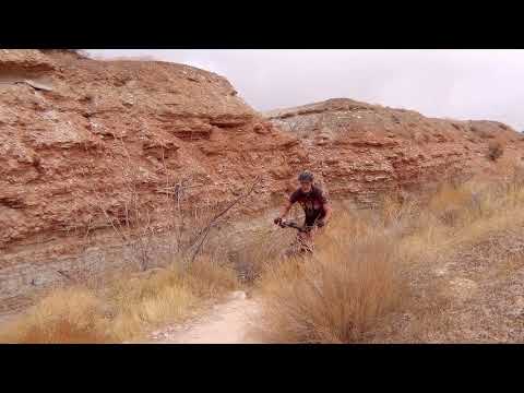
View on the trail as Snakepit climbs up the wash. Photos December 8, 2011 by Bruce.
SnakepitThe Snakepit Trail joins the eastern and western sides of the Stucki Spring trail. The Snakepit
Rim trail parallels Snakepit on a shoulder of the bluff above, joining
Snakepit near each end.
On the eastern side, Snakepit forks off
Stucki Spring
about
1/4
mile from the beginning of Stucki Spring just southwest of Clavicle Hill.
On the western
end, Snakepit rejoins Stucki
Spring as it heads along the western side of the
Bearclaw Poppy
preserve,
about 2/3 of the way between the Cottonwood Wash overlook and Stucki Springs
itself.
The Snakepit Trail itself is 2.3 miles long. But it must be combined with other trails in order
to reach it, so your minimum mountain bike ride will be around 10 miles.
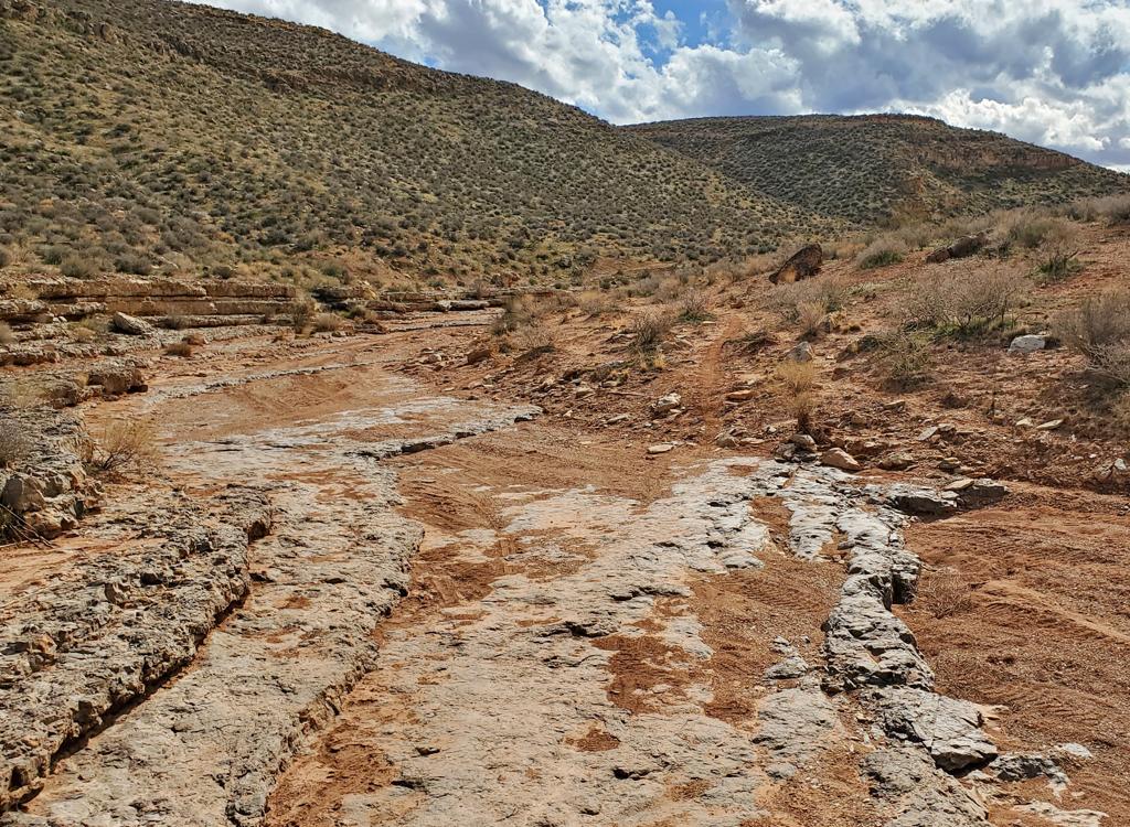
The eastern two miles
of the Snakepit Trail lie in a branch of Cottonwood Wash. There may be
occasional spots of
standing water in the winter and early spring. On the western end, it
curves and dips through
a scrub desert.

Looking to the east, near the point where Snakepit forks off the Stucki Springs trail. The red mesa is Bloomington Hill.

Cruising along in the wash on Snakepit.
The trail surface is easier intermediate technical. It's suitable for experienced beginners.
(There's one steep side-slope that can be avoided by taking the southern
fork in the wash --
see the map.) Beginners can start from Bloomington and ride the easy
Bearclaw Poppy
uphill trail directly to Stucki then Snakepit for an easy cruise.
The Snakepit Trail can be used as an easier alternative climb to the southern side of the
Stucki Spring
loop. You can insert this trail into just about any ride that uses Stucki Spring. In late winter,
Snakepit (or Snakepit Rim) may be ready to ride when the southern limb
of Stucki is still a
bog of wet white clay. Do NOT ride these trails when muddy -- the white
clay trail sections
especially are easily damaged.

I recommend riding the Snakepit loop in the clockwise direction (up Snakepit and down Snakepit Rim) because the sight lines are limited in the wash. If you turn it loose downhill, you'll hit somebody.

Near the western end of Snakepit, the trail begins to pull out of the wash.
For a simple ride, start at Bloomington and take the Bearclaw Up trail to the Stucki Springs
trail. About 1/10th mile later, keep to the right on Snakepit and veer
toward the wash. Next
comes a fork. Stay left in the washbottom. (The trail on your right climbs
up to a small ridge
to join the Snakepit Rim trail.)
Shortly after you climb out of the wash, you'll find the Snakepit Rim trail on your right.
Turn 180 degrees and fly down along the colorful shoulder of the bluff.
Watch for the connector
back to Stucki and Bearclaw, and take Bearclaw back to the trailhead.
On this page I describe a longer ride that uses Snakepit and the Snakepit Rim trail. I'm calling
it theSee the by-the-mile description below. It starts on
Bearclaw
from the Green Valley trailhead, then turns east on the Stucki Connector to reach
Stucki Spring
Then it follows Stucki to Snakepit and drops down Snakepit to rejoin Stucki. From there, it
proceeds to Clavicle Hill.

Lots of fun riding in the wash.

After taking Snakepit to Stucki Spring, we're going to descend from the Cottonwood Wash overlook on a high-speed run along the edge of the wash.
At Clavicle Hill, the route forks west on the Snakepit Rim, which parallels the northern edge
of the wash in which Snakepit runs. It will rejoin Snakepit in two miles.
When Snakepit reaches
Stucki, fork hard left and follow Stucki to the Cottonwood Wash overlook,
then continue on
Stucki all the way back to Clavicle Hill. This time, climb up the Acid
Drops to head home on
the Bearclaw Poppy trail. This ride is 17.1 miles total.
The most certain way to find the Snakepit Rim trail is on the western end. Ride the Snakepit
Trail from the west side of the Stucki Spring trail. You'll be heading
east. After 1/2 mile
on Snakepit (before you head into the wash), you'll reach a trail fork.
The trail on the right
is the continuation of Snakepit; the left trail is Snakepit Rim.
The connection from Snakepit Rim to Bearclaw at Clavicle Hill can be a little hard to navigate.
There are several interconnecting outlaw trails branching on the west
side of the Acid Drops.
If you're bound for Clavicle Hill, keep heading directly east. But may
I suggest taking the
connector on your right back to Stucki Spring, then climbing to the base
of Clavicle Hill to
Bearclaw.

Heading east on the Snakepit Rim trail, returning from the short loop.

Looking north from the Snakepit Rim trail.
If you're determined to find the eastern end of Snakepit Rim from Clavicle Hill for an east
to west ride, go to Clavicle Hill. Just below Clavicle Hill (on your left
if you dropped down)
is a trail heading west. Below the next drop is another trail to the west.
These trails meet
after about 100 yards at a three-way intersection. At the junction, take
the trail on the left
that traverses around the little hill heading west. Don't go up the wash
-- this third trail
heads up to connectors that rejoin Bearclaw above Clavicle Hill.
Once you're on the westbound trail, stay straight and generally left. Any forks to the right
(heading toward the mesa) will go on to join the Stucki Cutoff trail.
Two trails that head
straight south at 90 degrees to Snakepit Rim drop down to the Snakepit
Trail. (Note: Do NOT follow faint little trails! This area is a preserve to protect the endangered Bearclaw
Poppy. And it already has enough tracks to thoroughly confuse riders.)

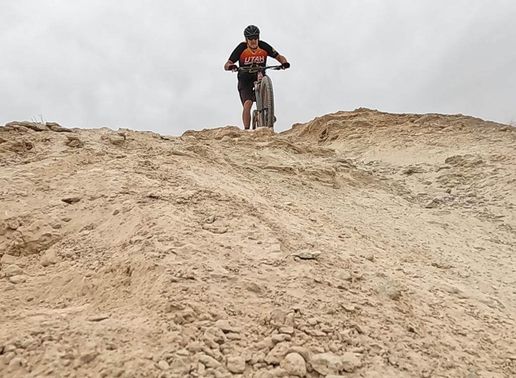
Nice rolling desert riding. We're looking west on the western end of Snakepit.

View into Snakepit from a viewpoint on the Stucki Springs trail just to the south of Snakepit.
Bottom Line!
Snakepit is a fun trail that offers a variation on the desert riding in the area. If there's
water in the wash, Snakepit Rim offers an alternative path or a loop route.
Of the two trails,
Snakepit is definitely more interesting as a climb, while Snakepit Rim
offers a blazing downhill.
The 17-mile Snakepit Pretzel ride described below lets you hit both trails,
plus the best part
of Stucki Springs.
Snakepit Pretzel Ride from Bearclaw:
0.0 From upper Bearclaw TH, uphill
N37 05.337 W113 38.431
0.4 L across stepover gate
N37 05.171 W113 38.829
1.1 L on Stucki Cutoff connector
N37 04.788 W113 39.054
1.4 Two trails join on L, stay R westbound
N37 04.770 W113 39.362
2.8 Keep R at three forks over 0.2 mi
N37 05.534 W113 40.241
3.5 At Stucki Spring, L and southwest
N37 05.985 W113 40.561
4.0 L on Snakepit N37 05.661 W113 40.933
4.6 Keep R on Snakepit
N37 05.185 W113 40.833
(L = Snakepit Rim)
6.4 Join Stucki, keep L
N37 04.272 W113 39.590
6.6 4-way, go L on Stucki
N37 04.157 W113 39.391
6.7 Below Clavicle Hill, fork L
N37 04.212 W113 39.313
On Snakepit Rim
6.8 Keep L N37 04.278 W113 39.326
7.1 Keep straight N37 04.361 W113 39.509
8.9 Keep straight, join Snakepit
N37 05.185 W113 40.833
9.6 L on Stucki N37 05.661 W113 40.933
11.2 Cottonwood Wash view, go L
N37 05.232 W113 42.140
13.9 Keep R on Stucki
N37 04.621 W113 40.244
14.9 Keep R as Snakepit joins
N37 04.272 W113 39.590
15.1 4-way again, go L
N37 04.157 W113 39.391
15.2 Climb to top of Clavicle Hill, go N
N37 04.222 W113 39.304
Head back on Bearclaw
16.0 Back at first fork N37 04.788 W113 39.054
17.1 Back at parking
Getting there, Bearclaw trailhead: Take the Bluff Street I-15 exit in St.
George and turn west. Immediately turn south (left). Go over the hill and
turn right on Dixie Drive. Keep straight past the golf
course and some businesses. Turn left at the sign for Green Valley
Spa. (If you reach a "Green Valley Market" with gas pumps, you
just passed it. Turn around and backtrack to the second road on your
right.) Drive past the spa and park at the end of the road to start your
ride, or drive down into the valley to park at the official Bearclaw Poppy
trailhead. From the top of the mesa, head down into the broad valley.
Climb the wide dirt road on the north (right) side of the little sandstone
canyon. About 1/2 mile up the road, keep going through the gate at the
parking area.
Bloomington trailhead: Go to the west end of Navajo Drive in
Bloomington. Go across the cattle guard. See the low rail on the fence 100
feet to your right? That's the trailhead. N 37° 03.116' W 113°
37.362'. Start out on Bearclaw Poppy, and fork left on the mini-loop about
1/3 mile later.


