In Sleepy Hollow a small creek has occasional beaver ponds among the willows. Photos and trail check-out ride August 21, 2009 by Bruce and Jackie.
Sleepy Hollow TrailThe Sleepy Hollow Trail is a non-motorized trail in the hills north of Strawberry Reservoir.
The singletrack route is 3.2 miles; most riders will want to go the extra
0.8 mile up the ATV
route to a fabulous viewpoint. The climb extends from an elevation of
8200 feet to almost 10,000
feet. The trail isn't very technical, but requires good legs. The upper
ATV portion can be
a little loose. The out-and-back is 8 miles total with 1800 vertical feet
of climbing.
Another ride option for Sleepy Hollow is a loop ride using the
Co-op Creek
singletrack trail. This route adds another 2.5 miles on ATV track and 1.5 miles on the Co-op
Creek Road, plus 4.7 miles on the Co-op Creek Trail. The loop can be done
either direction,
but the climbing is a bit more humane when done clockwise, starting on
Co-op Creek and descending
Sleepy Hollow.

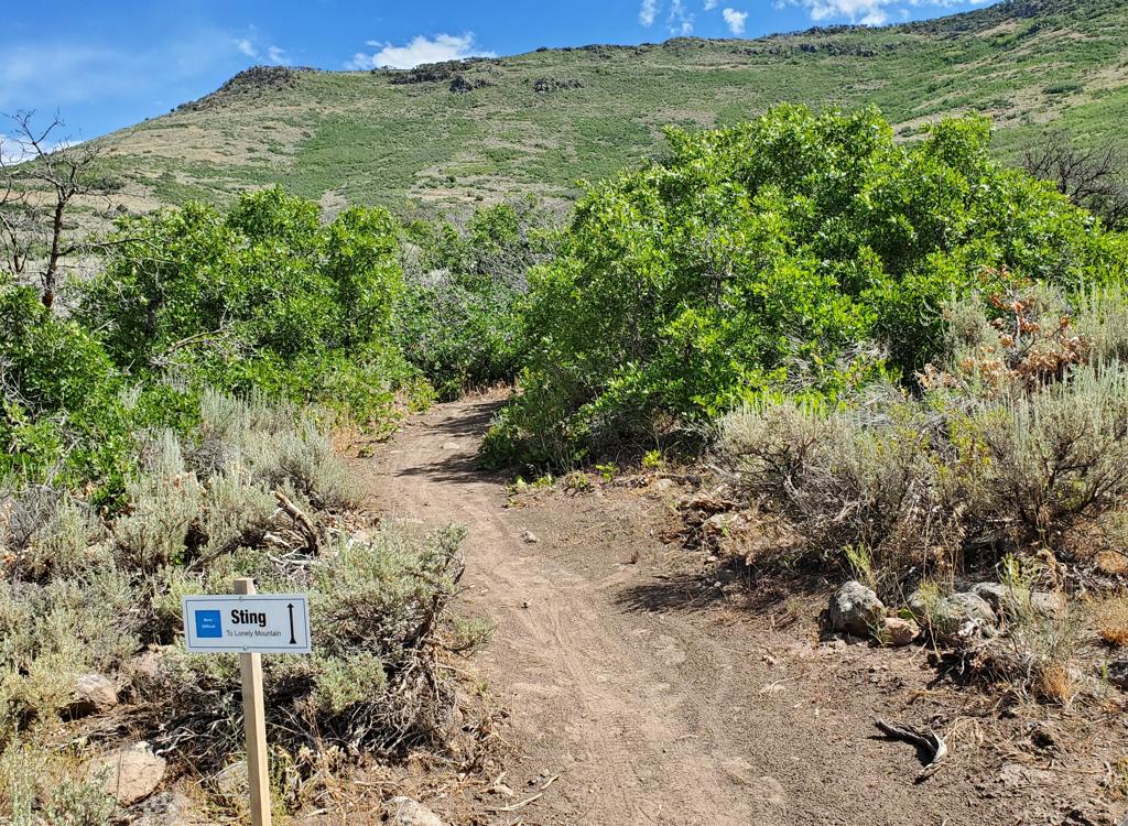
Sleepy Hollow Trailhead. From here, we climb 1800 vertical feet uphill over the next 4 miles.

Trail view uphill, a little higher in the hollow.
The ride starts with 1.5 miles of straight-ahead singletrack gaining 700 vertical feet. The
trail then turns to the right, exiting the Sleepy Hollow and traversing
around the next mountain.
After about a mile and a half of more mellow climbing, the pitch increases again to around
500 vertical per mile.
On the day I rode, shortly after this turn the continuing trail had been churned by a herd
of illegal ATV riders. (A large fallen aspen blocked continued passage,
so they denuded the
mountainside trying to get around before giving up and going back. But
from here to the upper
trailhead the trail had become a loose two-track.) Hopefully, a barrier
fence and signs will
prevent illegal motorized traffic by the time you ride this trail.
At mile 3.2, the trail meets the Chicken Creek ATV route. Keep straight (left) as the climb
continues at a 10% pitch. The loose surface may make climbing a little
tougher here. It's still
fairly easy in granny gear, although the loose surface lends itself well
to a bigger gear (and
higher speed) if you've got the leg for it.

Jackie gets a drink and cools off in a beaver pond.

Looking downhill in Sleepy Hollow, about 1.5 miles from the trailhead.
At mile 4, you'll reach the top of the mountain. The cliffs of Red Ledge will be on the east
(to your right). To the northwest, you can see the peaks of Mount Timpanogos,
Lone Peak, and
Box Elder Peak many miles in the distance. To the southwest, you can see
Mount Nebo.
Riding notes, climb to viewpoint
out-and-back:
0.0 Go through log fence and start uphill
N40 17.402 W111 09.865
1.6 Fork R (don't follow faint ST up draw)
N40 18.401 W111 08.944
3.2 Meet Chicken Creek ATV route
N40 17.827 W111 08.465
Go straight (L) and uphill on
DT
3.7 Keep straight (L) and uphill
N40 18.183 W111 08.085
4.0 Viewpoint area N40 18.365 W111 07.906
Retrace route
8.0 Back at parking

Typical trail section on the "traverse" portion of the upper two miles.

Near the viewpoint at 9,950 feet, we're looking east toward Red Ledge.
After looking at the view, either turn around and bomb back to the trailhead, or continue on
the ATV route to do a counter-clockwise loop ride, returning through Co-op
Creek.
(For a description of the clockwise loop starting at Co-op Creek,
please see the
Co-op Creek Trail
page.)
To finish the counterclockwise loop from the viewpoint, keep going north-northwest on the ATV
track, keeping left at the intersections. (As you begin to descend, the
first fork has a short
route to the top of Racetrack Peak (10,400) for awesome views in all directions
if you want
to climb a little more.)

View to the south of Strawberry Reservoir.

View northwest. Mount Timpanogos is on the left.
About a mile and a half from the viewpoint, the ATV trail begins to descend more quickly (about
500 vertical per mile) through several switchbacks. When it arrives at
the large gravel Co-op
Creek Road, make a hard right turn and continue a more-gentle descent
northward.
After 1.3 miles on the road, watch for a doubletrack on your left. About 100 yards down this
DT, the upper trailhead for the Co-op Creek Trail is on your left. (If
you arrive at the bottom
of a ravine and begin climbing again, you've gone way to far.)

View from the middle of the ATV route. We're about half-way from the viewpoint to the descent on fairly level track.

View uphill on the ATV track between Co-op Creek Road and the ride south below the ridgeline. Moderate slope.
There's a fork 1.4 miles down the Co-op Creek Trail. Keep straight (left and uphill). At the
bottom the trail, climb 2/3 mile on doubletrack to arrive at the Co-op
Creek Road. Your vehicle
is just across the road.
Riding notes, loop up Co-op Creek returning via Sleepy
Hollow:
0.0 From Sleepy Hollow Trailhead N40 17.402 W111 09.865
Cross road and descend west on DT
0.7 Enter ST straight ahead at turnaround
N40 17.554 W111 10.332
Descend gently toward creek
2.2 Trail climbs over small rise, cross branch of creek
N40 18.768 W111 09.934
Begin climbing west uphill away from
creek
3.3 Keep straight (hard L downhill = to Willow Creek)
N40 19.282 W111 09.452
4.7 Upper trailhead, turn R on DT N40 19.928 W111 08.792
For out-and-back, turn around here.
For loop: R on Co-op Creek Road N40
19.901 W111 08.770
6.0 Hard L uphill on DT (Chicken Creek ATV route)
N40 19.119 W111 09.105
7.9 Keep R (ATV track on L heads up over ridge)
N40 18.706 W111 08.228
8.4 Keep straight (L = climbs to top of Racetrack Peak)
N40 18.366 W111 07.906
8.5 Highest point of ride, Red Ledge on L, views on R
Ignore smaller tracks forking
L
8.7 Keep R and southwest N40 18.183 W111 08.085
9.3 Critical Fork! As ATV track turns L, keep straight
N40 17.827 W111 08.465 - begin
Sleepy Hollow ST trail
10.0 Faint fork in draw. Go L and downhill. N40 18.401 W111 08.944
12.5 Back at trailhead

Map of Sleepy Hollow
Getting there: Take US-40
southbound from Heber and drive up Daniel's Canyon 17 miles from the US-40
to US-189 junction. After passing the summit, continue another 5.5 miles,
passing the Strawberry Administrative area and paved road on your right. 7
miles past the summit, 1.5 miles from the road fork, turn left on the
Co-op Creek Road. N40 14.639 W111 09.419. (Stop at the outhouse in the
parking area if you need to.) Drive 3.4 miles up the Co-op Creek Road. As
the road turns sharply left and uphill (about 150 feet before a metal
gate), note a parking area on your right with a log fence at the end, N40 17.402 W111 09.865.
The log fence is the trailhead for the Sleepy Hollow Trail.
The Co-op Creek Road above the Sleepy Hollow trailhead
is closed Nov 1 until July 1.
Facilities: None in the trail area. There's a bathroom
at the bottom of the Co-op Creek Road.