

Shram Creek is a lesser-known trail in Payson Canyon. Original review and photos by Bruce on June 5, 2006. Latest update June 24, 2017.
Shram Creek
The Shram Creek trail runs from the Rock Spring trail down to the Winward Reservoir road in Payson Canyon. It can be done as part of a loop, as discussed on this page, or as a shuttled downhill when combined with the Frank Young or upper Lizard Lake trails.
The Shram Creek trail itself is 2.5 miles long with 1000 vertical feet of elevation change.
The upper end on Rock Spring is at almost 8000 feet elevation. The terrain
alternates between
forest riding and open meadows. Trees are mostly aspen and fir, with occasional
spruce. The
meadows often turn into a riot of flowers in June as the Mule's Ears and
penstemmon bloom.

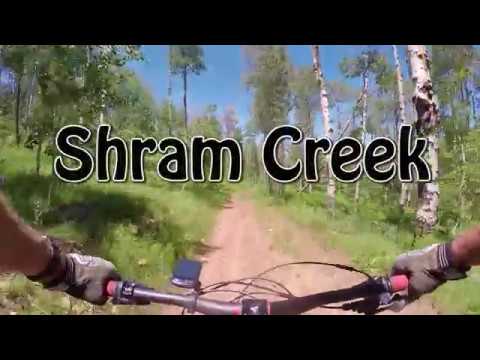
Handlebar view as we descend. The terrain is a mix of aspen, fir, and maple.

Bruce heads downhill.
The trail is usually ready to ride by early June. Expect a few muddy spots due to ooze from
small springs, even into late summer. Because horses are frequent on this
trail (and begin
riding before the snow is off the trail), you may find yourself bouncing
over deep, rock-hard
hoof-holes on occasion.
The pitch of the Shram Creek allows it to be climbed, but most riders select it as a downhill.
Two trails leave the Nebo Loop road high on the ridge above: Frank Young
and upper Lizard Lake.
Each of these descend from 8400 feet down to the Rock Spring trail, where
a short downhill
ride on Rock Spring will take you to Shram Creek.

Coasting into the junction of the Frank Young trail with Rock Spring. From here, it's a hard left turn onto Rock Spring then 0.9 miles -- mostly downhill -- to the top of Shram Creek.

Most of the Shram Creek trail is a downhill plunge in aspen, fir, and spruce. Here we've hit a smooth meadow, looking north towards Lone Peak.
The Jones Ranch - Shram Creek Loop
The Shram Creek Loop is an 8.7 mile loop in Payson Canyon with 7 miles of singletrack and 1.7 miles of pavement. The ride starts at 6850 feet elevation, with a gain of 1400 feet to 8250. Total climbing will be around 1700. This is an intermediate technical ride.
You can park to begin the ride at two spots. If you park at Shram Creek, you'll climb the paved
Nebo Loop road first, and finish downhill. If you park in the "corral"
at the Jones Ranch trailhead,
you do half your climb at first on singletrack, then finish with the second
half on the road.

We're climbing up alongside a little creek on the Jones Ranch trail.

Rock Spring...
Jones Ranch is a smooth and reasonably easy climb (as of 2006). But the conditions will depend
on the season and on horse traffic. After two miles, you'll turn to the
right on the Rock Spring
trail.
The Rock Springs trail rolls up and down three hills. In spots, there may be some rough rock
and erosion damage. Highlights of this trail are the springs and Lizard
Lake, depending on
the season..

and Lizard Lake.

Descending through the aspen on Shram Creek.
The descent down Shram Creek is fun, with some technical spots, usually due to erosion and/or
horse damage. An option for expert riders is to veer onto the Lizard Lake
trail as an alternative.
Riding notes, clockwise from Jones Ranch
trailhead:
0.0 ST uphill on R side of road
N 39° 56.544 W 111° 39.449
1.7 Trail joins from L (Payson Lakes)
N 39° 55.383 W 111° 38.939
1.9 Go R uphill on Rock Springs (trail 101)
rough, rocky
N 39° 55.204 W 111° 38.908
3.1 Fork, keep R
N 39° 54.775 W 111° 39.812
3.9 Fork R downhill on Shram Creek (trail 124)
N 39° 54.765 W 111° 40.674
Keep L at first fork
5.6 Fork R
N 39° 55.890 W 111° 40.868
6.1 Trail joins from R, continue straight
N 39° 56.056 W 111° 40.634
6.9 Keep R until trail drops to cattleguard
N 39° 56.595 W 111° 40.571
R up gravel road to Nebo Loop
R on pavement
8.7 At parking.

Map of the Shram Creek loop ride
Getting there: Going south, take
the Payson exit 250 from I-15 and turn left. Head into Payson on U-115 to
the traffic light, then turn left (100 North, U-198). About 1/3 mile
later, at the top of a small hill, turn right at 600 East. Zero your
odometer here.
Shram Creek trailhead -- Drive 9 miles up the Nebo Loop Road. (Pass the Grotto Trail and Bennie Creek Cutoff Trail.) As you approach a cattleguard at around 9.5 miles, there's a dirt road on the right. Parking is at the wide area on your left. The trail starts about 150 feet down the dirt road, just across the cattleguard, on the left.
Shram Creek trailhead -- Drive 9 miles up the Nebo Loop Road. (Pass the Grotto Trail and Bennie Creek Cutoff Trail.) As you approach a cattleguard at around 9.5 miles, there's a dirt road on the right. Parking is at the wide area on your left. The trail starts about 150 feet down the dirt road, just across the cattleguard, on the left.
Jones Ranch trailhead -- Drive 10.9 miles up the Nebo Loop
Road.
(Pass the Grotto Trail and Bennie Creek Cutoff Trail. Pass the Shram Creek
trailhead and cross a cattleguard, then go another 1.8 miles up the road.) Watch for
a parking area with a wood-rail fence on your left. The trail starts
uphill on the right side of the road, across from the parking area. N 39° 56.544
W 111° 39.449
Riding resources for this trail:
Single-page riding guide
GPS track files (right-click and "Save as..."):
Shram Creek trail only
GPX of loop
Payson Canyon area file
Large-format topo map (700K):
View map
2017 upper Payson Canyon trail topo
Lodging, camping, shops: Links to south Utah County area resources
Single-page riding guide
GPS track files (right-click and "Save as..."):
Shram Creek trail only
GPX of loop
Payson Canyon area file
Large-format topo map (700K):
View map
2017 upper Payson Canyon trail topo
Lodging, camping, shops: Links to south Utah County area resources
Updated 2017


