View to the southeast as the La Sal Mountains peek over the sandstone terrain. Photos and write-up by Bruce, April 2009.
Salt Wash Singletrack
with connections to Sovereign TrailThe Salt Wash Singletrack is a 5.8-mile route located just north of
Moab. It can be done out-and-back, or as a loop by combining the
Sovereign
Singletrack
or two possible ATV routes. This trail is advanced
technical due to ledges, sand, steep descents and grunt climbs. The ride I
describe here is 10.5 miles, advanced technical.
The Salt Wash trail is used by motorcycles as well as bicycles. (Some of the turns are too
tight for a full-sized cycle. During my ride I saw two throttle-jockeys
pull their bikes out
of the dirt and manhandle them back into position.) The motorcycles will
chew up some of the
steeper pitches, making it impossible for you to ride uphill. These hike-a-bikes
are short,
50-60 feet at the most.

My climb up this bluff is interrupted by a couple of gas-powered trail enthusiasts. Neither rider was able to clean this switchback turn.

View of typical tight singletrack on the northern end of Salt Wash.
If you're planning to do Salt Wash along with Sovereign, my advice would be to ride north on
Sovereign and south on Salt Wash. Going southbound puts 95% of the sand
on downhill stretches,
so with appropriate sand-digging skill it's possible to keep riding. (I
bogged down only twice
when southbound.) It also makes the fun center section ledge-to-sand downhill,
rather than
an unrideable sand-to-ledge uphill.

Heading south, we'll have to climb over this bluff.

Northbound pitches are more gentle on the north half.

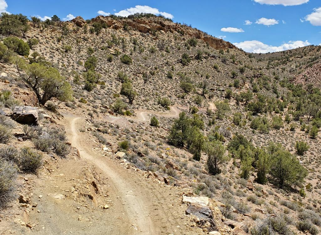
On the southern half, Salt Wash follows the western edge of the rocky ridge. This is fun stuff.
There are three short connector trails (and two trail crossovers) that entangle Salt Wash with
Sovereign. You can easily hop between trails to do more of the fun stuff.
Salt Wash is marked
with green paint; Sovereign with blue. Connector trails have black paint
spots.
Salt Wash has less continuous slickrock than Sovereign. The rock tends to be mounds that the
singletrack goes over. Add a bit of sand between rocks, and Salt Wash
is a more difficult ride
than Sovereign. Do both and see if you agree. My ideal ride would be:
North from Willow Springs
on Sovereign, switch over to northbound Salt Wash at the top connector,
climb over the bluff
and descend the steep Salt Wash DH to the Dalton Wells-area slickrock.
Then I'd climb Sovereign
and descend the tough Sovereign DH off the bluff, take the connector again
and return southbound
on Salt Wash. See my ride description below.
Absolutely don't ride north on Salt Wash from the Willow Springs trailhead. If you must go
northbound, take Sovereign up to the first connector trail. Avoid the
sand!

The trail is heading northwest, as sand alternates with mounds of rock.
, but you can skip...")
Switchbacks are DH-only (this is actually the Sovereign Trail), but you can skip them by jumping over to the climbing route for your descent.
But if you follow my ride plan, you've got to have good switchback technique. Make that "switchback
in deep loose slop on a cliff edge" technique. I was able to go cleanly
down the Salt Wash
DH northbound, and the Sovereign DH southbound. But the turns are tight,
steep, and deep with
moon dust. If you freeze the front wheel by being too timid in the turn,
you'll pitch outward
and down the mountain.
Loop ride, Sovereign and Salt Wash:
0.0 From trailhead, go E on Willow Springs road
N 38° 41.876' W 109° 39.868',
alt=4350
0.1 Fork L on DT
0.6 L on ST as DT crosses wash
Northbound on Sovereign
N 38° 42.277' W 109° 39.485'
1.1 Salt Wash ST crosses, follow blue dots
N38 42.597 W109 39.431
1.8 Connector, keep R, N38 42.907 W109 39.511
2.5 Connector, keep R, N38 43.247 W109 39.440
3.4 L onto connector N38 43.695 W109 39.378
3.6 R on Salt Wash, N38 43.864 W109 39.590
4.0 Stiff climb onto mesa
4.3 Fork L, N38 43.864 W109 39.590
5.1 Trails join. 40 feet later, fork R
N38 44.083 W109 39.351
Steep switchbacks downhill!
5.3 Bottom, go L on edge of rock
N38 44.203 W109 39.368
5.7 Hard L out of wash on DT
N38 44.230 W109 39.769
5.8 Fork L to climb Sovereign
N38 44.151 W109 39.819
Option: R into wash for
upper Sovereign
(Connects to Cedar Mountain)
6.3 Keep straight past Salt Wash DH
N38 44.083 W109 39.351
40 feet later, keep L on
Sovereign
7.0 Fork L (stay on Sovereign)
N38 43.736 W109 39.527
In 0.1, begin steep DH plunge
7.3 Fork R on connector (you've been here)
N38 43.695 W109 39.378
7.5 Fork L on Salt Wash southbound
N38 43.631 W109 39.601
Struggle over a couple of
bluffs...
8.2 Connector, keep R, N38 43.228 W109 39.535
Fun stuff here!
9.1 Connector, keep R, N38 42.873 W109 39.540
9.6 Pass bailout to ATV on R, N38 42.670 W109 39.517
9.8 Cross-over, stay on Salt Wash
N38 42.597 W109 39.431
10.0 R on ATV track N38 42.491 W109 39.330
10.3 Pass Sovereign Fork
10.5 Back at parking
Getting there, Willow Springs Road Trailhead:
On US-191 north of Moab, about 10 miles after crossing the Colorado, turn east on dirt Willow Springs Road. Keep L at
fork at mile 1.3. At mile 2.0, park in the rock-outlined area on your left N 38° 41.876' W 109° 39.868', just before a
natural gas pump building on the R. Start the ride by continuing down
Willow Springs Rd.
Getting there, Dalton Wells Road Trailhead: On US-191
north of Moab, about 11 miles after crossing the Colorado, turn east on dirt Dalton Wells Road. As the cindered path
turns R, go straight onto the dirt road. Reclose the gate at mile 0.2, and
cross the broad sandy wash. At mile 1.7, park at the fork in the road N 38°
43.584' W 109° 40.783'. The R fork takes you to the top of the
trail for the Dalton Loop. The L fork takes you further on Dalton Wells
Road, where you can connect to the southern 6 miles of trail.

Map of Salt Wash and Sovereign


, but you can skip...")