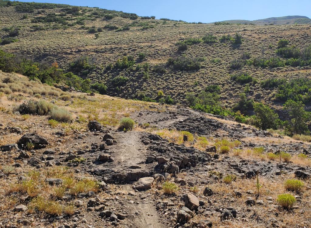
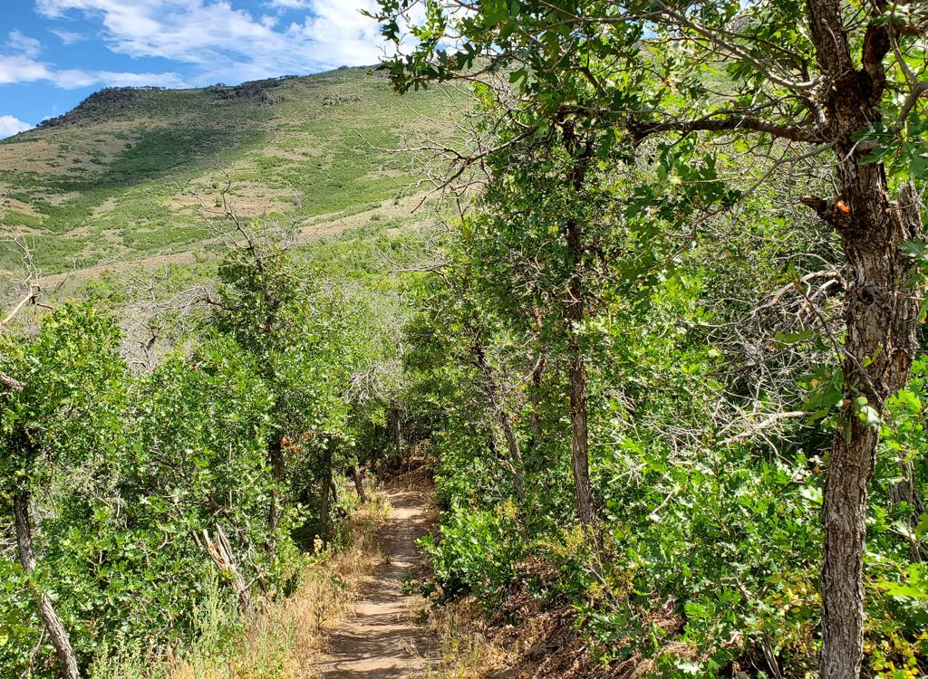
Round Valley is a mountain biking trail complex located between the eastern edge of Park City and US-40. The terrain is sagebrush and oak at an altitude of 6800 feet. There are over 35 named trails in the area, varying from broad cindered pathways for families to intermediate-technical singletrack. Link to specific rides for Big Easy , Happy Gilmor and Tin Man ; Rambler, Ramble On and Pulp Friction ; and Porc-u-climb and Downward Dog .
There are four "community" trailheads in residential areas (see below). You can also connect to Round Valley via a paved spur from the paved Rail Trail.


The trails are heavily used by local families. On the broad doubletrack trails, there will be kids and bike trailers. On singletrack, you'll pass many muscular trail-runners accompanied by very large but well-controlled dogs.


In 2016, the trail system was extended north to connect to the Trailside Bike Park in Snyderville (see the map). connects the west Rambler trailhead to Silver Creek Parkway (just east of the bike park), with a formal trailhead at its north end. Happy Gilmor also has a short connecting trail to the ridgeline trail of the park, located a bit west of the trail fork where TM ends on Happy Gilmor.
New in 2017 on Round Valley's west side, Porc-u-climb is a new easy uphill-only trail from Seventy 101 to Nowhere Elks. A bit south on Nowhere Elks, Down Dog is an easy descender all the way to Matt's Flat. See the map for an easy lariat loop ride using these trails.


Very nice riding area, heavily used by locals but also of interest to out-of-towners. Free of snow much earlier than other Park City rides. Navigation can be complex simply because of the multitude of trail options, but you can pick a day of riding from quick and mellow to brutal and exhausting.


This ride has 5.5 miles on singletrack and the rest on paved trails. There's 600 vertical feet of climbing total, but the steepest gain is about 200 feet per mile. Top altitude is 7075 ft. Start either at Quinn's or at the Rail Trail at Prospector Square. Link via the paved connector to Rambler in the sports complex. At the west end of Rambler hop on Old Farm Road southbound then westbound. Turn left when you see the Farm Trail and follow it to McCleod Creek southbound. At Park Avenue join the paved trail to Kearns Blvd and go east on the bike path back to the Rail Trail. (See link to one-page riding guide below for map and mile-by-mile instruction.)

From Quinn's Trailhead, head southwest (to the left of the small hill) on Fast Pitch. Keep straight at the intersections and join Hat Trick. Go to the right as you reach the Cove trailhead and climb up Matt's Flat, staying on the broad trail. Keep straight on Cammi's, then fork right onto Round Valley Express. Zoom downhill. As you approach US40, turn south and right on the paved path and follow it back to the sports complex.

Find the Rambler trail as it leaves paved road just east of the stables. Climb uphill a short ways and fork left toward "Practice Loop" and "Matt's Flat". Keep straight past Nowhere Elks and two forks for the practice loop. Fork right uphill on Valderoad. Keep straight until you reach Round Valley Express. Veer right on RV Express. At the gate, turn 90 degrees right uphill on Rambler. 100 feet later, fork left to Ramble On. Stay on Ramble On until it rejoins Rambler. Continue south back to the trailhead.

This is a less-complicated (and slightly shorter) variation of the USCS Round Valley race loop. From Quinn's, go north (to the right as you face the sign), then after 200 feet drop to the lower DT trail (Fairway Hills, going the same direction you were). Fork right at the next intersection onto Fast Pitch. Head uphill as other trails join. Veer right just before the Cove TH. Turn left on the singletrack Backslide and cross the mountain. At the bottom, fork hard left on Matt's. As you near the road, fork hard left uphill on La Dea Duh for some rocky tech stuff. Descend and join Rademan Ridge, then fork 90 degrees right on Rambler. Now follow Rambler all the way back.

Find Rambler just east of the stables. Go a bit uphill. At the first intersection, fork left towards Matt's Flat / Practice Loop. Quickly fork right uphill onto Nowhere Elks. Climb to the top of the mountain, then cross Rambler onto Rusty Shovel and have a nice downhill. At the bottom, go left on Ramble On. When you reach Rambler, fork left uphill. Climb to the ridge again on Rambler, then descend Rambler and follow it back to the trailhead.


On I-80, turn south at Silver Creek Junction (towards Heber). At the second exit (about 3 miles later) turn right towards Park City on Kearns Blvd (Highway 248). Less than 1/4 mile from the exit, turn right at the light onto Round Valley Drive. Quickly turn left onto Gilmor Way. Follow it around (pass the first parking lot) and veer north. You'll pass parking lots on your right. Head to the top of the parking area. Quinn's TH is across Gilmor Way. The other trails can be reached by heading toward the Ice Arena building. Bathroom and water are found in the middle of the parking area.
Quinn's TH: Directly across Gilmor Way from the top of the long main sports complex paved parking area. N40 40.764 W111 28.204.
Rambler trail: Pedal on paved trail or road to the north. Go the entry to the parking lot on the south side of the Ice Arena. At the road crossing, turn north toward the stables. Rambler is the singletrack immediately on your right, just a few feet up the road. N40 40.889 W111 28.318
Practice Loop trail: Go to Rambler as above, but don't turn onto the trail. Instead, go up the paved road toward the stables 1/10 mile. Just as it turns to the left, fork right on the yellow cinder path (Ability Way). The Practice Loop singletrack is about 100 feet up the path on your right. N40 40.945 W111 28.493
Leave US-40 (189) at the Silver Creek exit and turn west (toward Snyderville). Stay straight on Silver Creek Parkway until it ends in the Trailside Park parking lot. To connect to Happy Gilmor, you have two options: (1) You can climb the broad trail right at the parking lot entry to the top of the saddle ridge, then head south when the main trail turns left to climb to the twisty DH trails. When you reach Happy Gilmor, turn right to head for the Old Ranch (Rambler) trailhead, or go left to find TM. (2) Backtrack on Silver Creek Parkway, past the church, and turn right at a dirt road with a gate. Veer left from DT to ST, and you're on Happy Gilmor.
NOTE! A new trailhead has been constructed at the point where Happy Gilmor leaves Silver Creek Parkway, about 1/10th mile east of the entry to the Trailside Bike Park lot.
Community Trailheads: (No water and
bathrooms at these access points.)
Round Valley Way. Meadows Drive to Sunny Slopes Drive to
Round Valley Way. Parking lot,
access to the doubletrack trails just downhill from Somewhere Elks and
Backslide singletracks. N40 40.979 W111 29.121
Cove (Meadows Drive). Meadows Drive turns east at traffic
light on 224 (Park Ave north of town). Parking on the north side of the street. Connects
uphill to La Dea Duh and the west end of Matt's Flat. N40 41.066 W111 30.112
Fairway Hills. Meadows Drive to Silver Cloud Dr to Morning
Sky Court. No dedicated parking. Go to the end of Morning Sky
Court. Street dead-ends at entry to
Fairway Hills Connector. Room for a couple of vehicles. N40 40.664 W111 28.984
Silver Summit Parkway. (First southbound exit US-40) Unmarked, about 1/3 mile east of the church.
Minimal roadside parking. Two singletracks
head south. They join and connect to Round Valley Express DT. Further uphill, ST
connects to Ramble On at mile 1.4. N40 42.759 W111 29.523
Silver - Quinn TH. From Silver Summit Parkway just west of
US-40, south on Highland Drive. Parking after road turns to gravel. N40 42.726 W111 29.012
Old Ranch (Rambler) TH. From 224, go east on Old Ranch Road. Turn north as
you approach the hill. Parking is on the east side of the road. N40 42.055 W111 30.442
Single-page riding guide to Classic Loop GPS Track Files (right-click and "Save Target as..."):
Classic Loop GPX
Rambler only
Rambler-Pulp Friction loop
Beginner Fast Pitch - Round Valley Express track
Rambler to Valderoad to Ramble On Loop
Nowhere Elks - Rusty Shovel - Rambler figure 8
Wide sampler loop (La Dea Duh, Rambler)
USCS race loop 2013 track
Park City P2P track
Loop including Lost Prospector
Round Valley area Multi-Track file
Satellite map for printing: View map
Lodging, camping, shops: Links to Park City area resources