A bit of road and Colorado River is seen as we look east near the start of Rocks...
A bit of road and Colorado River is seen as we look east near the start of Rockstacker. Photos done in a rainstorm on 3/24/2011 by Bruce. My apologies.
Rockstacker

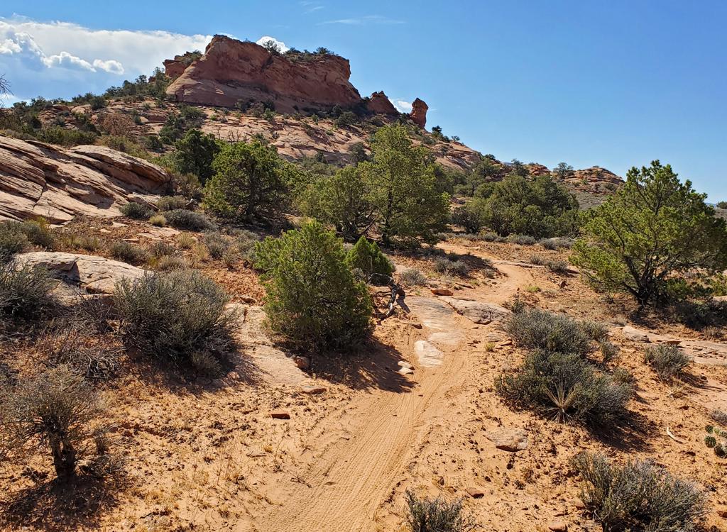
The Rockstacker Trail is a highly technical singletrack route that connects the Pothole Arch Trail to the Jackson Singletrack at the top of Amasa Back . It's only 1.7 miles long but involves a lot of work both uphill and downhill. There are some very dangerous spots. Only true experts should attempt this ride.

Rockstacker is usually done in a west-to-east direction. Climb the Amasa Back trail. Or climb Hymasa then continue Amasa from the saddle. Have your fun. Next head for the Pothole Arch trail. Rockstacker forks off of the Pothole Arch trail 1.2 miles from its beginning.
As I climb up Amasa Back, the blowing snow has given way to rain. Not wearing my...
As I climb up Amasa Back, the blowing snow has given way to rain. Not wearing my cold-weather tights -- they're wrapped around the camera to keep the water away.
Sunlight breaks through to illuminate the rincon called Jackson Not-Hole, a big ...
Sunlight breaks through to illuminate the rincon called Jackson Not-Hole, a big chunk of Wingate sandstone left isolated by the river's changing channel.
Starting altitude of Rockstacker is 4600 feet. There will be a lot of sharp downhills and tough uphills, but the trail loses only about 100 feet of elevation from west to east. But I think you do that 100 feet about 10 times.
So, assuming you're a fearless and skilled tech rider, here's the plan: we'll climb Amasa, go to Pothole Arch, then descend by way of Rockstacker and Jackson Singletrack. Fool.
A band of blue sky approaches -- before the next batch of rain clouds -- at the ...
A band of blue sky approaches -- before the next batch of rain clouds -- at the junction of Rockstacker with the Pothole Arch Trail. The trail will quickly drop from the Navajo sandstone to the Kayenta.
Looking southwest. Rockstacker drops off the left side of this photo in a scary ...
Looking southwest. Rockstacker drops off the left side of this photo in a scary plunge. Ride it? I didn't even want to walk it.
Note that the Jackson Singletrack has potentially deadly cliff exposures. It's called a "Bike and Hike" route for a reason. There are spots that you absolutely Should Not Ride, no matter how skilled you are.

The ride description below is the way I rode it, but my honest suggestion is that you skip Jackson and connect to the Amasa Back trail for your descent once you've completed Rockstacker.

An alternative descent is to cross over the ridge as Rockstacker ends at Jackson ST and take Amasa south to the ridgeline. There you'll find the Captain Ahab singletrack. This isn't an easy trip either -- you'll climb uphill for a mile, then descend a tough technical trail with cliff exposures.
The downhill drops are sometimes steep and often rough. Here the trail drops sha...
The downhill drops are sometimes steep and often rough. Here the trail drops sharply between the trees to the band at lower left. Later on, there's a set of switchbacks that are insanely tricky and dangerous.
Some sections are smooth slickrock with fabulous views. The trail here is the sm...
Some sections are smooth slickrock with fabulous views. The trail here is the smooth band heading to the middle of the photo.
Riding notes, Amasa to Pothole Arch to Rockstacker to Jackson:
0.0   Exit parking, uphill on road N38 31.710 W109 35.705
0.6   Drop R off road N38 31.435 W109 36.096
0.8   Cross creek N38 31.589 W109 36.080
2.8   Top of climb, for now N38 31.079 W109 37.115
3.5   Pass Portage connector, keep straight
        N38 31.721 W109 37.678
3.7   Keep L at fork to Jackson ST
        N38 31.761 W109 37.756
4.4   Keep L on Amasa at Pothole fork
        N38 31.876 W109 38.369
5.1   View - End of Amasa - backtrack
        N38 31.678 W109 38.871
5.8   Back at Pothole Arch Trail, fork L
6.2   Alternate joins on L, unmarked
        N38 32.047 W109 38.661
7.0   Keep L and straight (R=Rockstacker)
        N38 32.533 W109 38.449
7.8   R 100 ft to Pothole Arch N38 33.115 W109 38.447
        then back and go north
8.0   Viewpoint, turn around N38 33.228 W109 38.545
9.0   Back at fork. Go R on Rockstacker!
        N38 32.533 W109 38.449
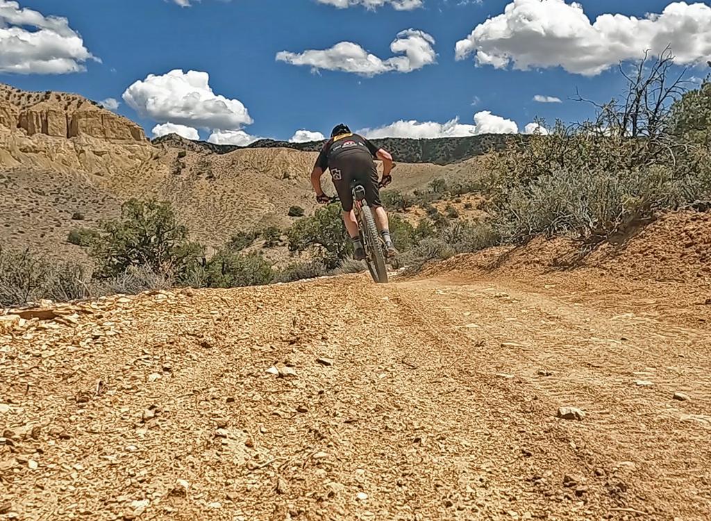
9.1   First scary plunge. Yikes!
Rough ledges await.
Rough ledges await.
Smooth singletrack for a while.
10.9   Junction with Jackson ST, keep L
          N38 31.748 W109 37.594
          (R = 0.1 mile climb to Amasa, bailout!)
11.8   Cliff exposures. Walk, you fool!
12.8   At Kane Creek, turn R along creekside
          N38 31.935 W109 36.152
13.0   Cross creek, go left N38 31.904 W109 35.947
13.1   At Kane Springs parking area
          N38 31.945 W109 35.948
          R uphill on road
13.6   Back at parking
Bottom line
I'd do Rockstacker again. But at the Jackson Singletrack I'd ride up and over the rise to descend Amasa.

Riding resources:
Printable one-page riding guide
GPS track files (right-click and select "Save Target as..."):
    Area trails GPX
      Amasa-Pothole-RS-JackST route
    Rockstacker only
Topo map for printing:   High-Res
Lodging, camping, shops:    Link to Moab area resources

View of the Colorado as we approach the Jackson singletrack. The side canyon is ...
View of the Colorado as we approach the Jackson singletrack. The side canyon is Kane Creek, where the ride started.
Rockstacker
Rockstacker
Getting there:
Head south on Moab's Main Street. When you reach the McDonald's on your right, turn right onto Kane Creek Blvd. After 0.6 miles, go straight where the road seems to turn right (500 West). Drive along the Colorado River about 5 miles until the road turns to gravel, and head uphill about 2/3 mile. Watch for the "Amasa Back Parking" area at GPS N 38° 31.329' W 109° 35.501'. Head further up the gravel road 1/2 mile, and turn right onto the trail at the sign.