Includes portion of Midmountain Trail
The loop ride described here is 13 miles long, with 2000 vertical feet of climbing. There are two shorter options using alternate trails. It's a strenuous climb, and the top altitude of 8400 feet will bother some riders. There's a section with tricky rocks on the descent via Hollys, but otherwise it's easily done by an intermediate rider.
Out-and-back: Robs to Ambush, 4.4 miles, 800 vertical.
Robs up, Ambush down loop: 8.7 miles, 1200 vertical.
Robs up, Hollys down, ST return: 9.7 miles,1300 vertical.
Robs-Hollys, pavement, Sunpeak up: 12.6 miles, 2000 vertical.
And of course, you can add miles with out-and-backs on Hunter toward Pinebrook, up to the top of Millcreek via the Crest Connector, or on the southbound Midmountain Trail. Or you can climb Ambush to return from the bottom of Hollys.


Starting at Robs trailhead puts 600 vertical into two miles of climbing right at the end. I like to finish off a ride, but many don't.
At mile 2, the forest will open up on a ridge, with views to the south as you head west. At 2.2, you'll reach the junction with Ambush. For a shorter loop, fork left here. (To continue on to Hollys, keep left and climb uphill.)


On to Hollys. From the Ambush junction, it's about 1/2 mile to the Midmountain Trail. Fork left. The Hunter Trail, on your right, can be ridden as an out-and-back (it goes mildly downhill, so you'll have to climb back). The trail goes to Pinebrook, but there's no public easement, so don't use this as a return from Midmountain unless you're riding with a Pinebrook resident.
At mile 3.7 of your ride, pass the Crest Connector. If you want, it's 1.3 miles (and 450 vertical) from here to the junction at upper Mill Creek.


It you want to add some miles, you can keep going south on Midmountain, then return later. It will be mildly uphill coming back. Red Pine Lodge is about a mile south.


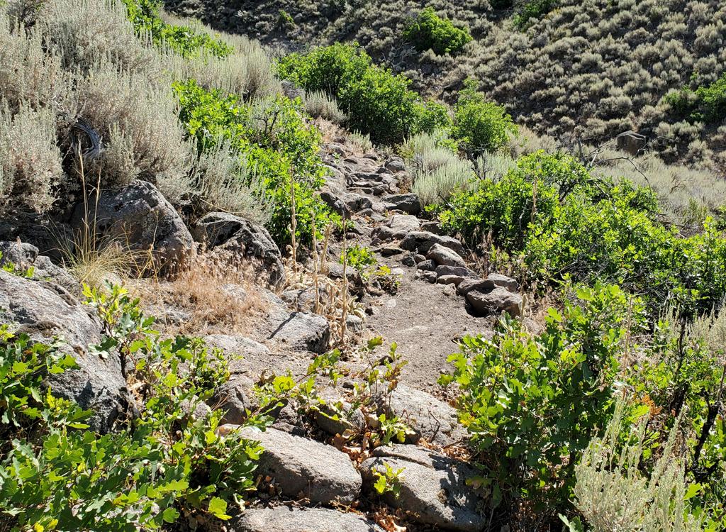
Hollys starts out smooth, but there are some technical sections in the middle. You'll need to deal with big rocks and roots. It's all fun. If you don't think so, walk your bike for a few feet, then get back on.
For the ST loop option, find a trail heading northwest along the edge of the construction site (2010). Depending on which of two trails is open -- above or below the construction fence -- when you hit a dirt road in the bottom of the canyon, you may be either above or below the return singletrack. Use the GPS track, or scout around. I can't get more specific, because the trail bypass has changed in the past month, and will certainly change again. Climb Rosebud to Robs, then descend.


Find the Sunpeak trail on the left about 50 yards before the end of Sunpeak Drive. (2010: no trailhead parking, not even a sign!) Alternate: The DuBois trail starts at the north end of the parking for the recreation center on Bear Hollow Drive 1/3 mile away. For either trail, just keep heading uphill. When you hit Robs, head R downhill 0.6 miles to parking.
0.0 Begin climb on Robs N40 41.952 W111 33.963
0.6 Keep R and uphill on Robs
N40 41.824 W111 34.005
0.9 R on Robs (L=ST return) N40 41.810 W111 33.693
2.2 Keep R (L=Ambush, short loop)
N40 41.857 W111 35.050
2.6 L on Midmountain N40 41.729 W111 35.345
3.7 Keep straight (hard R = to Wasatch Crest)
N40 41.483 W111 35.135
5.5 L on DT, sharp L downhill, find ST on L
Hollys N40 40.969 W111 34.721
7.2 Keep R as two ST's join near ski lift
N40 41.213 W111 34.690
8.7 For ST return (shorter) L on ST
For big loop, downhill on paved road
N40 41.142 W111 33.495
N40 41.042 W111 33.210 Road veers back east.
9.6 L just after Ambush parking on Summit Drive
N40 41.257 W111 32.904
9.8 R (northeast) at traffic circle. Cooper Lane
N40 41.398 W111 33.009
10.1 L at stop sign. N40 41.640 W111 32.863
Sunpeak Drive. Follow road northwest.
10.3 L uphill to Sunpeak Trail
N40 41.719 W111 32.956
(Alternate turn R on Bear Hollow Drive
Recreation ctr parking, trail north end.
N40 41.781 W111 32.826 DuBois Trail)
12.0 R and downhill as you reach Robs
12.6 Back at parking.
Bathroom: At The Canyons. None at Robs.
Water: The Canyons, plus convenience stores 1/2 mile away from
trailheads.
Camping: None in immediate area. Nearby at Rockport, Echo, or
Jordanelle Reservoirs.
Bike Services: Multiple shops in Park
City.

Single-page riding guide: View to print
GPS track files (right-click and "Save as..."):
GPX course for loop
GPX tracks area trails
Park City area multi-track file (>140 trails)
Large-format area topo map (600K): View
Lodging, camping, shops: Links to area resources