
View east toward Green Valley (the first escarpment is the location of the Green Valley race loop, and the dark mesa is Black Hill) from the Rim Runner viewpoint. Photos April 6, 2009, by Bruce.
Rim Rock
plus Rim Runner, Rim Rambler, and Rim Reaper Trails
Santa Clara River Preserve
plus Rim Runner, Rim Rambler, and Rim Reaper Trails
Santa Clara River Preserve
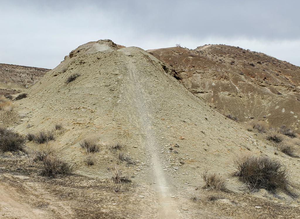
The Rim Rock trail system is part of the Santa Clara River Preserve, lying across Cove Wash from the more well-known Barrel Roll trail. The riding here is a little more technical, but not overly difficult. Climbing is fairly mild except for the grunt out of Cove Wash. The 4 trails offer options for shorter or longer rides.
The trails in the Rim Rock system are (in increasing altitude and distance from the step-over
entrance to the riding area) Rim Reaper, Rim Rambler, Rim Rock, and Rim
Runner. Note that Rim
Rambler takes you to the upper (singletrack) stem of the Rim Rock loop.
There's a doubletrack
labeled "Rim Rock" extending from the gate to this singletrack, but few
people care to ride
it.

Looking north over the Cove Wash trailhead. The road is on the right. Barrel Roll is top left. To get to Rim Rock, we need to drop down the doubletrack and cross Cove Wash.

Bruce starts on Rim Reaper at the step-over gate. To the left is the doubletrack section of Rim Rock, which would take you straight up to the singletrack lariat. (Consider this a route for hikers.)
Rim Reaper and Rim Rambler are easy trails, suitable for beginners. (Yes, there's one gnarly
thread-the-crooked-needle then a sharp step-up on Rim Rambler that's advanced
tech. Walk it.)
Rim Rock and Rim Runner are intermediate, with a couple of slightly steep
spots and some rock
rollovers that may challenge less-skilled riders.
The route I describe here is 6.7 miles, with absolute altitude change of 400 vertical feet.
This ride will have about 600 total feet of climbing. It starts at the
Cove Wash trailhead,
but you can shorten the ride by two miles by driving directly to the Rim
Rock stepover trailhead
(see below).

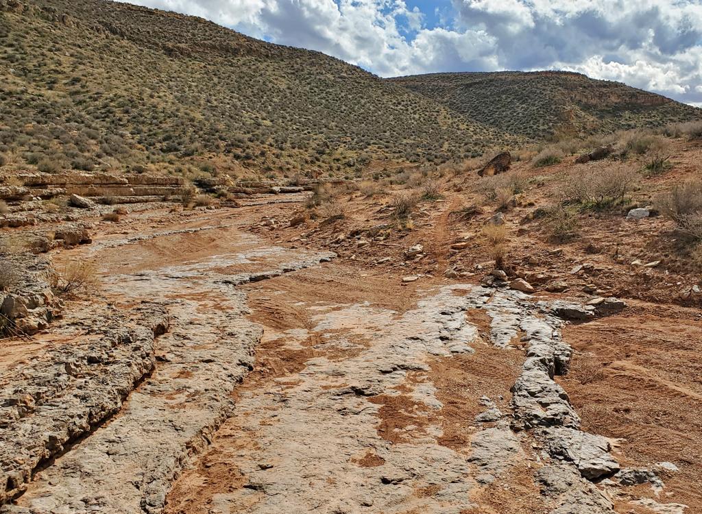
Just starting out from the Cove Wash trailhead near Santa Clara, we're about to plunge down into Cove Wash. Across the valley, we see the doubletrack trail climbing up from the wash. That's the toughest piece of the trail.

Bruce navigates a squeeze and rock step-up on Rim Rambler. The Pine Valley Mountains are to the right and the sandstone cliffs near Snow Canyon are to the left.
The ride begins at the stepover gate just south of the fenced parking area. (The west stepover
is for the Barrel Roll and Blackbrush trails.) At the edge of the wash,
the route turns west
and descends into the wash.
At the wash bottom, make a hard left and head down the wash about 150 yards (watch out for
the fence crossing the wash at head level). Exit the wash to the right
and begin climbing the
hill. About 0.1 mile after exiting the wash, watch for a singletrack on
your right. Hook right
and follow the dirt road west 1/2 mile to the preserve border.

We've reached the preserve and are heading south on the Rim Reaper trail.

On the Rim Rambler trail, we're heading west.
Step across the gate, then immediately head left on the Rim Reaper singletrack. (The main doubletrack
is the Rim Rock trail.) After 1/2 mile, fork left again on Rim Rambler
and follow it around
the cliff line. The climbing here is fairly gentle, and the trail is smooth
and easy for beginners
to ride.
The Rim Rambler trail connects directly to the spot where the Rim Rock trail turns from DT
into ST. Just go across and continue. Next comes a short steep downhill
as you cross a saddle.
Just after climbing back up, you reach the fork of the Rim Rock loop.
I suggest going left.

View south from the viewpoint near the intersection of Rim Rambler and Rim Rock.

Descending from the far end of the Rim Rock loop.
Turn left again and do the lariat-shaped Rim Runner trail, and the viewpoint spur at the southwest
corner. This will give some of your best views. Just go left every time
you come to a fork.
Continue your left-hand rule as you return to the Rim Rock trail and loop
around the edge of
the mesa. The riding is a little more technical here, with some rock rollovers
and a couple
of tight turns.
One sharp-angle turn has some rough cobblestones near an exposed drop. Intermediates may need
to dismount for that turn, and for a couple of tight switchbacks. Overall,
however, I thought
it was a pretty easy ride and more fun than Barrel Roll. Check it out.

Looking back toward St. George and Black Hill from the Rim Rock trail.

View up the Rim Runner Trail, just before the loop starts. The trail reaches the south edge of the cliffs.

View southwest from the viewpoint on the Rim Runner Trail, about 3 miles into the ride.

View of terrain on the western side of the Rim Rock loop, as the bike rolls over outcrops of sandstone. This is the Shinarump layer of the Chinle formation.
Dirt route from Green Valley, 5 miles (plus city streets) each way: Up DH
section of GV racecourse (1.8 miles). Step across the fence and go down
into the dip facing northwest. Drop down
very-steep DT into the next valley, proceed west then northwest and
go through the fence to Stucki Springs (1.3 miles). R on Stucki Springs Rd
1.8 miles then left at fork, pass DT going up to fence on your L about 0.12bwfz8R_OTc
mile later, then keep L at the next fork 100 yards later. Continue to
step-over trailhead at mile 0.5 from the fork.
Dirt Green Valley alternate, 8.4 miles: Head up road to Bearclaw parking,
continue on Bearclaw to Stucki ATV connector 1.4 miles after Bearclaw TH.
Follow connector to Stucki springs, then follow the road. Advantage: avoid
the hike-a-bike back up the bluff on the way back.
Dirt route from Bloomington: Follow the Stucki Spring directions on that trail page. When you reach the spring, go through the fence and head R on the Stucki Springs road northbound as above.

View north from the Rim Rock Trail, looking towards Ivins and Santa Clara. The Pine Valley Mountains are in the distant background. The large red cliff is just south of Snow Canyon, and the white cliffs lie above the highway at the top of the canyon.
Ride notes, from Cove Wash TH:
0.0 Step over on DT to south of parking
N37 07.247 W113 40.481
0.1 Veer R and descend into Cove Wash
0.2 Hard L, descend wash bottom
N37 07.182 W113 40.516
0.3 R out of wash, climb south side of mesa
N37 07.135 W113 40.449
0.6 R off DT onto ST
N37 06.947 W113 40.253
(If you miss ST, take DT to R at 0.7)
1.0 Step over gate, L on ST in 30 ft
N37 07.074 W113 40.610
Rim Reaper Trail
1.5 Fork L on Rim Rambler
N37 06.892 W113 40.630
2.1 At DT, cross vs up to viewpoint
N37 06.901 W113 40.855
Rim Rock Trail
2.5 Fork L to start loop
N37 06.881 W113 41.027
2.6 Fork L on Rim Runner
N37 06.831 W113 41.087
150 ft, L at fork (loop starts)
3.1 L to viewpoint
N37 06.694 W113 41.167
3.2 Back from viewpoint, go L
3.4 Finish loop, go L
150 ft, L again to resume Rim Rock
3.5 Keep L (R = shortcut)
N37 06.885 W113 41.094
3.9 Fork L (straight = from shortcut)
N37 06.902 W113 41.105
5.0 Back at loop fork, go L
5.3 Back at DT, fork L
(Option, cross to Rim Rambler)
5.5 Pass Rim Rambler ST
N37 07.040 W113 40.744
(Option Rim Rambler, 0.3, L on Rim Reaper)
5.7 Back at stepover
6.7 Back at Cove Wash TH

Rim Rock trails
Getting there: In St. George, head north on Bluff
Street and turn left on Sunset Blvd. Drive 3 miles west on Sunset through
Santa Clara. As you're reaching the end of Santa Clara, look for a road
crossing the river on your left. It's about 200 feet before the Jacob
Hamblin Home (which will be on your right if you pass the turn). Turn and
cross the river and follow the road as it turns right. About 0.4 miles
from Hwy 191, turn left onto the dirt Stucki Springs road.
At mile 0.7, turn right at the sign "Santa Clara Preserve." Pass the water tank, and at mile 1.3, turn right again through the fence. This road will veer left, then arrive at a log fenced parking area at mile 1.5, N37 07.253 W113 40.508. (For a route to the trailhead from St. George by bicycle, see above, or download 5 track options from Green Valley: GPX )
At mile 0.7, turn right at the sign "Santa Clara Preserve." Pass the water tank, and at mile 1.3, turn right again through the fence. This road will veer left, then arrive at a log fenced parking area at mile 1.5, N37 07.253 W113 40.508. (For a route to the trailhead from St. George by bicycle, see above, or download 5 track options from Green Valley: GPX )
Alternate trailhead for beginners: As you
leave Santa Clara, you can continue on the Stucki Springs road (instead of
turning right at the Preserve sign). After going through Cove Wash, 1.7
miles after turning onto the Stucki Springs road, turn right. Keep
straight where a road forks left uphill, then keep left at the next fork
and drive another 0.5 miles to the stepover gate. This allows you to ride
the Rim Reaper and Rim Rambler trails without the more-difficult descent
and climb found in Cove Wash.
Singletrack from Santa Clara: There's a singletrack trail you can ride from the valley to the trailhead. After crossing the river and following the road as it turns right, pass the dirt Stucki Springs road. About 100 feet past the road, a doubletrack heads obliquely westward uphill on the left, turning quickly into singletrack heading up along the wash. at about 1/3 mile, keep R at the fork (L rejoins the road). The trail will climb up and west of the water tank, then join the road right at the fence of the preserve. From here, ride a short distance on the road to the Barrel Roll parking lot (see wide-area topo map).
Singletrack from Santa Clara: There's a singletrack trail you can ride from the valley to the trailhead. After crossing the river and following the road as it turns right, pass the dirt Stucki Springs road. About 100 feet past the road, a doubletrack heads obliquely westward uphill on the left, turning quickly into singletrack heading up along the wash. at about 1/3 mile, keep R at the fork (L rejoins the road). The trail will climb up and west of the water tank, then join the road right at the fence of the preserve. From here, ride a short distance on the road to the Barrel Roll parking lot (see wide-area topo map).
Riding resources for this trail:
Single-page riding guide
GPS track files (right-click and "Save as..."):
Rim Rock tracks
Area multi-track file
Wider-area topo for printing:
View full area topo
Smaller view
Lodging, camping, shops: Links to St. George area resources
Single-page riding guide
GPS track files (right-click and "Save as..."):
Rim Rock tracks
Area multi-track file
Wider-area topo for printing:
View full area topo
Smaller view
Lodging, camping, shops: Links to St. George area resources
Latest update 2018