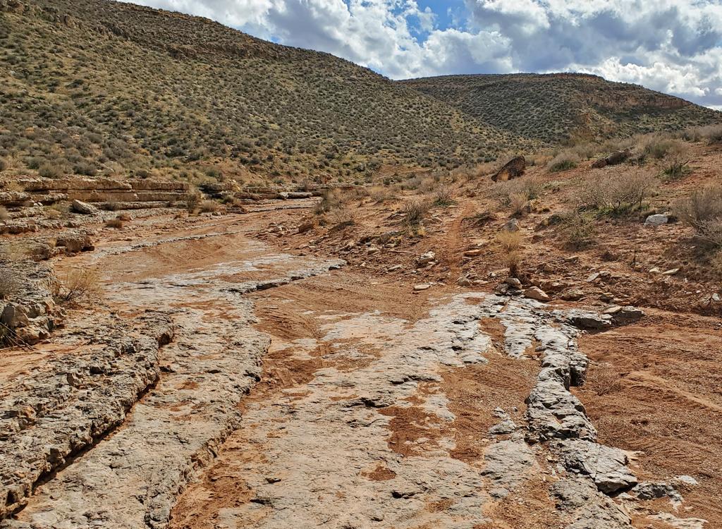
At the southern end of the loop, looking north along the skirts of Moenkopi clay and mudstone. Photos and ride description by Bruce on October 12, 2011. Updated January 7, 2015.
Rhythm and Blues
with Rock and RollRhythm and
Blues is a short mountain biking loop near Quail Creek in southwest Utah. It lies on the
skirts of a mesa just south of Quail Creek Reservoir. The Rock and Roll
trail lies within the Rhythm and Blues loop (see below). Riding both loops
gives you a worthy six-mile ride. The trailhead is
shared with the newer
Quail Creek west lakeside trail
.
The Rhythm and Blues loop bike trail is only 2.6 miles in length, and is a designed to be ridden
clockwise. It can be a fairly quick ride for a skilled technical rider,
or a long and frustrating
ride for an early-intermediate. Starting at 2900 feet elevation, there's
only 100 feet of absolute
elevation change, but lots of short up-and-downs add to about 300 vertical
feet of climbing.

Parking area. The trail exits the parking zone at the far left side. The caprock at the top of the mesa is Shinarump conglomerate, the same rock found at Gooseberry Mesa. Here it tends to be more "chunky" with embedded rock because it lay closer to the mountain source of pebbles.

The trail contours around the small washes on the skirts of the mesa. Here we're looking east shortly after leaving the parking lot. A water treatment facility is on the opposite side of the road.
The trail will invite you to do a couple of laps. The outbound lower (eastern) side of the
loop is intermediate technical. The quick turns and bucking-horse down-ups
require good balance
and bike-handling skill. The upper half (the return route) is advanced
technical. It will be
sufficient challenge for skilled riders.
The ride starts from a spacious gravel parking area 1/2 mile from US-9 on the road to Quail
Creek Reservoir. From the parking area, go to the left and start uphill
on smooth singletrack.
The trail to your right -- the
Quail Creek Trail
running north parallel to the road -- goes 2.1 miles north along the skirts of the mesa.

There are a few of these thread-the-needle passages between chunks of conglomerate.
 half of the loop.")
More typical trail surface on the lower (east) half of the loop.
At the first trail fork about 50 yards uphill, keep to the left for a clockwise ride. (The
right fork is the return from the loop.) You'll head south on an undulating
ribbon of hard-packed
white clay. The entire trail lies in the Shnabkaib Member of the Moenkopi
Formation. The Moenkopi
was formed on a broad mud-plain in the early Triassic era when the ocean
was to the west along
the Utah-Nevada border. The bands of color depend on the minerals present
when the mud was
laid down.
The yellow rock layer above you is the Purgatory Sandstone. The red slopes above it are the
Upper Red Member, the top of the Moenkopi Formation. At the end of the
Triassic (about 200
million years ago), the land under the ocean in western Utah rose up.
West of the Hurricane
fault, the land became mountainous highlands. Rivers brought gravel and
sand from the west
to form the Shinarump Conglomerate of the cliff-top Chinle Formation.
These are the rocks you
see scattered around.

Southbound, the trail joins and leaves the old irrigation structure a couple of times.

On the lower side, the trail rocks over the pleats in the clay skirts of the mesa. The riding is easier-intermediate on this downhill side.
The trail will periodically drop into the old Leeds Creek canal as it heads south. The irrigation
structure is still visible as a depression surrounded by rough cement
peeking above the desert
soil.
The trail will veer to the southwest as it approaches US-9. It will begin to climb uphill through
a few turns to reach the red dirt higher on the skirts of the mesa. At
mile 1.1, keep left
at the fork for Rhythm and Blues (turning right takes you on Rock and
Roll, see below).
Now the trail turns northbound, following lines where softer clay has eroded off a harder layer
to form a bench. Because you're now at the base of the steeper slopes
of Moenkopi, rocks that
have broken off the Chinle caprock tend to catch here. So there are more
chunks of conglomerate
to contend with.

Heading back north, the trail follows a break in the skirts caused by a harder, more erosion resistant limestone layer within the Moenkopi. The sea reclaimed the mudflats for a while as this layer was laid down.

Some of the drops are sharp with a sudden upturn at the bottom. Beginners will not do well on these dips.
As you head northbound on the clockwise loop, the trail gets steadily more technical. Intermediates
will find a lot of spots to walk. (If you're forced off your bike, stay
on the trail. Don't
hike trailside!)
Many of the turns are quite tight. And the shoulder is soft clay that will grab your wheel.
Good practice at bike control!
Skilled riders will find it's possible to clean everything. But you may want to reserve the
all-out go-for-it run for your second lap. There were two spots where
a fast-but-wrong entry
point to a rock roll-over would put you into a wheel-trap before you could
stop.

Typical rollover with a surprise waiting on the other side, then a dip and climb, then a steep plunge.

On some of the ridges, piloting the bike over and around the rock obstacles while maintaining uphill momentum can be tricky.
A couple of times, you'll descend a bit and think you're done, only to reverse course and climb
up another ridge. Fun stuff.
The trail rejoins the outgoing trail just above the parking lot. Take another lap, and this
time, ride it all without putting a foot down.
When riding Rhythm and Blues, stay on the trail at all times. The little blackish stalagmites
on the dirt are cryptobiotic soil -- a living crust of symbiotic organisms.
Even laying your
bike down off-trail will cause damage that takes many years to heal.

The trail has dropped into a wash for 100 feet. Then it's time to turn back uphill again.

North view near the southern end of the loop. If you can get the nearby highway out of your mine, it's actually very scenic.
Don't ride this trail when it's wet. After a storm, or in early spring when the clay still
holds a lot of water, the trail will not hold up under bike tires.

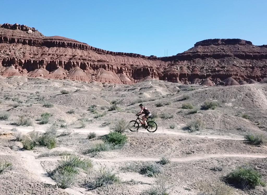
Looking northeast from the southern end of Rock and Roll. The yellow band on the mid-slope is the Harrisburg or Purgatory Sandstone. It lies within the base of the Upper Red Member of the Moenkopi Formation. Photos January 7, 2015.
The Rock and Roll trail lies within the Rhythm and Blues loop. But it's not a shortcut. Rock
and Roll itself is 2.2 miles long, winding all over the rolling badlands.
Like R&B, Rock and
Roll is a one-way trail, extending from the southwest corner of Rhythm
and Blues up to the
northeast corner of the loop.
From parking, a loop using southbound Rhythm and Blues and returning northeast via Rock and
Roll is 3.4 miles. Find the trail fork at mile 1.1 of R&B (as of Jan 2015,
there are no signs
or markers). Turn right (northbound toward the reservoir) on Rock and
Roll as R&B continues
west.

Typical terrain. Dropping into washes and climbing out.

Like upper Rhythm & Blues, Rock and Roll is an expert-level trail.
Rock and Roll is a delight of meandering undulating trail. Again and again you'll drop down
into a wash then climb back up to a ridge overlooking SR 318. The trail
manages to be 0.6 miles
longer than this same section of R&B northbound.
The trail joins R&B just as the loop begins its final descent toward the parking lot. On R&B,
you probably didn't notice the subtle trail coming in. Keep straight and
right, descending
to the first trail fork. (Do NOT go southbound on either R&B or Rock and
Roll. Both trails
are one-way.)

Sample meander. Nice riding.

Rhythm & Blues
Getting there:On I-15 about 10 miles north of St. George, take the Hurricane (US-9) exit eastbound. Drive
2.6 miles. After descending part-way down the hill, turn left toward Quail
Creek at the light.
Drive another 0.5 miles north and find the broad gravel parking area on
the left side of the
road. The trail starts on the south (left) side of the parking area.
For more technical riding at Quail Creek, see the pages
for the
Quail Overlook trail system
and
the
Quail Creek Trail
.


 half of the loop.")