Includes Cliff Trail (and Zorro trailhead)
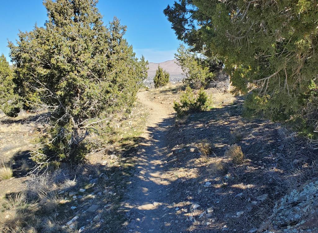
The Provo Canyon Race Loop is a fun 1.7 mile winding singletrack romp in lower Provo Canyon. It lies on a shelf area between the steeper upper and lower mountain slopes. At an altitude of 5200 feet on a south-facing slope, the riding season is usually May through November. You can reach the trail from other area trails, with many riders taking the paved Provo River Parkway from town.


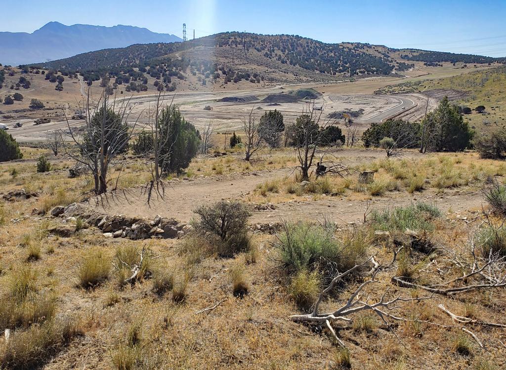
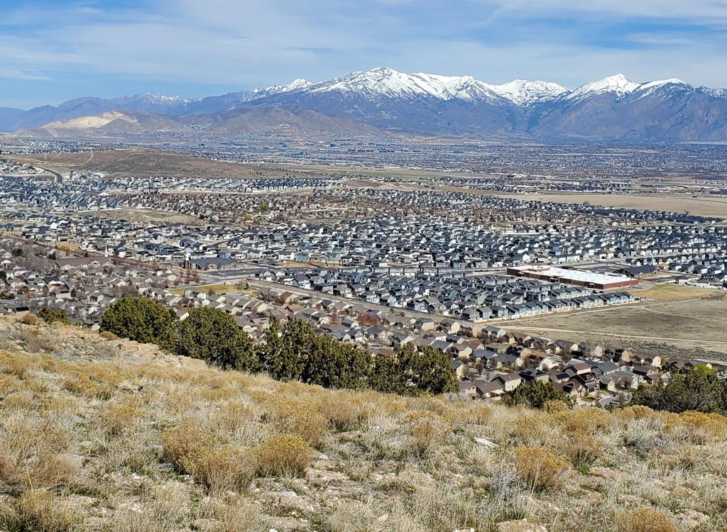
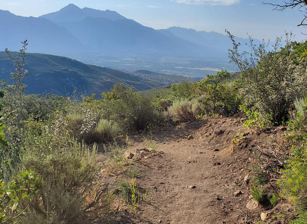
There are constant views of Cascade Mountain to the south, Timpanogos to the north, Provo Canyon to the east, and the conglomerate cliffs of the canyon entry to the west. It's a pretty ride.
1. Do not ride these trails during the winter ( December 1st to April 15th). Deer will not survive if frequently disturbed.
2. Unauthorized trail-building is strictly prohibited! Stay on-trail!
3. To reduce erosion and prevent "trenching" of trails, do not ride trails when muddy.
4. Avoid disturbing wildlife, keep your dog on a leash.
5. You must have a current Utah fishing or hunting license to enter the WMA!
The quickest way to reach the loop is from below, via a half-mile gravel road from Canyon View Park.
Many riders enter the loop from the uphill side, descending from the Bonneville Shoreline Trail. This section of the BST is the Orem Bench Road.
On the west, the BST trailhead is near the water treatment plant (see below). In Provo Canyon, the Orem Bench Road is reached via the Great Western Trail (GWT) from Canyon Glen Park, climbing the Dragon's Back.


From Canyon View Park, the route will be 2.7 miles with 550 vertical feet of climbing. Go uphill on the gravel road, keeping to the left at the 0.3-mile road fork. At 0.4 miles, hop on the singletrack. You'll reach the loop at mile 0.5 from the trailhead. The natural direction for this access trail orients you for a counterclockwise ride.
You'll pass a cheater joining uphill on the left, then arrive at a fork 0.2 miles after joining the loop. Go left. The trail that descends into the ravine is the East Access trail. Now keep generally flat and straight to avoid being suckered onto a shortcut.


At mile 1.2, the Upper Access trail will fork right uphill. Keep straight.
The next fork is at mile 1.5, where the Cliff Trail (West Access) descends steeply to join you on your right. Keep straight, and in 0.2 miles you'll be back at your starting point.The easier route is the Upper Access trail. Stay on the BST. When the road turns sharply back to the right, start watching for a singletrack on the right (downhill) side. If you reach a trail heading uphill (Betty), you went a little too far. Keep straight as the steeper alternate trail crosses over and descend 0.5 miles to the race loop.


Many riders drop into the loop via the Cliff Trail. This is an expert-level trail descending from the BST. It's 1/2 mile long with 200 feet of elevation change.
Of course, you can also climb from the the Race Loop to the BST on the Cliff Trail. The first pitch is a little steep as you climb away from the loop, then it's fun.
The Bench Road will begin to turn to the left near a cement water-handling thingy and a tower. Before the turn, drop downhill to the right on doubletrack. Keep straight and left (ignoring a singletrack or two forking 90 degrees downhill) and roll into singletrack.


If you're just riding through the Race Loop on your way uphill to the Timpanogos foothill area trails, take the Bottom Access. But now go left (clockwise) on the Race Loop. In 0.3 miles, keep straight to pass Cliff. Exit the loop at its highest point on the Upper Access trail and climb to the BST.
And if you don't see Betty forking uphill within 100 yards of reaching the Bench Road, you went the wrong way on the doubletrack.
After many years, the Race Loop remains a quickie favorite of local riders. It's a fun and rapid ride, either as an after- or before-work hammer-it, or as a side dish to other riding in the area.

0.0 DT uphill (west of upper parking)
N40 19.531 W111 38.702
0.3 Keep L and straight
N40 19.607 W111 38.826
0.4 R on ST (Bottom Access)
N40 19.602 W111 38.951
0.5 Straight onto Race Loop
N40 19.618 W111 39.033
0.55 Keep straight N40 19.641 W111 39.017
0.7 Fork L (R = East Access)
N40 19.677 W111 38.935
0.8 - 1.1 Keep straight x 4 cheaters
1.2 H intersection! Go L downhill
N40 19.764 W111 39.102
1.5 Back at H, go straight on upper trail
1.7 Keep straight L (R = Upper Access)
N40 19.809 W111 39.068
2.0 Keep L (R = Cliff Trail)
N40 19.660 W111 39.213
2.2 Back at Bottom Access
2.7 Parking

Via Orem BST Trailhead: Drive towards the mountains on 800 North. At 800 East, turn left and drive north about 1 mile. Immediately past the cemetery and just uphill from the fence, turn right (east) on Cascade Drive just before the Y in the road and drive 1/2 mile, go up 2 short switchbacks, and park in the paved parking area or the gravel overflow parking below it. Take the Bench Road (BST) east one mile and pick the Cliff Trail (starts as a doubletrack near the water structure), or go another half-mile to the easy Upper Access trail.
Water and bathrooms at Canyon View Park
Via Dragon's Back (GWT and BST): Drive 2.6 miles up Provo Canyon and turn left into the parking area for Canyon Glen. After finding your parking spot, go back to the end of the parking lot where you entered, then turn right and go directly north toward the river and find the bridge across to the parkway. Turn right, and find the GWT on your left about 200 feet later, forking uphill just before the paved parkway curves around a rock outcrop. Take the singletrack uphill. When the singletrack trail ends at a gate on gravel road, you have two options: (1) uphill then left for the BST (Orem Bench Road), and (2) drop immediately to the left downhill on gravel road. When the road turns from southwest to east, take the singletrack west. Cross through the ravine and climb to the Race Loop.
One-page riding guide from Canyon View
GPS track files: (Right click and Save as...)
GPX Race Loop only
Track via Canyon View (2.7 mi)
Via BST (5.7 mi)
Via Zorro and Cliff (4.6 mi)
Multi-track area file (over 70 tracks)
Topographic maps for printing:
Orem Bench area
Wider canyon mouth area
Lodging, camping, shops: Links to Provo area resources