View north early in the ride. Photos and review by Bruce on October 23, 2013.
Prospector Trail in Moab
The Prospector Trail runs along the hillside just east of US 191 in northern Moab. This is a short trail that splits in the middle to create an upper and a lower riding option before rejoining. The more-technical upper route is 1 mile in total length. If you ride the easier lower path, it will be 0.9 miles. The trail is best suited to upper-intermediate riders.
This isn't a "destination trail." It's a trail you ride while your buddy fixes his broken derailleur.
Or for something to do if you've got a half hour of daylight after you
check into your motel.
Or it's an interesting detour from pavement as you're riding back into
Moab from a ride like
Porcupine Rim.

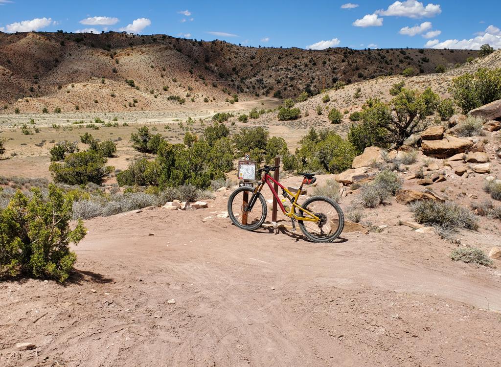
The south end of the trail. Good thing the "Trail" sign is there. Otherwise you'd never notice the path into the trees.

Parts of the trail are steep-ish, with constant turns and dips. We're looking northwest toward The Portal.
You might think that a trail that runs along the edge of a city would be targeted to beginning
riders. That's not the case here. The trail dips and winds constantly
along the steep mountainside.
There are some short stiff loose climbs that will challenge your tire
tread. The lower route
requires solid intermediate skills and confidence. I'd rate the upper
route as appropriate
for upper-intermediate to early-advanced riders.
On the lower route, climbing will be 150 vertical feet. You'll gain and lose elevation in short
bits. The upper route has 1/4 mile of sustained climbing, with a total
of 250 feet of total
climbing.

Looking south.

We're on the lower trail as it zigzags along the base of the slope.
Because the trail sits on fully-exposed slope, it will get toasty hot on sunny days. The upper
route is certainly not a cruiser trail. I was dripping sweat at 11 am
on October 23.
Both ends of the trail begin with a quick set of barely-ride-able switchbacks. Walk the first
100 feet if you must, and you probably will. This first little climb will
count for about 30
feet of the total elevation change.

View southwest from the lower trail.

Rock formations along the trail.
The trail dips and twists as it hugs the side-slope. Sharp rocks line the trail edge, which
falls away quickly. If you go down, expect some blood. But the riding
is fun and invites you
to motor right along. For a short trail within a rock's throw of the highway,
it's actually
a decent ride.
The north end of the trail starts at the south corner of the Zipline on US 191 (across from
Denny's). On the east side of Highway 191 look for the "Trail" sign and
a path heading uphill.
(In 2013, it's right where the paved bike path ends.) From this end, the
trail will look ugly
and not-worth-doing until you cross the paved driveway to the restaurant
at 0.2 miles.

We're southbound and climbing on the upper trail. Note the slash on the steep hillside straight ahead in the shadow. That's the trail.

View west toward Moab from the upper trail. The ribbon in the valley is the lower trail.
On the south end, the trail is also marked by a large "Trail" sign. It's about 200 feet north
of the rock shop. Don't park at a business. There's room to park in the
dirt by the side of
the road near the trail.
The trail heads east into the trees at 90 degrees to the road. Then it hits a switchback climb to get up and above the property along the highway.
From the Bike Hub by the Colorado River (under construction in fall 2013), take the paved bike
path south, riding on the east side of Highway 191. It's 1.2 miles to
the northern end of the
Prospector Trail.

Looking north on the Highway 191 bike path, about 1/4 mile south of the bridge.

Looking up a steep loose slope on the upper trail. If you fall, don't tip to the right.
Riding notes from the northern end:
0.0 Find trail just south of the Zipline building
N38 35.304 W109 33.612
Climb switchbacks to top, head south
0.2 Cross driveway to restaurant
N38 35.297 W109 33.469
0.4 Trail forks on ridge
L = higher path, R = lower
N38 35.257 W109 33.422
0.8 Trails rejoin N38 35.082 W109 33.242
1.0 Descend to highway
N38 34.984 W109 33.213
Getting there:
From the middle of Moab, go north on Highway 191 (Main Street) until the road veers to the northwest. Now watch for the big Moab Rock Shop on your right. About 200 feet past the rock shop, find a spot to park on the dirt of the shoulder. (Don't take up parking in any of the local businesses!) Find the trail at N38 34.984 W109 33.213.
To start from the north, keep driving two miles north. Park at the Bike Hub where U-128 meets Highway 191 at the Colorado River. Bike south to the north end of the trail at N38 35.304 W109 33.612.

Prospector map
Riding resources for this trail:
GPS track file (right-click and "Save as..."): GPX tracks
Lodging, camping, shops: Links to Moab area resources
GPS track file (right-click and "Save as..."): GPX tracks
Lodging, camping, shops: Links to Moab area resources