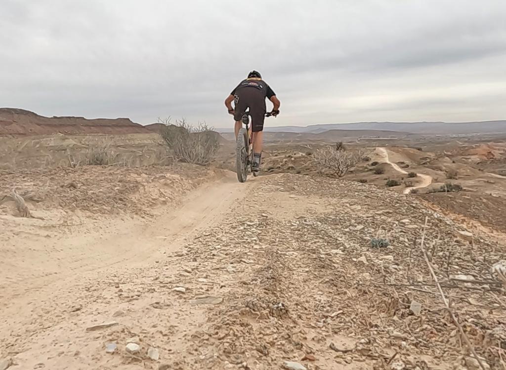

The Prospector Trail is a delightful desert romp near red cliffs of Navajo Sandstone. The trail begins on the north near Leeds, about 15 miles north of St. George, and continues southwest to Washington. The trail lies in the Red Cliffs Desert Reserve. The riding is easy and can be done by beginning cyclists (with a few hike-overs).


At the southern end, the Grapevine trailhead connects to a path over a steepish hill to reach Prospector near the Church Rocks loop. There are two trails down the north side of this hill, and most riders take the uglier route. (See below in the trailhead info section.)
The most popular "Prospector Trail" ride uses only the piece between the Cottonwood Trailhead and Church Rocks (where riders do a loop before heading back for an 11-mile ride). But let's cover all your ride options...


Some riders begin this ride at Silver Reef. From the gravel parking area just south of the Wells Fargo building, N 37° 15.142' W 113° 22.028', work southwest on dirt roads. [ Track Files for Silver Reef to Harrisburg: GPX Silver Reef ] The dirt road will turn into the Leeds Reef trail on a low ridge, then drop into the small valley heading south. As you hit the White Reef trail near the trailhead, you have two options.


From the Red Cliffs recreation area road west of the fee station, find the trail on the south side of the road and climb up the small hill to head. This leg will be about 2.5 miles. Here there are a few low hills to climb, with the largest as you climb away from the trail intersection in Cottonwood Canyon. (Note that the trails going westbound enter the wilderness area and are closed to bikes.)

At the top of the climb out of Cottonwood Canyon, keep as straight south as you can. The trail(s) to your left head down to the Cottonwood trailhead 1/3 mile away. The trail heading west uphill to the right follows the rim of Cottonwood Canyon. So if you're coming from the north, you won't actually pass through the Cottonwood Trailhead.
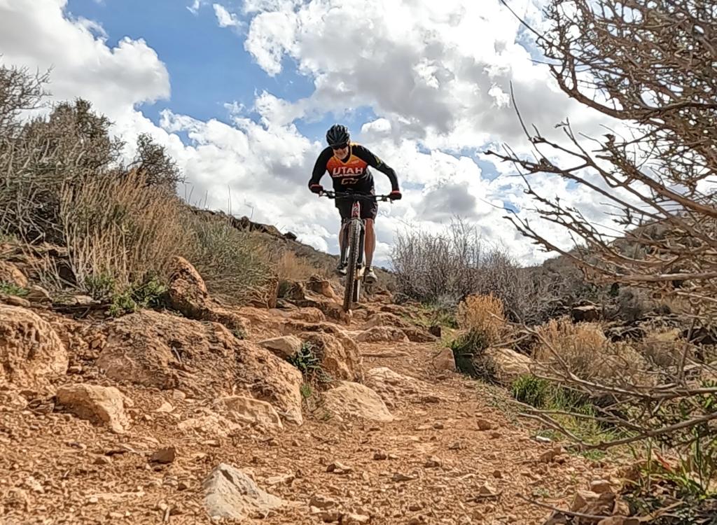
Cottonwood to Church RocksIf you started at the Cottonwood trailhead, you'll veer south as you reach the trail intersection. At first, the trail doesn't seem wonderful. But after a bit of rock and a nasty descent into the wash, Prospector settles into a swooping twisting desert ribbon that's a riot to ride.


Connecting to Washington, routes A-D: When you hit
the main east-west wash below the southern end of the Church Rocks Loop, you have
several options to get into Washington. This would be of interest mainly for
shuttled pampered riders doing a point-to-point ride.
A. Go down
the wash and through the tunnel under the freeway. Really. Jog downhill a
bit, then climb up the mesa to your left. Follow the gravel road east and
find a paved bike trail dropping off the mesa into Coral Canyon. Go east until
you find Telegraph Road then turn right.
B. Hike a tiny distance up the wash, and
find the Grapevine Trail heading up over the hill. Expect to hike-a-bike. Keep left past two
trails. At the border of the Reserve, catch the doubletrack down to Buena
Vista Blvd.
C. Start out as in (B), but at the second fork, go right
up the Grapevine Trail, then left on the Dino Tracks Trail. When you reach
the water tank, drop down the dirt road to Buena Vista.
D. Ride clockwise onto Church Rocks. At the far southwest corner of the loop is
a fork on slickrock. Right takes you north uphill on Church Rocks. Left and
slightly downhill will connect to a trail that climbs up the hill to the south.
At the top of the hill, fork left and go 1/4 mile. Then fork right as the trail
connects to the Grapevine trail at the top of the hill

White Reef and Red Reef trailheads are BLM fee areas ($5 per car in 2022). These trailheads have bathrooms and water. The Red Reef trailhead (down the road toward the cliffs from White Reef) has camping and covered picnic facilities.
Silver Reef: Take the Silver Reef I-15 exit and head west, following the signs to Silver Reef. Find the parking area just south of the Wells Fargo building N 37° 15.142' W 113° 22.028'. Work southwest on dirt roads.
Grapevine Trailhead: On I-15 just north of Washington, take exit 13 for Washington Parkway. Turn north on Washington Parkway toward the mountain (left if you're coming from St.G). The road will end immediately after the northern off-ramp. Continue straight onto dirt (note: will change as area develops). 100 yards later, pass through fence and park. N37 08.981 W113 29.430. The ride starts on the dirt road that's to your right as you go through the fence, heading northeast parallel to the freeway. As the road turns west (left), find the singletrack trail that continues north. Follow it to the top of the hill. Straight ahead is a steep rocky plunge into the wash. If you go left 1/4 mile, there's an alternate trail that's a calmer smoother ride. It will take you down through the wash to the southwest corner of the Church Rocks Loop. To get directly to Prospector, fork right.
One-page riding guide for this trail
GPS track files (right-click and "Save as..."):
Red Cliffs Recreation Area multi-track file
Tracks for Silver Reef dirt road link
High-Res topo map: View
Red Cliffs area map: View
Lodging, camping, shops: Links to St. George area resources