Looking west over the canyon of the Colorado River from the Pothole Arch Trail. ...
Looking west over the canyon of the Colorado River from the Pothole Arch Trail. Photos and ride description from a ride by Bruce on March 24, 2011.
Pothole Arch Trail

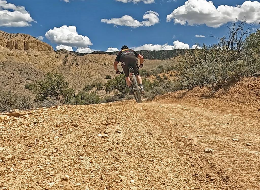
The Pothole Arch Trail is an out-and-back trail that forks off the Amasa Back trail near the top. The trail is short -- only 2.2 miles each way -- but it's a fun and scenic pleasure to ride. It will almost make you forget the suffering of climbing Amasa Back to get to it. Plan on an advanced tech ride with over 2000 feet of climbing.

The Pothole Arch Trail offers some alternatives to a simple out-and-back. You can reach it via a slickrock route (called Domes?), from near Amasa Back's end-of-trail viewpoint. On the way back from the arch, you can fork onto Rockstacker for a short loop, or make a long loop all the way to the bottom by adding Jackson. Note: Rockstacker and the Jackson Singletrack are very technical and dangerous. They should only be attempted by highly skilled and adventurous riders.
Were beginning to climb uphill on the Amasa Back trail, looking back east at the...
We're beginning to climb uphill on the Amasa Back trail, looking back east at the fins of Navajo sandstone of Kane Creek Canyon.
Some mellower riding surface as we climb the Kayenta sandstone toward the top of...
Some mellower riding surface as we climb the Kayenta sandstone toward the top of Amasa.
This ride description assumes you'll climb Amasa and go to the viewpoint at the end of the trail. Then you'll backtrack to the official start of the Pothole Arch Trail, ride to the arch and the viewpoint a bit beyond. Then you'll head back via Amasa.
Our ride starts from the Amasa Back parking area, just up the Kane Creek Canyon road. Hop back on the gravel road heading uphill. 0.6 miles later, fork right and drop down the ugly stair-step slope to Kane Creek. Cross the creek and begin climbing the Amasa Back trail. This first part of the trail is ugly. It gets better. If you want to avoid the brutal ledges of the main Amasa jeep route, hop onto the Hymasa singletrack for a lovely climb.
Sun breaks through the storm clouds as we look north toward the potash plant on ...
Sun breaks through the storm clouds as we look north toward the potash plant on the Colorado. The cliffs to the left are Jackson Not-Hole; to the right is the viewpoint at the end of the Amasa Back trail.
Riding along the edge of the cliffs, were looking at Jackson Hole, with the rinc...
Riding along the edge of the cliffs, we're looking at Jackson Hole, with the rincon Not-Hole on the right. There are occasionally hairy spots between sections of mellow riding.
The Amasa Back trail climbs from 4100 feet to 4700 over 1.9 miles. 300 vertical per mile average doesn't sound like much, but there are some nasty rough little climbs scattered between mellower sections. There will be some rough rock outcrops to test your uphill skills as you climb the ledges of Kayenta sandstone.
After cresting the hill at mile 2.7, the trail turns from west to northwest and begins descending. You'll hug the edge of the cliffs, looking toward Jackson Hole on your left, with occasional glimpses of the Colorado River. You'll pass the connection to the Jackson Hole portage (an up-the-cliffs scramble from the Jackson Hole area of the Colorado River valley carrying your bike) at mile 3.5.
Weve reached the trail fork. The little ledge starting in the center of the phot...
We've reached the trail fork. The little ledge starting in the center of the photo is the Pothole Arch Trail.
Continuing on, the trail narrows into desert singletrack with occasional technic...
Continuing on, the trail narrows into desert singletrack with occasional technical spots.
Shortly after passing the under the wires of the power line, you'll reach the Jackson singletrack connector at mile 3.7. Keep left on the main doubletrack route.

Ride on another 1/2 mile or so. At mile 4.4, the Pothole Arch trail forks off on your right. For this ride, we'll go to the Amasa viewpoint (and climb a bit) first. Keep left and begin climbing again. Follow Amasa to the viewpoint at mile 5.1, then backtrack to the Pothole Arch Trail. (There's a shortcut across the rolling sandstone if you know how to find it. I've heard it called "Domes" but I'm not sure if it's an official route. I didn't see any signs during my ride. See the GPS track file.)

Back at the Pothole Arch fork, turn left and head northwest along the edge of the hill. The route quickly becomes singletrack during a short climb, then begins descending.

Around 0.4 mile from the beginning of Pothole Arch, the singletrack reaches open slickrock (to your left). This is where the alternate shortcut joins.

Were descending the slickrock area, looking north. The trail is the white stripe...
We're descending the slickrock area, looking north. The trail is the white stripe of rock.
Looking east toward the Colorado River.
The trail will alternate between slickrock and singletrack. The riding here is pretty easy compared to the challenges of the Amasa Back trail. You'll enjoy the cruise. There are views in every direction.
In the sandstone areas, the trail is marked by an old red stripe of rolled paint. When you come to the junction with Rockstacker at mile 7.0 from parking, keep straight as Rockstacker forks hard to the right. This intersection is marked with a trail sign.
The trail is now rolling Navajo Sandstone. Easy riding. The paint stripe is the ...
The trail is now rolling Navajo Sandstone. Easy riding. The paint stripe is the trail.
As we near the arch, the up-and-downs get a little more prominent.
Keep rolling over domes of Navajo sandstone. In a little hollow as you descend a dome, you'll spot Pothole Arch in the dome to your left. This is the official end of the line. Most riders will backtrack 100 feet from the arch, then continue north about 0.2 miles to an awesome viewpoint.
Riding notes, Amasa to Pothole Arch:
0.0   Exit parking, uphill on road N38 31.710 W109 35.705
0.6   Drop R off road N38 31.435 W109 36.096
0.8   Cross creek N38 31.589 W109 36.080
2.8   Top of climb, for now N38 31.079 W109 37.115
3.5   Pass Portage connector, keep straight
        N38 31.721 W109 37.678
3.7   Keep L at fork to Jackson ST
        N38 31.761 W109 37.756
4.4   Keep L on Amasa at Pothole fork
        N38 31.876 W109 38.369
5.1   View - End of Amasa - backtrack
        N38 31.678 W109 38.871
Pothole Arch.
Pothole Arch.
View west over the Colorado River.
5.8   Back at Pothole Arch Trail, fork L
6.2   Alternate joins on L, unmarked
        N38 32.047 W109 38.661
7.0   Keep L and straight (R=Rockstacker)
        N38 32.533 W109 38.449
7.8   R 100 ft to Pothole Arch N38 33.115 W109 38.447
        then back and go north
8.0   Viewpoint, turn around N38 33.228 W109 38.545
10.2 Rejoin Amasa, head back
14.6 Back at parking
Getting there: Head south on Moab's Main Street. When you reach the McDonald's on your right, turn right onto Kane Creek Blvd. After 0.6 miles, go straight where the road seems to turn right (500 West). Drive along the Colorado River about 5 miles until the road turns to gravel, and head uphill about 2/3 mile. Watch for the "Amasa Back Parking" area at GPS N 38° 31.329' W 109° 35.501'. Head further up the gravel road 1/2 mile, and turn right onto the trail at the sign.

Riding resources:
Printable one-page riding guide
GPS track files (right-click and select "Save Target as..."):
   Area trails GPX
   Amasa/Pothole ride
   Pothole Arch only
Topo map for printing: High-Res

Bike services: Moab
Bathroom: Kane Creek parking, Amasa Parking
Camping: Kane Creek sites
Water: Campgrounds

Map of the Pothole Arch trail area