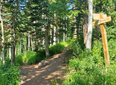

with Red Potato, Lexie & Ethan trails
These short trails offer nice views and greatly increase the area riding options. The Potato Hill trail starts at a trailhead on Traverse Mountain Road and descends to the Bonneville Shoreline Trail (BST) just west of Coyote Hollow. It's only 1/2 mile in length. The Red Potato trail extends from the Potato Hill trailhead west 0.7 miles downhill to the BST just east of Red Rock. At 0.4 miles down Red Potato, the newer Lexie & Ethan trail heads 0.6 mile west past Red Rock to join the BST near its crossing of Mike Weir Drive.
This trailhead also provides a nice start for riding Ann's Trail as part the Draper Rim Loop (11.5 miles, 1500 vertical when you include the Potato Hill trail downhill to the BST at the start of the ride). And for bigger miles, when you reach the top of Clarks add a loop of Rush down, Canyon Hollow up for a total 17 miles, 2300 vertical.


A nice beginner ride is a loop using Potato Hill, BST, and Red Potato. This little loop is only 2.2 miles with 250 vertical feet of climbing. We decided to call this little ride "the Potato Soup loop."


Potato Hill is also a great trail for climbing, with gentle slope and nothing tricky. There's 150 vertical feet of elevation change over the half-mile between the BST and the Potato Hill trailhead.


A nice easy loop ride is to start from the Red Rocks (Mike Weir Drive) trail head and ride the BST to Red Potato. Fork right uphill and climb to Lexie & Ethan and fork right again. Now descend back to the BST and fork right to return to the trailhead access. This loop is only 1.6 miles with 150 feet of total climbing. It's an easy outing for beginning riders. (See the video below.)


Eastern Potato Hill mini-loop, clockwise:
0.0 North, then L after fence N40 29.305 W111 50.924
Go NW up to viewpoint N40 29.326 W111 50.968
Backtrack to fence, veer L (east)
0.2 L (North) downhill on Potato Hill N40 29.286 W111 50.845
0.7 Keep straight (east) on BST N40 29.479 W111 50.539
1.3 Straight (R) over bridge to Clarks N40 29.562 W111 50.220
2.6 Hard R onto Ann's N40 29.204 W111 49.380
4.6 R onto connector to Potato Hill N40 29.266 W111 50.815
4.8 Back at trailhead

0.0 North through fence N40 29.305 W111 50.924
then R (east) downhill toward Ann's N40 29.286 W111 50.845
R into underpass N40 29.270 W111 50.837
Keep L as Little Valley forks R
1.5 Straight as Maple Hollow joins from L N40 28.647 W111 51.340
1.6 L as Maple Hollow drops R N40 28.635 W111 51.343
3.5 R onto road N40 28.880 W111 52.017
then rapid L onto singletrack
4.0 Under road N40 29.054 W111 51.965
At tunnel exit, fork R on BST N40 29.075 W111 51.989
4.9 Cross street, L uphill on ST N40 29.163 W111 51.645
5.3 Keep L uphill (R = down to TH) N40 29.295 W111 51.338
Then straight (180-R = Red Rock trail)
5.4 R uphill on Red Potato
5.7 Hard L (R = Lexie & Ethan) N40 29.250 W111 51.211
6.1 Back at Potato Hill TH

0.0 Through fence at TH N40 29.312 W111 50.934
then L down Red Potato
0.4 Hard R (L = Lexie & Ethan) N40 29.250 W111 51.211
0.7 Hard R onto BST N40 29.344 W111 51.156
1.6 Hard R uphill onto Potato Hill N40 29.477 W111 50.532
2.1 Hard R uphill to stay on Potato Hill N40 29.285 W111 50.843
Straight = to Ann's
2.2 L into parking

This ride starts at the Mike Weir (Red Rock) trailhead with a left turn onto the eastbound BST. It uses half of Red Potato as the climb, Lexie westbound, then the BST to return. Quick, easy, and only a touch of climbing.
0.0 Uphill 300 feet from Mike Weir TH
L turn onto BST N40 29.295 W111 51.342
0.3 R uphill on Red Potato N40 29.332 W111 51.146
0.6 R on Lexie & Ethan N40 29.250 W111 51.211
1.2 R onto BST N40 29.175 W111 51.581
1.5 L downhill towards TH N40 29.295 W111 51.342
1.6 At parking

Begin the ride from the Potato Hill trailhead by taking the Potato Hill trail over to Ann's Trail and heading east. (Leave Potato Hill at the first fork by keeping straight and heading for the tunnel. Don't enter the tunnel. Keep left on eastbound Ann's.)
Fork uphill on Potato Hill. Near the trailhead, join Ann's, but this time, go to the right and pass through the tunnel. Head west (consider the fun detour on Little Valley) climbing Ann's then descending back to the BST.
Take the BST eastbound to Lexie & Ethan or to Red Potato, then climb up to the Potato Hill trailhead. (The ride description assumes you'll do Red Potato.)
0.0 At TH, R on Potato Hill N40 29.312 W111 50.930
0.1 Straight at fork N40 29.286 W111 50.844
L (eastbound) on Ann's N40 29.276 W111 50.834
2.2 Straight (R) and join Clark's N40 29.204 W111 49.382
2.4 Peak View TH. L on Rush N40 29.292 W111 49.247
2.8 L on Rush (R = The Trees) N40 29.266 W111 49.430
3.2 The Trees rejoins N40 29.461 W111 49.435
3.9 Keep L (R = to Canyon Hollow) N40 29.670 W111 49.583
4.5 L on Canyon Hollow N40 29.715 W111 49.928
4.9 Keep L, then L uphill N40 29.618 W111 50.312
(Straight = to Coyote Hollow TH)
5.1 L on Bonneville Shoreline N40 29.560 W111 50.233
5.6 L on Potato Hill N40 29.479 W111 50.535
6.1 Straight (L = to TH) N40 29.286 W111 50.844
then R into Tunnel on Ann's westbound
6.3 Straight (R = Little Valley option) N40 29.175 W111 50.816
6.5 Keep L (R = Little Valley) N40 29.061 W111 50.916
7.5 Maple Hollow joinsN40 28.649 W111 51.339
200 ft, then keep L on Ann's N40 28.635 W111 51.342
8.0 Keep straight (L = to Maple Hollow TH)
N40 28.493 W111 51.586
9.6 R on Bonneville Shoreline N40 28.874 W111 52.037
10.0 Through tunnel, R on BST (L = Oak Hollow)
N40 29.075 W111 51.989
10.9 Cross road N40 29.166 W111 51.652
Keep L (R = Lexie & Ethan N40 29.178 W111 51.585)
11.2 Keep R (L = to TH) N40 29.294 W111 51.344
then stay on BST (R = Red Rocks)
11.4 R onto Red Potato N40 29.344 W111 51.156
11.7 Hard L (R = Lexie & Ethan) N40 29.250 W111 51.211
12.2 Back at TH

Note: See the Ann's Trail page (or click link to topo map below) for overview of some other loop ride options. For a nearby easy ride, see the Little Valley page.
Bathrooms: At Potato Hill trailhead.
Water: None at the trailhead
Camping: No
Dogs: On leash (Dogs NOT allowed on Maple Hollow
DH, Rush, or Ghost
Falls!)
Printable one-page guide to smaller rides
One-page guide to the Bow Tie ride
GPS track files (right-click and select "Save Target as..."):
Eastern Potato Hill mini-loop
Western mini-loop
Red Potato Only
Potato Hill Only
Potato West Loop
Lexie & Ethan loop from Little Valley
Lexie & Ethan track
The Potato Bow Tie figure-eight ride!
Draper Area Trails GPX
Potato Hill - Ann's - BST Loop
Potato Hill-Ann's-BST Loop with Rush-Canyon Hollow
Potato Soup Beginner Loop (Red Potato + BST + Potato Hill)
Topo map for printing:
View map, Potato Hill area
Wider area
Corner Canyon area trail overview page
Lodging, camping, shops: Links to southern SLC resources