View of the world from Poison Spider Mesa, looking south. The Colorado River lie...
View of the world from Poison Spider Mesa, looking south. The Colorado River lies in front of the foreground cliffs.
Poison Spider Mesa and Portal Trail

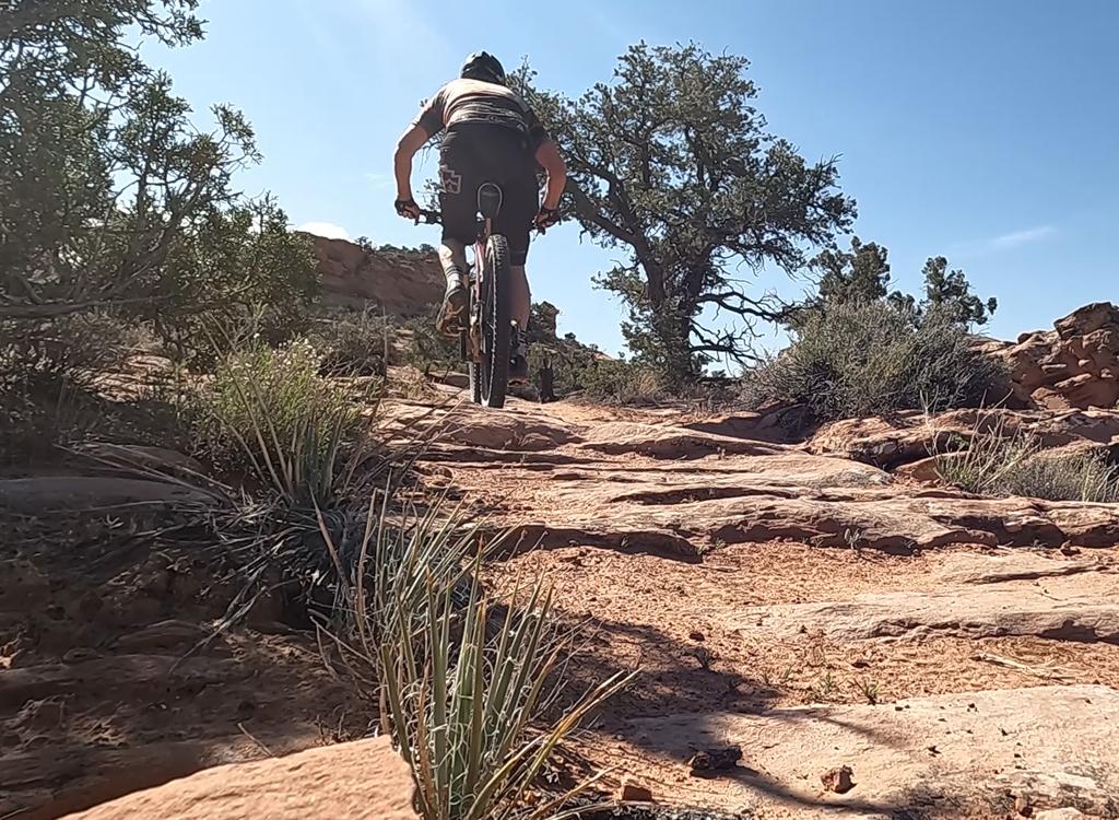
The Poison Spider Mesa trail is one of the "Must Do" rides of Moab. Combining physically demanding biking challenges with great views, this trail is for expert bikers. The trail can be ridden as an out-and-back, but here I describe a 13-mile loop that includes the infamous Portal Trail as the return-route off the mesa. Altitude gain is 1000 feet.

The trail up to the mesa is a series of slickrock steeps mixed with sections of jeep road. Save some energy for the top -- even after you've finished your 1000 vertical, you'll be grinding up one sandstone dome after another.
Chad Hunter cranks up the rough slickrock steps of the trail leading up to Poiso...
Chad Hunter cranks up the rough slickrock steps of the trail leading up to Poison Spider Mesa. April 14, 2000.
Gary Argyle pauses on the slickrock at the top of the mesa to take in the view. April 16, 2000.
You'll navigate a path past the towering Wingate sandstone cliffs along the Colorado, up onto the domes and bowls of Navajo sandstone of the mesa. Gary Argyle pauses on the slickrock at the top of the mesa to take in the view. April 16, 2000.
You share the Poison Spider Mesa trail with jeeps and motorcycles. But even on weekends with jeep outings, you're all by yourself most of the time.
Polish the rock with spinning jeep tires, then toss on some sand, and youve got ...
Polish the rock with spinning jeep tires, then toss on some sand, and you've got a good chance of tires slipping on the slope. Here Dominic has to bail after suddenly losing traction on a climb.
Doc Argyle poses with Banana Thunder at the arch on Poison Spider Mesa. In the e...
Doc Argyle poses with Banana Thunder at the arch on Poison Spider Mesa. In the eye of the arch, you can see the beginning of the Moab Rim Trail across the Colorado River. Photo by Mike Engberson, April 14, 2000.
At the top of the mesa, slickrock sections are scattered between short sections of sand that are rideable, but will suck the life out of your legs. On the slickrock sections, the trail is marked by little white "jeeps" painted on the rock. This is GREAT stuff!
Watch for the fork where the Golden Spike Trail separates from the Poison Spider trail at GPS N 38° 33.728' W 109° 35.800'. Make sure you follow the little jeeps, not the spikes.
Matt Flygare rolls down a section of the punishingly steep slickrock of the mesa...
Matt Flygare rolls down a section of the punishingly steep slickrock of the mesa. The dark spot at the lower left is a drop-off, leading 500 feet straight down. Hold that rock, Mattie-boy! April 14, 2000.
On the upper Portal Trail southbound. The trail is exactly one bounce away from ...
On the upper Portal Trail southbound. The trail is exactly one bounce away from a 200 foot drop.
The Portal Trail heads back south (to your right) when you reach the viewpoint overlooking Moab at GPS N 38° 35.033' W 109° 35.688'. The jeep road that continues north joins the Golden Spike trail.

The Portal Trail starts as a narrow single-track, edging ever-closer to the vertical cliffs above the Colorado River. Remember to look where you're going, not where you don't want to go! Even on the rideable sections at the cliff-top, a long drop to the Colorado is just a few feet away.

But seriously, folks...

The Portal Trail is a gnarly and dangerous return route. It can be fun for an expert biker, but there are sections where you should get off your bike as you carefully walk along the edge of the cliffs. This is a trail where overly confident bikers die.

My brother-in-law's bike went over the cliff here. He did not. The bike, however, did not survive.
A rock drop, then a quick turn to avoid going over a 200 foot cliff.
Chad Hunter follows Matt Flygare down the lower section of the Portal Trail. Apr...
Chad Hunter follows Matt Flygare down the lower section of the Portal Trail. April 16, 2000.
After clearing the cliffs, the Portal Trail gets rad. It drops 1000 feet in around a mile, with narrow squeezes, ledge drops, loose rock, and insane turns. Intermediate riders can find some stuff they'll like, but most likely they'll walk their bike much of the way down.

When you hit the paved road, go west downriver a couple of miles to your starting point.

Riding notes:
0.4   Fork R
1.5   Keep R
1.6   Keep R
3.1   Fork L (diamonds) for less sand
3.2   Trails rejoin
3.6   Fork L (jeeps)
3.7   Trails rejoin again
3.9   Keep L
        Follow painted jeeps

6.0   Fork R
6.5   At Little Arch (spur goes R downhill)
6.7   Fork L
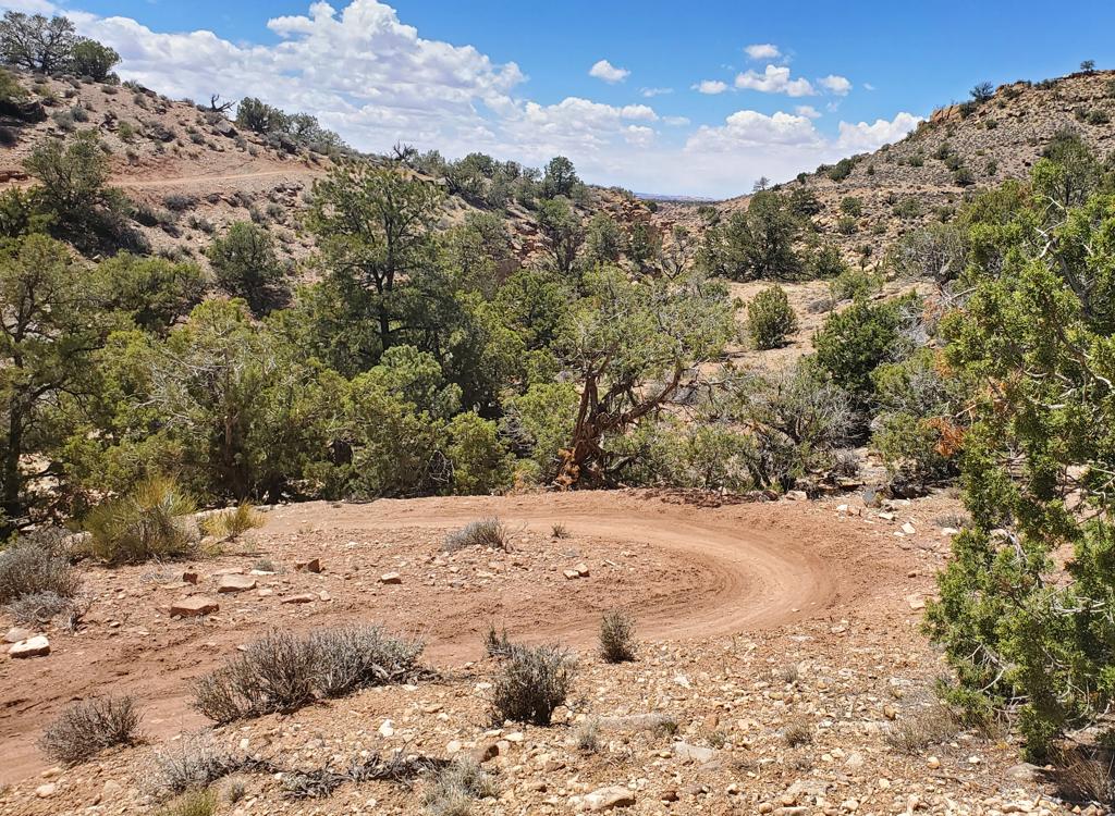
7.2   Follow cairns uphill
7.6   Pass fence and drop-off warning sign
7.7   Fork R uphill
8.2   At rim. Portal Trail is singletrack on R
11    Bottom of Portal Trail, turn R on road
13    Right up to parking
Matt Flygare, Dominic Bria, Bruce Argyle, Mike Engberson, Chad Hunter, and Gary ...
Matt Flygare, Dominic Bria, Bruce Argyle, Mike Engberson, Chad Hunter, and Gary Argyle of the " Biking Team" pose on the rock of Poison Spider Mesa. April 16, 2000.
Getting there: From the middle of Moab, drive north on US-191 for 4.2 miles, turning left (west) onto U-279. After another 6.2 miles (10.4 miles from Moab's center street), turn right on a short dirt road with a sign that says "Dinosaur Tracks." The trailhead is at GPS N 38° 31.917' W 109° 36.473'.

GPS track files (right-click and "Save as...")
   GPX area tracks
   Poison Spider only
Topo map for printing:  View Hres    Lodging, camping, shops: Links to Moab area resources

Map of Poison Spider