Looking west from the Pipeline trail. The zigzag in mid-photo is the BST Rattlesnake section, which climbs up to the Pipeline. Original review May 26, 1999 by Bruce, with latest update July 5, 2022.
Mill Creek Pipeline Trail
Upper Pipeline and classic Lower PipelineThe Upper Pipeline and
lower
Pipeline trails extend from the bottom of the
Mill
Creek Canyon
and
Dog Lake
trails to a
viewpoint over the Salt Lake valley, with connections downhill through
Rattlesnake
Gulch
. This route is 10.6 miles in length,
with the lower half flat and easy, and the upper 5 miles intermediate
riding.
The Pipeline can be done as a stand-alone out-and-back ride, either as a whole or in part.
For example for beginning riders, starting at Burch Hollow and riding
west to the viewpoint
and back is a pleasant and easy first-timer cruise.
Many riders experience the Pipeline as the final segment of a shuttled ride of the Wasatch
Crest. This can only be done on even-numbered days, because upper Mill
Creek is closed to bikes
on odd days. (All of the Pipeline is open to ride on any day. But if you're
doing only the
Pipeline, you might want to consider the downhill traffic on even-numbered
days when you plan
your ride.)

A hiker on Upper Pipeline as I climb this two-way trail.

Cruising through maple forest on the lower Pipeline.
The western (lower) half of the Pipeline is a great lower-altitude alpine bike ride for beginners.
Above Burch Hollow, the top 5 miles require intermediate skill and a bit
of climbing muscle
if you're doing it out-and-back. The lower half is usually open by mid-April
or early May and
stays clear of snow until November. The portion above Elbow Fork needs
until late June to be
dry and clear of snow.
The combination of lower and Upper Pipeline plus the
Rattlesnake
BST
has around 2500 vertical feet of overall climbing, going from 5300
feet elevation to 7600 at the top.

Rattlesnake Gulch trailhead.
Rattlesnake Gulch. The Rattlesnake trailhead is 1.5 miles up the Mill Creek Canyon road
from Wasatch Blvd. There are bathrooms. The trailhead is located about 3/4
mile uphill from the fee station. (Mill Creek Canyon is a US Forest
Service fee area for vehicles. Bikes are free.) There's room for around 20
cars here, but it will fill up quickly on weekends. Info on the
Rattlesnake connections on the
BST-Rattlesnake
trail page.
Church Fork. Small parking area with sometimes-steep trail
leading up to the Pipeline. Located at mile 3.0 from Wasatch Blvd.

Burch Hollow trailhead.
Burch Hollow. Primitive parking strip along the road, with
0.2-mile trail linking to the Pipeline. At mile 4.1 from Wasatch Blvd.
Recommended starting spot for beginners, heading westbound after joining
Pipeline. There are no services at this trailhead.

The entry into the westbound lower Pipeline, located just downhill across the bridge from the parking strip at Elbow Fork.
Elbow Fork. Primitive parking between the top of the
lower Pipeline and the bottom of Upper Pipeline. At mile 5.9 from Wasatch
Blvd. The Pipeline trail entries can be found just downhill from the
parking area (for eastbound downhill riders), or around 100 yards uphill
(for riders heading up the Upper Pipeline). There's a bathroom at this
trailhead.

One of the entries into the Upper Pipeline, this one in an area of primitive roadside parking just downhill from the overflow lot.
Mill Creek Road Upper Pipeline. Room for a few cars at roadside
with short trail up to Upper Pipeline at mile 7.4 from Wasatch Blvd.
GWT/Upper Millcreek -- 3 access points. At mile 8.2 there's roadside parking, then in
0.3 miles miles you'll arrive at the overflow lot. The main lot is 1/10th mile further
uphill. All connections to the upper Pipeline are on the south side of the road.
There are bathrooms at the upper lots. These trailheads are used for the Dog
Lake and Mill Creek Canyon trails, or for a
shuttled Pipeline-only ride.

Looking east at Grandeur Peak from the western lower Pipeline trail.
The "lower Pipeline" extends from Elbow Fork on the uphill end to a viewpoint overlooking the
valley. It's 7.3 miles long, with 700 feet of elevation loss when done
east to west (from Elbow
Fork to the viewpoint). The trail surface is mostly very easy, but there's
one short up-and-down
near Church Fork that's a hike-a-bike for beginners. And the mile of stiff
slope when heading
uphill from Burch Hollow to Elbow Fork is tough.
Several
trails connect the Mill Creek Canyon road to the trail, allowing riders
to pick up the trail and
bail out at four locations (see the trailhead information). To do the entire
trail out-and-back from the
Elbow Fork trailhead on the Mill Creek Canyon road, it's 14.6 miles. Some
riders
climb the paved canyon road and connect to the trail at one of the upper
locations, then drop down
Rattlesnake Gulch
for a loop ride.

Chad passes the Church Fork entry to the pipeline in 1999.

The terrain is oak brush with occasional open grassy areas, with maple forest and an occasional fir on the eastern cooler slopes.
Much of the trail is smooth hard-pack dirt. But the narrowness and exposure to steep hillsides
make it an "intermediate trail" that's still suitable for brave beginners.
Much of the trail
is shaded cruising through the woods, while the western third is exposed
to wind or heat on
steep slopes.
The trail bed is firm, giving good support to your tires even when wet. This is an excellent
early-season ride.
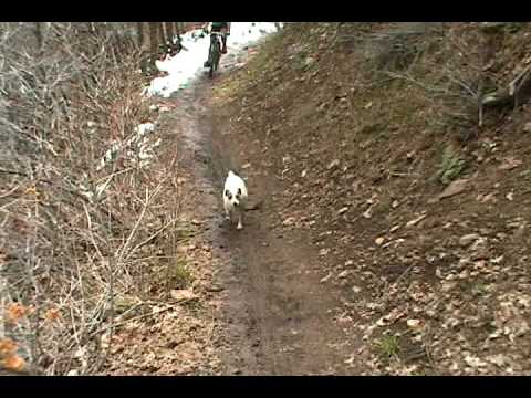
Dogs are allowed in Mill Creek Canyon. On
odd-numbered days, they can be off-leash. Be sure Fido is
compatible with other mutts. You're sure to run into a few of them.
Jackie
(at left) thinks nothing of this 14-mile run.
Even on weekdays, the trail sees heavy use. On weekends, it's usually packed with hikers and
riders. Be courteous. And be smart. Our ER sees occasional head-on collisions
by bikers speeding
on this trail.

Jackie the Jack Russell terrier and her pet biker. Self-portrait May 26, 1999.

A pipeline elbow sits alongside the trail.
The trail, as you might guess from the name, follows an old water pipeline corridor. You will
occasionally spot loops of re-bar poking out of the ground and an iron
elbow here and there.
The "lower" Pipeline can be divided into two segments. The easy part is from Burch Hollow west,
where the trail is flat and easy to ride. The western segment is ideal
for beginning riders,
and has been used by many people for their first "dirt" mountain bike
ride. An out-and-back
ride from Burch Hollow to the viewpoint is 9.2 miles with only around
100 feet of climbing.

View to the west from the Pipeline.

A typical bit of trail in maple forest.
The harder segment is from Burch Hollow to Elbow Fork. The eastern segment has 600 feet of
elevation gain when done from Burch Hollow eastbound. Most of this elevation
gain occurs over
a single mile of tough climbing. Any rider with good bike control can
ride from east to west
downhill without much problem, but to go uphill from Burch Hollow requires
good aerobic fitness
and strong legs.

Two views: Above is a look uphill into Mill Creek Canyon while riding east on the lower Pipeline trail.

As we round a corner heading west, we're seeing a bit of the Salt Lake Valley with the Bingham Canyon Mine.

Approaching Elbow Fork riding uphill on the Pipeline.
While most of the Pipeline is easy cruising, I wouldn't recommend taking a newbie down Rattlesnake
Gulch -- either the Rattlesnake BST or the expert-level Rattlesnake Gulch
trail. Start with
an out-and-back from Burch Hollow to the viewpoint.
See the
Bonneville Shoreline Trail Rattlesnake Section
trail page for
further information on these two trails. Rattlesnake BST is an
intermediate-level ride but with tight switchbacks that will make
beginners dismount. And Rattlesnake Gulch is a steep advanced technical
plunge. When the dust gets deep and
slippery, Rattlesnake Gulch can be a white-knuckle slide for the best riders.
The Pipeline is an option for winter fat-bike riding. The flat surface packs down nicely. Burch
Hollow is a good starting point.

This is a fun ride after a spring storm. Here Dominic Bria follows Matt Flygare through a dip before the days of fat bikes. Ride in the snow, ride on frozen ground, but DON'T ride in the mud!!! Photo March 25, 2000.

Two looks from the lower Pipeline east of Burch Hollow. Here we're looking down into Mill Creek Canyon.

And here's the view down the trail. Maple and scrub oak with a healthy growth of grass in the July sunshine.
Here's the deets on a ride plan for experienced beginners. Park at Burch Hollow. Pedal 1.5
miles up the paved road. You'll be gaining 600 feet of elevation, so it's
a bit of a grunt.
And there's the whole car-dodging thing. Find the entry to the lower Pipeline
at Elbow Fork.
The trail takes off on your left just before the road takes a sharp turn
to the right.Do the entire trail to the viewpoint, then turn around. Watch for the Burch Hollow trail fork
on your way back. 5.5 miles from the overlook you'll see a fork in the
trail at N 40° 41.954'
W 111° 43.434'. Take the right fork 1/4 mile down to the Burch Hollow
trailhead. The full trip
is around 14 miles.
If you're using the Pipeline as a downhill route from the
Wasatch
Crest
you'll probably descend the Rattlesnake BST or Rattlesnake Gulch
to the Mill Creek Canyon road near the canyon mouth. See the
Rattlesnake
BST
trail page for details on these descents.

Matt cranks through the Church Fork area in 1999.

Entry to the Upper Pipeline trail for an uphill ride, looking at the right side of the road when pedaling uphill. If you're coming down, this is where you'll turn downhill and follow the pavement past the Elbow Fork trailhead.
The Upper Pipeline trail was finished in late 2021. It runs parallel to the paved road from
Elbow Fork to the trailheads at the top. For riders coming down from the
Wasatch Crest
on a shuttled ride, it provides a much-needed alternative to riding on the narrow busy Mill
Creek Canyon road. The expected riding season for this portion of the
Pipeline will be late
June through mid-October.
The Upper Pipeline is 3.4 miles long with 900 vertical feet of elevation gain. The upper end
is at 7600 feet. The trail runs along a north-facing slope above the paved
road, with occasional
climbing switchbacks to gain elevation without making the trail too steep
for climbers. The
trail has a very different "feel" from the lower Pipeline, with shady
fir forest and undulating
swooping trail.

Typical trail view heading uphill.

On a climbing switchback where we ride through a couple of turns to gain elevation.
The Upper Pipeline is a two-way trail, and like the lower Pipeline, it can be done on any day.
(Bikes are only allowed on the upper Mill Creek Canyon trails on even-numbered
days.) Dogs
can accompany you off-leash on odd-numbered days.
If you're doing an out-and-back ride in the lower canyon, I'd suggest doing it on an odd-numbered
day. That way you won't encounter shuttled riders blasting down the trail.
There are several
blind corners that have a high chance for collision if downhill riders
don't slow as they approach.

Looking down at a switchback. These are not swooping high-speed turns. This is a two-way trail, and the switchback platforms are built for climbing. Check your speed when descending.

A rare meadow as we head downhill on Upper Pipeline.
The downhill entry to the trail is found just uphill from the Elbow Fork parking area, on the
opposite side of the Mill Creek Canyon road.
There are three uphill entries to the trail in the Big Water area, one at each of the parking
areas. If you're headed uphill, these will all fork away to the left.
If you're riding downhill,
just keep straight at the trail forks.
When riding downhill from the Upper Big Water lot, find the parking connector trail on the
south side and head downhill. Keep straight as the trail from the lower
lot joins to become
the lower Big Water trail. In 100 yards, fork right on the Upper Pipeline
as Big Water heads
uphill.

Trail fork at the lower roadside parking area. Left rolls down to the parking area while the Upper Pipeline continues on the right. (It's one of the few trail forks that has a sign in July 2022, and unfortunately it's signed as "Big Water" which is the destination of the trail, not the NAME of the trail. This is a quirk of Forest Service signage that bugs me. You never know if a sign means you're ON the trail or if it means you have to go this way to GET TO the trail.)

Descending Upper Pipeline past a rock outcrop.
In another 0.4 miles, keep straight as a trail from roadside parking joins. At 1.1 miles from
this fork, there's another descending trail to roadside parking. Keep
level and veer a bit
left.
When the trail turns to cross the creek, head down the road past the Elbow Fork parking area.
Veer left across a bridge, then enter the lower Pipeline singletrack on
the right side of the
road.
Bottom Line!Awesome "first dirt" riding for beginners, but with lots of fun riding for experts. The drawback
is that Mill Creek is very popular -- with good reason -- and will be
crowded on weekends.
The newer Upper Pipeline trail adds to the ride possibilities and will
be much appreciated
by riders doing the
Wasatch
Crest
.

Chad ponders the meaning of life as he looks southwest over the Salt Lake Valley from the viewpoint at the end of the trail. Meantime, Jackie is pondering whether there are still Powerbars left in his camelbak.

Western easier half of the Pipeline route, from the overlook to Burch Hollow
Getting there:
Get to Foothill Blvd on the east bench of Salt Lake City via I-215. Exit at 39th South. Take
3800 South eastbound into the canyon. Proceed up the Mill Creek Canyon
Road to your chosen
trailhead. See the mileage information in the trailhead info above.
Fiscal Note:
There's a $5 fee per car (2020, $3 for seniors), payable as you leave the canyon. It doesn't cost anything if
you ride your bike up -- it only costs if you take a car into the canyon.

Eastern part of the Pipeline route, from Burch Hollow to Big Water.