
View east as the morning sun hits the bluff. The trail is mostly slickrock, but the brush that grows in every crack gives the impression that it's soil! April 5, 2000. Page updated 2008 and 2017.
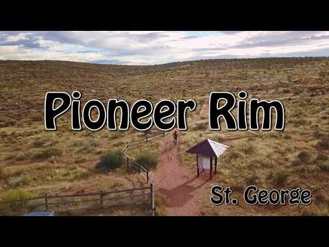
Pioneer Rim Trail
(Plus Pioneer Park mini-trail)
The locals say "Pioneer Park" to refer to two trails: (1) Pioneer Rim, an advanced-technical trail skirting the cliff-edge above Pioneer Park, and (2) a short easy trail within Pioneer Park itself that features a beginner's taste of slickrock.
Pioneer Park is located in the red cliffs on the north side of St. George. Kids love to explore
the trails between red hoodoos, and there's some easy slickrock to try
your beginning biker
skills. Our map shows a short loop within the park that climbs onto a
slickrock shelf, heads
west, then returns via a slot between hoodoos to the starting point.

Bruce cruises a flatter section of rock in 2017. Note the hikers, who climbed up the rock wash from Pioneer Park.
Pioneer Rim

Heading east from the parking lot.
The Pioneer Rim trail does NOT start in Pioneer Park. It is located on the cliffs above it.
The trailhead is at the top of the hill on Snow Canyon Parkway, about
1/2 mile uphill from
the west Pioneer Park parking lot. Newbies will NOT enjoy the Pioneer
Rim trail -- reserve
this ride for advanced or upper-intermediate riders.
The ride is about 90% slickrock, two miles each way. After crossing a small 4-wheeler road
above Pioneer Park, the rock becomes more technical. In this second part
of the trail, it's
harder to follow the path. Many riders turn around before this second
cliffside area, but it's
worth pushing on and doing a little route-finding.

From the parking area, the trail climbs south and east before descending down to the edge of the sandstone cliffs.

There will be ledges and rough sandstone.
From the trailhead, start riding east (away from the road). Turn to the right for "Pioneer
Rim" at the trail fork and follow the trail uphill. As you approach the
top of the ridge, turn
right again at a T intersection.
The trail will now turn toward the south, then drop down off the hill eastbound. This trail
doesn't see as many riders as most St. George area trails -- and there
are a couple of alternate
paths -- so sometimes the route can be a bit hard to follow. Just remember
you're trying to
reach the cliff edge to the south.

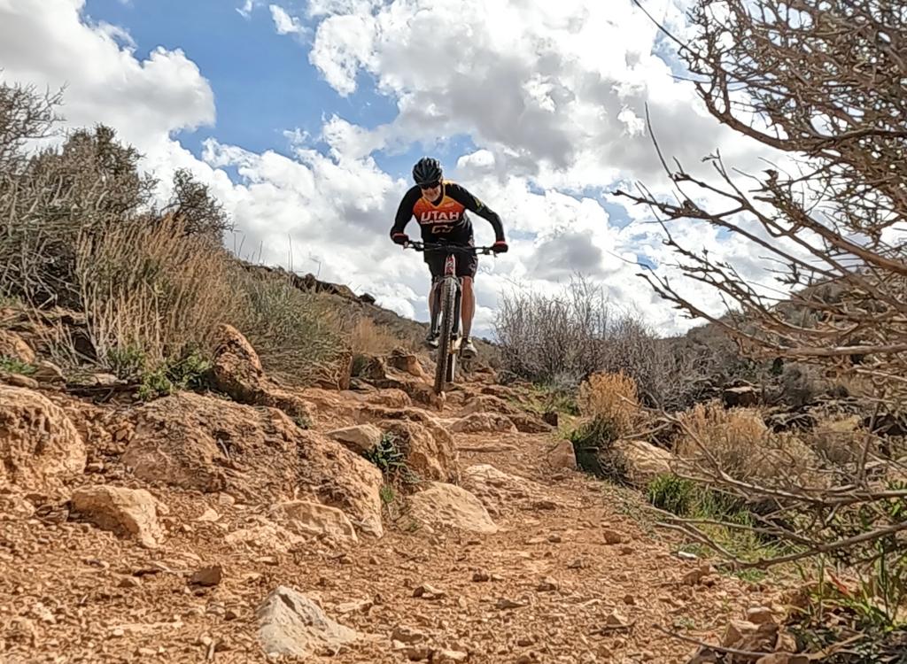
Bruce cruises the "breaks" above Pioneer Park in November 2017.

Slightly techy, and certainly bumpy, stuff on the eastern end.
As you reach a ledge area above the mounds of rock cliff, keep working to the east. Generally,
you're looking for something that looks like a path, in the general area
where the dirt and
the open rock meet. Sometimes you'll be on open slickrock; other times
you're on rocky dirt
singletrack just above it.
Just over a mile from the trailhead, the trail drops down to a gravel road. Cross to the other
side and find the route back up to the top of the slickrock. The riding
now becomes advanced
technical. The trail is less obvious -- where you can identify a single
route. Again, you're
riding fairly close to where the rock drops away to the valley. Watch
for small small rockpiles
(cairns), rows of rocks, and tire marks.

On the eastern end of the ride, approaching the turtle fence and Industrial Blvd.

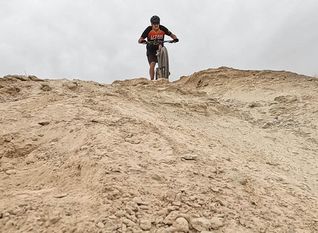
Bruce attacks a short but steep ramp. The distinction between "The Trail" and "Not Quite the Trail, but I'm Riding" can be tricky.
About 1/2 mile later after crossing the dirt road, you'll come to a turtle-fence. There's a
little loop here (might be hard to spot if it's your first time). Most
bikers use this as a
turn-around spot, but you can also continue east another 1/3 mile to connect
with Industrial
Drive for a road-return if you want.

Watch where you're putting your tires. Break your clavicle or leave some skin on the rock, but don't hurt my pet tortoise! Not every bump in the trail is a rock!

The trail is located in a desert tortoise protection area. Here an 18-inch mojave tortoise craws out into the morning sunshine to warm up. Photos from 2000.
Bottom Line!
Fun for skilled riders, beautiful rock. Short and relatively lonely. But if you add this trail to City Creek (right across the Snow Canyon Parkway from the trailhead) and the Bluff Street Cliffs (Owen's) ride, it's a worthy day of riding.

How can anyone NOT love this trail?
Pioneer Park

Jessica, Alex, Diane, and Kristen rode around the paved picnic loop, then explored the many dirt paths leading up to the cliffs. May 5, 2000.
The park itself is a good place for your beginning bikers to play, and for the non-bikers to
explore fun trails among the many sandstone canyons. There's a circle
route within the park.
But the park has seen significant development over the years, with large
paved parking lots
putting many families and hikers onto the sandstone and dirt paths. So
I DO NOT recommend riding
in the park on weekends -- it's just too busy.
There is a path on the west side of the park that follows the open rock. Beginners can cruise
on this flat area and say they've ridden on slickrock. Unfortunately,
it's a short segment.
But if your family is already there with bikes on the car, check it out.
There are two parking lots. A small lot on the west end serves hikers and connects directly under the street to the paved bike path along Snow Canyon Parkway. The main lot on the east serves picnic areas.

Bruce rides through Pioneer Park on May 5, 2000.

Map of Pioneer Park
Getting there:
From St. George Blvd (the main drag), head north on Main Street (towards the "Dixie" painted on the big rock above the cliffs). When you reach Hope Street, turn right, then immediately take the left fork and climb Skyline Drive to the top of the cliffs. Turn left on Snow Canyon Parkway (labeled Skyline Drive on some city maps, and called Turtle Road by many locals). 1/2 mile up from the intersection after crossing the top of the hill, turn right into the fenced parking area. The trail starts at the far end at the kiosk. (On the northwest corner of the lot -- left from where you entered the parking lot -- there's a paved path leading down to an underpass. This will take you to the paved bike path across the road, and allow you to connect to City Creek and Owen's trails.
Bathrooms and water: Pioneer Park. None at the upper trailhead.
Riding resources for this trail:
Single-page riding guide
GPS track files Pioneer Rim (right-click and "Save as..."):
GPX Pioneer Rim
Easy loop only
High-res topo of Owens and City Creek (500 KB): View
Lodging, camping, shops: Links to St. George area resources
Single-page riding guide
GPS track files Pioneer Rim (right-click and "Save as..."):
GPX Pioneer Rim
Easy loop only
High-res topo of Owens and City Creek (500 KB): View
Lodging, camping, shops: Links to St. George area resources
Original ride 2000. Updated 2008 and 2017