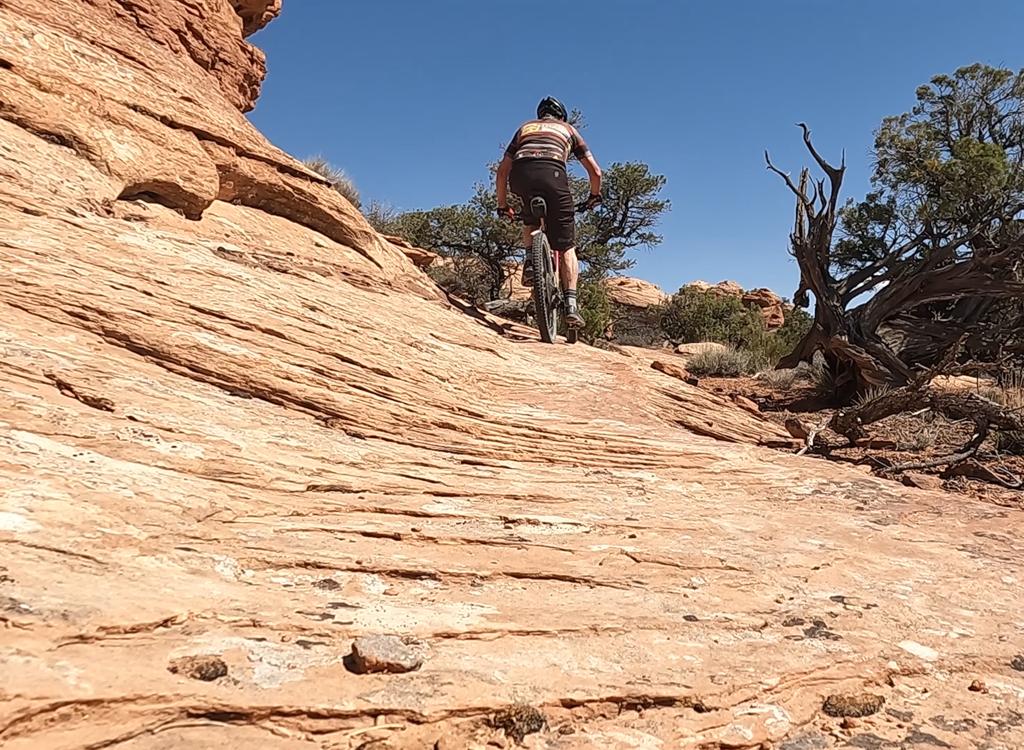
Bruce climbs the slickrock of Rocky Tops. Checkout ride May 16, 2014. Photos by Bruce and his son Alex. Page last updated in 2018.
Navajo Rocks - East
Rocky Tops to Ramblin 9-mile loopNavajo Rocks is a newer riding area north of Moab, but it's quickly
become very popular. In 2014 the first
portion was finished by the
Moab
Trail Mix
trailbuilders. This eastern half consists of the Rocky Tops
trail south of Highway 313 and the Ramblin
trail north of the
road.
In 2015 a connector called Middle Earth joined the west end of Ramblin to
Coney Island (see
Navajo Rocks West
) near the west end of Rocky Tops.
The full Navajo Rocks loop is about 18 miles long.
Note 2018: The loop now has a preferred (not required) riding direction, clockwise. This minimizes
the amount of passing when large numbers of bikers are on the trail. Faster
single riders will
actually do better going "against the grain" by pedaling counterclockwise,
because that way
you're not having to individually overtake, announce yourself, then pass
each rider among the
many spread-out individuals in each group of clockwise riders.
The east trailhead is on the north side of Highway 313 (the road to
Canyonlands and
Dead Horse Point
, found
10 miles north of Moab on Highway 191). Just
over 5 miles from Highway 191, you'll pass a view area. Now watch for
the
fenced trailhead on your right about 1/4 mile uphill. Ramblin enters the
parking area on the west end. Rocky Tops
is across the road.

Ramblin exits the east loop parking

Ramblin and Big Mesa begin together at the east trailhead.
The west trailhead is further uphill on 313, at mile 6.4
from 191, just as you reach the top of a
hill. Look for a gravel turn on
your right just as you pass through the cut in the hill. Ramblin and Big
Mesa share the first
1/4 mile of singletrack trail. Middle Earth is across the road.
There's
also a trail access at mile 6.1, where a dirt road heads south (left as
you climb 313). Drive 100 yards down to a little loop 100 on the left
side of
the dirt road. Pedal down the doubletrack 0.3 miles to the junction of
Rocky Tops
and Coney Island. (The continuing doubletrack, marked by white stripes
once it reaches slickrock, connects to
Seven Up
in the valley below.)
Ten miles of new trail has been completed west of the original loop in late 2014. From the west trailhead at the end of
Ramblin (see below),
Big Mesa follows the edge of the sandstone cliffs
westbound 3.5 miles then becomes
The Big Lonely at Mineral Bottom Road.
After some rock riding, Big Lonely crosses Highway 313 over a sage flat and 3.5
miles later becomes
Coney Island. Coney Island has twisty singletrack as
it begins to drop off the mesa, then offers rock riding until it reaches the
doubletrack where Rocky Tops starts. Just before Rocky Tops, Middle Earth joins
Coney Island. For details, see the
Navajo
Rocks West page
.

West half of Navajo Rocks -- NOT discussed on this page. Looking southwest on Big Mesa.

This photo shows why Navajo Rocks has become so popular. Great slickrock, great views.
This page covers the eastern half of Rocky Tops (Middle Earth, Rocky Tops, and Ramblin). It's
written as though you'll be riding the east half-loop in a counterclockwise
direction. (Note
that the recommended riding direction for the loop is clockwise -- the
opposite of my description.)

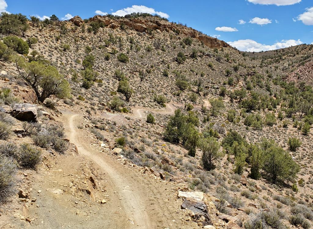
Looking north from Middle Earth, showing the trailhead area on Highway 313. The trail starts as unattractive dirt.
Middle Earth is 1/2 mile in length, running from the west trailhead (Big Mesa and west Ramblin
trailhead). From the trailhead, cross the road and head south on Middle
Earth's singletrack.
Middle Earth is mostly hardpack dirt, but has one area of slickrock riding.
It reaches Coney
Island after 1/2 mile.
On a clockwise ride of the eastern loop, you'd be using Middle Earth northbound to connect
from Coney Island to the west Ramblin trailhead.
If you're doing the west (Big Mesa - Big Lonely - Coney Island) loop, a clockwise ride would
have you going southbound on Middle Earth. So expect two-way traffic.

Southbound on a counterclockwise ride. (Or a clockwise ride of the western Navajo Rocks half-loop.)

On Middle Earth, we're descending off sandstone southbound. The junction with Coney Island is just past the trees, mid-skyline in the photo.
Middle Earth is a good "gut check" for beginning and early-intermediate riders. If ANYTHING
on this half-mile was hard for you to ride, you shouldn't continue to
Rocky Tops. Instead,
consider the easier western loop.
On the counterclockwise loop, fork left when you reach the Coney Island trail, 0.6 miles from
the trailhead.
Coney Island (just a piece)

On Middle Earth, we're descending off sandstone southbound. The junction with Coney Island is just past the trees, mid-skyline in the photo.
The eastern 0.2 miles of Coney Island lies between Middle Earth and Rocky Tops. (Rocky Tops
was there first, and officially started at the dirt road. Coney Island
was built later, and
Middle Earth later still. So the changeover of trail name and color marking
still occurs at
the dirt road.)
Coney Island is marked with yellow paint on the sandstone. On the counterclockwise ride, descend
0.2 miles to a dirt road and continue across.

Alex has found the entry to the singletrack Rocky Tops. We're looking east from the doubletrack to Seven Up.
As you cross the Seven-Up access doubletrack, you'll notice that the yellow stripes have changed
to turquoise. This is Rocky Tops. On your counterclockwise ride, head
east on flat singletrack.
(This dirt road is the connector to
Seven Up
,
and the lower portion is used for the
Chisholm loop
ride. There's also a singletrack connector to Seven Up, coming up in 0.15
mile at N38 37.805 W109 46.680.)
At first the singletrack is flat and easy. This section lies on the Kayenta sandstone, which
tends to form flat ledges for easy riding. One-half mile later, you hit
the Navajo sandstone
and start climbing.
Rocky Tops is the most technical trail in the Navajo Rocks area. It's OK for experienced upper-intermediates,
but overall it crosses the border into advanced technical.

Alex cruises along the edge of the mesa on Kayenta sandstone. We're looking west. The brown cliffs on the skyline are Entrada. The humps in the "meadow" are Navajo.

We're now on Navajo sandstone as Bruce climbs up and around. In the valley below, Seven Up climbs toward the Mag 7. There's a connector to Seven Up about 1/2 mile from the west end of Rocky Tops.
The ride gets steadily more technical as the trail progresses from west to east. Although you
think you're going to be coasting downhill, you're going to do a fair
amount of climbing in
short segments. Intermediates can ride this loop, although a few short
areas require advanced
skills. Rocky Tops is the most technical of the Navajo Rocks trails.
This first climb is fairly gradual. The pitches are easily manageable by a conditioned intermediate
rider. Well, there are a couple of short grunts that I thought were pretty
easy to clean if
you hit them with attitude.

Alex follows the well-marked trail as it climbs up through the Navajo layer.

With the La Sal Mountains in the background, Alex follows the cliff edge around the mesa.
This first major climb will take you up through the entire thickness of the Navajo sandstone
layer. It's a bit of a grunt, but do-able. There's harder stuff coming
up later.
At this first "summit" you'll find flat riding firm dirt on the cap-rock. Roll around the edge
of the mesa and enjoy the views.
After passing through the sagebrush area, you're back to Navajo sandstone. After a long stretch
of flat and smooth slickrock, you'll get into some rough stuff and rollers
as you again descend
toward the valley.

Bruce begins the drop from the mesa.

Back on Navajo Sandstone. We're looking east toward spires of Entrada.
The trail will now undulate up and down. There are long stretches of sandstone with bits of
dirt, then long stretches of dirt with bits of sandstone. Sandstone areas
are marked with turquoise
paint stripes.
In the middle area of Rocky Tops, the sandstone is pretty smooth. It will get tougher as you
progress to the east. As the rock becomes rougher, the ups-and-downs more
frequent, and the
dirt becomes softer, it will require advanced riding skills to keep going.

Bruce attacks one of the steeper pitches of sandstone. But the climbs aren't very long, nor are they horribly steep.

Blooming miniature barrel cactus.

Prickly pear.
.")
Near the end of the cliff-side slope looking south (riding north).
Around mile 2.6, there's a long segment of side-sloping sandstone at a bottom of a cliff. Intermediates
will view this with terror, but it's all very ride-able -- not nearly
as steep as it looks
from the south end. Coast the steeper spots so you don't pedal-bang. "Pedal
circles" so the
bike doesn't bob up and down -- bouncing is a recipe for a pedal-strike
on the uphill side.
Just before mile four, the trail drops down onto Kayenta sandstone. You'll follow the cliff
edge around a side canyon. Then you'll meander toward the highway. This
area remains fairly
technical, more of an upper-intermediate to easier-advanced.
At mile 4.7 of Rocky Tops, you'll reach Highway 313. Cross to the trailhead parking area and
spot the Ramblin singletrack passing through the log fence on your left.
 skirts the edge of the abyss.")
Bruce (in the circle) skirts the edge of the abyss.

Looking north on Ramblin, shortly after dropping away from the road.
The Ramblin trail quickly drops from dirt onto rolling sandstone. The stone is now marked with
rust-colored stripes of paint. To the north, you're looking at cliffs
of Entrada sandstone.
The trail will descend down the sandstone to follow the edge of a small canyon westbound. There
will be a bit of up-and-down riding here, but most of the stone is fairly
smooth.

Nice stuff.

Monitor and Merrimac buttes, so named because they resemble the civil-war ironclad warships that fought to a stalemate outside the confederate port of Norfolk, Virginia.
Looking back over your shoulder to the northeast, you'll see Monitor and Merrimac buttes.
You'll continue gradually descending (but with plenty of short climbs) during this first third
of Ramblin. The little dirt stretches gradually get longer and looser.
My impression was that
a clockwise ride (the recommended direction) might actually work better
here, as many of the
sloppy-sandy sections were slightly uphill as I rode counterclockwise.

Plenty of sandstone between short bits of dirt trail.

Dirt singletrack along the top of a sandstone canyon. Heading west.
In the middle of the ride is a fairly long section of dirt singletrack. It's well-packed in
most spots, but there are occasional short stretches of Moab sand. Nothing
that would bog a
typical rider down.
On the second half of Ramblin, you're gradually regaining the altitude you lost, plus gaining
altitude for the general upslope from east to west. But you're back on
sandstone slickrock
and loving life.
Ramblin ends
at the western Highway 313 Navajo Rocks trailhead. But before it ends,
Big
Mesa forks to the left. Fork right to finish up at parking. Or, keep going
on
the Big Mesa portion of
Navajo Rocks West
.

As we come past the western end of the Entrada cliffs, we'll turn south to the highway.
East half-loop, from older DT trailhead
(see map)
Riding notes, counterclockwise:
From parking on dirt loop 100 yards from 313
0.0 South on doubletrack N38 38.045 W109 46.823
0.2 Stay L on main DT N38 37.889 W109 46.869
0.3 L onto ST (trail sign) Rocky Tops
N38 37.809 W109 46.825
(Straight = to Seven Up trail)
0.9 Climb away from Kayenta onto Navajo
1.2 Top of mesa
2.6 Sideslope under cliff
4.1 Top of cliff above canyon
4.9 Cross Highway 313, start Ramblin
N38 37.809 W109 46.825
6.7 Cross ATV route
8.3 Left downhill on 313 N38 38.212 W109 47.099
8.6 Right onto dirt road N38 38.121 W109 46.821
8.7 Back at parking
East half-loop, from Middle Earth
Riding notes, counterclockwise:
0.0 Cross 313 from west parking to ST
Middle Earth N38 38.214 W109
47.109
0.6 L on Coney Island
N38 37.834 W109 47.008
0.8 Cross DT to Rocky Tops (R = to 7-up)
N38 37.809 W109 46.825
1.4 Climb away from Kayenta onto Navajo
1.7 Top of mesa
3.1 Sideslope under cliff
4.6 Top of cliff above canyon
5.4 Cross 313 to TH, L on Ramblin
N38 37.809 W109 46.825
7.2 Cross ATV route
8.6 R (L = Big Mesa)
N38 38.357 W109 47.100
8.8 Back at parking
Full loop from East
Trailhead (17.4 mi)
Riding notes, clockwise:
0.0 Cross 313 from East Parking
Rocky Tops N38 37.809 W109
46.825
4.6 Cross DT to Coney Island (L = to 7-up)
N38 37.809 W109 46.825
4.8 Stay L (R = Middle Earth)
N38 37.834 W109 47.008
7.7 Veer R, start Big Lonely
N38 36.919 W109 48.351
8.2 Cross road N38 37.210 W109 48.720
8.3 Keep R (L = Chisholm)
N38 37.257 W109 48.795
10.8 Cross DT to Big Mesa
N38 38.085 W109 48.445
14.2 Keep L to Ramblin (R = west TH)
N38 38.357 W109 47.100
17.4 Back at parking

Navajo Rocks
Getting there:
From I-70 and Crescent Junction, drive south on US-191 for 20 miles. If
coming from Moab, drive about 9 miles north of the Colorado River on
Highway 191. Turn west on Highway 313.
East Parking: At mile 5.3 (shortly after you pass the view
area), there's a fenced trailhead on the right.
This is where the loop crosses the highway. Park here to start at the east
end of Rocky Tops or Ramblin.
White Dot DT (old trailhead or 7-up access): At mile 6.1, turn
left onto dirt road. The little loop 100 yards down on the left side of
the dirt road is the parking area. N38 38.031 W109 46.815. Start your ride
by pedaling south along the dirt road.
West Parking: Proceed on Highway 313 as above, but
at mile 6.1 keep driving straight as you pass the main parking area. At
mile 6.4 just as you reach the top of a hill, look for a gravel turn on
your right just as you pass through the cut in the hill. Go 100 feet and
park by the trail sign. (If you missed the turn, you'll have another
chance 100 yards further down the road.) Ignore the wide ATV path and take
the singletrack just to the left. Ramblin and Big Mesa share their first
1/4 mile of trail. Middle Earth is across the road.
Facilities:
Bathrooms and water: None at trailheads
Camping: BLM campgrounds southwest of loop via gravel road from 313
commercial campground on 191 across from 313;
state park campground at Deadhorse Point.


.")
 skirts the edge of the abyss.")