Typical trail view on Mustang looking east toward the La Sals, as smooth slickro...
Typical trail view on Mustang looking east toward the La Sals, as smooth slickrock alternates with hardpacked dirt singletrack. Ride review and photos by Bruce on October 28, 2015. Latest update 2018.
Mustang Loop

The Mustang Loop lies along Highway 313 northwest of Moab. It's part of the Horsethief Area trail system built in 2015, and is the key to the mountain bike riding area. The loop's top altitude is 5950 feet, with a usual riding season of April through November. The loop is intermediate in technical requirement.

You must take a connecting trail to reach Mustang. There are nearby trailheads from above the loop ( Chisholm and Getaway ) and from below ( Bull Run - 7-up).

Most riders will choose the Highway 313 ( Chisholm Trail ) trailhead. This parking area is 12 miles uphill from 313's origin on Highway 191, 9 miles north of Moab. The Chisholm Trail passes through this trailhead and will deliver you to the Mustang Loop in 0.5 miles.

Looking east from the Chisholm trailhead on Highway 313. To head for Mustang, fo...
Looking east from the Chisholm trailhead on Highway 313. To head for Mustang, follow the singletrack around the stock pond.
Looking north from the Getaway Trail parking area along the Gemini Bridges road....
Looking north from the Getaway Trail parking area along the Gemini Bridges road.
Many riders start at the new upper Getaway trail, located at the start of the Gemini Bridges dirt road as it leaves Highway 313. In 0.6 miles, the "handle" of the Mustang Loop forks off of Getaway.

Another option for reaching the Mustang Loop is to climb uphill from 7-up . The top of 7-up heads northbound from the Bull Run trailhead (1.1 miles down the Gemini Bridges road). From 7-up, you can climb Wildcat, Hildalgo , or the Whirlwind trail to reach Mustang.

The Mustang Loop is shaped like a lariat, with the tail portion facing south -- and connecting to the Getaway trail. The loop portion is three miles around, and the "tail" is 0.2 miles. There's 300 feet of elevation change from the top of the loop (5950 feet altitude) and the bottom.
View on the handle of Mustang just after it forks northbound off of Getaway.
Climbing up and around a couple of outcrops as we ride clockwise around the Must...
Climbing up and around a couple of outcrops as we ride clockwise around the Mustang Loop toward the fork with the Chisholm trail.
The surface is hardpacked dirt singletrack alternating with Entrada sandstone. On rock, the route is marked with yellow paint stripes. Overall, the trail is an early-intermediate in techical requirement, but experienced beginners can manage -- with perhaps a couple of "I think I'll walk this" spots.
On entering the area from the Chisholm Trailhead you'll head downhill on Chisholm 0.5 miles -- with around 50 feet of elevation loss -- to reach the Mustang Loop. If you fork to the left for the clockwise ride, you'll enter a long smooth rock-and-dirt downhill heading northeast. At 0.8 miles from this fork, you'll reach your first riding option as you hit the northern leg of the Whirlwind Loop (Forking left here would take you on a clockwise ride around Whirlwind; right is the combined route of both loops.)
Descending on the Mustang Loop. On the skyline center are Monitor and Merrimac, ...
Descending on the Mustang Loop. On the skyline center are Monitor and Merrimac, buttes of Entrada sandstone.
The area features a mix of juniper and pinion pine, with bitterbrush, sage, and ...
The area features a mix of juniper and pinion pine, with bitterbrush, sage, and the occasional Brigham Tea.
The two trails join for about 1/10 mile as Mustang descends through its arguably most-technical spot. Then the southern limb of the Whirlwind Loop forks away to the left.
If you want to ride the other loop option -- Wildcat and Hildalgo -- you'll fork downhill to the left on Whirlwind. Wildcat forks off Whirlwind about 1/10 mile downhill. In turn, Hildalgo forks off Wildcat after another 0.2 downhill miles.
There will be frequent views of the La Sal Mountains to the southeast.
A closer look back at the buttes to the northeast as we leave the area of the Wh...
A closer look back at the buttes to the northeast as we leave the area of the Whirlwind Loop intersections.
The track file "Horsethief Tour" below is a 14-mile ride starting at Getaway, hitting all of the Horsethief Area trails including upper Getaway ; Mustang; Chisholm, Rowdy and Wrangler ; the Whirlwind Loop ; and the lariat of Wildcat and part of 7-up plus Hildalgo This would be my recommended ride for upper-intermediates.
After passing the Whirlwind forks, Mustang continues clockwise and begins a gentle climb. You'll regain 250 vertical feet over the next 1.3 miles. Now you'll reach the trail fork for the "handle" of the lariat. If you're heading for Getaway, fork to the left.

To loop back around to Chisholm, keep right. It's 0.6 miles and 50 vertical feet of climbing to get back to the Chisholm Trail fork.

Climbing uphill on the southwest side of the Mustang Loop.
Descending from the highest spot of the loop, where the trail passes over a sadd...
Descending from the highest spot of the loop, where the trail passes over a saddle west of these rocks.
Bottom Line!

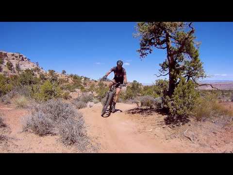
Very nicely built trail with fun (and fast) riding. While great for solid intermediate riders, it can be managed by experienced beginners. The additional area trails -- that you access via the Mustang Loop -- make this a great destination for a day's riding.

Riding notes, Mustang Loop clockwise from Chisholm:
0.0   East from 313 (Chisholm) TH
        N38 34.866 W109 47.857
0.5   L on Mustang Loop
        N38 35.088 W109 47.586
1.3   Keep R (L = Whirlwind  joins)
        N38 35.501 W109 47.388
1.4   Keep R (L = Whirlwind leaves)
        N38 35.499 W109 47.308
2.7   Keep R (L = toward Getaway)
        N38 34.909 W109 47.267
3.3   L on Chisholm N38 35.088 W109 47.586
3.8   Back at parking

Mustang Loop from Chisholm trailhead, counterclockwise...

[Back to video list ]
Map of the Horsethief riding area
Getting there:  From I-70 and Crescent Junction, drive south on US-191 for 20 miles (about 9 miles north of the Colorado River if you're driving out from Moab) to Highway 313. Drive uphill 11 miles.
Horsethief West:  On your right at mile 11.8 from Highway 191, turn toward the campground. The mountain bike trailhead is before the campground on your left. Start southbound on Chisholm to reach the Mustang-area trails.
Highway 313 (Chisholm) Trailhead:  At mile 12.5, spot the trailhead kiosk on the left side of the road. Turn into parking. Pedal east (away from the highway) on Chisholm to intercept the Mustang Loop in 0.5 mile.
Gemini Bridges Road (Getaway) Trailhead:  For longer rides of the area trails. At mile 12.9, turn left at the Gemini Bridges sign. About 200 feet from the pavement, spot a small parking area on your left with the Getaway Trail just east of parking. Mustang forks away from Getaway 0.6 miles from the trailhead.
Bull Run Trailhead:  Drive 1.1 miles down the Gemini Bridges dirt road, then turn right into the trailhead. Start your ride to the Horsethief Area trails by heading left on 7up.

Riding resources:
Printable one-page ride summary, from Chisholm
GPS track files (right-click and select "Save Target as..."):
    GPX multi-track, area trails
    Mustang from Getaway TH
    Mustang from 313 (Chisholm) trailhead
    Horsethief Tour from Getaway (14 miles)
Topo map for printing:   View Horsethief Area Trails topo
Lodging, camping, shops:     Link to Moab area resources

Bathrooms: Horsethief Campground
Water: Horsethief Campground
Camping: Horsethief CG, nightly fee