
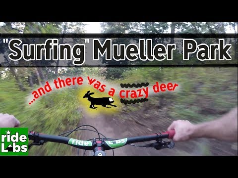

In Bountiful's Mill Creek Canyon is the Mueller Park trail, a great lower-altitude alpine ride. Riders commonly do this trail as a 7-mile out-and-back to Big Rock, a 13-mile out-and-back to Rudy's Flat, or as a 13-mile loop using North Canyon as either the descent or the climb.


The Mueller Park trailhead is reached the Mueller Park road, which is a continuation of 1800 South Street in Bountiful. This is a popular trailhead and will be crowded on weekends. Even on weekdays, you'll likely need to park along the street that leads to the trailhead and pedal uphill. The Mueller Park trail is across the bridge behind the parked cars. The Bonneville Shoreline (and connections to other trails) is up the campground road.

At the uphill end of Canyon Creek Road in Bountiful (reached via Bountiful Blvd), you can find roadside parking and begin pedaling uphill. You'll have the option of gravel service road or a singletrack trail on the right (south) side of the road, found 100 feet uphill from the gate. The first mile will be relatively steep (around 500 vertical feet of climbing). The pitch mellows once you reach the National Forest border. You can connect to Mueller via the Bonneville Shoreline, Mahogany Ridge, or directly up North Canyon.
NOTE: There's a plan for a road and formal trailhead for access to North Canyon. As of my last visit to this trailhead, these instructions are accurate.

The single-track is usually open by mid-April and stays clear of snow until October. There may be a few snowdrifts in the pines at the top until early June. The first half of the trail is smooth hard-pack dirt and is easy even for novices. The half-way point is marked by a split in the trail going on to a big rock. This rock is officially named "Big Rock", but is called "Elephant Rock" by many locals.
At the Elephant Rock spur, the new 304-305 DH trail crosses. (The trail has no official name as of October 2024.) Make the turn to the right uphill to continue on Mueller Park.
After Big Rock, the trail becomes slightly steeper and more affected by rocks and roots, rated a solid intermediate level for aerobic effort and technical skill. From the trailhead at the edge of the city, the Mueller Park trail gradually rises 1900 vertical feet. This is a solid (yet not unpleasant) aerobic workout.
At mile 4.2 of Mueller Park, the Peregrine trail forks away to your left. (The Peregrine trail curves around the valley to join Maple Syrup, then Hornet, then the BST connector back to the trailhead.) To your right is the new 304-305 DH trail. (This route has no official name as of October 2024. It drops down through the Elephant Rock area, then ends at the creek. Here Bring It Home takes you uphill to a trail fork with Hornet -- for a return to the trailhead -- or Maple Syrup -- to begin a long climb back uphill via Peregrine.)


At the spur to Big Rock (Elephant Rock), the new DH trail crosses. You can divert onto the lower part of the DH here, or turn to continue climbing Mueller Park.


About a mile above Elephant Rock, you can divert off of Mueller Park onto the newer Peregrine trail or the Mueller DH.
The reverse loop uses North Canyon for the climb, with the descent down Mueller Park trail. Park at the Mueller Park trailhead. Bike back down the paved road 0.6 miles, turning left at the intersection. At 2.3 miles, turn left onto Canyon Creek. At 3.0 miles, the pavement ends. Proceed past the gate up the dirt road. Ignore branching roads at 4.0 through 4.1 miles, keeping straight ahead. At 4.4 miles, the dirt road ends, with the singletrack climbing up the draw on your left. The singletrack is an easier pace than the road. Switchback turns are easily rideable both uphill and down. At 7.0 miles, you reach Rudy's Flat. Ignore smaller trails branching off to the right. Begin the descent. At 9.9 miles, you'll reach the Big Rock turnoff, then the bridge to the parking area at 13.5 miles.


Mueller Park is one of Utah's great classic rides. It gets a little crowded on weekends, but it's a ride you've got to do.


Mueller Park: On I-15, take the 2600 south Bountiful/Woods Cross exit. Go east towards the mountains. The road will turn north and be renamed Orchard Drive. While heading north, turn right (east) on 1800 south. This street takes you to the trailhead about 2 miles later, where you'll see parking places on the right side of the road. Go across the stream on the bridge to begin the ride.
North Canyon: On I-15, take the 2600 south Bountiful/Woods Cross exit. Go east towards the mountains. The road will turn north and be renamed Orchard Drive. While heading north, turn right (east) on 1800 south. Just as you reach the bottom of a steep hill, turn right at the intersection. (This is about 0.6 miles before the Mueller Park trailhead. If you arrive there, backtrack.) After 1.7 miles, turn left on Canyon Creek and go uphill 0.7 miles to the end of the pavement. Start your ride by heading east (uphill) on the dirt road.
Bonneville Shoreline 1.3 miles
Elephant Rock 3.4 miles
and DH cross-over
Peregrine, DH top 4.2 miles
Rudy's Flat 6.3 miles
Mahogany Ridge 6.7 miles
BST on North Canyon 8.2 miles
North Canyon trail end 8.5
Pavement North Canyon 10.0
Full loop back to Mueller trailhead 12.7

Single-page riding guide
GPS track files (right-click and "Save as..."):
Mueller GPX only (to Rudy's Flat)
Area GPX multi-track file
Mueller and down North Canyon, loop
North Canyon only
High-res topo for printing:
View Map Include North Canyon as loop: View
Lodging, camping, shops:
Links to northern SLC resources Links to Ogden area resources


