Mega Steps forks eastbound off Copper Ridge road. The EKG trail is 1/2 mile uphi...
Mega Steps forks eastbound off Copper Ridge road. The EKG trail is 1/2 mile uphill. Photos and ride descriptions by Bruce on November 3, 2011.
Mega Steps Trail

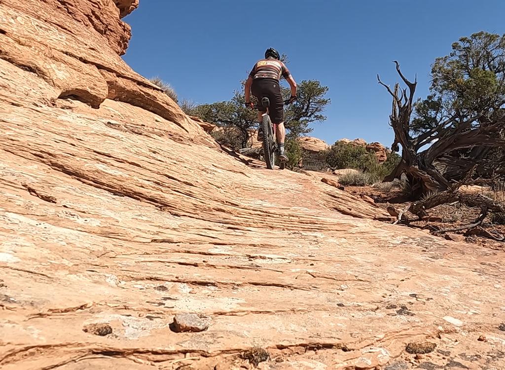
Mega Steps is an uphill/downhill route on the far north end of the Klondike Area trails complex. At the top, it connects to the far north corner of the Baby Steps Loop . After heading northwest along the ridgeline, it turns and descends to the Copper Ridge Road.

Mega Steps itself is 3.2 miles in length. But any ride that uses all of Mega Steps will be at least 12 miles total. You can reach the trail via Copper Ridge Road at the bottom, via the EKG Trail 1/2 mile from the bottom, or by Baby Steps at the top. (You can reach that upper junction with Baby Steps by climbing Baby Steps North, Little Salty , or Baby Steps South.) The Alaska Trail begins and ends on Mega Steps, offering additional ride opportunities.
The climbing grade is fairly easy, and not too technical. The trail is marked wi...
The climbing grade is fairly easy, and not too technical. The trail is marked with light-green paint stripes.
A quick drop from the Salt Wash sandstone down through the red dirt to the Entra...
A quick drop from the Salt Wash sandstone down through the red dirt to the Entrada. We're still heading uphill, though.
Mega Steps is intermediate in technical requirement. Less bike-handling skill is required for the downhill, but the trail rides well either way. I really like Mega Steps as a climbing route, and prefer it to the traditional Baby Steps south.

The complexity of the trail system allows for multiple riding options of varying length and difficulty. My "featured ride" is 20.4 miles, but most riders would select something a little shorter.

The trail has 550 vertical feet of altitude change. Because there are a couple of brief descents, total climbing will be 650 over 2 miles. After the initial climb, the trail turns to head south along the top of the ridge, where you can enjoy views in all directions.
The trail enters this broad Entrada slickrock area as it nears the top.
After climbing above the slickrock, were nearing the ridgeline, where the Salt W...
After climbing above the slickrock, we're nearing the ridgeline, where the Salt Wash caprock lies in chunks.
The trail begins with ugly dirt ribbon through weeds. After reaching slickrock 1/3 mile later, there's a glorious riding. At first, it's almost entirely slickrock. As you get higher, it's more dirt with rock rollovers.
On rock areas, the trail is well-marked with stripes of light green paint. Strategic placement of dead branches and rocks helps you quickly spot the riding line.
View east from the top of the ridge. The rock on the skyline is Entrada, with a ...
View east from the top of the ridge. The rock on the skyline is Entrada, with a layer of Navajo below, then bands of Kayenta on the bottom half of the lower cliff.
Meandering along the ridgeline, were now looking southwest.
Meandering along the ridgeline, we're now looking southwest.
During the initial climb, most of the rock is Salt Wash sandstone from the Morrison Formation. Once you drop down through the red dirt, the broad area of the open rock is the Entrada Formation -- for example, the large expanse of slickrock near the top. The dirt on top of the Entrada is the Curtis formation. These strata are all from the Jurassic period.
Loop with Mega Steps up, Baby Steps North down:

If you're trying to save some leg, take the Copper Ridge road to the base of Mega Steps. A simple loop up Mega Steps and down Baby Steps North isn't tough at all. The ride description is at the bottom of the page.

To the southeast are the La Sal Mountains.
Were dropping down to meet Baby Steps.
We're dropping down to meet Baby Steps.
Mega Steps uphill w EKG both ways:

This nice ride uses EKG northbound and again southbound to give your legs and shoulders a workout. You'll climb Mega Steps in two pieces, taking the upper section upper first.If you get tired, every up-down trail connects through EKG to Copper Ridge road. So there's a bailout every mile along EKG.

Sample rides going uphill on Mega Steps
Loop Mega Steps up, Baby Steps down:
0.0   East across cattle guard
        N38 46.417 W109 42.735
0.8   Veer L on Copper Ridge Rd
        N38 46.997 W109 43.072
1.7   Keep on DT (R = Baby Steps S)
        N38 47.545 W109 43.603
2.6   Keep on DT (R = Little Salty)
        N38 48.182 W109 44.193
3.6   Keep on DT (R = Baby Steps N)
        N38 48.801 W109 44.839
4.3   R on ST Mega Steps
        N38 49.197 W109 45.405

4.9   Straight (R = EKG, L = Alaska)
        N38 49.427 W109 45.003
6.4   Fork R N38 50.101 W109 44.204
         Top of ridge (L=Alaska)
7.5   R on ST Baby Steps N
        N38 49.481 W109 43.795
8.5   Join EKG (on R), keep straight
        N38 48.973 W109 44.610
        100 ft, veer R as EKG goes L
8.8   L on Copper Ridge Rd
        N38 48.803 W109 44.840
11.6 Fork R (L = Klondike)
        N38 46.997 W109 43.072
12.4 Back at parking
Above ride:   Single-page riding guide      Track File
Mega Steps uphill w EKG both ways:
0.0   East across cattle guard
        N38 46.417 W109 42.735
0.8   Veer L on Copper Ridge Rd
        N38 46.997 W109 43.072
1.7   R to Baby Steps South
        N38 47.545 W109 43.603
2.1   L onto EKG
        N38 47.742 W109 43.284
3.8   Cross Little Salty, keep straight
        N38 48.598 W109 43.912
5.2   R uphill joining Baby Steps North
        100 ft then veer L to stay on EKG
        N38 48.960 W109 44.614
6.2   R uphill on Mega Steps
        N38 49.420 W109 45.034
7.8   Top of ridge, fork L (R=Alaska)
        N38 50.101 W109 44.204
8.9   Reach DT N38 49.480 W109 43.799
        Keep straight on Baby Steps southbound
10.3 Fork R on Little Salty
        N38 49.129 W109 43.379

11.3 Cross EKG, keep straight
        N38 48.598 W109 43.912
12.0 R on Copper Ridge DT
        N38 48.179 W109 44.193
13.0 Keep straight (R = Baby Steps N)
        N38 48.802 W109 44.840
13.8 R uphill on Mega Steps
        N38 49.196 W109 45.404
14.2 R on EKG
        N38 49.420 W109 45.034
15.2 Cross Baby Steps, stay on EKG
        N38 48.960 W109 44.614
16.6 Cross Little Salty, stay on EKG
        N38 48.598 W109 43.912
18.3 R downhill on Baby Steps South
        N38 47.742 W109 43.284
18.7 L on Copper Ridge Rd
        N38 47.545 W109 43.603
19.7 Fork R (L = Klondike)
        N38 46.997 W109 43.072
20.4 Back at parking
Above ride:   Single-page riding guide       Track File
Downhill on Mega Steps
Looking to the west on Mega Steps as we head north on the downhill version.
The downhill route on Mega Steps starts where the doubletrack section of Baby Steps ends at the top of the ridge. (Baby Steps forks left downhill. Mega Steps is straight ahead. To the right a doubletrack heads downhill -- don't go there.)
There will still be a little climbing for about a mile as Mega Steps meanders along the top of the mountain. There views in all directions, although they're just average by Moab standards. The start here isn't the scenery, it's the riding.
Weve reached the north end of the ridgeline. Were looking northeast. The cliffs ...
We've reached the north end of the ridgeline. We're looking northeast. The cliffs across the valley are Kayenta sandstone. The spires on the skyline are Entrada.
Were dropping toward this big tabletop of Entrada sandstone. To the west are the...
We're dropping toward this big tabletop of Entrada sandstone. To the west are the Blue Hills.
Mega Steps now turns from northbound to westbound and begins dropping from the Morrison Formation's Salt Wash sandstone down through the brown dirt of the Curtis. You'll spend some time on a broad tabletop of Entrada sandstone before climbing back uphill to the top of the Curtis dirt.
Once on top of the Salt Wash sandstone again, Mega Steps begins a steady downhill toward the Copper Ridge road. When you hit the EKG trail fork, you're almost to the bottom of the slickrock. Many riders choose to turn left here and take EKG southbound, instead of dropping all the way to the dirt doubletrack.
There are a few little ledges and opportunities for wheelies, but everything can...
There are a few little ledges and opportunities for wheelies, but everything can be rolled easily by an intermediate rider.
Baby Steps up, Mega Steps down, EKG back:
0.0  From upper parking, east over cattleguard
       N38 46.417 W109 42.735
0.8  Fork left on DT Copper Ridge Road
       N38 46.997 W109 43.072
1.7  Fork R on ST Baby Steps South
       N38 47.545 W109 43.603
       Climb through slickrock area
2.1   Straight uphill (L = EKG)
        N38 47.741 W109 43.285
2.6  Trail veers R, N 38° 48.02' W 109° 42.88'
3.5  Slickrock, fork L following marks
       N38 47.958 W109 42.584
       (R = connect to Klondike)
3.9  L on ST, N 38° 48.28' W 109° 42.69'
5.1   Back at DT, fork L
        N 38° 48.41' W 109° 42.77'
6.1   Fork L to join Klondike trail
        N38 48.578 W109 42.373
6.2   Keep straight N38 48.656 W109 42.260
6.6   Keep R and descend
        N38 48.817 W109 42.085

6.8   Fork L in valley
         N38 48.811 W109 41.871
8.2   Fork L and climb hill
        N38 49.310 W109 43.045
8.8   Top of hill, R on DT (L = Little Salty)
        N38 49.102 W109 43.371
9.9   Straight onto Mega Steps ST uphill
        N38 49.480 W109 43.797 (L = Baby Steps)
11.0 L downhill (R=Alaska)
        N38 50.101 W109 44.204
12.8 L on EKG  N38 49.420 W109 45.034
13.8 Cross Baby Steps, stay on EKG
        N38 48.960 W109 44.614
15.1 Cross Little Salty, stay on EKG
        N38 48.598 W109 43.912
16.8 R downhill on Baby Steps South
        N38 47.742 W109 43.284
17.2 L on Copper Ridge Rd
        N38 47.545 W109 43.603
18.2 Fork R (L = Klondike)
        N38 46.997 W109 43.072
18.9 Back at parking
Above ride:   Single-page riding guide       Track File
Map of Klondike riding area

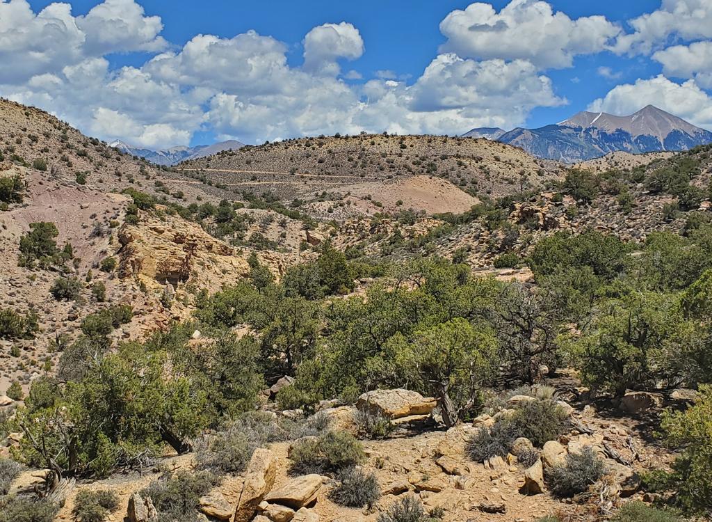
Getting there: Starting at the Colorado River, drive 15 miles north from Moab. Look for a turnout with parking on the right and a sign for Klondike Bluffs Road. There will usually be cars parked there (GPS N 38° 44.452' W 109° 44.037'). For a longer ride, park here and ride up the road.  Most cyclists will choose to go through the gate and drive 2.7 miles. Keep left at the fork. At 2.8 miles, park your car in the broad parking area by the fence. Go eastbound across the cattleguard through the fence and begin your ride.

Note: Map color-coded to show named trails individually. Does not correspond to described loops above.

Northern Klondike TH:  On Highway 191 8.5 miles south of I-70 and 6.5 miles north of the southern Klondike Bluffs road (about 5 miles north of the airport), watch for a "Northern Klondike" sign at N38 49.504 W109 46.893. Turn east (toward the sandstone bluff). Keep to the right as the road winds south around a small hill. 1.2 miles from the highway as the road is heading east toward the bluff, fork right on a fainter jeep road N38 49.103 W109 46.061, as the main road continues to the dinosaur tracks. (Park here if the road is in bad shape.) At mile 1.6, you'll come to the TH for the Jasper and Agate loops (N38 49.087 W109 45.625) on your right. At 2.0 miles, you're at the bottom of Mega Steps at a larger parking area N38 49.179 W109 45.417.