The Green Pond Loop is a beautiful singletrack ride on the east side of Mount Ogden. It incorporates the East Fork Trail , Green Pond Trail, Snowbasin's Strawberry Express connector trail, and the Wheeler Creek Trail . From any of the three trailheads on the loop, it's 11.6 miles with 1600 vertical feet of climbing, rising to a peak altitude of 6900 on the slopes of Snowbasin resort.
Some riders still refer to this route as the "Maples Loop." That's because the upper Wheeler Creek trail used to be called the Maples Trail, and the loop could be ridden while camping at the Maples Campground north of Snowbasin. The campground no longer exists. And the "Maples Trail" is a short connector from Snowbasin to the Ogden Canyon Overlook doubletrack.


Consider starting at the Wheeler Creek trailhead opposite the Pineview dam: the Wheeler trail adds an easy 3.5 miles plus 500 vertical (15.1 miles total, total climbing 2100 ft).
For a shorter ride, you can cut the loop in half by using Middle Fork (trail info on the East Fork loop page). Or you can skip the higher-elevaton bits by turning onto the Snowbasin access trail near Green Pond. See the topo map link below.
The Green Pond trailhead sits in the middle of the climb on the south end of the loop. For most riders, this is the quickest trailhead to get to. On weekends, the trailhead parking fills up with hikers, but there's room to park along the road.
The Ogden Canyon Overlook trailhead is at the Snowbasin resort. As you approach the resort base in your car, veer to the left and descend to the big parking area. The loop starts at the doubletrack behind the gate on the northwest corner.


At the trail fork 2.9 miles up East Fork, go left and climb 0.2 miles to the Green Pond trailhead. Cross the road to the Green Pond trail. You've now climbed 700 vertical feet.


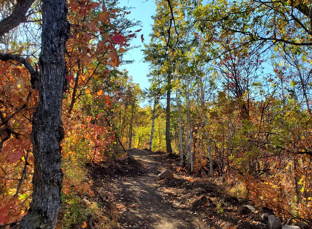
At 0.7 miles from the road, keep left for the longer loop ride. The right fork will take you directly to Snowbasin. (It will rejoin the loop there.)
Green Pond ends on Needles at mile 2.6 from the Green Pond trailhead. Keep right and begin your downhill!


The upper Wheeler Creek trail has been reworked in recent years, and is mostly broad and easy to ride. After a couple of miles, you'll reach the bumpy, trenched lower portion and you'll follow this to Art Nord.
Nice loop, very much worth doing. On weekends, expect lots of hikers and dogs on the lower Green Pond trail.

Add 1.8 to mileage if starting from Pineview Trailhead
0.0 Art Nord Trailhead, right on paved road
N 41° 14.017' W 111° 49.224' Alt=5430
0.1 L on ST (East Fork Trail)
2.5 Fork L uphill
N 41° 12.453' W 111° 49.995' Alt=6220
2.8 Cross paved road (Green Pond Trail)
N 41° 12.412' W 111° 50.124' Alt=6310
3.2 Faint foot trail branches left uphill to Green Pond
N 41° 12.185' W 111° 50.189' Alt=6380
3.6 Fork L N 41° 12.313' W 111° 50.414' Alt=6510
4.8 Cross gravel road, turn north N 41° 11.951' W 111° 50.606'
5.3 Keep R (Snowbasin Trail system) N 41° 12.139' W 111° 50.717'
5.7 Cross dirt road at gas line, go downhill
(If riding reverse, keep L downhill) N 41° 12.377' W 111° 51.020'
Pass W side of lodges and parking areas
(don't drop directly down to lodges)
7.7 Gravel road at NW corner of parking area
Turn L on gravel road (Maples CG road)
N 41° 13.118' W 111° 51.795' Alt=6250
8.2 R on ST at Wheeler Creek Trail sign
N 41° 13.539' W 111° 51.817' Alt=6210
10.2 Keep L (R = Middle Fork trailhead)
N 41° 13.707' W 111° 50.307' Alt=5640
11.6 Back at Art Nord Trailhead

From the south, leave I-15 for US-89 in Farmington. Turn right (east) to take I-84 up Weber Canyon. Take the Huntsville/Pineview exit and turn left under the freeway, then right to continue up the canyon. About a mile later, follow the signs to turn left towards Huntsville on U-167. 6.8 miles after leaving I-84, turn left on U-226 towards Snowbasin. The Green Pond trailhead is at a parking turnout 1.3 miles from the turn. The Snowbasin turnoff (which leads to the parking area at the Ogden Canyon Overlook trail) is 3.0 miles. Note that if the old Snowbasin road is locked, you can't drive from here to the Middle Fork trailhead (4.7) or Art Nord (6.0).
Single-page riding guide
GPS track files (right-click and "Save as..."):
Loop Green Pond from Art Nord TH
Loop around Snowbasin to Icebox from Wheeler TH
Loop around Green Pond from Snowbasin
GPX multi-track file
Specialty track files (right-click and select "Save target as..."): Mt Ogden 50K race Loop GPX
2010 Intermountain Cup race loop GPX
High-res area topo map for printing: View map
Lodging, camping, shops: Links to Ogden area resources