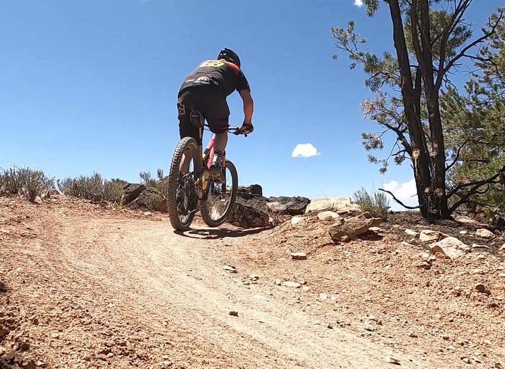

The Magnificent 7 or "Mag 7" is a series of trails that create a 26-mile point-to-point route. The loop is closed by shuttling Highway 191 and 313 (or making a long pavement return). There are actually 9 or 10 trail segments, depending on how you're counting. The key players are Bull Run, a bit of Gemini Road, Arth's Corner, Little Canyon, Gold Bar ST and upper Gold Bar Rim, Golden Spike, the north end of Poison Spider, and the Portal Trail.
Bull Run is a 5.4-mile route and was the first section of the Mag 7 to be completed (2011, extended in 2015). It follows open rock along the edge of Bull Canyon. The trail ends on Arth's Corner to continue the Mag 7. However, riders can turn on the Gemini Bridges road about 1/4 mile above the parking area for a visit to the arches. (From Bull Run, turn right on the dirt road to the Bridges. As you hit Gemini Bridges, you'll be at mile 6 for the descent. Pick up the Arth's Corner about 0.1 miles below the Gemini Bridges parking area.)


(If you followed Bull Run all the way to Arth's Corner, you've missed the bridges. If you want to see them, you can turn right to Arth's trailhead and backtrack uphill to the bridges.)
Park your bike in the rack at the Gemini Bridges trailhead and walk 0.2 miles to the twin arches. Hike back to your bike. Exit the parking area to the east (downhill). Pass a couple of viewpoints. Rejoin the main road in 1/4 mile and catch Arth's Corner singletrack on your left about 0.1 mile from the junction.
This is a fun slickrock and singletrack ride that meanders downhill to meet the Metal Masher 4x4 road. This is an easy segment of the trail. The singletrack portion is only 1.5 miles long. After hanging right on Metal Masher, you cross the road to the Little Canyon Singletrack to continue the ride. Mile 8.5


The Little Canyon ST is 2.3 miles of very fine stuff, angling 400 vertical downhill over slickrock and singletrack. As you hit the wash at the bottom, you'll climb up to a slickrock shelf to continue with the Gold Bar Rim singletrack. Mile 10.8!
The Gold Bar Singletrack is 2 miles of pretty fine stuff. It's slickrock that angles steadily uphill, with a few tech spots. Then it dumps onto the Gold Bar 4x4 jeep trail to avoid a trail-closed area. You're at mile 12.8 as you finish the ST.


Gold Bar 4x4 is the motorized route with loose cobble, lots of ledges and difficult tech stuff. Plus jeeps, if you don't pick your riding day as well as we did. The distance for this trail segment is 1.8 miles. As you reach the Gold Bar Rim and stand atop the cliffs, the total distance covered is 14.6 miles with around 1300 vertical of climbing so far.
The next portion of the route is the Golden Spike jeep trail. Golden Spike has over 6 miles of up and down riding, and is pretty strenuous. Most of the ride is only moderately technical, but there are some challenges. As of April 2011, there are no specific Mag 7 signs on Golden Spike. The southern end could use a few more that-a-way signs for bikers as alternates fork off, but it's reasonably easy to pick the right track.


The official route calls for a little jaunt onto the north end of Poison Spider. I assume the official ride is to finish Golden Spike then head north on Poison Spider. Add 2 or 3 miles -- we're at 23.

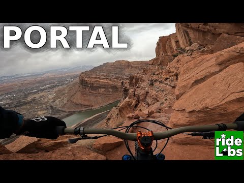
The Portal Trail is first spooky, as you ride along the edge of sheer cliffs, then difficult when you hit the technical portions. Plan to hike through a few spots. Ride what you safely can. The trail will descend to the Potash Road, where you can catch your shuttle. (Or do a 26-mile return on paved bike path and roads. That's 52 miles, if you're counting.) As you hit the pavement, you should be around mile 25. Add a couple of road miles if you're parked at the Poison Spider TH.
[ The Portal is included on the Poison Spider page ]

From I-70 and Crescent Junction, drive south on US-191 for 20 miles (about 9 miles north of the Colorado River if you're driving out from Moab) to Highway 313. Drive 13 miles on 313 to the Gemini Bridges sign and turn L onto dirt road N38 34.390 W109 47.548. Find a spot to park. Begin riding down the gravel road toward the start of Bull Run.
Finish:
To ride back to town, L on Potash Road about 3.5 miles, R on 191 and 1.5 miles to the Colorado River. For vehicle shuttle parking, find a wide spot, or go to the Dinosaur Tracks parking at the Poison Spider trailhead.
GPS track file (right-click and select "Save Target as..."):
Area trail tracks
GPX Mag 7 as single route
Topo maps for printing:
Low Res Mag 7
Bull Run
Arth's
Little Canyon
Gold Bar
Golden Spike
Poison Sp / Portal
Lodging, camping, shops: Link to Moab area resources