

with Solis Way, Alan's Alley and Bonus Loop
Luke's Trail is a fun twisting singletrack on the mesa on the north edge of Price, part of the Wood Hill Trail System. As an out-and-back, it's a fast 6 miles round trip. Overall altitude change is 300 vertical feet, climbing from 5900 to 6200 feet. Most riders will combine Lukes with other area trails for a longer ride. See the Wood Hill area page for other connecting trails on the mesa.


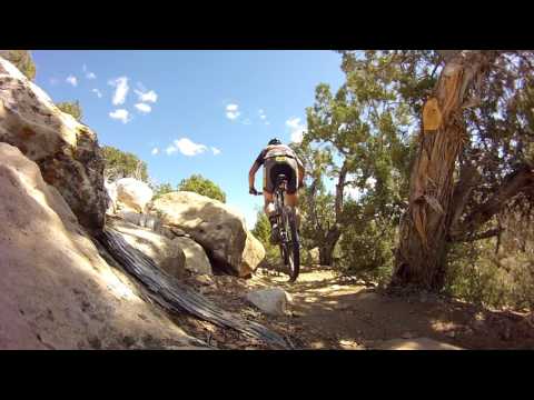
You're riding on soft dirt and sandstone from the Cretaceous period. If you drift off-trail, the dirt will suck your tire down into the depths. Stay on the trail.


From the northwest corner of the parking lot (between the kiosks), cross the doubletrack to Solis Way. Now ride generally north 0.8 miles. The route will cross Bill's Sandy just before it reaches Luke's Trail on the cliff edge. Go either way.
Luke's will be your key to other area trails. Northbound from the most southern end (from the old trailhead), there will be a left fork to Alan's Alley then a right fork to the downhill end of Bill's Sandy . As Luke's reaches the cliff, Alan's Alley rejoins on the left as Luke's turns right.
At the fence with the cattle extruder ride-over, a shortcut called Dick's Cutoff heads over to the northern end of Smo' Joes . A bit further north, the Bonus Loop forks left downhill.
At its north end, Luke's connects to IMBAtween by crossing Kenilworth (Wood Hill) road. IMBAtween takes you to Mead's Rim and Therapy.


Start from the old Luke's trailhead. Stay on Luke's. Pure beginners and young children will find a good turn-around at mile 1.4, just after Alan's Alley rejoins the trail. There are nice views from the mesa edge, which gives a good "we got here, let's go back" end to a short out-and-back ride. (Also, consider a loop around Alan's Alley as a beginner ride.)
Start at the south end. Ride Luke's without doing the more-technical side dishes, Alan's Alley and Bonus Loop. At the top, Lukes ends on the gravel Kenilworth road. That's your turnaround. A big further up that road is the top of Meads Rim. Straight across the road is IMBAtween, which will connect you to Smo' Joes or Mead's Rim .


For upper-intermediates, I suggest Luke's Bigger Loop. It's 10.6 miles and has some more technical riding on upper Lukes and IMBAtween before joining Smo' Joes. My version includes a detour onto Wyatt's Way before return via Knott Pete's Rim.


Experts can enjoy nice day's riding with a figure-8 ride as follows: Lukes to IMBAtween to Meads Rim northbound. Onto Floating Rocks to Lollipop. Down Shamrock & Roll to Yoo Hoo. Road to Luke's and fork left on Luke's. Again take IMBAtween. This time fork south on Smo' Joes. Add Wyatt's Way and Knott Pete's Rim for a 16-mile ride.
The old classic ride started in Price at Pioneer Park and proceeded west then north on a stiff doubletrack climb past the painted rocks. The DT heads north along a narrow ridge with great views before reaching the official Luke's trailhead on the mesa 1.4 miles later. The return from the top of Luke's is via Mead's Rim , which will return you to the outskirts of town as Mead's drops off the next mesa to the east.


Alan's Alley is a 1.3-mile side trail off Luke's. It begins one mile from the trailhead and heads west along the edge of the mesa, then returns to Luke's. (You'll miss about 0.3 miles of flat riding on Luke's.) It's a bit more technical than this early section of Luke's, but still easy.
The Bonus Loop is a lariat-shaped side trail that forks off Luke's near the top. It's 0.8 miles in length. The loop itself is pleasant cruising, but there's a rough tough but short trip down a wash and back up before you reach the loop.


0.0 Northwest corner of park, go west (towards water tank)
N 39° 36.476 W 110° 48.548 alt=5640
0.15 Keep straight on dirt (R dead-ends)
0.18 R on dirt road (goes up hill between C's)
N 39° 36.458 W 110° 48.738
0.45 Keep straight at all intersections, top of hill
N 39° 36.660 W 110° 48.797 alt=5890
1.1 Go R around water tank
N 39° 37.205 W 110° 48.760
1.35 Turn L at DT
N 39° 37.360 W 110° 48.780
1.4 Parking area, begin singletrack
N39 37.367 W110 48.811
Cross doubletracks at 1.5, 2.0, 2.3
2.4 Keep straight (R), L=Alans Alley
Add 1 mile if doing Alans Alley
N39 38.038 W110 49.049
Cross doubletracks at 2.5, 2.6
2.7 Keep straight (R), L=Alans Alley return
N39 38.246 W110 49.160
N 39° 38.248 W 110° 49.165 alt=6140
3.8 Over cattleguard
(R = cutoff to Smo' Joes on east rim)
N39 38.826 W110 48.492
3.85 Pass under power line ("White Trash Point")
N39 38.656 W110 48.660
4.0 Keep R (L = Bonus Loop)
N39 38.848 W110 48.458
Add 0.7 miles if doing Bonus Loop
4.05 Cross DT
N39 38.849 W110 48.430
4.3 At Kenilworth Road
N39 39.035 W110 48.253
Direct to Meads via Kenilworth Road:
0.0 Turn L uphill on DT
0.5 Keep R on smaller road (don't go to pump station)
0.8 Just after road splits around junipers,
spot opening in fence, with DT on R
N39 39.577 W110 47.941
0.0 Start at Lukes TH on mesa
N39 37.367 W110 48.811
Cross any doubletracks
1.0 Fork L on Alan's Alley*
N39 38.038 W110 49.049
2.3 Fork L, back on Lukes
N39 38.246 W110 49.160
3.5 R just before cattlegrate
N39 38.826 W110 48.492
Cattlegrate Cutoff trail
3.7 Cross road to DT (stay R of fence)
N39 38.723 W110 48.340
N39 38.721 W110 48.274
5.2 Keep R, L=Wyatts Way
N39 37.726 W110 48.241
5.3 Fork L on Knott Petes Rim
N39 37.653 W110 48.275
L = Wyatts Way return
6.5 Cross bigger road onto DT
N39 37.357 W110 48.697
6.6 At trailhead
*Subtract 1 mile if you skip Alan's Alley
0.0 Start at Lukes TH on mesa
N39 37.367 W110 48.811
Cross any doubletracks
1.0 Fork L on Alans Alley
N39 38.038 W110 49.049
2.3 Fork L, back on Lukes
N39 38.246 W110 49.160
3.5 Cross cattlegrate (R=cutoff)
N39 38.826 W110 48.492
3.6 L downhill on Bonus Loop
N39 38.848 W110 48.455
3.7 L uphill on DT N39 38.886 W110 48.455
3.8 Keep R onto ST then follow powerline
N39 38.878 W110 48.526
3.9 ST veers L away from powerline
N39 38.906 W110 48.625
4.2 Back at DT, keep straight
4.3 R on ST N39 38.886 W110 48.455
4.4 Cross gravel road N39 38.848 W110 48.432
4.7 Cross Kenilworth road to IMBAtween
N39 39.035 W110 48.253
5.5 R on Smo' Joes N39 39.073 W110 48.065
5.6 Cross DT N39 39.037 W110 48.121
6.0 Cross cattleguard
Keep straight N39 38.721 W110 48.274
L = cutoff trail
8.0 Hard L on Wyatts Way
N39 37.726 W110 48.241
8.1 R downhill on DT
Cross road to ST
8.8 Hard R (L=Devils Backbone)
9.5 Keep L onto Knott Petes Rim
N39 37.653 W110 48.275 (R = S'mo Joes)
10.7 Across road to DT
N39 37.357 W110 48.697
10.8 Back at parking

Getting there, Pioneer Park
Classic ride or for return via Mead's Rim
Eastbound on US 6, take the first Price exit.Turn left and enter town on 100 North.
About a mile after leaving the freeway, turn left (north) onto 100 East.
Go four city blocks to the far end of Pioneer Park, turn right onto 500 North and find a parking place.
The ride starts at the corner of 100 East 500 North.
You'll be riding west (towards the water tank).
Getting there, Luke's or Wood Hill trailhead
Enter Price as above. Turn left (north) on 300 East.Drive to 900 North and turn left.
The road will turn to dirt and/or narrow asphalt, and will veer right and climb the mesa.
Classic Luke's trailhead: One-half mile later at the top of the mesa, just after passing the mound of dirt that hides the city water tank, fork left (west) and proceed 100 yards to a primitive parking area. the trail begins on the west side.
Wood Hill trailhead: On the dirt road, drive to the top of the mesa as above, but continue north another 1/2 mile. The prominent trailhead is on your left.
Camping: Primitive sites just southwest of the trailhead
Water: None at trailhead.
Bathrooms: Pioneer Park in Price
Bike services: Price
One-page riding guides:
Classic Luke's
Little Luke's Loop
Bigger Luke's Loop
GPS track files (right-click link, then save as a file):
GPX area with individual trail tracks
Luke's only
Luke's little loop course
Luke's bigger loop course
Maps for printing:
Luke's topo (area of loop only)
Full area topo Classic Luke's, satelite view
Classic Luke's w Mead's topo
Price-Area trails Large-format map courtesy of Price Area Singletrack Society
Lodging, camping, shops: Links to Price area resources


