Looking across the valley at Park City Mountain Resort. First review and photos July 8, 2002 by Bruce. Last update October 2017.
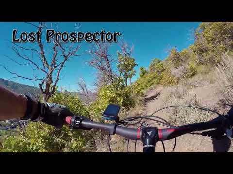
Lost Prospector Loop
Freemason, Lost Prospector, and Skid Row trailsThe Lost Prospector Loop is an easy route on Park City's
east side. The loop starts on paved Park City trail, transfers to buff
easy singletrack on the side of a small mountain, then descends to the
Rail
Trail
. This 7.2-mile loop has
a beginning altitude of 6800 feet, with a peak of only 7100. Its low altitude means
this trail clears of snow a few weeks earlier than the trails west and
south of Park City.
The classic 7.8-mile ride, as described below, was created before the completion of the Freemason
Trail in 2017. If you want to ride the classic route, start at the Prospector
Square Rail Trail
trailhead and go west on the Rail Trail toward the center of town. Turn
south as you connect
to the Town Trail on the west side of Bonanza Drive, then continue south
along Deer Valley
Drive. When the trail pops onto the street at the roundabout, do a 180
and descend Deer Valley
Drive a little bit. Turn right to climb Aerie Drive up to Prospector to
start the singletrack.

In this drone shot, Bruce heads southwest on Freemason above the spot where Bonanza Drive hits Deer Valley drive.

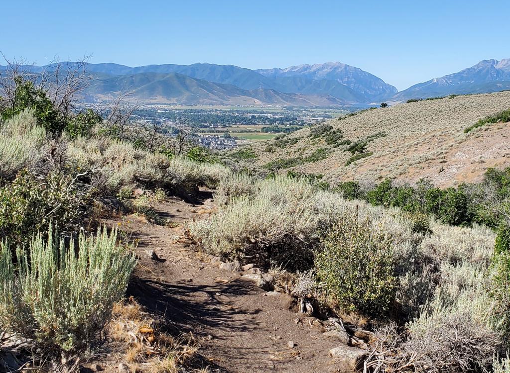
The riding is easier-intermediate, with no technical challenges. Much of the terrain is scrub oak, with groves of aspen and maple in the cooler spots.
Most riders are now doing a loop that includes Freemason, Lost Prospector, and Skid Row (see
by-the-mile description below). This is my recommendation! This loop can
be done in either
direction. Between the bottom of Skid Row and Freemason is a mile and
a half of the paved Rail
Trail. With Freemason, your climbing is on singletrack instead of paved
bike path (as in the
classic loop).
This ride is a good introduction to dirt for those who are just starting, or aren't in the
best of shape. But it's also a good quick "off-day" hammer-down ride for
advanced bikers. A
conditioned rider can complete this loop in around an hour. This loop
is easy-intermediate
technical, easy aerobic. Total climbing is just over 600 vertical feet.

View northeast on the western side of Lost Prospector, heading through sagebrush and gambel oak. This is a rare bumpy section with embedded rock.

Heading east on the paved Rail Trail. The carsonite post to my right is the entry to the Freemason Trail.
The Freemason Trail is 1.7 miles long with 300 feet of altitude gain. It starts on the Rail
Trail near the Prospector parking lot and climbs around the west side
of Masonic Hill. Freemason
ends on Lost Prospector near Aerie Drive.
To reach Freemason from the Prospector Avenue parking lot (see below), turn left to head east
on the paved Rail Trail. After 0.2 miles, turn to the right at the trail
marker. Begin climbing
through aspen forest.

Handlebar view as we begin climbing.

Most turns have a high berm. Plenty of room to crank around the radius on your way uphill, or to rail around on the downhill.
Freemason will climb through four turns on the north side of Masonic Hill. The terrain will
transition between aspen, maple, and scrub oak groves. There will be occasional
fir, chokecherry,
and hawthorn. About half of the trail lies on this cooler northern slope.
The trail here is smooth dirt ribbon with a fairly gentle rate of climb. Most of the climbing
will be complete by the time you reach the western side of Masonic Hill.
The trail has frequent
gentle turns and swoops that add to the fun.

Mixed forest of aspen, maple and fir.

Views are frequent, and pretty.
On the western slope, the trail tends to be hot and dry and there's a bit more rock. You'll
ride through sage and scrub oak, hearing the sounds of traffic on Deer
Valley Drive to your
right below you. The slopes of Deer Valley are straight ahead, and those
of Park City Mountain
are to your right.
When the trail reaches Lost Prospector, fork hard left to
reverse directions. Continue the loop on Lost Prospector northbound.
Other ride options at the end of Freemason are:
(1) Right. Take Lost Prospector to Aerie Drive, then connect to Gambel
Oak.
(2) Straight. Cross Lost Prospector to Masonic. Masonic is a more techy,
narrower less-traveled trail. It will cross over Lost Prospector a couple
of times before climbing south to connect to the top of
Gambel
Oak
.
")
Arriving at the Lost Prospector trail. (Photo taken from the Masonic Trail.)

Drone shot as Bruce cranks past a tall fir among the oak.
Lost Prospector traverses Masonic Hill from the southwest corner to the northwest tip. There
will be a bit of gentle climbing and descending. It's 3.2 miles from Freemason
to Skid Row.
The west side of the singletrack begins in gambel oak and sagebrush. The hillside here is exposed
and tends to be warm in the summer. You'll have views over Park City to
your left.

Sun-exposed areas, such as the west slope, are dominated by scrub oak with a smattering of sagebrush.

The trail winds around to the northern hillside in this 2002 photo. Trees include maples and aspen as well as stands of scrub oak. The trail gets smoother and the air a bit cooler.
As Lost Prospector reaches the north side of the hill, the nature of the ride changes. The
trail is wide and smooth, fairly flat with gentle turns. As it curves
around to the mountain's
north side, you ride through quaking aspen and maples, with tall wildflowers.
Lupine, delphinium,
penstemmon, thimbleberry, and columbine form a thick, tall carpet.
The Masonic Trail will join on your right, then leave downhill on your left. Unless some major
digging has taken place on Masonic, Lost Prospector will be the broad,
more-traveled trail
and the navigation should be obvious.
Masonic joins again from left downhill, then exits to the right uphill.
(From here, it climbs around the east side of Masonic Hill to April
Mountain where it connects to
Gambel Oak
and the
Solamere
Connector
.)

Rolling a turn above a ravine, at around the trail's midpoint.

The aspens of October tower over the rider.
There will be a connecting descender trail in the bottom of every canyon. You'll pass three
of these descending trails before you reach Skid Row, so don't be suckered
into dropping downhill
yet. The first trail drops to (and crosses) Freemason, the next to Euston
Drive, and the marked
SOS trail descends to the Rail Trail. Keep level.
About two miles into Lost Prospector, the trail descends about 100 vertical feet to find a
new traverse at 6900 feet elevation.
Lost Prospector ends at Skid Row. Keep left and downhill to descend.
If you keep right and uphill, Skid Row climbs to the Foxtail Trail. Both ends of this trail
connect to city streets on the hill.

Approaching the trail fork with Skid Row.

Bruce pops out into a rare clearing between groves of trees on Skid Row.
Skid Row is a continuous descent. It's 0.8 miles down to the Rail Trail, dropping just under
200 vertical feet. There will be about a dozen turns, but they're bermed
for speed.
The trail is smooth dirt, broad and well-traveled. There aren't any rocks or technical spots.
Not even a root.
Almost all of the descent is in tall forest of aspen and maple, so there are no views to take
your attention.

The descending is fun and fast.

Railing a turn in the fall leaves.
Remember this is a two-way trail. It's also used by hikers, runners, and dogs. Keep your speed
in control and slow for the blind corners!
As you approach the Rail Trail, keep to the left to head westbound toward Park City. The paved
path angles uphill and is straight as an arrow, so 1.5 miles of bike-path
return can seem tedious.

Looking west on the Rail Trail.

This was the view in 2002 going clockwise. The Skid Row singletrack that climbs the mountain is on the right, just before this bridge. Note that the trail is now paved here. Round Valley is about 1/3 mile to the east.
Other options from this spot? The Rail Trail sends a connection over to
Round
Valley
To go there, fork to the right (east).
Notes, counterclockwise loop with
Freemason:
0.0 Parking on Prospector Avenue
From parking, L on Rail Trail
N40 39.669 W111 29.887
0.2 R on Freemason
N40 39.753 W111 29.657
1.8 Hard L on Lost Prospector
N40 39.042 W111 29.885
(Straight = Masonic, R = to
Gambel Oak)
2.7 Straight (L = drop down to Freemason)
N40 39.453 W111 29.626
3.6 Straight (L = down to Euston Drive)
N40 39.458 W111 28.998
4.5 Keep R (L = SOS to Rail Trail)
N40 39.873 W111 28.806
4.9 Fork L (R = uphill on Skid Row to Fox Tail)
N40 40.072 W111 28.485
5.7 L on Rail Trail
N40 40.237 W111 28.422
7.2 Back at parking
Ride notes, CLASSIC counterclockwise loop:
0.0 Right (west) out of the parking lot
0.25 L on sidewalk
0.3 At crosswalk, cross street to paved trail
0.5 Keep straight at fork
1.4 Fork L, up to traffic roundabout
U-turn to head north
downhill on Deer Valley Dr.
1.8 Turn R uphill on Aerie Drive
1.95 Small parking lot on R, N 40° 39.034' W 111° 29.811'
Singletrack across the
street (on L)
2.1 Trail merges from L (advanced tech trail)
Keep straight
2.75 Crossing, keep straight (R) (L=advanced)
3.2 Fork L (R=to Gambel Oak)
N 40° 39.431' W 111° 30.004'
3.9 Cross doubletrack
4.1 Trail in from R, then fork. Go R uphill
4.85 Fork R, straight (L downhill = SOS)
5.35 Fork R downhill onto Skid Row
6.25 At Rail Trail, turn left
7.8 Back at Prospector trailhead
Alternate rides:
Lariat with Gambel Oak and Masonic: When Freemason hits Lost
Prospector, turn right. At the road, jog uphill and find the singletrack
to
Gambel Oak
. Go to the top of April Mountain,
keeping straight onto Masonic. Descend Masonic and return on Freemason.
Loop-around upper mountain add-on: When Freemason hits Lost
Prospector, go straight onto Masonic. Climb on Masonic until you hit
Gambel Oak at the top of the hill. Descend and connect back to Lost
Prospector at Aerie Drive, then do Lost Prospector and Skid Row as in
the
usual loop.
Fox Tail: At the fork where you'd turn you descend to the
Rail Trail on Skid Row, you can also go right, climbing uphill through
a
couple of switchbacks to a paved road on top of the mountain. From here,
you can blunder your way downhill through several street intersections
to
the
Solamere Connector
, then over the mountain
to
Gambel Oak
. 
Lost Prospector and Skid Row
Getting there:
On Park City's Main Street, turn left onto Kearns Blvd., as though you were heading to US 40.
About 1/4 mile later, turn right on Bonanza Drive. At the "Rail Trail"
sign about 200 feet
later, turn left onto Prospector Avenue, then right into the parking lot
for the Rail Trail.
The trail is at the far (south) end of the parking lot. N 40° 39.684'
W 111° 29.894'


")