Longbranch Trail
The Longbranch Trail is 1.1 miles in length, and is part of the Brand Trails complex just north of Moab. It's not a stand-alone trail. To reach either end, you need to cover a couple of miles on expert-level singletrack trail. Your minimum ride will be several miles.
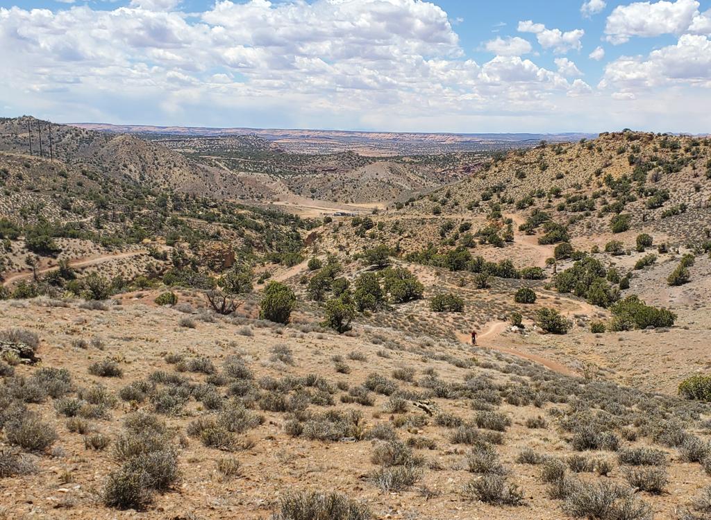
Longbranch is expert-level technical, and is one of the more difficult in the Brand Trails area. It might be a tad tougher than Deadman's Ridge (which is a bit tougher than Bar B), but not as hairy as Killer B.


Longbranch forks off the Deadman's Ridge trail at its southernmost spot, just before it turns to descend to Old 191. It joins the Bar B loop's western half about 100 yards from the fork with Killer B. It can be used to complete a nice little loop of Deadman's plus Bar B, or to get from Deadman's to Killer B.
Longbranch begins and ends at about 4400 feet elevation, but it descends 100 feet in the middle. There's quite a bit of up-and-down riding, and a few tight turns. There are some exposures to steep rocky slopes.


The trail is well-built and easy to follow. Turns flow well. Paint spots on the rock help you sight the lines while motoring along.
My "featured ride" takes EZ to Deadman's Ridge. Then you'll fork off Deadman's Ridge onto Longbranch. At Bar B, you'll fork left to head northbound on the western side of the loop. At the northern end of Bar B, you'll cross over to Rockin A, then on to Circle O. After short jaunt on Bar M, you can take the shortcut over to parking. Or for a longer ride, you can follow Bar M around to Lazy for the return.


I rode Longbranch north-to-south. I didn't get a chance to try the opposite direction, but it seems like it would be about the same difficulty level.
Sample ride, counterclockwise loop:
0.0 East on DT from parking (lower lot!)
N38 39.107 W109 40.110
0.2 R on ST (Lazy-EZ Loop)
N38 39.188 W109 39.990
0.3 R on EZ N38 39.165 W109 39.853
1.5 L to stay on EZ N38 38.517 W109 39.400
1.6 R on Deadman's N38 38.574 W109 39.280
3.3 R to stay on Deadman's N38 38.255 W109 38.671
3.8 Stay straight (R) N38 38.072 W109 38.586
4.3 Fork L on Longbranch
N38 37.845 W109 38.612
5.4 L on Bar B N38 37.599 W109 38.186
6.3 Keep straight (R) N38 38.089 W109 38.563
6.6 Fork R N38 38.262 W109 38.593
6.7 Cross DT to Rockin A
N38 38.273 W109 38.489
8.4 Cross wide area to Circle O
N38 39.167 W109 38.907
11.0 R on DT N38 39.712 W109 39.689
11.2 L on Bar M N38 39.640 W109 39.861
11.4 R uphill on shortcut N38 39.488 W109 39.716
12.0 Straight on DT (EZ-Lazy fork)
N38 39.188 W109 39.989
12.2 At parking

Getting there:
From the north, exit I-70 at Crescent Junction and drive south on US-191 for 22 miles. From Moab, drive 7 miles north from the Colorado River on 191. When you see the Gemini Bridges parking area, look for a gravel road on the opposite side (east, away from the cliffs). Turn onto the gravel road and immediately go right. Drive past the first parking lot. (This is restaurant parking or fee parking GPS N 38° 39.38' W 109° 40.66'.) As you approach the fence and kiosk at the paved trail, turn left and drive 1/4 mile to the gravel parking lot in the bottom of the valley N38 39.107 W109 40.110.
Riding resources for this trail:
Single-page riding guide
GPS track files (right-click and "Save as..."):
GPX all Moab Brand area
trails
Longbranch
only
Loop ride as
above
High-res topo for printing (500 KB):
View
Lodging, camping, shops:
Links to Moab area resources