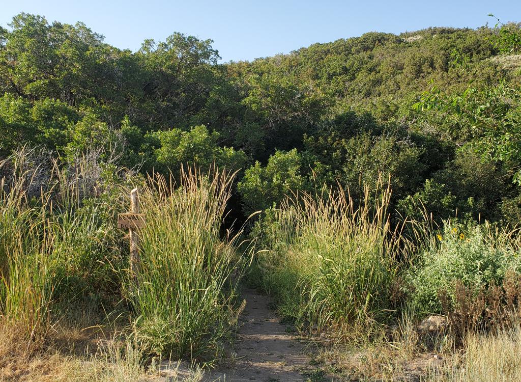
. Later, the trail becomes stee...")
Lower portion of the trail, looking east (uphill). Later, the trail becomes steeper and enters deep woods. Photo June 18, 1999
Little Cottonwood Creek Trail
The Little Cottonwood Creek Trail is a lower-elevation alpine ride that starts right at the mouth of Salt Lake City's Little Cottonwood Canyon. The trail is a fairly wide single-track with some rocky sections. It's usually open by May and can be ridden until November. (Patches of snow may be encountered in early or late season.) Out-and-back, the trail covers 7 miles. Elevation gain is 1300 feet. It's a quick ride, but will test your thighs if you're not in shape.
The first portion of the trail is smooth hard-pack dirt with a gentle slope. After a mile,
the slope increases. Rocky sections will test your bike handling skills.
("Endos" are common
on this trail during the ride back.) Most of the year, you'll encounter
some water running
in sections of the trail. We'd rate this trail a solid intermediate with
some short advanced
portions.

Penstemon, among the more common wildflowers along the trail. June 18, 1999

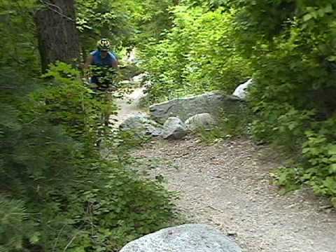
Bruce rolls down the upper section of Little Cottonwood. May 4, 2001.
Even on weekdays, the trail sees fairly heavy use. But the trail is wide and passing is usually
easy.
Much of the trail is shaded by the woods, with spruce, maple, oak, choke cherry, and box elder. The trail follows Little Cottonwood Creek up the canyon.
The boulders, and the canyon walls, of Little Cottonwood are granite from an igneous intrusion that melted its way up through the existing rock strata about 26 million years ago. This rock brought with it minerals that created rich veins that were mined in Alta and American Fork Canyon. The gold and silver concentrates in nearby limestone, not in the granite itself.
After three and a half miles (and 1300 feet vertical), the trail ends across the creek from
an old ruin (GPS N 40° 34.231' W 111° 43.024'). Along the creek, you'll
see many reminders
of the day when nature was to be conquered, controlled, exploited, or
destroyed.

An old ruin sits across the creek at the end of the trail. June 18, 1999

Buttercup.
Note: Dogs are NOT allowed in the Cottonwood Canyons. If you want to ride with Fido, go to
Mill Creek Canyon
(a few miles north),
Bonneville Shoreline
(one mile south), or the
Corner Canyon South Mountain Loop
(five miles south).

Getting there: From the south, take the 90th South I-15 exit, which turns into 94th South. Continue east to the mouth of Little Cottonwood. Just before the stop sign (where you turn right onto the road up the canyon), you'll see a paved turnoff to your right taking you to the Temple Quarry Trail parking area. Park, and head up the canyon on the dirt trail that parallels the paved Temple Quarry Trail at the end of the parking lot. From the north, take Wasatch Blvd. When you see the illuminated road condition sign at the mouth of Little Cottonwood, turn right then immediately left again into the Temple Quarry parking. The trailhead GPS is N 40° 34.310' W 111° 46.441'.
Riding resources for this trail:
Single-page riding guide
GPS track files (right-click and "Save as..."):
GPX
Small-format topo map: View
Large-format topo map (1.5 MB): View
Lodging, camping, shops: Links to southern SLC resources
Single-page riding guide
GPS track files (right-click and "Save as..."):
GPX
Small-format topo map: View
Large-format topo map (1.5 MB): View
Lodging, camping, shops: Links to southern SLC resources