Chad Hunter hits the end of the hiking trail in Arches National Park. Photo April 18, 1999 by Bruce.
Klondike Bluffs Trail
This is the original doubletrack ride from the highway to the edge of Arches National Park (followed by a hike to the overlook). The Klondike Bluffs Trail is a modest climb, but isn't too technically difficult. It's a good trail for someone who's in good shape, but is inexperienced in mountain biking. It makes an excellent first "slickrock adventure." Round trip, it's 9.6 miles on the bike and 1 mile on foot (bikes aren't allowed off-road in Arches National Park, so you hike the last half mile).
This is the original doubletrack ride from the highway to the edge of Arches National Park (followed by a hike to the overlook). The Klondike Bluffs Trail is a modest climb, but isn't too technically difficult. It's a good trail for someone who's in good shape, but is inexperienced in mountain biking. It makes an excellent first "slickrock adventure." Round trip, it's 9.6 miles on the bike and 1 mile on foot (bikes aren't allowed off-road in Arches National Park, so you hike the last half mile).
If you want to stay away from ATVs and jeeps, there are bicycle-only singletrack routes in
this riding area. For example, you can bypass the first half-mile of Klondike's
doubletrack
by using the
Inside
Passage
singletrack. Other nice rides that interconnect with Klondike Bluffs (such as
Baby
Steps
) are described on the
Klondike
Bluffs trail system page
.

Dinosaur footprints are found in newly exposed areas of Entrada sandstone. April 18, 1999 by Bruce.

Chad heads up a slickrock ramp. The riding surface here is Entrada sandstone. The boulders of Salt Wash sandstone have dropped down from the top of the brown dirt layer (Curtis Formation). These rocks are from the Jurassic Period.
Highlights of the Klondike Bluffs ride include dinosaur footprints, fun and not-too-tough rock
to practice on, and a fabulous view of Klondike Bluffs at the end of the
ride.
The trail climbs 800 feet in four miles. Give yourself about three hours, including sightseeing.
The trail begins with just over a mile on modestly smooth double-track with a short sand dig
as you cross the wash. At mile 0.5 you'll pass the reconnection of
Inside
Passage
,
Jurassic
at 0.7, and
Dino
Flow
at 0.9. After turning uphill it covers 2-1/2 miles on slickrock (mostly fairly smooth Entrada
sandstone). You'll find a connector to
Baby
Steps
and
UFO
here. Then there's a mile more on rocky road. At the end of the road is a short section of
single-track that climbs to the border of Arches National Park.

Dominic Bria has great memories of this trail, including three tire changes and a derailer adjustment. Photo April 18, 1999 Bruce Argyle

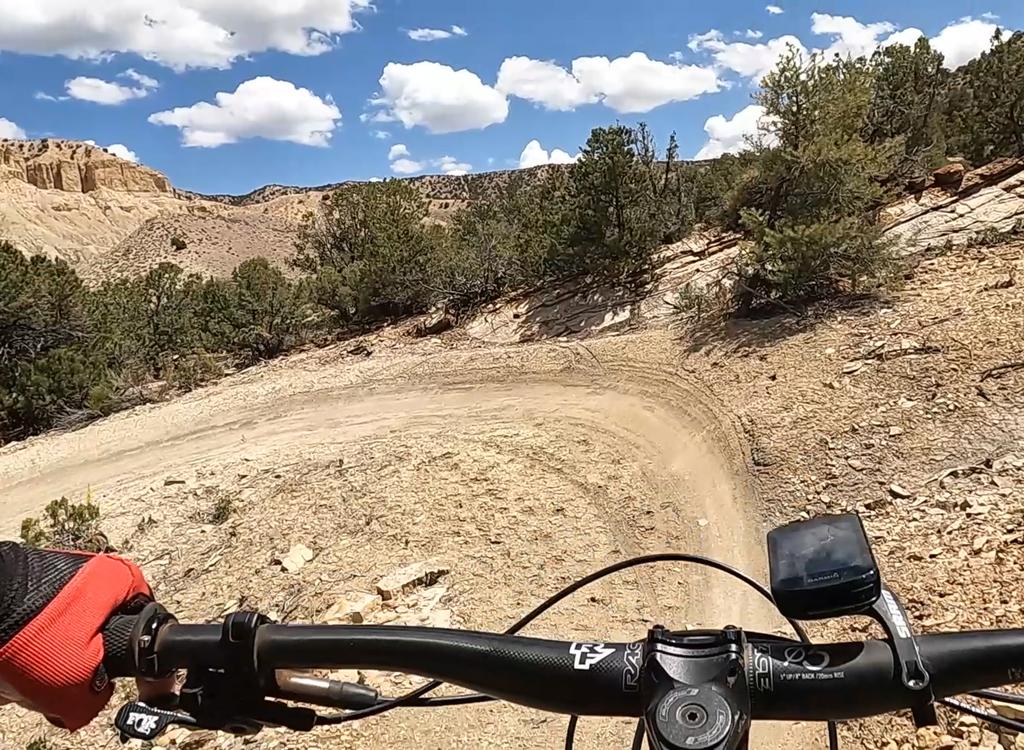
Climbing up the trail. The white stripes show the trail route. You'll share this route with jeeps.
If you want a longer ride, you can start at the highway. (Our trail description assumes you'll
drive the first 2.8 miles of graded road, then unload your bikes at the
gate to the double-track
trail.) Or, ride uphill via the
Baby
Steps
trail. This adds a few extra miles, and requires advanced skills.
Just before the end of the trail, the abandoned Brontosaur copper mine can be reached via a short spur. It's worth a look. (Watch for a spur on the right as you head east uphill and are approaching the badland hills.)
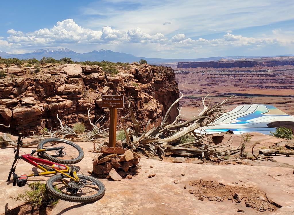
At the end of the bike trail, a 1/2-mile foot trail takes you to a breath-taking view of the
Klondike Bluffs of Arches National Park. The fractures in the rock that
created these fins
were created by thickening of the salt dome found deep underground. As
the salt "flowed" under
heat and pressure to thicken in this area, the overlying rock was pushed
up into a curve, developing
multiple fracture lines as it bent.

Dominic heads up the slickrock.

This is what you came here for. View from the top looking into Arches National Park. The arches of the park are formed of Entrada sandstone, formed from sand dunes like the Navajo, but with finer texture. Photo April 18, 1999
Klondike Bluffs is a starting point for riders headed for
Jurassic
,
Baby
Steps
,
EKG
,
Little
Salty
,
Dino Flow
, and
Mega Steps
, and more. These trails can be combined with Klondike Bluffs into many ride variations.
Getting there:
Starting at the Colorado River, drive 15
miles north from Moab. Look for a turnout on the right. There will usually be cars parked
there. Go through the gate and drive 2.7 miles. Keep left at the fork. At 2.8 miles, park
your car at the gate and begin your ride.
Riding resources:
One-page printable riding guide
GPS Track Files:
Klondike
Bluffs
Baby Steps Loop
Baby
to Klondike
GPX multi-track
file of all Klondike area trails
Topo map of this trail:
View
Area map, including Baby Steps:
View
Klondike area
Lodging, camping, shops:
Links to Moab area resources

Klondike Bluffs doubletrack route