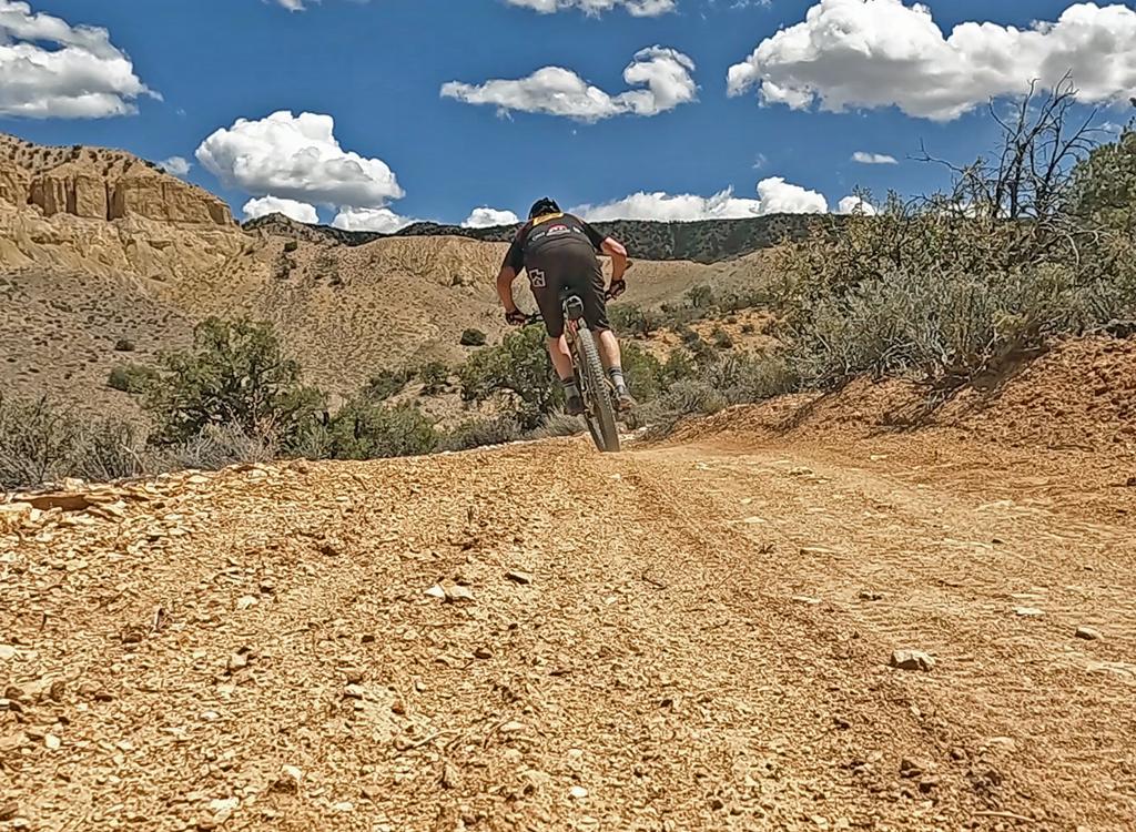
Klondike Bluffs Area Trails
Klondike Bluffs has been a popular mountain bike destination for many years. But new non-motorized trails have been created on the tilted rock mesa north of Klondike bluffs to create many varied and satisfying ride possibilities. Climbing (or downhill) routes go southwest to northeast and include (from south to north) Klondike, Baby Steps south, Little Salty, Baby Steps north, and Mega Steps. Traversing routes in the northwest-to-southeast direction are Copper Ridge Road, Dino Flow, and EKG.

Klondike Cliffs Trail
This is the old classic trail, which you'll share with jeeps and ATVs. From the upper parking, it's 9.6 miles round trip. At the Arches National Park border, you'll stash your bike for a half-mile walk to the Klondike Bluffs viewpoint. An alternate is to use Baby Steps for half of the trip and convert Klondike Cliffs to a loop ride rather than out-and-back.

Baby Steps Loop Trail
Baby Steps is a bike-only route with slickrock climbing and dirt singletrack. It rejoins Klondike Bluffs for a tiny distance near the top of the hill before dropping off the other side. After heading north, it then climbs back over the ridge and descends to Copper Ridge Road. The top of Mega Steps and Little Salty connect to upper Baby Steps, allowing a combination of rides. The traditional Baby Steps loop is 14.8 miles.
[ Baby Steps page ]

Mega Steps Trail
Mega Steps is a good alternate climbing route, or a great downhill. After climbing from Copper Ridge Road to the ridgeline, it traverses over to Baby Steps. It's 3.2 miles in length, and is the northernmost trail of the complex. A loop ride with Mega Steps and EKG will be 19 miles.
[ Mega Steps page ]

Little Salty Trail
Little Salty is an alternate up- or downhill route. It extends 1.7 miles from the spot where Baby Steps climbs back over the ridge down to Copper Ridge Road. It splits the area between Baby Steps south and Baby Steps north. A loop up Baby Steps and down Little Salty will be around 13 miles

EKG Trail
This trail traverses the slope between Baby Steps south and Mega Steps. It's 4.1 miles long, and the minimum ride using this trail will be over 11 miles. Many loop ride routes will use part, or all, of EKG for a portion of the return. As of 2012, the southern end of EKG now extends to Dino Flow near its beginning on the Klondike road.
[ EKG trail page ]

Dino Flow Trail
Dino Flow skirts the edge of the escarpment to provide a high-speed singletrack connection between the Klondike Bluffs road and Mega Steps. Dino Flow runs mid-way between (and parallel to) EKG and the Copper Ridge dirt road, transecting Baby Steps South, Salt Wash, Baby Steps North, Mega Steps, and ending at the Dinosaur Tracks parking area.

These are easy and short interconnected singletrack loops west of Copper Ridge Road. The ride using Midline to the Jasper Loop is suitable for kids and true beginners. The northern trailhead is just west of the bottom of Mega Steps.

Trail begins at the intersection of EKG and Mega Steps. Heads northeast to the ridgeline, meeting Nome and Homer on the way. Curves around to end at the top of Mega Steps. Length 4 miles.

Advanced-technical trail starts on Dino Flow, crosses Alaska while climbing further uphill and loops around to descend and end on lower Alaska. Length 2 miles.

Up-and-down trail connects Dino Flow near the Dinosaur Tracks trailhead to the northern side of Alaska. It's a faster way up the mountain if you started from the Dino Tracks parking. Length 0.8 miles.

High-speed smooth singletrack that extends from the southern end of the Jasper Loop down the west side of the valley to the Klondike Trail 3/4 mile from the southern parking. 3.2 miles.

Short (0.4 mile) trail offers fun singletrack to bypass the first section of the doubletrack (and moto-infested) Klondike Bluffs trail.

1.9-mile lariat loop forks uphill off the southern end of the EKG trail. Upper-intermediate to advanced technical.

Short and very easy lariat loop trail for beginners at the far north end of Klondike. Forms a continuation of the northbound route of Jurassic, Jasper, then Agate to reach the northernmost trailhead on the Dinosaur Tracks road.

Extensions off Miner's Loop, connecting to Baby Steps uphill. Can be used for a longer Miner's Loop ride, or as a route to connect uphill.

More-technical riding options off Baby Step South, can be used to extend or shortcut the classic ride, or as a nice technical loop in themselves.

Water: None
Toilet: Dinosaur Tracks parking
Camping: Not here
Information: Moab visitor's center
Dinosaur Tracks TH: At the road fork at mile 1.2, keep left on the main road toward the dinosaur tracks. About 1/2 mile further, turn to the right into the parking area. The Dino Flow trail is up against the mountain, to the left of the pit toilet.