

View northwest downhill. The trail slices down the top of a ridge, dropping 800 vertical.
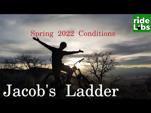
Jacobs Ladder
Jacobs Ladder is a unique downhill trail above Corner Canyon, dropping 800 vertical in 1.3 miles. In 2022, an agreement between the Forest Service and Draper City made the lower portion of Jacob's Ladder (below the Peak View connector) a one-way bikes-only trail. Riders should use the new Peak View trail (from the Peak View trailhead at the top of Traverse Ridge) as the uphill to create a loop ride. Hikers must use Peak View for both climbing and descending.
The loop up Peak View and down Jacob's is 4.3 miles with 800 feet of climbing. Then add whatever distance and elevation you rode to get to Jacobs Ladder. Below, I describe a 10.6-mile ride that ends with 4 miles of 2000-vertical downhill. More on that later.From the top, the trail rolls and plunges down the top of a sharp ridge,
passing over rock outcrops while also offering whoop-de-doos on trail
sidewalls. Lower down, switchbacks lengthen the ride and decrease the
slope as you fly through scrub oak forest. Jacobs Ladder connects to the
Upper
Ghost Falls
trail at the Corner Canyon Road for a continuous downhill
romp. Or you can loop around for another go.
First, you need to decide how you'll get to Jacobs Ladder. Most Salt Lake riders start in the
valley and ride up on singletrack. The two most popular routes are
Clarks
from the Coyote Hollow trailhead (7 miles),
Canyon
Hollow
, (8 miles) or
Ghost Falls
from the Equestrian Center (10 miles). You can connect to these trails via the Bonneville Shoreline
from either
north
or
west
.
 and Mike head uphill on U...")
Derek (in the UtahMountainBiking.com race team colors) and Mike head uphill on Upper Ghost Falls. Photos by Bruce, September 25, 2008.
Or if you're not in the mood for extra climbing, you can drive your
car to the Peak View trailhead. Now connect to the Peak
View trail and pedal uphill to the spot where the Jacob's access
doubletrack forks away from the
Three Falls
trail.

As the Salt Lake Valley falls away in the background, Mike cranks around a switchback on the newer Jacobs Ladder trail section.
Utah County riders can climb
Longview
or grind up
Hog Hollow
to the Porcupine Trail, then turn onto the Peak View trail to get onto the loop.
The upper portion of the DH trail runs down the top of a fin. The surface is often chunky and
loose. Average grade here is 15%. The very bottom section of Jacob's Ladder
was re-cut in 2008,
with switchbacks calming the old plunge. The grade on this new lower section
is around 8%,
for 300 feet elevation loss over a relatively mild 0.7 mile.
The fin you ride down seems to be an "intrusion dike" where magma found a fault line in the limestone and welled upward into it. Rock alternates between granite and unusual-looking melted mineralized limestone.

Looking back east uphill as we near the end of the fin. You'll ride over rock outcrops, skitter in pea-gravel, and hit sidewall whoop-de-doos. At the top of the photo, that's Box Elder Peak.

Derek takes a little downhill near Ghost Falls.
The ride from the Equestrian Center gives you 4 miles of downhill and 2000 feet of elevation
loss as you fly down Jacobs Ladder then continue on to Upper Ghost Falls,
Ghost Falls North,
and Lower Corner Canyon. The ride will around 11 miles.
Although Jacobs Ladder is known for the downhill, there are impressive views from the ridgeline.
Stop and look around a little.

Getting there, Equestrian TH: Leave I-15 at the
Bluffdale exit and go east on Highland Drive. Stay on Highland until you
reach the parking area for the Lynn Ballard ball park on your left. To
find the trail, go to the west end of the parking area near the trail
kiosk. Drop down the hill and turn left into the tunnel under the road.
After climbing out of the tunnel, turn left and climb back up. Or cross
the street to the ST at the sidewalk. The uphill trail is directly across
from the entrance into the parking area.
Peak View trailhead: On Suncrest Drive, turn onto Canyon Pointe Drive. Keep straight until you find yourself on the narrower paved trailhead road. It's 0.7 miles from Suncrest Drive to Peak View. This trailhead has bathrooms, water, and repair facilities.
Coyote Hollow TH: Take the Bluffdale exit from I-15 and turn east towards the mountains. Climb the hill as above, but turn right at the light on Traverse Mountain Road. After one mile, turn into Mike Weir Drive on your left. Pass the Mike Weir trailhead 1/2 mile later and continue another half mile until the road veers left downhill. Take the next right turn, turn right again, then left. You should now be on Gray Fox Drive. Take the next right into Coyote Hollow Court. The parking is on the right at the end of the pavement.
Corner Canyon Road Jacob's TH: The Corner Canyon Road is found by taking Draper Blvd (123rd South) to 13th East, turning right down the hill, then east (left) at the traffic roundabout onto Pioneer Road. Go towards the mountains to 20th East, then turn right. When the road turns to dirt, keep heading uphill. About two miles up the road, spot a log-fenced parking spot on the right, with a gate on the main road about 100 yards uphill.
Angel Gate at Spring Hollow (upper Hog Hollow and top of Hog Hollow Creek): On Westfield Road, turn uphill (north) on Beacon Hill Blvd. Drive 0.5 miles, then as Beacon Hill turns to the right (east), turn left on Lighthouse Drive to continue straight north uphill. Lighthouse will become Angel Gate. Keep straight until you pass the irrigation facility, then park. At the northeast corner of the fence, a doubletrack descends east across the hollow. Immediately after crossing the creek, turn left on Hog Hollow.
Riding resources for this trail:
GPS track file (right-click and "Save as..."):
GPX Peak View and Jacobs
High-res topo (about 370K): View
Corner Canyon area trail overview page
Lodging, camping, shops: Links to southern SLC resources
GPS track file (right-click and "Save as..."):
GPX Peak View and Jacobs
High-res topo (about 370K): View
Corner Canyon area trail overview page
Lodging, camping, shops: Links to southern SLC resources
Facilities: There's a toilet at the Peak View trailhead, at Jacob's trailhead (where Jacobs
Ladder meets the Corner Canyon road), at the Corner Canyon BST trailhead
and at the Equestrian
Center parking. Water is available at the Equestrian Center and Peak View.
Updated 2022


