The Superfly 100 cowers on the cliff edge above the Colorado during the descent down Jackson. 18 inches from my bike's front tire is a 200-foot cliff. Photos by Bruce on March 24, 2011.
Jackson Singletrack on Amasa Back
What to say about this 2.2 mile trail that drops off the north side of Amasa Back? Very scary. Very technical. Makes the deadly Portal Trail seem like pedaling around the park. Only for true expert riders. See the Amasa Area page for other riding options.
I'm glad I did this ride. But I won't hurry back. There's extremely technical stuff with significant
injury potential. And cliff-side spots where any mistake will be deadly.
The trail starts just over the ridge from the middle of the Amasa Back trail. You can also use Hymasa to climb to the Amasa saddle to connect to Jackson. (Where the power lines cross the trail, a left fork takes you 0.1 miles to the singletrack.) You can get to it from there, or you can connect to it by riding Rockstacker from the Pothole Arch Trail.

Near the Jackson Singletrack fork on Amasa, looking toward the viewpoint at the end. Yes, I got rained on. Plus snow. It blew over quickly.

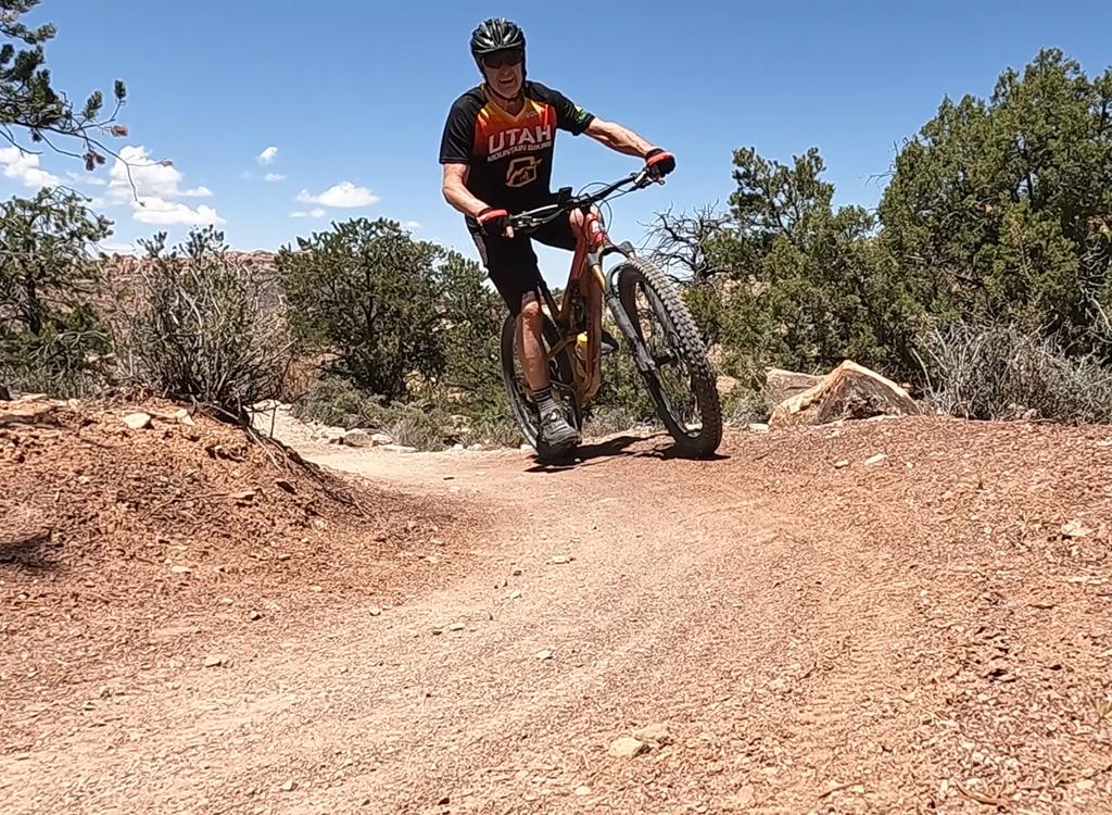
Beginning of the trail, as seen from Rockstacker.
This is called a "Bike and Hike" trail. That's because there are sections you're not expected
to ride. This applies to some extreme technical sections (see photos below)
and some spots
where you tiptoe along the edge of the cliff (more photos below).
The trail drops 600 vertical feet, most of it in sudden technical plunges, from an altitude
of 4600. There will be some highly technical challenges.

Series of tall ledges. Just a tad taller than the typical chainring.

Evidence of bikers offering up their chainring teeth as a sacrifice to the mountain. It's not the teeth -- it's getting knocked off your line and winding up on an unscheduled flight.
You'll think you're doing fine, until about a mile into the trail. Here the trail slithers
right on the edge of a deadly drop-off. Get off and walk.
I probably walked less than 1/4 mile total, dismounting perhaps 6-8 times. Because I was alone,
on a stormy day in early spring, with no other cars in the Amasa parking,
I may have been a
little more timid than you'd be. But once I start getting off the bike,
the flow is interrupted
and it gets easier to dismount for the next trivial tech spot.

More downhill fun. This spot actually flows well, once you get over the initial ledge.

Another deadly spot. 24 inches of trail sneaks around the out-leaning rock, with sheer vertical cliff on the left.
The route that's described below is a ride that tours the major trails of Amasa Back. It starts
from the Amasa parking area. Climb Amasa to the viewpoint, then backtrack
to the Pothole Arch
trail and head out to the arch.
Backtrack on Pothole Arch to the Rockstacker fork and ride the Rockstacker trail to the Jackson
Singletrack.

Tricky switchback. The apex of this hairpin turn lies on top of a little cliff.

The views are awesome, but appreciating them usually requires making a full stop!
After a mile of deadly cliff exposures, steep plunges, and crazy technical stuff, the trail
drops onto a brushy shoulder above the river and becomes, well, boring.
OK, there are views.
But by now, cumulative heebie-jeebies made me want to get the hell back
to my car. Gonna be
wanting a paved bike path for the next ride.
Riding notes, Amasa to Pothole Arch to
Rockstacker to Jackson:
0.0 Exit parking, uphill on road N38 31.710 W109 35.705
0.6 Drop R off road N38 31.435 W109 36.096
0.8 Cross creek N38 31.589 W109 36.080
2.8 Top of climb, for now N38 31.079 W109 37.115
3.5 Pass Portage connector, keep straight
N38 31.721 W109 37.678
3.7 Keep L at fork to Jackson ST
N38 31.761 W109 37.756
4.4 Keep L on Amasa at Pothole fork
N38 31.876 W109 38.369
5.1 View - End of Amasa - backtrack
N38 31.678 W109 38.871
5.8 Back at Pothole Arch Trail, fork L
6.2 Alternate joins on L, unmarked
N38 32.047 W109 38.661
7.0 Keep L and straight (R=Rockstacker)
N38 32.533 W109 38.449
7.8 R 100 ft to Pothole Arch N38 33.115 W109 38.447
then back and go north
8.0 Viewpoint, turn around N38 33.228 W109 38.545
9.0 Back at fork. Go R on Rockstacker!
N38 32.533 W109 38.449
9.1 First scary plunge. Yikes!
10.9 Junction with Jackson ST, keep L
N38 31.748 W109 37.594
(R = 0.1 mile climb to Amasa, bailout!)
11.8 Cliff exposures. Walk, you fool!
12.8 At Kane Creek, turn R along creekside
N38 31.935 W109 36.152
13.0 Cross creek, go left N38 31.904 W109 35.947
13.1 At Kane Springs parking area
N38 31.945 W109 35.948
R uphill on road
13.6 Back at parking
Riding resources:
Printable one-page riding guide
GPS track files (right-click and select "Save Target as..."):
Area trails GPX
Amasa-Pothole-RS-JackST route
Jackson ST only
Topo map for printing: High-Res
Lodging, camping, shops: Link to Moab area resources
Printable one-page riding guide
GPS track files (right-click and select "Save Target as..."):
Area trails GPX
Amasa-Pothole-RS-JackST route
Jackson ST only
Topo map for printing: High-Res
Lodging, camping, shops: Link to Moab area resources

The water's a little high. Actually, the trail hugs the shoreline on your right and heads upstream to a shallower crossing.

Map of the Jackson Singletrack area.
Getting there:
Head south on Moab's Main Street. When you reach the McDonald's on your right, turn right onto Kane Creek Blvd. After 0.6 miles, go straight where the road seems to turn right (500 West). Drive along the Colorado River about 5 miles until the road turns to gravel, and head uphill about 2/3 mile. Watch for the "Amasa Back Parking" area at GPS N 38° 31.329' W 109° 35.501'. Head further up the gravel road 1/2 mile, and turn right onto the trail at the sign.
Head south on Moab's Main Street. When you reach the McDonald's on your right, turn right onto Kane Creek Blvd. After 0.6 miles, go straight where the road seems to turn right (500 West). Drive along the Colorado River about 5 miles until the road turns to gravel, and head uphill about 2/3 mile. Watch for the "Amasa Back Parking" area at GPS N 38° 31.329' W 109° 35.501'. Head further up the gravel road 1/2 mile, and turn right onto the trail at the sign.