Looking east on the trail. Thanks to Shelby Meinkey for the beta on this trail and for some of the photos. Review ride by Bruce (and Jackie) on January 28, 2011.
Icehouse Trail
The Icehouse Trail runs down a sloping mesa on the skirts of the Pine Valley Mountains just west of Washington. It can be done as an 18-mile loop, or as a 6-plus mile shuttled downhill. Top altitude is 5100 feet, lowest 3100. It's a fun and fast downhill route, suitable for either downhill-specific bikes or light cross-country bikes.
The Icehouse Trail runs down a sloping mesa on the skirts of the Pine Valley Mountains just west of Washington. It can be done as an 18-mile loop, or as a 6-plus mile shuttled downhill. Top altitude is 5100 feet, lowest 3100. It's a fun and fast downhill route, suitable for either downhill-specific bikes or light cross-country bikes.
The Icehouse Trail itself is 6 miles of almost non-stop downhill, descending 2000 vertical
feet. There are occasional very short gentle climbs to keep you honest.
Intermittent pumice
boulders in the trail surface raise the overall tech level to upper-intermediate.
The final
1/3-mile plunge off the mesa is advanced technical and requires good skills..

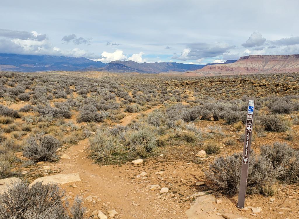
This is the spot you're looking for. My bike is sitting on the stepover gate at the entry to the desert preserve

The first mile is a little less ridden-in, and also has a little climbing now and then. You'll soon be out of the junipers.
Those who want to Earn their Vertical -- or who don't have a shuttle -- can ride up Cottonwood
Road for an 18-mile loop. The 2000 vertical of climbing occurs over 10
miles (with some up-and-down
added) on graded dirt road, so it's basically just a long cruise to the
upper trailhead. After
the first mile the Cottonwood Road surface turns to dirt. It becomes more
narrow and rough
after passing the Broken Mesa trailhead.
Icehouse is much less technical than
Broken Mesa
(which joins Icehouse about half-way down). It also lacks Broken Mesa's ugly initial climb
over the mountain. The typical rider will prefer the cruise/plunge down
Icehouse to the tricky
technical boulders of Broken Mesa.

Once you reach the main mesa, it's a gradual tilt toward Washington. The riding is fast and furious.

Looking southeast.
At 5100 feet, the upper trail area receives snow in the winter. Depending on recent storms,
the last two miles of road may be impassible to vehicles due to mud. On
my ride in late January,
there was still snow under some junipers. Despite 2 weeks without a storm,
shady areas of the
trail were still wet. Well, frozen mud -- I was riding in the early morning.
Riders report that this trail varies greatly from year to year. It's not a heavily traveled
trail, so a slight decrease in riders or a freak storm can have a big
negative effect. You
might want to ask for current trail conditions at a local bike shop.

View back uphill at the Pine Valley Mountains, from a couple of miles down the hill. The trail here is just a narrow ribbon, but easy to follow.

Looking northeast as we get closer to Washington.
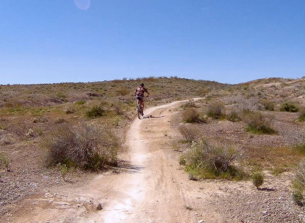
The first mile of singletrack carves through juniper forest. The trail breaks out into scrub,
then open grass on a broad flat tilted mesa. Enjoy 360 degrees of views
as you fly down the
trail.
I though Icehouse was a lot of fun to ride (last visit 2013). The trail whoops and swoops down
the mountain with grin-inducing speed. Occasional embedded boulders break
up the whoosh now
and then.

An improved berm, as the trail has been receiving TLC recently.

Heading down Icehouse on the final leg, after Broken Mesa has joined.
You'll notice some "Wilderness Study Area" signs along the trail. Don't freak. You're not breaking
the law. The area BEHIND the signs -- on the left side of the trail --
is the protected area.
The trail itself, and the territory to the right of the trail, are not
part of the wilderness
study area.
After the
Broken Mesa
trail joins you at mile 3.5, there are two more miles of relatively straight and uncomplicated
downhill flight.
Then you reach the plunge off the mesa. Drop your seatpost and buckle up, cowboy. It's going to be a rough ride now.

The final drop to the outskirts of Washington.

Dropping down the old ice-wagon doubletrack.
The final plunge off the mesa is steep. The surface varies with recent weather and trail maintenance.
Two years ago, it was a highly techy endo-fest boulder pile. This time
(2011) it was smooth,
thanks to our local trail worker heroes. But it's around 15-20% slope.
Not a good spot for
beginners.
Loop ride, from T-Bone Trailhead:
0.0 North (uphill) on road N37 08.430 W113 33.982
0.7 Pass water tank (return path north of tank)
N37 09.056 W113 34.032
2.6 Fork L on main road N37 10.592 W113 34.059
6.3 Pass Broken Mesa TH (keep L)
N37 13.398 W113 34.439
6.8 Through dip
7.3 Keep R N37 13.891 W113 33.866
8.6 Fork R (Critical Fork!) on smaller DT
N37 14.390 W113 32.706
9.8 Fork R toward gate (150
feet away)
N37 13.715 W113 31.948
9.8 Stepover to L of gate is trail
N37 13.699 W113 31.961
13.1 Broken Mesa joins on R, keep downhill
N37 11.625 W113 32.168
14.9 Begin plunge off mesa
15.5 R on Power Line trail N37 10.038 W113 31.703
17.9 L down road N37 09.056 W113 34.032
18.5 Back at parking
N37 13.715 W113 31.948
9.8 Stepover to L of gate is trail
N37 13.699 W113 31.961
13.1 Broken Mesa joins on R, keep downhill
N37 11.625 W113 32.168
14.9 Begin plunge off mesa
15.5 R on Power Line trail N37 10.038 W113 31.703
17.9 L down road N37 09.056 W113 34.032
18.5 Back at parking

Map of the Icehouse and Broken Mesa trails
Getting there, loop ride: Southbound on I-15, exit in
Washington at Exit 10 (Green Springs Drive). Turn right as you exit, then
immediately turn left on Red Hills Parkway. Drive 1.5 miles, then turn
right on Cottonwood Road. (From the St. George Blvd exit of I-15, turn
west towards the city center, then immediately turn right on 10th East. Zero
your odometer here. Take the next right on Highland, then next left onto Industrial Road. Turn left
at 0.7 on Red Rock Road. The road will turn to gravel. Keep left at the next
fork, continuing north uphill on Cottonwood Road.) About 2 miles up
Cottonwood Road, you'll see
the T-Bone trailhead parking on your left. Park here and begin by riding
up the road the way you were going. (Alternate: 1/2 mile after the
T-Bone trailhead, you'll pass a water tank on your right. The return trail for the
loop option comes back here. You can park here for a slightly shorter
ride.)
Driving route to the top: To reach the top for the shuttled ride, start out as above, but keep going up Cottonwood Road. The pavement ends at mile 3.7. Keep left at the next fork at 5.4. At the sign "Red Cliffs Mesa Rim Trail" at mile 8.8, keep straight (left) on the main road. You'll cross the forest boundary, drop through a wash, then reach a fork at mile 9.8. Keep right. The road gets rougher. At mile 11.3, a smaller doubletrack forks right, signed 092 or 902. If you have high-clearance 4-wheel, you can drive 1.2 miles further to the singletrack trailhead. Otherwise, quickly find a spot to park and begin riding the doubletrack southeast. Watch for the right fork at mile 1.2 with the stepover to the left of the gate.
Shuttle parking: Leave a car on Buena Vista Blvd, just off I-15's Exit 10 in Washington. Head southwest to the mountain that marks the entry to St. George. Turn right on Red Rock Road and head uphill to the top of the trail. To get back to your car, drop down the mesa as described above, cross the doubletrack to a singletrack trail heading south. Then work your way downhill through the golf course and into town
Riding resources for this trail:
Single-page riding guide
GPS track files (right-click and "Save as..."):
GPX
High-res topo for printing (1.1 MB): View map
Lodging, camping, shops: Links to St. George area resources
Single-page riding guide
GPS track files (right-click and "Save as..."):
GPX
High-res topo for printing (1.1 MB): View map
Lodging, camping, shops: Links to St. George area resources
Bathroom: T-Bone trailhead?
Water: None on trail
Camping: Nearby Quail Creek, Red Cliffs
Bike services: St. George
Water: None on trail
Camping: Nearby Quail Creek, Red Cliffs
Bike services: St. George