Looking toward the Moab Rim viewpoint near the northern end of the Hidden Valley...
Looking toward the Moab Rim viewpoint near the northern end of the Hidden Valley Trail. Photos and description April 9, 2011 by Bruce.
Hidden Valley Trail

This trail will not be your Moab favorite. It's rarely done as a stand-alone trail because of a miserable 1/3 mile bike portage. Its purpose is to offer a connection to the Moab Rim trail for those who absolutely MUST do a loop ride.

Note: Hidden Valley is NOT "Hidden Canyon" -- which is a ride out near Bartlett Wash.

The Hidden Valley trail is 3.2 miles long. Located on the west side of the Moab Valley at the southern edge of town, the trail climbs 700 feet to the top of the cliffs. 300 feet of this climb is done in an ugly 1/3-mile rock-scramble, tough either uphill or downhill. This trail connects the Hidden Valley trailhead to the Moab Rim trail, about a mile before the Moab Rim's viewpoint.
Riding the loop counterclockwise, were heading up the first portion of the Hidde...
Riding the loop counterclockwise, we're heading up the first portion of the Hidden Valley trail after branching off Moab Rim. The moto churn on this steep slope makes it tough going.
Were now at the Wilderness Study Area border, where some 4-wheeled vehicles have...
We're now at the Wilderness Study Area border, where some 4-wheeled vehicles have expressed their opinion to the border posts.
Hidden Valley is considered a hiking trail, but has been used for a long time by bikers. So despite going through a Wilderness Study Area, the route is bike-legal. But you must ride on the official trail.
I climbed up Moab Rim and descended Hidden Valley in a loop ride. If I were to do the loop again, I'd go UPHILL on Hidden Valley. I'd wear regular shoes for the rock-scramble, taking my bike shoes in the backpack. It would also be nice to pop the wheels off and strap the bike to my back. It's miserable to walk the bike through the big boulders.
Climbing up the slickrock toward the rim. Well be going through the notch as we ...
Climbing up the slickrock toward the rim. We'll be going through the notch as we ride counterclockwise.
Looking up at the trail. The route meanders up this mountain face and over the r...
Looking up at the "trail." The route meanders up this mountain face and over the ridge.
So I'm going to reverse the order of my photos to describe a climb up Hidden Valley to Moab Rim. This is a clockwise loop, starting from the Hidden Valley trailhead.

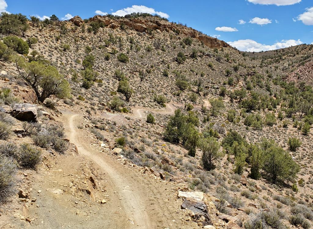
From the kiosk at the trailhead, go south on singletrack and ride as long as you can (about 0.1 mile). Then start hiking.

The trail will become a jumble of big boulders. It's significantly easier to hike uphill than to ease yourself down over the rocks while carrying your bike. That's why I recommend the clockwise loop, even though traditionally riders have done it the other way.
Yeah, right. Hop on and pedal.
Looking down at the parking area.
Stop to enjoy the views periodically.

An option for your loop ride is to insert the Pipe Dream singletrack between the trailhead of the Moab Rim and Hidden Valley.

Pass through the Moenkopi Formation to the Chinle Formation, looking up at the Wingate cliffs.

Almost done. Keep climbing.

Yes, thats the trail. Its easier to carry the bike than to have the pedals and d...
Yes, that's the trail. It's easier to carry the bike than to have the pedals and derailleur constantly hanging up on rocks.
Were looking back toward the La Sal Mountains, after finally reaching trail that...
We're looking back toward the La Sal Mountains, after finally reaching trail that we can ride. A bit of rain is falling. Wind is 30 mph with gusts up to 60.
We're finally over the edge. Now there's some trail to ride. We pedal up toward Hidden Valley itself.
Hidden Valley has 1.8 miles of straight, smooth singletrack. Not worth the climb just to ride it, but it's nice to turn the pedals. From south to north, the trail is slightly uphill.
Looking north as we ride toward the ridge that will be our highest point of the ...
Looking north as we ride toward the ridge that will be our highest point of the ride. We'll go into that little notch on the left of the photo.
After a mile and a half of pedaling up Hidden Valley, theres a quick steep curve...
After a mile and a half of pedaling up Hidden Valley, there's a quick steep curve up to a ridgeline. Now it's downhill.
After a lazy cruise up the length of Hidden Valley, the trail will climb sharply over a small pass. Then it heads downhill over singletrack and slickrock to the Wilderness Study Area border.
When you arrive at the WSA border, go uphill past the posts about 200 feet. Fork downhill on a loose steep doubletrack. The next intersection will be the Moab Rim trail. Straight (left) takes you toward the trailhead. Right and uphill will take you to the valley viewpoint at the end of the Moab Rim trail.

For more info on the loop ride, see the Moab Rim page.

View northwest as we head toward the WSA border.
Riding notes, clockwise loop w road return:
0.0    Southwest from trailhead N38 31.906 W109 31.033
0.4    Begin riding bike
2.2    Steep uphill, crest and descend ST
2.9    WSA border, R and uphill N38 32.613 W109 33.430
3.0    L downhill on DT (R = view) N38 32.655 W109 33.346
3.2    R on Moab Rim (straight L = return trail)
         N38 32.727 W109 33.532
4.0    At viewpoint, look and turn around
         N38 32.907 W109 32.918
4.8    Back at fork, go R N38 32.727 W109 33.532
5.1    Keep L (R=to alternate) N38 32.865 W109 33.719
5.4    Keep L (R=sandy alternate route) 
         N38 32.909 W109 33.990
6.7    Keep L (R=alternate rejoins) N38 33.454 W109 34.279
7.6    Top of Rim, viewpoint beyond cable
8.5    Moab Rim Trailhead, R on road
         N38 33.521 W109 34.997
10.5  Pipe Dream ST on R (5th West)
         N38 34.128 W109 33.680
         Alternate N38 33.899 W109 33.424
11.3  R on US-191 N38 33.824 W109 32.990
14.5  R toward Hidden Valley TH
15.0  Back at car
Map of the Moab Rim and Hidden Valley route.
Getting there, Hidden Valley TH:
On Main Street (US 191) in Moab, head south. At Kane Creek Blvd (McDonalds on corner), zero your odometer and drive 3.2 miles south on 191. Watch for a Hidden Valley Trailhead sign on your right. Follow this road 1/2 mile to the trailhead parking. The Pipe Dream trail is in the southwest corner of the parking area.

In the map at right, the Hidden Valley trail is shown in blue. The green Pipe Dream trail is an alternate dirt ST return route for the loop ride.

Bathrooms:  Moab Rim TH
Camping: Multiple campgrounds, not at trailhead
Water: none at trailhead
Bike services: many, see link below

Riding Resources for Hidden Valley:
Single-page riding guide
GPS track files (right-click and "Save as..."):
     GPX all area trails
     Hidden Valley only
     Loop with Moab Rim / Pipe Dream
     Loop w road return
Topo maps for printing:  Hidden Valley and Moab Rim
Lodging, camping, shops:    Links to Moab area resources