
The Green Valley Race Loop lies in southwest St. George's Green Valley area. The top portion of the race loop lies on BLM land, but the historic race staging area is on private property that is undergoing subdivision development at the time of this update in 2025. The upper-elevation half of the former race loop is often included on recreational rides such as the Barrel Trail and as part of the course for endurance races such as True Grit.
The race course interconnects with the Barrel Trail. At the top of the race loop is a (steep and less-popular) path to the Stucki Springs Trail. The race loop also connects to the Santa Clara trails via Cove Wash. With multiple singletracks and ATV paths in the area, the exact layout of an "official" race loop varied from year to year. So just ride, explore, and have fun.
The race loop is moderate aerobic, mostly easy technical with a smattering of advanced technical. However, because brainless ATV-jockeys started following singletrack as quickly as it was created, the trail is a shadow of its former self. If you're looking for pristine narrow desert singletrack, use the DH portion of this trail to connect to the Barrel Trail, which is right next door.

2025: Construction of homes has now begun over the entire length of the bottom of the valley. You can no longer pedal directly onto the race loop from below. Access through the construction area may not be possible by car, and isn't easy by bicycle. For now, consider starting from the Cove Wash side of the riding area.

You can reach the race loop by connecting through the Barrel Trail system from the Bearclaw Poppy northern trailhead. From Dixie Drive in southern St George, turn onto Canyon View Drive and go all the way to the top. Turn right at the "T" then follow the road as it curves downhill and left. When you hit the bottom, turn to the right on the road that climbs up the slope and follow it 1/3 mile along the edge of "The Gap" canyon to the Bearclaw parking area. The Rowe trail starts at the parking area, while the Blue Barrel trail is located up the dirt road across from the Bearclaw Poppy step-over gate. The simplest connection is to go up the road, then find the trail on your right and follow it generally downhill and northeast until you hit the border of the subdivision, where you'll find Reacharound to start the loop.

In St. George, head north on Bluff Street and turn left on Sunset Blvd. Drive 3 miles west on Sunset through Santa Clara. As you're reaching the end of Santa Clara, look for a road crossing the river on your left. It's about 200 feet before the Jacob Hamblin Home (which will be on your right if you pass the turn). Turn and cross the river. About 0.4 miles from Hwy 191 as the paved road turns right, cross to the dirt Stucki Springs road as it climbs steeply south. At mile 0.7, keep left at the sign "Cove Wash Trailhead" to stay on the Stucki Springs road. Keep left again at the next fork. At the bottom of a wash, begin your ride heading left (east). As you approach homes a mile later, keep left to find the singletrack climbing along cliffs up to the race loop.

Turn off Dixie Drive onto Sunbrook Drive. Follow it all the way west until you hit a "T" intersection. Turn right aind a roadside spot to park. Look for a singletrack trail that crosses the wash heading west. The first left fork is the route up Keyhole Wash between the homes. The second is the connector singletrack running uphill to the west along Box Canyon Wash. As you reach the hillside above the homes, keep right to start a counterclockwise lap on the race course.

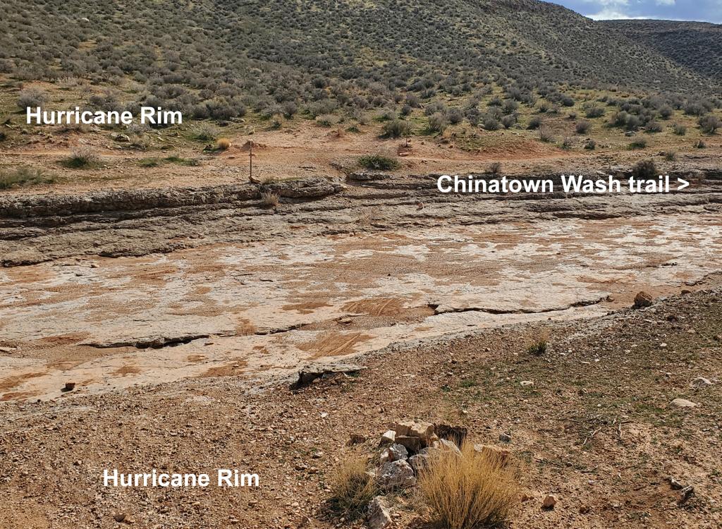
The loop will consist of a northbound gently-climbing traverse on a segment called Reacharound just above the subdivision to reach Box Canyon Wash, then a climb along the southern rim of Box Canyon Wash to the top of the cliffs. This is followed by a short traverse to the south, then a descent down a ridgeline. The trail then drops into a rock-bottomed wash called Rock Wash for a climb uphill. Fun tech options here. After some additional climbing, the trail descends back down to the private property border, where you'll need to connect to Reacharound for another lap.
Head north toward the subdivision, and the trail will then bend to the west. At the corner of the homes, it will again turn to the north. There will be a few trail forks. In general, pick the option that keeps you on singletrack near the subdivision.


At the top, curve to the south and find the ridgeline trail that heads east back toward town. Descend until you drop into a wash. After dropping to the bottom of the hill, the trail turns 180 degrees into Rock Wash (also called Cowpond Wash). Fork right uphill into the wash bottom. Climb up the wash and enjoy attacking the ledges.
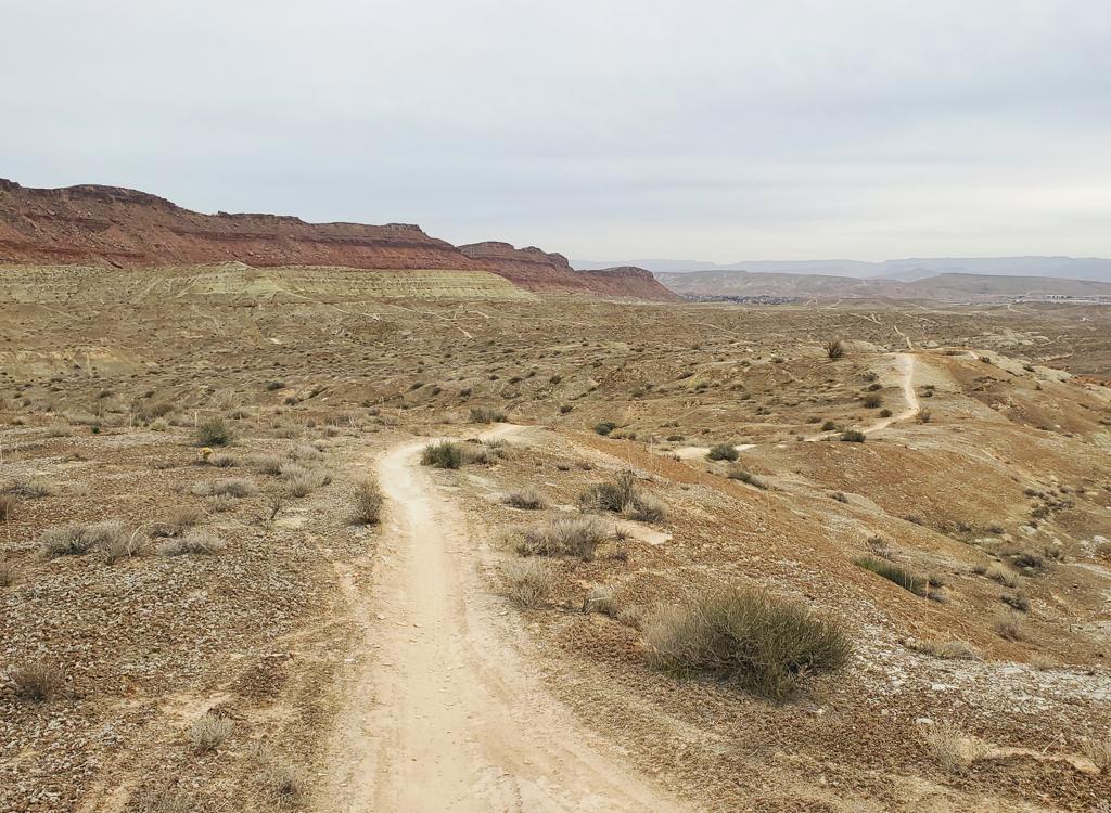
At a doubletrack near the edge of the cliffs, cross southbound over to singletrack, which will then turn to the left downhill. At the trail fork, keep left to descend. (The uphill right fork climbs to the top of the upper Barrel Trail. You'll pass another connector to Barrel about 150 yards down from this trail fork. An option at the trail fork is to climb all the way uphill to a view over the Stucki Spring area, then return to the downhill race trail)
The downhill will undulate and twist through a few shallow drainages. At a rocky area at the bottom, find Reacharound for a second lap.


Alternatively, stay on Dixie Drive for another mile and turn left on Sunbrook. Go to the end, and at a T interection, turn right and find a place to park. Catch a trail heading west on the south side of a small canyon.