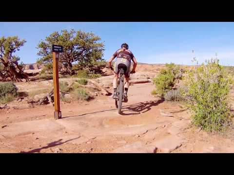
Handlebar view of slickrock riding on Great Escape. Review and photos by Bruce on March 23, 2012.
Great EscapeThe Great Escape trail is a bikes-only singletrack in the
Gemini
Bridges
area near Moab. Great Escape itself is 3.5 miles long with just
over 400 vertical feet of elevation change. It's intermediate in technical
requirement, and is not too tough aerobically. The top altitude (near
Gemini
Bridges) is 5120 feet.
The mountain bike trail begins across from a tiny parking area on the Gemini Bridges Road (straight
across from
Arth's Corner
and
Getaway
singletrack trails), about 0.4 miles downhill from the Gemini Bridges hiking trail and main
parking area. It extends downhill to join the
Little Canyon Singletrack
about 1/2 mile from where Little Canyon ST becomes the
Gold Bar Singletrack
as it crosses the
Gold Bar Rim
road.

Starting down Great Escape. Behind my back, there's a parking lot with room for 5 to 6 vehicles. Chances are, it will be full.

Bike and vehicle parking at the Gemini Bridges hiking trail. This is where the Short Loop ride (7.5 miles) starts.
Although Great Escape joins two trails of the
Magnificent 7
trail system, it's NOT part of the official Mag 7. Riders descending the Mag 7 (part 1) can,
however, substitute Great Escape for Arth's Corner and the upper 1.6 miles
of
Little Canyon
Singletrack
Ridings can also go directly from downhill
Getaway
to Great Escape, or from Great Escape to Getaway when riding uphill.
I think the best way to ride Great Escape is to combine it with the upper
Little Canyon Singletrack
and
Arth's Corner
to form a loop. From the Gemini Bridges parking -- which you'll be forced to use on weekends
because the trailhead parking will be full -- the loop will be 7.5 miles
with 500 vertical
feet of climbing. This is suitable for intermediate riders. See the "short
loop" ride description
below. I did a counterclockwise loop, but the trail rides well in either
direction.

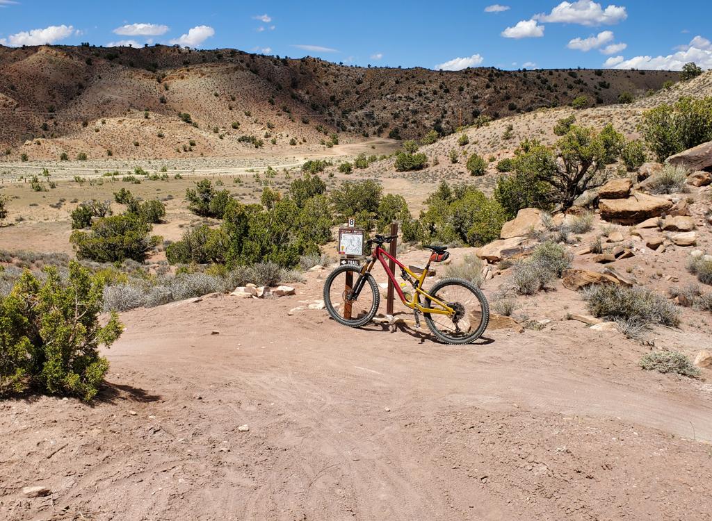
This signpost parks the spot on the Gemini Bridges road where (if heading downhill) Arth's Corner is on the left and Great Escape forks to the right. Note trail map on post.

Some of the trail has long stretches of slickrock, but most of the route crosses humps of rock separated by dirt and brush, and a sparse forest of pinion pine.
Advanced riders will want to start on
Bull Run
near Highway 313 (see lariat loop ride description below). This ride is 19.7 miles with 1700
vertical feet of climbing. Ride Bull Run downhill, do the loop, then ride
Bull Run back uphill.
This ride is upper intermediate technical, but will be quite strenuous
because of the constant
bike motion required to ride uphill on the ledge-filled trail. Remember
it's a reverse-profile
ride: you'll be grunting uphill when you're the most tired.

Shortly after the trail begins, a 30-foot spur takes you to this view of Gemini Bridges to the west.

Heading southeast over slickrock, with Behind the Rocks in the midground and the La Sals on the skyline. Note the green paint, and the line of rocks marking the trail.
The trail is marked with cairns, trailside logs, and stripes of light-green paint on the rock.
It's easy to navigate either direction.
The riding surface is about 80% rock, 20% dirt. On my ride (just a few weeks after the trail
opened), some of the dirt spots were a little soft. There were two sharp
dirt turns where the
tires dug and washed out. These were spots that required a bit of power
to hit an uphill slope
after the turn. Not a crash, but a fishtail. With time, these spots should
pack and berm. There
were no sand bogs like on Bull Run.

For a while, the trail approaches the edge of Bull Canyon from above.

Smooth Entrada sandstone, with the trail plainly marked.
The biking is similar to Arth's and Little Canyon -- smooth rolling sandstone alternating with
some small ledges and occasional strips of dirt singletrack. Occasional
pinions and junipers
dot the slope, with bitterbrush and sage where the roots can find some
dirt. There are views
of the La Sal Mountains to the southeast, and occasional glimpses of Two
Tortoise Rock.
The rock is Entrada sandstone. It's mostly smooth and tacky under the tires. But as the trail
gets lower in the rock strata (closer to the underlying Navajo), the Entrada
becomes striated
with dirt and rock in pancake layers that form ledges.

The La Sal Mountains and Bruce's Superfly 100 bracket Two Tortoise Rock.

More typical trail surface, looking northwest and slightly uphill.
Most riders will want to start from the Gemini Bridges parking area. The easiest way is to
drive up Highway 313 (10 miles north of Moab), then turn left on the Gemini
Bridges Road at
mile 13 from US-191. Drive 6 miles downhill on the dirt road. (You can
drive there on the Gemini
Bridges Road from 191, but it's spooky narrow and steep.)
Park in one of the Gemini Bridges spots. There are several three-car spots along the little
loop. Then pedal downhill to where the parking loop rejoins the main Gemini
Bridges road. This
will be 0.2 miles from the bike rack and the hiking trail.
As of 2012, there are now a few parking spots directly at Arth's Corner TH across from Great
Escape.

Lower on the mountain, broken rock and dirt create a more ledge-filled riding enviroment. We're looking northeast toward the canyon of the main Gemini Bridges Road. (The gooney bird is around there somewhere.)

End of the trail. This is the spot where the Great Escape ends on the Little Canyon singletrack. To make a loop, go LEFT.
From Gemini Bridges, ride 1/4 mile downhill until you see signs for Great Escape and Arth's
Corner. Turn right on the Great Escape singletrack. After 150 yards, stop
at a short spur on
your left to look at the Gemini Bridges to the west.
Now pedal on to mile 2.2 from the Gemini Bridges hiking trail and cross the
Bull Canyon
Road. FYI, the Two Tortoise Rock doubletrack is about 100 yards south of you (to your right),
on the left (uphill) side of the road. That's in case you want to mix
it up and follow Little
Canyon to
Gold Bar
, then catch
Two Tortoise
back uphill.

Heading uphill on the Little Canyon Singletrack.

At the end of the Little Canyon ST, we enter the Metal Masher (Little Canyon Rim) road for 0.1 mile before turning left onto the Arth's Corner singletrack.
At mile 3.9, Great Escape ends on the
Little Canyon
Singletrack
You're about 1/2 mile from where Little Canyon ends on the
Gold Bar
4x4 road. If you go right, you can descend to Gold Bar, where you can pick up the
Gold Bar Singletrack
or the Two Tortoise Rock trail.
If you go left, you'll climb about 1-1/2 mile on Little Canyon ST (crossing the Bull Canyon
Road again on the way) until it ends at the Gemini Bridges Road. To reach
Arth's Corner, stay
straight and go 150 yards up the
Metal Masher
road, then find the ST on your left. Arth's will take you back to the beginning of Great Escape,
or to Getaway if you're climbing further uphill.

Handlebar view as we head uphill on Arth's Corner. Very similar terrain and riding.
Lariat Loop with Bull Run, Little Canyon,
and Arths, 19.6 miles:
0.0 Park immediately after turning L off 313
N38 34.401 W109 47.523
Pedal downhill on Gemini
Bridges Road
1.2 R to Bull Run TH N38 34.921 W109 46.581
1.3 R on Bull Run ST
3.1 Join DT, keep R N38 35.443 W109 45.156
3.3 R off DT onto ST N38 35.434 W109 44.903
4.9 Cross Crips Hole Road N38 35.389 W109 43.508
5.8 R on Gemini Bridges Rd N38 35.307 W109 42.589
6.0 R to Gemini Bridges parking (why not?)
N38 35.309 W109 42.589
Trail and parking N38 35.228
W109 42.595
6.3 Rejoin Gemini Bridges main road, keep R
N38 35.271 W109 42.396
6.5 R on Great Escape
N38 35.246 W109 42.238
6.6 Short spur to view of Bridges on L
N38 35.147 W109 42.241
8.3 Cross Bull Canyon Road
N38 34.971 W109 40.960
10.0 L on Little Canyon Singletrack
N38 35.652 W109 40.540
10.7 Cross Bull Canyon Road
N38 35.732 W109 41.007
11.6 ST ends, straight across Gemini Bridges Rd
to Metal Masher road N38 35.776
W109 41.624
11.7 L uphill on ST Arth's Corner
N38 35.885 W109 41.673
13.2 R on Gemini Bridges Road N38 35.246 W109 42.238
13.4 Keep R on main road
N38 35.271 W109 42.396
13.6 Keep straight (R) on main road
N38 35.309 W109 42.589
13.8 L on Bull Run singletrack
N38 35.307 W109 42.589
14.8 Cross Crips Hole road N38 35.389 W109 43.508
18.4 Bull Run TH, uphill on Gemini Bridges Rd
19.6 Back at parking
Short Loop (Gemini-Great Escape-Little
Canyon-Arths), 7.5 miles:
Park in one of the Gemini Bridges spots, then pedal downhill
to where the road rejoins the main Gemini Bridges road,
at 0.2 miles from the bike rack and the hiking trail. Because
parking spots are all along the turnout, we'll start the odometer
from the road fork:
0.0 Keep R to continue downhill
N38 35.271 W109 42.396
0.2 R on ST (Great Escape)
N38 35.246 W109 42.238
0.3 Short spur to view of Bridges on L
N38 35.147 W109 42.241
2.0 Cross Bull Canyon Road
N38 34.971 W109 40.960
3.7 L on Little Canyon Singletrack
N38 35.652 W109 40.540
4.4 Cross Bull Canyon Road
N38 35.732 W109 41.007
5.3 ST ends, straight across Gemini Bridges Rd
to Metal Masher road N38 35.776
W109 41.624
5.4 L uphill on ST Arth's Corner
N38 35.885 W109 41.673
6.9 R on Gemini Bridges Road N38 35.246 W109 42.238
7.1 L to Gemini Parking N38 35.271 W109 42.396
Bottom Line!
This ride is worth doing. But it's not much different in feel, tech factor, or views than Arth's
or Little Canyon. So if you've already done the other Mag 7 trails, ride
Great Escape to mix
things up a little. But don't feel bad if you're forced to miss it as
you're doing Mag 7.I really liked the lariat ride using Bull Run to descend to the loop, then climbing back up
Bull Run to 313. But the constant bumpy tech riding was a lot of work.
For a 20-mile ride with
only 1700 vertical, it left me pretty worked over.

View uphill on the return up Bull Run.

Map of Great Escape area
Getting there:From I-70 and Crescent Junction, drive south on US-191 for 20 miles. Or,
drive about 9 miles north of the Colorado River if you're driving out from
Moab. Turn west on Highway 313 (the road to
Dead Horse Point and
a href="/trails/whiterim/">
Canyonlands). Drive 13 miles on 313 to the Gemini Bridges sign and turn L
onto dirt road.
For Bull Run lariat ride: Find a spot to park immediately after turning
off 313. Begin riding down the dirt road and turn right to the Bull Run
trailhead at mile 1.3.
For the loop ride from Gemini Bridges: Drive down the gravel road 6
miles to the Gemini Bridges parking area N38 35.232 W109 42.597. Pedal
downhill 0.2 mile from the fork where the parking lane rejoins the main
dirt road. Arth's is on your left (your return route if going
counterclockwise), and Great Escape is directly across the road on your
right.