

Alex tries out the rock of Slickrock 101 in May 2017. Original review by Bruce in 2001.
Gooseberry Mesa Beginner Trails
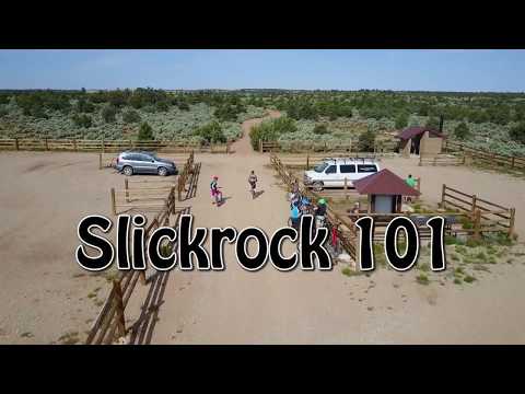
White Trail and Slickrock 101
While Gooseberry is known for its technical rock, there are opportunities for new riders. The White Trail is a former jeep road extending to the tip of the mesa. It's 7 miles round-trip, and is the easiest ride on the hill. Slickrock 101 is singletrack and open rock, forking away from the White Trail and rejoining 1.3 miles later. It's also known as the "practice loop."
Both rides originate at the White Trailhead, a mile west of the main trailhead. As of 2017,
this trailhead now has extensive parking and a bathroom. A gate controls
vehicle access to
the White Trail as it heads west.
 exits the parking area to the wes...")
The White Trail (straight ahead in this photo) exits the parking area to the west. Slickrock 101 forks away to your right about 1/3 mile down the path.
White Trail (mesa doubletrack)

Kristen and Alex look northwest towards the Pine Mountains from the North Rim of Gooseberry. Photos June 16, 2004.
The Gooseberry Mesa "White Trail" is the old jeep road that travels east-west on Gooseberry
Mesa. This trail is suitable for beginning riders, even those who aren't
in great shape. The
trail is 3.5 miles in length. Up-and-down riding is minimal, with short
gentle climbs. The
road gains about 150 vertical feet of elevation as you travel westward,
so the return trip
is fast and easy.
For the most part, the track of the trail is fairly firm dirt, with an occasional slickrock
area. Here and there, there are occasional not-too-rough outcrops. Kids
can pick their way
through without too much trouble. There are a couple of short sections
of shallow sand (about
100 feet or so) -- most sand-savvy riders can cruise right through. Some
spots are a bit rough
for a bike trailer, but it can be done.

Heading back to the east, Jackie the biker-dog paces the kids.

If so inclined, the braver of your young riders can try short sections of the North Rim or South Rim trails, as these trails meet the White Trail in several locations along the ride.
You'll cruise past, and over, outcrops of chinarump conglomerate. Juniper, cedar, and pinion
pine alternate with shrubs of manzanita, gooseberry, sage, and ephedra.
The scenery gets progressively
better as you move westward.
Riding notes, approximate mileage:
0.0 Start west on doubletrack
0.3 Pass Slickrock 101 end on R (good detour for rock-hungry youngsters)
0.6 Cattle Grate Trail on L (advanced tech riding)
1.1 ST connector on R (option of 1-mile intermediate ST ride)
1.3 Keep right at fork (L goes to South Rim trail)
2.0 North Rim Trail connector on R (100 yards to view from North Rim)
2.1 Hidden Canyon Maze on L
2.7 North Rim joins on R
2.8 Yellow Trail leaves on L (advanced tech, 1/2 mile)
3.0 Yellow Trail reconnects on L
3.5 At South Rim (head west if you want to go to the Point)

Taking in the views from the mesa rim.
Slickrock 101

Alex turns north to enter Slickrock 101. These photos May 9, 2017.
The Slickrock 101 trail forks away from the White Trail 0.3 miles west of the White Trailhead.
As shown in the photo, the spot is marked by a carsonite post and a rock
cairn.
On the open rock areas, the trail is marked by white paint spots. Just connect the dots. The
rock is of varying difficulty, with little waves and occasional big humps.
It helps if you've
mastered the technique of keeping your butt off the saddle.

Handlebar view of a mellower area of open rock. See the white spots? Keep your eyes high so you can flow with the trail.

Alex cruises through bumps of sandstone.
Slickrock alternates with dirt singletrack. There are occasional rough spots and mildly steep
ramps that can stop a beginner. Just walk over what you can't ride, then
resume pedaling.
A half mile from the White Trail, you'll reach a trail fork on slickrock. The right-side trail
is fairly technical and is NOT a beginner trail. Keep to the left.

Pick your way over the slickrock. The line of white dots is not necessarily the smoothest riding line.

Heading west. Slickrock will alternate with dirt singletrack.
Follow the dots through a broad open rock area. Keep to the left as the technical northern trail rejoins, then as you go through a dip, keep left again. (The right fork here would take you to the North Rim and the Windmill Trail . This route is upper-intermediate in technical requirement.)
At the next trail fork at mile 1.3, keep left again. (Again here, the right fork heads for
the North Rim.) After 100 yards, you'll dump out onto the White Trail.
Turn left and pedal
0.3 miles back to the trailhead.

Exiting the singletrack to the White Trail.

Getting there:
As you pass through Hurricane on Highway 9, turn south at the Highway 59 sign. One block later, turn left and drive out of town. About 15 minutes later, you'll pass a gas station on the left-hand side, then some fields. Watch for a "Scenic Byway" sign, and turn left onto a dirt road (14.8 miles from the turnoff in Hurricane). Two miles later, just as you reach the mountain, the Gooseberry Mesa road turns off on your left. Another 3.6 miles after the turnoff, take the left fork at the bathroom. Now stay on the bigger road, ignoring any forks. 1.1 miles later, you'll cross a cattle guard. Park there. The White Trail is the continuation of the road you were traveling. GPS: N 37° 08.491' W 113° 10.299'
Lodging, camping, shops: Links to St. George area resources


